Wabash, Nebraska

Last updated

Wabash, Nebraska
Wabash, NE.jpg
North on Elm Street
USA Nebraska location map.svg
Red pog.svg
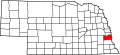
Wabash
Location within the state of Nebraska
Coordinates: 40°53′10″N96°15′20″W / 40.88611°N 96.25556°W / 40.88611; -96.25556
Country United States
State Nebraska
County Cass
Elevation
1,290 ft (390 m)
Time zone UTC-6 (Central (CST))
  Summer (DST) UTC-5 (CDT)

Wabash is an unincorporated community in Cass County, Nebraska, United States. [1]

History

A large share of the early settlers being natives of Indiana caused the name Wabash, after Wabash, Indiana, to be selected. [2] A post office was established at Wabash in 1886, and remained in operation until it was discontinued in 1965. [3]

Related Research Articles

<span class="mw-page-title-main">Cass County, Nebraska</span> County in Nebraska, United States

Cass County is a county in the U.S. state of Nebraska. As of the 2020 United States Census, the population was 26,598. Its county seat and largest city is Plattsmouth. The county was formed in 1855, and was named for General Lewis Cass.

<span class="mw-page-title-main">Cass County, Indiana</span> County in Indiana, United States

Cass County is a county located in the U.S. state of Indiana. As of the 2020 United States Census, its population was 37,870. The county seat is Logansport. Cass County comprises the Logansport, IN Micropolitan Statistical Area.

<span class="mw-page-title-main">Wabash County, Illinois</span> County in Illinois, United States

Wabash County is a county located in the U.S. state of Illinois. According to the 2020 census, it had a population of 11,361. Its county seat is Mount Carmel. It is located in the southern portion of Illinois known locally as "Little Egypt".

Wabash may refer to:

<span class="mw-page-title-main">Eel River (Wabash River tributary)</span> River in Indiana, United States

The Eel River is a 94-mile-long (151 km) tributary of the Wabash River in northern Indiana in the United States. Via the Wabash and Ohio rivers, its waters flow to the Mississippi River and ultimately the Gulf of Mexico. The Eel River rises southeast of Huntertown in Allen County and flows southwest through Allen, Whitley, Kosciusko, Wabash, Miami, and Cass counties to join the Wabash at Logansport. The river was called Kineepikwameekwa Siipiiwi - "river of the snake fish" by the Miami people, who inhabited the area at the time of European contact, the English rendered it as Ke-na-po-co-mo-co. It is the northern of the two rivers named Eel River within Indiana.

<span class="mw-page-title-main">Treaty of St. Mary's (1818)</span> 1818 treaties between the United States and Native Americans

The Treaty of St. Mary's may refer to one of six treaties concluded in fall of 1818 between the United States and Natives of central Indiana regarding purchase of Native land. The treaties were

<span class="mw-page-title-main">Adams Township, Carroll County, Indiana</span> Township in Indiana, United States

Adams Township is one of fourteen townships in Carroll County, Indiana. As of the 2010 census, its population was 516 and it contained 209 housing units.

<span class="mw-page-title-main">Indiana State Road 15</span>

State Road 15 is a north–south state road in northern part of the US state of Indiana. Its southern terminus is at U.S. Highway 35 and SR 22 near Jonesboro and its northern terminus is the Michigan state line, north of Bristol, where the roadway continues north as M-103. It is a surface highway that mostly passes farm fields but passing through a few cities of Marion, Wabash, Warsaw, and Goshen. Running for 94.835 miles (152.622 km) through the state, SR 15 is maintained by the Indiana Department of Transportation (INDOT).

<span class="mw-page-title-main">Indiana State Road 16</span>

State Road 16 is an east–west state road in the US state of Indiana. The western terminus is at an intersection with U.S. Highway 41, near Ade, and its eastern terminus is at SR 5, near Huntington. The state road runs through seven counties in northern Indiana mostly through rural farm fields and small towns.

<span class="mw-page-title-main">Indiana's 2nd congressional district</span> U.S. House district for Indiana

Indiana's 2nd congressional district is an electoral district for the U.S. Congress in Northern Indiana. It includes South Bend, Elkhart, and Warsaw.

<span class="mw-page-title-main">Logansport, Indiana</span> City in Indiana, United States

Logansport is a city in and the county seat of Cass County, Indiana, United States. The population was 18,366 at the 2020 census. Logansport is located in northern Indiana at the junction of the Wabash and Eel rivers, northwest of Kokomo.

Noble Township may refer to:

<span class="mw-page-title-main">Eel Township, Cass County, Indiana</span> Township in Indiana, United States

Eel Township is one of fourteen townships in Cass County, Indiana. As of the 2010 census, its population was 18,767.

<span class="mw-page-title-main">Lewisburg, Indiana</span> Unincorporated community in Indiana, United States

Lewisburg is an unincorporated community in Miami Township, Cass County, Indiana.

<span class="mw-page-title-main">Three Rivers Conference (Indiana)</span>

The Three Rivers Conference is a high school athletic conference in northeast Indiana, consisting of schools in Cass, Fulton, Miami, Wabash, and Whitley counties.

<span class="mw-page-title-main">National Register of Historic Places listings in Carroll County, Indiana</span>

This is a list of the National Register of Historic Places listings in Carroll County, Indiana.

<span class="mw-page-title-main">National Register of Historic Places listings in Fulton County, Indiana</span>

This is a list of the National Register of Historic Places listings in Fulton County, Indiana.

<span class="mw-page-title-main">National Register of Historic Places listings in Miami County, Indiana</span>

This is a list of the National Register of Historic Places listings in Miami County, Indiana.

The 138th Indiana Infantry Regiment served in the Union Army between May 27 and September 22, 1864, during the American Civil War.

References

  1. U.S. Geological Survey Geographic Names Information System: Wabash, Nebraska
  2. Fitzpatrick, Lillian L. (1960). Nebraska Place-Names. University of Nebraska Press. p. 33. ISBN   0803250606.
  3. "Cass County". Jim Forte Postal History. Retrieved August 25, 2014.