Factoryville, Nebraska

Last updated
Factoryville, Nebraska
USA Nebraska location map.svg
Red pog.svg
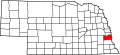
Factoryville
Location within the state of Nebraska
Usa edcp location map.svg
Red pog.svg
Factoryville
Factoryville (the United States)
Coordinates: 40°48′N95°58′W / 40.800°N 95.967°W / 40.800; -95.967 Coordinates: 40°48′N95°58′W / 40.800°N 95.967°W / 40.800; -95.967
Country United States
State Nebraska
County Cass
Population
 (2000)
  Total0
Time zone UTC-6 (Central (CST))
  Summer (DST) UTC-5 (CDT)
Area code(s) 402
GNIS feature ID1897821

Factoryville is a ghost town in Cass County, Nebraska, United States. [1] Located approximately halfway between Union and Nehawka, the town straddled the Lincoln-Union Highway and neighbored a smaller village called Mount Pleasant. It once featured a flour mill, stores, hotels, a post office, and a Methodist college called Factoryville College. Founded in the late 1850s, in 1873 its name was changed to Union Mills, and in 1880 it was changed back to Factoryville. [2] The post office was established in the late 1860s when a local named Isaac Pollard was traveling to the Eastern United States. Along the way he stopped in Washington, D.C., where he selected the name Factoryville, along with the name Nehawka for a neighboring town. [3]

The construction of the railroad on the opposite side of Weeping Water Creek from Factoryville led to the demise of the town, and by the 1890s there were only empty buildings. [4]

Related Research Articles

Omaha, Nebraska City in Nebraska, United States

Omaha is the largest city in the state of Nebraska and the county seat of Douglas County. Omaha is in the Midwestern United States on the Missouri River, about 10 miles (15 km) north of the mouth of the Platte River. The nation's 40th-largest city, Omaha's 2019 estimated population was 478,192.

Fillmore County, Nebraska U.S. county in Nebraska

Fillmore County is one of 93 counties in the U.S. state of Nebraska. As of the 2010 United States Census, the population was 5,890. Its county seat is Geneva. The county was named for President Millard Fillmore.

Cass County, Nebraska U.S. county in Nebraska

Cass County is a county in the U.S. state of Nebraska. As of the 2010 United States Census, the population was 25,241. Its county seat is Plattsmouth. The county was formed in 1855, and was named for General Lewis Cass.

Hastings, Nebraska City in Nebraska, United States

Hastings is a city and county seat of Adams County, Nebraska, United States. The population was 24,907 at the 2010 census. It is known as the town where Kool-Aid was invented by Edwin Perkins in 1927, and celebrates that event with the Kool-Aid Days festival every August. Hastings is also known for Fisher Fountain, and during World War II operated the largest Naval Ammunition Depot in the United States. It was chosen because of its centralized location from North to South and East and West in the country. This made it quicker to send ammunition by train to wherever needed.

North Bend, Nebraska City in Nebraska, United States

North Bend is a city in Dodge County, Nebraska, United States. The population was 1,177 at the 2010 census.

Central City, Nebraska City in Nebraska, United States

Central City is a city in Merrick County, Nebraska, United States. It is part of the Grand Island, Nebraska Metropolitan Statistical Area. The population was 2,934 at the 2010 census. It is the county seat of Merrick County.

Nebraska Territory Territory of the USA between 1854-1867

The Territory of Nebraska was an organized incorporated territory of the United States that existed from May 30, 1854, until March 1, 1867, when the final extent of the territory was admitted to the Union as the State of Nebraska. The Nebraska Territory was created by the Kansas–Nebraska Act of 1854. The territorial capital was Omaha. The territory encompassed areas of what is today Nebraska, Wyoming, South Dakota, North Dakota, Colorado, and Montana.

Fort Kearny United States historic place

Fort Kearny was a historic outpost of the United States Army founded in 1848 in the western U.S. during the middle and late 19th century. The fort was named after Col. and later General Stephen Watts Kearny. The outpost was located along the Oregon Trail near Kearney, Nebraska. The town of Kearney took its name from the fort. The "e" was added to Kearny by postmen who consistently misspelled the town name. A portion of the original site is preserved as Fort Kearny State Historical Park by the Nebraska Game and Parks Commission.

Fort Atkinson (Nebraska)

Fort Atkinson was the first United States Army post to be established west of the Missouri River in the unorganized region of the Louisiana Purchase of the United States. Located just east of present-day Fort Calhoun, Nebraska, the fort was erected in 1819 and abandoned in 1827. The site is now known as Fort Atkinson State Historical Park and is a National Historic Landmark. A replica fort was constructed by the state at the site during the 1980s–1990s.

Fontenelles Post

Fontenelle's Post, first known as Pilcher's Post, and the site of the later city of Bellevue, was built in 1822 in the Nebraska Territory by Joshua Pilcher, then president of the Missouri Fur Company. Located on the west side of the Missouri River, it developed as one of the first European-American settlements in Nebraska. The Post served as a center for trading with local Omaha, Otoe, Missouri, and Pawnee tribes.

History of Nebraska

The history of the U.S. state of Nebraska dates back to its formation as a territory by the Kansas–Nebraska Act, passed by the United States Congress on May 30, 1854. The Nebraska Territory was settled extensively under the Homestead Act of 1862 during the 1860s, and in 1867 was admitted to the Union as the 37th U.S. state. The Plains Indians were descendants of succeeding cultures of indigenous peoples who have occupied the area for thousands of years.

Rock Bluff, Nebraska Ghost town in Nebraska, United States

Rock Bluff is a ghost town in Cass County located approximately three miles east of Murray in the U.S. state of Nebraska. Once the home of an influential college called the Naomi Institute, Rock Bluff was instrumental in the 1866 vote that gave Nebraska statehood.

Fontanelle, Nebraska Place in Nebraska, United States

Fontanelle is an unincorporated community and census-designated place in Dodge and Washington counties, Nebraska, United States. The site of repeated incursions by the neighboring Pawnee tribe, Fontanelle was an early boom town in the Nebraska Territory, but waned in importance after failing to secure a railroad connection in the late 19th century. The 1860 Federal Census showed the town having dozens of residents, including farmers, carpenters, blacksmiths, clergymen, lawyers, and other professions. The town dwindled from a population of 500 to a few dozen after an early university left in the 1870s, it failed to get a railroad connection, and the nation suffered a financial depression.

Sweetwater is an unincorporated community in Beaver Township, Buffalo County, Nebraska, United States. It lies along Nebraska Highway 2, half way between Ravenna and Hazard. It is a part of the Kearney, Nebraska Micropolitan Statistical Area. Sweetwater is located on Mud Creek, a tributary of the South Loup River.

Enos Lowe was a pioneer doctor and businessman who was among the original founders of Omaha, Nebraska and served as president of the Second Iowa Constitutional Convention.

St. James, Nebraska Unincorporated village in Nebraska, United States

St. James, an unincorporated community in Cedar County, Nebraska, United States, was first settled in 1856 and served as the first county seat of Cedar County. St. James, however, claims two former locations. The first was at the confluence of Bow Creek and the Missouri River. The second covered ~67 acres 1.5 miles south of its original location and 0.6 miles northwest of today's location. Today’s St. James includes the St. James Marketplace, the Catholic cemetery, a bar/restaurant, and several homes.

Yocemento, Kansas Unincorporated community in Kansas, United States

Yocemento is an unincorporated community in Big Creek Township, Ellis County, Kansas, United States. The settlement lies across the banks of Big Creek where the seasonal stream meanders against the base of bluffs capped by massive limestone blocks, in which lies the 20th-century origin of the community.

Debolt, Nebraska Unincorporated Community in Nebraska, United States

Debolt is an unincorporated community in Douglas County, Nebraska, United States, located approximately seven miles northwest of Omaha.

Norris, Nebraska Abandoned village in Nebraska, United States

Norris is an abandoned village in Cedar County, NE, was surveyed in the mid-1870s and established by about 1878. It consisted of about 40 acres centered at the intersection of present-day 874th Road and 569th Avenue.

Green Island, Nebraska Abandoned town in Nebraska, United States

Green Island, 10.5 square miles of land in northwestern Cedar County, Nebraska bordering the Missouri River across from Yankton, SD, was home to Strahmburg a former town on the island. Green Island and Strahmburg have had their names used interchangeably over the years because, in part, the post office in Strahmburg was officially designated as Green Island. Supposedly Green Island acquired its name came the color of its lush vegetation. Though called an island, it was physically connected to Nebraska by a swampy, low-lying area along its southern edge. Both were destroyed by the Great Flood of 1881 on the Missouri. Their history is better understood knowing the braided, meandering, flood-prone history of the Missouri River in that area. Completion of Gavins Point Dam in 1957, 5 miles upriver from the former location of Strahmburg, greatly reduced the risk of floods on the river. Today the Missouri National Recreational River, 59-miles between Gavins Point Dam and Ponca State Park, has restrictions on commercial development. Early maps indicate the presence of numerous islands some of which, like Green Island, no longer exist.

References

  1. U.S. Geological Survey Geographic Names Information System: Factoryville, Nebraska
  2. Perkey, E. (1982) Perkey's Nebraska Place-names. Nebraska State Historical Society. p 30.
  3. Sheldon, A.E., Sellers, J.L. and Olson, J.C. (1918) Nebraska History. Nebraska State Historical Society. p 82.
  4. Federal Writers Project. (1939) Nebraska. Nebraska State Historical Society. p 270.