Mynard, Nebraska

Last updated

Mynard
Mynard, NE.jpg
East on Mynard Road
USA Nebraska location map.svg
Red pog.svg
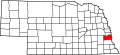
Mynard
Location within the state of Nebraska
Coordinates: 40°58′25″N95°55′26″W / 40.97361°N 95.92389°W / 40.97361; -95.92389
Country United States
State Nebraska
County Cass
Elevation
1,089 ft (332 m)
Time zone UTC-6 (Central (CST))
  Summer (DST) UTC-5 (CDT)
ZIP codes
68048
GNIS feature ID831551

Mynard is an unincorporated community in Cass County, Nebraska, United States. [1]

History

A post office was established at Mynard in 1894, which remained in operation until it was discontinued in 1939. [2] Mynard was named for Mynard Lewis, a railroad employee. [3]

Related Research Articles

<span class="mw-page-title-main">Cass County, Nebraska</span> County in Nebraska, United States

Cass County is a county in the U.S. state of Nebraska. As of the 2020 United States Census, the population was 26,598. Its county seat and largest city is Plattsmouth. The county was formed in 1855, and was named for General Lewis Cass.

<span class="mw-page-title-main">Cass County, Iowa</span> County in Iowa, United States

Cass County is a county located in the U.S. state of Iowa. As of the 2020 census, the population was 13,127. Its county seat is Atlantic. It was named to honor Lewis Cass, who was the 1848 Democratic nominee for president.

<span class="mw-page-title-main">Alvo, Nebraska</span> Village in Nebraska, United States

Alvo is a village in Cass County, Nebraska, United States. The population was 115 at the 2020 census.

<span class="mw-page-title-main">Eagle, Nebraska</span> Village in Nebraska, United States

Eagle is a village in southwest Cass County, Nebraska, United States. As of the 2020 census, the village population was 1,065.

<span class="mw-page-title-main">Greenwood, Nebraska</span> Village in Nebraska, United States

Greenwood is a village in northwest Cass County, Nebraska, United States. The population was 595 at the 2020 census.

<span class="mw-page-title-main">Louisville, Nebraska</span> City in Nebraska, United States

Louisville is a city in northern Cass County, Nebraska, United States. The population was 1,319 at the 2020 census.

<span class="mw-page-title-main">Manley, Nebraska</span> Village in Nebraska, United States

Manley is a village in Cass County, Nebraska, United States. The population was 167 at the 2020 census.

<span class="mw-page-title-main">Nehawka, Nebraska</span> Village in Nebraska, United States

Nehawka is a village in southeast Cass County, Nebraska, United States. The population was 173 at the 2020 census.

<span class="mw-page-title-main">South Bend, Nebraska</span> Village in Nebraska, United States

South Bend is a village in Cass County, Nebraska, United States. The population was 92 at the 2020 census. The main landmark is a pedestrian bridge across the Platte River which leads to Schramm Park State Recreation Area. It was built in 2004 on the pillars of the abandoned Rock Island Railroad bridge. Thirty-five trains a day—most of them coal trains—still pass through the area on the BNSF Railway main.

<span class="mw-page-title-main">Union, Nebraska</span> Village in Nebraska, United States

Union is a village in southeast Cass County, Nebraska, United States. The population was 195 at the 2020 census.

<span class="mw-page-title-main">Weeping Water, Nebraska</span> City in Nebraska, United States

Weeping Water is a city in Cass County, Nebraska, United States. The population was 1,029 at the 2020 census.

<span class="mw-page-title-main">William Orlando Butler</span> American general and politician

William Orlando Butler was a U.S. political figure and U.S. Army major general from Kentucky. He served as a Democratic congressman from Kentucky from 1839 to 1843, and was the Democratic vice-presidential nominee under Lewis Cass in 1848.

<span class="mw-page-title-main">Omaha–Council Bluffs metropolitan area</span> Metropolitan statistical area in the United States

The Omaha metropolitan area, officially known as the Omaha–Council Bluffs, NE–IA, Metropolitan Statistical Area (MSA), is an urbanized region in Nebraska and Iowa in the American Midwest, centered on the city of Omaha, Nebraska. The region consists of eight counties, and extends over a large area on both sides of the Missouri River. Covering 4,407 square miles (11,410 km2) and with a population of 967,604 (2020), the Omaha metropolitan area is the most populous in both Nebraska and Iowa, and is the 58th most populous MSA in the United States. The 2003 revision to metropolitan area definitions was accompanied by the creation of micropolitan areas and combined statistical areas. Fremont, in Dodge County, Nebraska, was designated a micropolitan area. The Omaha–Council Bluffs–Fremont Combined Statistical Area has a population of 1,058,125 . Approximately 1.5 million people reside within the Greater Omaha area, within a 50 mi (80 km) radius of Downtown Omaha.

<span class="mw-page-title-main">Nebraska Highway 63</span> Highway in Nebraska, United States

Nebraska Highway 63 is a north–south highway in eastern Nebraska with a length of 13.93 miles (22.42 km). It is also known throughout Cass County as 238th Street, except in the village of Alvo, where it adopts the name Russell Street. Its southern terminus is at U.S. Highway 34 east of Eagle. Its northern terminus is at U.S. Highway 6 southwest of Ashland.

<span class="mw-page-title-main">Naomi Institute</span> United States historic place

The Naomi Institute, also known as the Rock Bluff School, is located in the ghost town of Rock Bluff, Nebraska, three miles east of Murray. It was one of the earliest higher education institutions in Nebraska, founded in 1870 as a pioneer college. The building was listed on the National Register of Historic Places in 1977.

<span class="mw-page-title-main">Rock Bluff, Nebraska</span> Ghost town in Nebraska, United States

Rock Bluff is a ghost town in Cass County located approximately three miles east of Murray in the U.S. state of Nebraska. Once the home of an influential college called the Naomi Institute, Rock Bluff was instrumental in the 1866 vote that gave Nebraska statehood.

<span class="mw-page-title-main">National Register of Historic Places listings in Cass County, Nebraska</span>

This is a list of the National Register of Historic Places listings in Cass County, Nebraska.

<span class="mw-page-title-main">Wabash, Nebraska</span> Unincorporated community in Nebraska, United States

Wabash is an unincorporated community in Cass County, Nebraska, United States.

<span class="mw-page-title-main">Mynard Road Bridge</span> United States historic place

The Mynard Road Bridge, now located near Ashland, Nebraska, is a historic Warren truss leg bedstead bridge that was built in 1900. It was probably built by J.R. Sheeley and Company, of Lincoln, Nebraska and was listed on the National Register of Historic Places in 1992. The 50-foot (15 m) Mynard Road Bridge was the longest of its engineering type remaining in the state of Nebraska when the historic inventory was done in 1992, and was still used for vehicular traffic at that time. The bridge was originally situated on the Maynard Road and was built to span an unnamed stream, 4.7 mi (7.6 km) southeast of Louisville, Nebraska. In 2000, the bridge was relocated to be used as a pedestrian bridge at the Lee G. Simmons Conservation Park and Wildlife Safari.

Mynard may refer to:

References

  1. U.S. Geological Survey Geographic Names Information System: Mynard, Nebraska
  2. "Cass County". Jim Forte Postal History. Retrieved August 25, 2014.
  3. Fitzpatrick, Lillian L. (1960). Nebraska Place-Names. University of Nebraska Press. p. 32.