Old Goa is a historical site and city situated on the southern banks of the River Mandovi, within the Tiswadi taluka (Ilhas) of North Goa district, in the Indian state of Goa.

Margao is the commercial capital of the Indian state of Goa. It stands on the banks of the Sal river and is the administrative headquarters of Salcete sub-district and South Goa district. It is Goa's second largest city by population after Vasco.

Salcete is a subdivision of the district of South Goa, in the state of Goa, situated by the west coast of India. The Sal River and its backwaters dominate the landscape of Salcete. Historically, the sixty-six settlements south of the Zuari River formed the original Salcette territory. Salcete forms a part of the bigger Konkan region that stretches along the western shoreline of peninsular India.
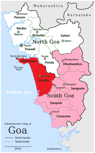
South Goa district is one of two districts that together constiitue the state of Goa, India, within the region known as the Konkan. It is bounded by North Goa district to the north, the Uttara Kannada district of Karnataka state to the east and south, while the Arabian Sea forms its western coast.

Navelim is a census town and fast growing suburb of the city of Margao located in the Salcete sub-district of South Goa district, Goa, India. It has a large parish and has played a crucial rule in South Goa politics at some stage. The region falls in the coastal South Goa sub-district of Salcete. It has been connected with some important persons from the world of Goan history too.

Hinduism is the majority religion of people living in Goa. According to the 2011 census, in a population of 1,458,545 people, 66.08% were Hindu.
Loutolim or LoutulimLottli pronounced:, Portuguese: Loutulim) is a large village of South Goa district in the state of Goa, India. It is an important settlement in the Salcete sub-district.

Cortalim is a village in Morumugão, Goa, India. Its native Goan population is entirely Catholic and their main occupations include fishing and agriculture. Located on the banks of the Zuari River, it was previously known as Kushasthale.

Nagueshi or Nagesh is a form of Lord Shiva worshipped by Konkani Hindus in India. The temple lies in verdant surroundings in the Ponda district of Goa. Unlike many other Hindu temples of Goa which were shifted out of the Velha Conquistas the Nagueshi Temple is at its original place. It has, however, been renovated a number of times. It is located in Bandode village, Ponda, North Goa district.

The Sal River is a small river in Salcete, Goa, India. Thought to be the smallest river in Goa. The river opens near Verna and flows in south-western direction for 16 kilometers passing through the villages of Nuvem, Mongul, Seraulim, Colva, Margao, Benaulim, Navelim, Varca, Orlim, Carmona, Dramapur, Chinchinim, Assolna, Cavelossim, Mobor and drains itself into the Arabian Sea at Betul. Sal river boating is also a tourist attraction.

Cavelossim is a village in South Goa district in the state of Goa, India.

Colva is a coastal village situated in the Salcete taluka, in South Goa district, of Goa state on the west coast of the Indian subcontinent. Colva Beach spans about 2.5 km (1.6 mi) along a sandy coastline of approximately 25 km (16 mi) extending from Bogmalo in the north to Cabo de Rama in the south.
Raia is a quaint village in the Salcete taluka of South Goa district, Goa state, India. It is located 4 km (2.5 mi) east from the district headquarters of Margao and 35 km (22 mi) from the state capital Panjim.

Pondataluka is a subdivision of the district of north Goa, in the Indian state of Goa. Its administrative headquarters is the township of Ponda.

Jainism flourished in Goa during the rule of Kadamba dynasty of Karnataka. Broken sculptures of the Jain Tirthankara Suparshvanatha, belonging to the period of the Goan Kadamba ruler Shivachitta Permadi Dev, were discovered in an old Jain temple in Jainkot, Naroa.
Camurlim, also known as Ambora, is a village in Salcete taluka in Goa, India. It is situate about 45 km south of the lively city of Mapusa, well known for its weekly Friday market.
Telaulim is a village in the Ponda taluka (sub-district) of Goa.
Vadi is a village in the Ponda taluka (sub-district) of Goa.

Adil Shahi–Portuguese conflicts refers to the various armed engagements that took place in India between the Portuguese Empire and the Sultanate of Bijapur, ruled by the Adil Shahi dynasty, whose rulers were known to the Portuguese as Hidalcão.

