Wadi Sharm

Last updated • 2 min readFrom Wikipedia, The Free Encyclopedia
Wadi Sharm
Wādī Sharm
Wadi Sharm - 3.jpg
United Arab Emirates relief location map.jpg
Red pog.svg
Persian Gulf relief location map.png
Red pog.svg
West Asia non political with water system.jpg
Red pog.svg
Native nameوادي شرم (Arabic)
Location
CountryFlag of the United Arab Emirates.svg  United Arab Emirates
EmirateFlag of the United Arab Emirates.svg  Fujairah
Physical characteristics
SourceNorthwestern slope of Jabal Badiyah (459 m (1,506 ft))
  elevation370 m (1,210 ft) (approximately)
Mouth Coastal and port area of the city of Sharm, in the Gulf of Oman.
  coordinates
25°27′57.4″N56°21′41.8″E / 25.465944°N 56.361611°E / 25.465944; 56.361611
  elevation
0 m (0 ft)
Length4 km (2.5 mi)
Basin size6 km2 (2.3 sq mi)
Basin features
River system Wadi Sharm

The Wadi Sharm (Arabic : وادي شرم, romanized: Wādī Sharm) [1] [2] [3] is a valley or dry river with flow ephemeral or intermittent, flowing almost exclusively during the rainy season, located in the northeast of the United Arab Emirates, in the Emirate of Fujairah.

Contents

It forms its own drainage basin, covering an area of approximately 6 km2 (2.3 sq mi), bordered to the north by the Wadi al Huwaybit / Wādī Liḩwе̄biţ; to the west by the Wadi Zikt and Wadi Wurayah, and to the south by Al Bidiyah. [4] [5]

The wadi originates on the northwestern slope of Jabal Badiyah (459 m (1,506 ft)), [6] and runs towards the coast, from southwest to east, zigzagging between steep, low hills, composed almost entirely of harzburgite, with a very steep and rugged relief.

On its course, the Wadi Sharm passes through the small town of Sharm (Sha'biyyah Sharm). [1] [7]

Floods, dams and reservoirs

As in other regions of the UAE, the coastal area of Sharm has occasionally been affected by unusually heavy rainfall and flooding. [8]

Flooding was particularly severe on March 23, 2009, following heavy rains and the collapse of the old earthen dam at the Wadi Sharm. [9] [10] [11] [12]

Wadi Sharm, currently channeled through the town of Sharm Wadi Sharm - 5.jpg
Wadi Sharm, currently channeled through the town of Sharm

When the old dam collapsed, the water contained in the reservoir flooded the city of Sharm, with 2,500 inhabitants, affecting entire neighborhoods, covering farms and roads with debris, disrupting the lives of hundreds of people. As a result, the damage caused by the flood amounted to millions of dollars. [13]

In the wake of this disaster, and to prevent the danger of flash floods and increase the potential for groundwater recharge, A new dam was built on the Wadi Sharm riverbed (coordinates: 25°28′6″N, 56°20′31″E). [14]

Toponymy

Alternative names: Wādī Sharm, Wadi Sharam, Ghalīlat Da'ān

The name and cartographic references of Wadi Sharm (with the spelling Wadi Sharam) were recorded in the documentation and maps produced between 1950 and 1960 by the British Arabist, cartographer, military officer and diplomat Julian F. Walker, during the work carried out to establish borders between the then called Trucial States, [15] later completed by the Ministry of Defence of the United Kingdom, on scale maps 1:100,000 published in 1971. [2]

In the National Atlas of the United Arab Emirates it appears with the spelling Wādī Sharm. [1]

Population

The Wadi Sharm area was mainly populated by the sharquiyín or sharqiyin tribe, [16] corresponding to the tribal section of Hamudiyin / Hamūdiyīn. [17] [18]

In the work of the British diplomat and historian John Gordon Lorimer, published in 1908 Gazetteer of the Persian Gulf, Oman and Central Arabia , reference is made to the village of Sharm/Sharam, describing it as a village of 40 houses of Sharqiyin, situated on the coast, the next village south of Dhadnah, which has 2,000 date palms, 4 camels, 10 donkeys, 50 cattle and 200 sheep and goats. [19]

See also

Related Research Articles

<span class="mw-page-title-main">Wadi Zikt</span> Wadi in the UAE

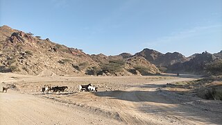
The Wadi Zikt is a dry river valley or river with ephemeral or intermittent flow, which flows almost exclusively during the rainy season, located in the northeast of the United Arab Emirates, in the Emirate of Fujairah.

<span class="mw-page-title-main">Baqal, Ras Al Khaimah</span> Village in the UAE

Baqal is a small agricultural and livestock town, located in the northeast of the U.A.E., in the Hajar Mountains of the Emirate of Ras Al Khaimah.

<span class="mw-page-title-main">Wadi Jib</span> Wadi in the UAE

The Wadi Jib is a valley or dry river with intermittent flow, which flows almost exclusively during the rainy season, belonging to the drainage basin of Wadi Bih, north-east of the United Arab Emirates (UAE), in the Emirate of Ras Al Khaimah.

<span class="mw-page-title-main">Wadi Barut</span> Wadi in the UAE

The Wadi Barut, is a valley or dry river, with ephemeral or intermittent flow, flowing almost exclusively during the rainy season, located in the northeast of the United Arab Emirates, in the Emirate of Ras Al Khaimah.

<span class="mw-page-title-main">Wadi Arus</span> Wadi in the UAE

The Wadi Arus is a valley or dry river, with intermittent flow, which flows almost exclusively during the rainy season, belonging to the river basin of Wadi Bih, north-east of the United Arab Emirates (UAE), in the Emirate of Ras Al Khaimah.

<span class="mw-page-title-main">Wadi Nahela</span> Wadi in UAE

The Wadi Nahela, also known as Wādī Ghēl, Wadi Ghil, Wadi Nahail, Wadi Nahala, Wadi Nehaila or Wadi Nuhaila, is a dry valley or river with intermittent flow, which flows almost exclusively during the rainy season, located at the northeast of the United Arab Emirates, in the Emirate of Ras Al Khaimah.

<span class="mw-page-title-main">Wadi Rahabah</span> Wadi in the UAE

Wadi Rahabah, is a dry valley or river with intermittent flow, which flows almost exclusively during the rainy season, located in the northeast of the United Arab Emirates, in the Emirate of Ras Al Khaimah.

<span class="mw-page-title-main">Wadi Kub</span> River in Ras Al Khaimah, United Arab Emirates

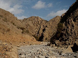
The Wadi Kub, is a dry valley or river with intermittent flow, which flows almost exclusively during the rainy season, located northeast of the United Arab Emirates, in the emirates of Fujairah and Emirate of Ras Al Khaimah.

<span class="mw-page-title-main">Shairi, Ras Al Khaimah</span> Village in the UAE

Shairi is a small agricultural and livestock town, located in the northeast of the United Arab Emirates (UAE), in the Hajar Mountains, Emirate of Ras Al Khaimah.

<span class="mw-page-title-main">Silay Al Khatami</span> Village in the UAE

Silay Al Khatami is a small agricultural and livestock village, located in the northeast of the United Arab Emirates (UAE), in the Hajar Mountains, Emirate of Ras Al Khaimah.

<span class="mw-page-title-main">Wadi Khabb Shamsi</span> Wadi in Oman

The Wadi Khabb Shamsi, is a valley or dry river, with ephemeral or intermittent flow, flowing almost exclusively during the rainy season, located west of the Musandam Governorate, in the Sultanate of Oman.

<span class="mw-page-title-main">Jabal Qihwi</span> Mountain in Oman

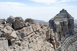
Jabal Qihwi or Jabal Qa'wah, along with the Jabal Al Harim and Jabal Bil Ays / Jebel Jais, are the three highest and most representative mountains of the Musandam Governorate, in Oman.

<span class="mw-page-title-main">Jabal Qada'ah</span> Mountain in the UAE

Jabal Qada'ah, also known as Jabal Al Aḩqab, is a mountain located in the Hajar Mountains range, northeast of the United Arab Emirates, in the Emirate of Ras Al Khaimah.

<span class="mw-page-title-main">Qada'ah</span> Village in the UAE

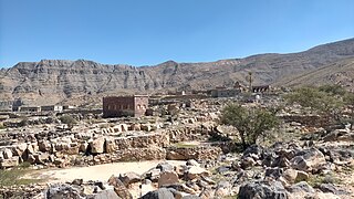
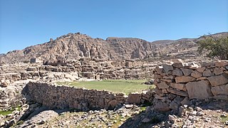
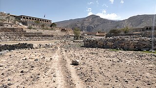
Qada'ah is a small agricultural and livestock village, located in the northeast of the United Arab Emirates (UAE), in the Hajar Mountains, Emirate of Ras Al Khaimah, at an approximate altitude of 870 m (2,850 ft), and just over a kilometer from the border with the neighboring Sultanate of Oman.

<span class="mw-page-title-main">Dafalas</span> Village in the UAE

Dafalas is a small agricultural and livestock village, located in the northeast of United Arab Emirates (UAE), in the Hajar Mountains, Emirate of Ras Al Khaimah, very close to the border with Oman.

<span class="mw-page-title-main">Wadi Safad</span> Wadi in UAE

The Wadi Safad, is a valley or dry river, with ephemeral or intermittent flow, which flows almost exclusively during the rainy season, located northeast of the United Arab Emirates, in the Emirate of Fujairah.

<span class="mw-page-title-main">Wadi Hatta</span> Wadi in Oman and UAE

The Wadi Hatta is a valley or dry river with ephemeral or intermittent flow, which flows almost exclusively during the rainy season, located north of Oman, in the Al Batinah North; and to the east of the United Arab Emirates, in the enclave of Hatta (Dubai).

<span class="mw-page-title-main">Wadi Hadf</span> Wadi in Oman and UAE

The Wadi Hadf is a dry river valley or river valley, with ephemeral or intermittent flow, which flows almost exclusively during the rainy season, located east of the United Arab Emirates, in the enclaves of Masfut (Ajman) and Hatta (Dubai), and north of Oman, in the Al Batinah North Governorate.

References

  1. 1 2 3 Jāmiʻat al-Imārāt al-ʻArabīyah al-Muttaḥidah. Geoprojects (U.K.) Ltd., The National atlas of the United Arab Emirates, Al Ain : United Arab Emirates University - 1993
  2. 1 2 Map FCO 18/1791 - 1972 - Oman and the United Arab Emirates (UAE): Dibba - Scale 1:100 000 - Published by D Survey, Ministry of Defense, United Kingdom (1971) - Edition 3-GSGS - The National Archives, London, England <https://www.agda.ae/en/catalogue/tna/fco/18/1791/n/1>
  3. Mindat.org - Ghalīlat Da‘‘ān, Al Fujayrah, United Arab Emirates
  4. Alhogaraty E. Environmental assessment for a biosphere reserve in the eastern region of the United Arab Emirates with help of geoinformatics (Doctoral dissertation). Chapter Eight - Hydrology and Hydrogeology<https://epub.ub.uni-greifswald.de/frontdoor/deliver/index/docId/646/file/16._Chapter_8._HydroHydrgeo_Revised.pdf>
  5. Alhogaraty E. Environmental assessment for a biosphere reserve in the eastern region of the United Arab Emirates with help of geoinformatics (Doctoral dissertation). Chapter Seven - Human activities<https://epub.ub.uni-greifswald.de/frontdoor/deliver/index/docId/646/file/15._Chapter_7._Environmental_Stress_Revised.pdf>
  6. Mindat.org - Jabal Badīyah, Al Fujayrah, United Arab Emirates
  7. Mindat.org - Sharm, Al Fujayrah, United Arab Emirates
  8. "UAE weather warning: Hailstones, flooding, and strong winds in parts of country. Tamara Wright, 2023". whatson.ae. Retrieved 2024-09-18.
  9. "Fujairah PWD denies reports of Dam collapse. March 23, 2009". www.wam.ae. Retrieved 2024-09-19.
  10. "Khalifa orders dam built in flooded area - Residents of damaged homes try to salvage what possessions they can as Red Crescent Authority distributes aid to stricken families. March 24, 2009". www.thenationalnews.com. Retrieved 2024-09-19.
  11. "President instructs construction of dam at Sharm Valley in Fujairah. March 24, 2009". gulfnews.com. Retrieved 2024-09-19.
  12. Dhanhani, Hamdan & Duncan, Angus & Chester, David. (2010). United Arab Emirates: Disaster Management with Regard to Rapid Onset Natural Disasters. Advanced ICTs for Disaster Management and Threat Detection: Collaborative and Distributed Frameworks. 65-79. 10.4018/978-1-61520-987-3.ch005. https://www.igi-global.com/gateway/chapter/44844
  13. Dhanhani, Hamdan Al Ghasyah (2010) ' Evaluation of the response capability of the United Arab Emirates (UAE) to the impact of natural hazards'. PhD thesis. University of Bedfordshire. https://uobrep.openrepository.com/handle/10547/241787
  14. "Work on increasing dam's capacity to begin soon - 2012". www.khaleejtimes.com. Retrieved 2024-09-19.
  15. FCO 18/1969 - 1959 - Sketch map drawn by Julian Walker for boundary delimitation: Dibba - The National Archives, London, England <https://www.agda.ae/en/catalogue/tna/fco/18/1969>
  16. "Mindat.org - Sharqīyīn, Ra's al Khaymah, United Arab Emirates". www.mindat.org. Retrieved 2024-06-30.
  17. FO 371/114648 - 1955 Land and sea boundaries of Trucial Sheikhdoms in Persian Gulf - The National Archives, London, England <https://www.agda.ae/en/catalogue/tna /fo/371/114648/n/138>
  18. FO 371/132894 1958 Tribes of Trucial States coast - The National Archives, London, England <https://www.agda. ae/en/catalogue/tna/fo/371/132894/n/94
  19. Gazetteer of the Persian Gulf. Vol. II. Geographical and Statistical. J G Lorimer. 1908', British Library: India Office Records and Private Papers, IOR/L/PS/20/C91/4, in Qatar Digital Library <https://iiif.qdl.qa/iiif/images/81055/vdc_100000000884.0x00014b/ IOR_L_PS_20_C91_4_1820.jp2/full/!1200,1200/0/default.jpg>

Commons-logo.svg Media related to Wadi Sharm (Fujairah) at Wikimedia Commons