Waikowhai

Last updated

Waikowhai
20230211 174201 Waikowhai.jpg
Waikowhai Superette on Hillsborough Road
CountryNew Zealand
City Auckland
Local authority Auckland Council
Electoral ward Albert-Eden-Puketāpapa ward
Local board Puketāpapa Local Board
Area
[1]
  Land206 ha (509 acres)
Population
 (June 2022) [2]
  Total5,550
New Windsor (3.6 km) Mount Roskill (1,259 m) Three Kings (2.9 km)
Lynfield (1.7 km)
Pfeil oben.svg
Pfeil links.svgWaikowhaiPfeil rechts.svg
Pfeil unten.svg
Hillsborough (1327 m)
(Manukau Harbour)(Manukau Harbour)(Manukau Harbour)

Waikowhai is an Auckland suburb, under the local governance of the Auckland Council. Waikowhai has the largest block of native forest left on the Auckland isthmus. The block was considered the too infertile for farming and subsequently not cleared but given to the Wesley Mission. Today the forest block hosts a valuable sample of Auckland's original fauna and flora. Waikōwhai Walkway extends for 10 km (6.2 mi) linking Onehunga to Lynfield Cove. [3]

Contents

Etymology

The name Waikowhai (sometimes spelt Waikowai) is mentioned on early European maps of the area and in newspapers from the 1850s. [4] [5] [6] The meaning of the name in Māori is unclear, either meaning kōwhai tree waters, or yellow water. [4]

History

The southern Auckland isthmus has been settled by Tāmaki Māori since at least the 13th century. A traditional trail existed at Waikowhai, linking Te Tōanga Waka (the Whau River portage) in the west to Onehunga in the east. The iwi and hapū of the Manukau Harbour moved seasonally between different areas, collecting seasonal resources and farming. By the early 18th century, the area was within the rohe of Waiohua. After the defeat of Kiwi Tāmaki, the paramount chief of the iwi, the area became part of the rohe of Ngāti Whātua (modern-day Ngāti Whātua Ōrākei). [4] There are two known sites of significance in the Waikowhai area, that are recorded on the 1853 map of the Manukau Harbour by Commander B. Drury: the Cape Horn headland is the recorded location of a fortified called Matengarahi, and the modern day Wattle Bay area, a site where many shell middens have been found, was called Taunahi. [4]

The land at Waikowhai was purchased through Robert FitzRoy's pre-emptive waiver scheme on 26 March 1844, as a part of Deed 208. [4] Most of the modern suburb of Waikowhai was land gifted to the Wesleyan Methodist Church by the Crown in 1850, for the use of the Wesleyan mission. The land was used by the mission for fishing and swimming by the pupils. [7] [4]

Waikowhai Bay was a popular destination for swimmers, day-trippers and picnickers in Auckland during the early 20th century. Gradually the bay lost popularity in the 1930s, due to increased pollution in the Manukau Harbour. [8]

In 1927, the Wesley Trust began developing and subdividing the land at Waikowhai for suburban housing, which was followed by government housing developments from the 1940s onwards. [9]

In the 1950s and 1960s, a rubbish tip and landfill was established at Waikowhai Park, which negatively impacted the area; causing pollution and blocking access to Waikowhai Bay. [4]

Demographics

Waikowhai covers 2.06 km2 (0.80 sq mi) [1] and had an estimated population of 5,550 as of June 2022, [2] with a population density of 2,694 people per km2.

Historical population
YearPop.±% p.a.
20064,833    
20134,956+0.36%
20185,439+1.88%
Source: [10]
View of the Manukau Harbour from Waikowhai Waikowhai.jpg
View of the Manukau Harbour from Waikowhai

Waikowhai had a population of 5,439 at the 2018 New Zealand census, an increase of 483 people (9.7%) since the 2013 census, and an increase of 606 people (12.5%) since the 2006 census. There were 1,518 households, comprising 2,715 males and 2,721 females, giving a sex ratio of 1.0 males per female, with 1,089 people (20.0%) aged under 15 years, 1,449 (26.6%) aged 15 to 29, 2,409 (44.3%) aged 30 to 64, and 492 (9.0%) aged 65 or older.

Ethnicities were 28.7% European/Pākehā, 6.7% Māori, 22.0% Pacific peoples, 47.3% Asian, and 4.3% other ethnicities. People may identify with more than one ethnicity.

The percentage of people born overseas was 52.0, compared with 27.1% nationally.

Although some people chose not to answer the census's question about religious affiliation, 27.5% had no religion, 41.0% were Christian, 0.4% had Māori religious beliefs, 14.5% were Hindu, 6.8% were Muslim, 3.0% were Buddhist and 1.8% had other religions.

Of those at least 15 years old, 1,407 (32.3%) people had a bachelor's or higher degree, and 582 (13.4%) people had no formal qualifications. 705 people (16.2%) earned over $70,000 compared to 17.2% nationally. The employment status of those at least 15 was that 2,211 (50.8%) people were employed full-time, 597 (13.7%) were part-time, and 189 (4.3%) were unemployed. [10]

Individual statistical areas
NameArea (km2)PopulationDensity (per km2)HouseholdsMedian ageMedian income
Waikowhai North0.703,4024,86090029.9 years$23,800 [11]
Waikowhai South1.362,0371,49861835.4 years$41,400 [12]
New Zealand37.4 years$31,800

Landmarks and features

Education

Waikowhai Intermediate School 20230304 180733 Waikowhai Intermediate School.jpg
Waikowhai Intermediate School

Waikowhai Intermediate School is an intermediate school (years 7-8) with a roll of 406. [16] It opened in 1964, and was originally used as a campus for the North Shore Teachers Training College. [17]

Waikowhai School is a contributing primary school (years 1-6) with a roll of 178, [18] which opened in 1956. [17]

Both schools are coeducational. Rolls are as of April 2023. [19]

Secondary schools in the area are Lynfield College and Mount Roskill Grammar School. Catholic secondary schools serving the area are Marcellin College and St Peter's College.

Related Research Articles

<span class="mw-page-title-main">South Auckland</span> Region of Auckland, New Zealand

South Auckland is one of the major geographical regions of Auckland, the largest city in New Zealand. The area is south of the Auckland isthmus, and on the eastern shores of the Manukau Harbour. The area has been populated by Tāmaki Māori since at least the 14th Century, and has important archaeological sites, such as the Ōtuataua stonefield gardens at Ihumātao, and Māngere Mountain, a former pā site important to Waiohua tribes.

<span class="mw-page-title-main">Onehunga</span> Suburb in Auckland, New Zealand

Onehunga is a suburb of Auckland in New Zealand and the location of the Port of Onehunga, the city's small port on the Manukau Harbour. It is eight kilometres south of the city centre, close to the volcanic cone of Maungakiekie / One Tree Hill.

<span class="mw-page-title-main">Blockhouse Bay</span> Suburb in Auckland, New Zealand

Blockhouse Bay is a residential suburb in the south west of Auckland, in New Zealand's North Island. It is sited on the northern coast of the Manukau Harbour, and is also close to the administrative boundary that existed between Auckland City and Waitakere City, two of the former four cities of what was the Auckland conurbation before amalgamation into Auckland Council.

<span class="mw-page-title-main">Mount Roskill</span> Suburb in Auckland, New Zealand

Mount Roskill is a suburban area in the city of Auckland, New Zealand. It is named for the volcanic peak Puketāpapa.

<span class="mw-page-title-main">Māngere</span> Suburb in Auckland, New Zealand

Māngere is a major suburb in South Auckland, New Zealand, located on mainly flat land on the northeastern shore of the Manukau Harbour, to the northwest of Manukau City Centre and 15 kilometres south of the Auckland city centre. It is the location of Auckland Airport, which lies close to the harbour's edge to the south of the suburb.

<span class="mw-page-title-main">New Windsor, New Zealand</span> Suburb in Auckland, New Zealand

New Windsor, founded in 1865, is a suburb of Auckland, New Zealand. It is located 10 kilometres (6.2 mi) from the Auckland city centre, between Mount Albert, Blockhouse Bay, Mt Roskill and Avondale.

<span class="mw-page-title-main">Māngere Bridge (suburb)</span> Suburb of Auckland in New Zealand

Māngere Bridge is a suburb of Auckland, New Zealand, under the local governance of the Auckland Council. Surrounded by the Manukau Harbour, the area is the most north-western suburb of South Auckland, and is connected to Onehunga in central Auckland by three bridges that cross the Māngere Inlet. Many features of the Auckland volcanic field are found in and around Māngere Bridge, including Māngere Mountain, a 106-metre-high (348 ft) feature in the centre of the suburb, and Māngere Lagoon, a volcanic tidal lagoon opposite Puketutu Island in the harbour. The suburb is also home to Ambury Regional Park, a working farm and nature sanctuary run by Auckland Council, that connects to the Kiwi Esplanade and Watercare Coastal walkways.

<span class="mw-page-title-main">Lynfield, New Zealand</span> Suburb in Auckland, New Zealand

Lynfield is a suburb of Auckland, New Zealand. It is under the local governance of Auckland Council. The suburb is located on the southwestern Auckland isthmus bordering the Manukau Harbour, much of which is densely forested with native forest. Lynfield was developed for suburban housing in the late 1950s and 1960s, modelled after American-style suburbs.

<span class="mw-page-title-main">Hillsborough, Auckland</span> Suburb in Auckland, New Zealand

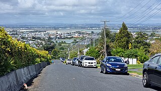
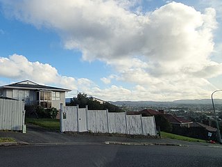
Hillsborough is a suburb of Auckland, New Zealand. It is under the local governance of the Auckland Council. Hillsborough is a leafy suburb of 20th-century houses. The area is serviced by two shopping areas; Onehunga and Three Kings. The area is served by secondary schools Mount Roskill Grammar School and Marcellin College.

<span class="mw-page-title-main">Wesley, New Zealand</span> Suburb in Auckland, New Zealand

Wesley is a suburb of Auckland, New Zealand, located in the south-west of the Auckland isthmus. The area is a part of the Oakley Creek catchment, and in the 19th and early 20th centuries was primarily swampland owned by the Weslayan Mission. The New Zealand Government developed Wesley as a state housing area in the 1940s and 1950s.

<span class="mw-page-title-main">Owairaka</span> Suburb in Auckland, New Zealand

Owairaka is a suburb of New Zealand's largest city, Auckland. It is under the local governance of the Auckland Council. The area was primarily rural until the 1930s, when the area experienced suburban growth. Owairaka is known for the Owairaka Athletic Club, a club that came to prominence in the 1960s, due to the success of coach Arthur Lydiard and athletes Murray Halberg and Peter Snell.

<span class="mw-page-title-main">Waikowhai Intermediate School</span> State, co-educational, intermediate school

Waikowhai Intermediate School is a coeducational intermediate school located in Mount Roskill, Auckland, New Zealand. It serves the areas of Mount Roskill, Waikowhai, Lynfield, Māngere Bridge and Blockhouse Bay. The current principal is David King.

<span class="mw-page-title-main">Auckland isthmus</span> Narrow landstrip in Auckland, New Zealand

The Auckland isthmus, also known as the Tāmaki isthmus, is a narrow stretch of land on the North Island of New Zealand in the Auckland Region, and the location of the central suburbs of the city of Auckland, including the CBD. The isthmus is located between two rias : the Waitematā Harbour to the north, which opens to the Hauraki Gulf / Tīkapa Moana and Pacific Ocean, and the Manukau Harbour to the south, which opens to the Tasman Sea. The isthmus is the most southern section of the Northland Peninsula.

<span class="mw-page-title-main">Puketāpapa Local Board</span> Local board of Auckland Council in New Zealand

The Puketāpapa Local Board is one of the 21 local boards of the Auckland Council, and is one of the two boards overseen by the council's Albert-Eden-Puketāpapa ward councilors.

<span class="mw-page-title-main">Āwhitu Peninsula</span> Place in Auckland, New Zealand

The Āwhitu Peninsula is a long peninsula in the North Island of New Zealand, extending north from the mouth of the Waikato River to the entrance to Manukau Harbour.

<span class="mw-page-title-main">Cornwallis, New Zealand</span> Coastal settlement in West Auckland, New Zealand

Cornwallis is a western coastal settlement of West Auckland, Auckland, New Zealand and forms part of the Waitākere Ranges Regional Park, bordering the Manukau Harbour. It is situated on the Karangahape Peninsula between the Kakamatua Inlet and Cornwallis Bay to the east. It was the site of the first European settlement in the Auckland Region, a timber and trading port that failed in the 1840s.

<span class="mw-page-title-main">Puketāpapa (local board area)</span> Local board area in Auckland, New Zealand

Puketāpapa is a local government area in Auckland, in New Zealand's Auckland Region. It is governed by the Puketāpapa Local Board and Auckland Council, and is located within the council's Albert-Eden-Puketāpapa Ward.

<span class="mw-page-title-main">Hillsborough Cemetery</span> Cemetery in Auckland, New Zealand

Hillsborough Cemetery is a large cemetery located in the Auckland isthmus suburb of Hillsborough.

<span class="mw-page-title-main">West Auckland, New Zealand</span> Region of Auckland, New Zealand

West Auckland is one of the major geographical areas of Auckland, the largest city in New Zealand. Much of the area is dominated by the Waitākere Ranges, the eastern slopes of the Miocene era Waitākere volcano which was upraised from the ocean floor, and now one of the largest regional parks in New Zealand. The metropolitan area of West Auckland developed between the Waitākere Ranges to the west and the upper reaches of the Waitematā Harbour to the east. It covers areas such as Glen Eden, Henderson, Massey and New Lynn.

References

  1. 1 2 "ArcGIS Web Application". statsnz.maps.arcgis.com. Retrieved 18 July 2022.
  2. 1 2 "Population estimate tables - NZ.Stat". Statistics New Zealand . Retrieved 25 October 2022.
  3. 1 2 "Waikōwhai Walkway: Manukau coastal walk". Auckland Council. Retrieved 12 May 2021.
  4. 1 2 3 4 5 6 7 8 Pishief, Elizabeth; Shirley, Brendan (August 2015). "Waikōwhai Coast Heritage Study" (PDF). Auckland Council . Retrieved 14 February 2023.
  5. "Notice". Maori Messenger: Te Karere Maori (in Māori). Vol. 1, no. 7. 1 September 1855. Retrieved 15 February 2023 via Papers Past.
  6. "E Rua Tekau Pauna. Panuitanga". Maori Messenger: Te Karere Maori (in Māori). Vol. 6, no. 10. 31 May 1859. Retrieved 15 February 2023 via Papers Past.
  7. Reidy 2013, pp. 24–25.
  8. Reidy 2013, pp. 132–133.
  9. Reidy 2013, pp. 71.
  10. 1 2 "Statistical area 1 dataset for 2018 Census". Statistics New Zealand. March 2020. Waikowhai North (142300) and Waikowhai South (142500).
  11. 2018 Census place summary: Waikowhai North
  12. 2018 Census place summary: Waikowhai South
  13. Mathews & Mathews Architects; Truttman, Lisa (February 2014). Puketapapa - Mt Roskill Heritage Survey 2013 (PDF) (Report). Auckland Council . Retrieved 12 February 2023.
  14. 1 2 Janssen, Peter (January 2021). Greater Auckland Walks. New Holland Publishers. p. 116-117. ISBN   978-1-86966-516-6. Wikidata   Q118136068.
  15. "Hillsborough Cemetery Loop: Waikōwhai Walkway". Auckland Council. Retrieved 12 May 2021.
  16. Education Counts: Waikowhai Intermediate School
  17. 1 2 Reidy 2013, pp. 162.
  18. Education Counts: Waikowhai School
  19. "New Zealand Schools Directory". New Zealand Ministry of Education. Retrieved 12 December 2022.

Bibliography