Wallooskee River

Last updated
Wallooskee River
Name origin:Wallooska, who in 1851 was the sole surviving member of a small band of Chinookan Indians who lived nearby [1]
Country United States
State Oregon
County Clatsop County
Source Northern Oregon Coast Range
 - elevation886 ft (270 m) [2]
 - coordinates 46°06′29″N123°40′29″W / 46.10806°N 123.67472°W / 46.10806; -123.67472   [3]
Mouth Youngs River
 - locationnear Astoria, Clatsop County , Oregon
 - elevation3 ft (1 m) [3]
 - coordinates 46°08′49″N123°48′40″W / 46.14694°N 123.81111°W / 46.14694; -123.81111 Coordinates: 46°08′49″N123°48′40″W / 46.14694°N 123.81111°W / 46.14694; -123.81111   [3]
Length10 mi (16 km)
USA Oregon location map.svg
Red pog.svg
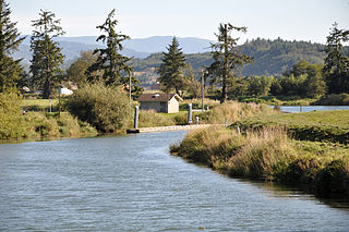
Location of the mouth of the Wallooskee River in Oregon

The Wallooskee River (also known as the Walluski River) is a tributary of the Youngs River, about 10 miles (16 km) long, in northwest Oregon in the United States. It drains a small area of the foothills of the Coast Range near the mouth of the Columbia River. The Youngs River is a tributary of the Columbia River.

Tributary stream or river that flows into a main stem river or lake

A tributary or affluent is a stream or river that flows into a larger stream or main stem river or a lake. A tributary does not flow directly into a sea or ocean. Tributaries and the main stem river drain the surrounding drainage basin of its surface water and groundwater, leading the water out into an ocean.

Youngs River river in the United States of America

The Youngs River is a tributary of the Columbia River, approximately 27 miles (43 km) long, in northwest Oregon in the United States. It drains part of the Northern Oregon Coast Range in the extreme northwest corner of state, entering the Columbia via Youngs Bay just approximately 10 miles (16 km) from its mouth.

Oregon State of the United States of America

Oregon is a state in the Pacific Northwest region on the West Coast of the United States. The Columbia River delineates much of Oregon's northern boundary with Washington, while the Snake River delineates much of its eastern boundary with Idaho. The parallel 42° north delineates the southern boundary with California and Nevada. Oregon is one of only three states of the contiguous United States to have a coastline on the Pacific Ocean.

Contents

It rises southwest of Astoria in a northern Clatsop County at 46°06′29″N123°40′29″W / 46.108165°N 123.674857°W / 46.108165; -123.674857 (Wallooskee River source) . It flows generally west in a winding course. About a mile before its mouth, it receives the Little Wallooskee River from the right at 46°08′32″N123°46′50″W / 46.1423303°N 123.780417°W / 46.1423303; -123.780417 (Little Wallooskee River mouth) which flows about 2 miles (3.2 km) from its source at 46°08′22″N123°44′09″W / 46.1395532°N 123.735971°W / 46.1395532; -123.735971 (Little Wallooskee River source) . The Wallooskee enters Youngs River from the east at the south end of Youngs Bay, approximately 2 mi (3 km) south of Astoria.

Astoria, Oregon City in Oregon, United States

Astoria is a port city and the seat of Clatsop County, Oregon, United States. Founded in 1811, it is the oldest American settlement west of the Rocky Mountains and the oldest city in the state of Oregon. Astoria is located on the south shore of the Columbia River, where the river meets the Pacific Ocean. The city is named for John Jacob Astor, an investor from New York City whose American Fur Company founded Fort Astoria at the site. Astoria was incorporated by the Oregon Legislative Assembly on October 20, 1876.

Clatsop County, Oregon County in the United States

Clatsop County is a county in the U.S. state of Oregon. As of the 2010 census, the population was 37,039. The county seat is Astoria. The county is named for the Clatsop tribe of Native Americans, who lived along the coast of the Pacific Ocean prior to European settlement.

Youngs Bay

Youngs Bay, or Youngs River Bay, is located in the northwestern corner of the U.S. state of Oregon. The Youngs River meets the Columbia River at this point, which is situated between Astoria and Warrenton.

Walluski

The name of the river was formerly spelled "Walluski" but the Board on Geographic Names changed it to "Wallooskee" in 1975. [3] Although there is not a formal settlement by the name of Walluski, Oregon, the Olney-Walluski area is considered a community by local residents and the Walluski area was a census precinct as recently as 1950. [4] [5] As of 1892, there was a Walluski School. [6] The school was located near Oregon State University's John Jacob Astor Agricultural Experiment Station, that was later used as the Clatsop Community College farm and today is the site of the Clatsop County Fairgrounds. [7] [8]

United States Board on Geographic Names US geographic naming government agency

The United States Board on Geographic Names (BGN) is a federal body operating under the United States Secretary of the Interior. The purpose of the board is to establish and maintain uniform usage of geographic names throughout the federal government of the United States.

Olney, Oregon unincorporated community town in Clatsop County, Oregon, United States of America

Olney is an unincorporated community and former company town in Clatsop County, Oregon, United States, on Oregon Route 202 approximately eight miles south of Astoria. Olney is located at 46.100109°N 123.757637°W. Its post office is assigned ZIP code 97325.

Oregon State University public university in Corvallis, Oregon, United States

Oregon State University (OSU) is a public research university in Corvallis, Oregon. The university offers more than 200 undergraduate degree programs along with a variety of graduate and doctoral degrees. It is also the largest university in the state, with a total enrollment exceeding 28,000. More than 230,000 students have graduated from OSU since its founding. The Carnegie Foundation designates Oregon State University as a "Community Engagement" university and classifies it as a doctoral university with a status of "Highest research activity".

There is also a Walluski soil series named for the area. [9]

Soil series succession of stratum

Soil series as established by the National Cooperative Soil Survey of the United States Department of Agriculture (USDA) Natural Resources Conservation Service are a level of classification in the USDA Soil Taxonomy classification system hierarchy. The actual object of classification is the so-called soil individual, or pedon. Soil series consist of pedons that are grouped together because of their similar pedogenesis, soil chemistry, and physical properties. More specifically, each series consists of pedons having soil horizons that are similar in soil color, soil texture, soil structure, soil pH, consistence, mineral and chemical composition, and arrangement in the soil profile. These result in soils which perform similarly for land use purposes.

See also

Related Research Articles

North Yamhill River river in the United States of America

The North Yamhill River is a 31-mile (50 km) tributary of the Yamhill River in the U.S. state of Oregon. It drains an area of the Northern Oregon Coast Range, as well as part of the Willamette Valley west of the Willamette River.

Alsea River river in the United States of America

The Alsea River flows 48.5 miles (78.1 km) from Alsea, an unincorporated community in the coastal mountains of the U.S. state of Oregon, to the Pacific Ocean near the city of Waldport. It begins at the confluence of the North Fork Alsea River and the South Fork Alsea River and ends in Alsea Bay, a wide estuary at Waldport. The river flows generally west-northwest in a winding course through the mountains of southern Benton and Lincoln counties, passing near the unincorporated community of Tidewater and through the Siuslaw National Forest. Its drainage basin extends into Lane County, along the headwaters of the South Fork Alsea River.

Big River (Oregon) river in Oregon, United States of America

The Big River is a tributary of the Coast Fork Willamette River, approximately 12 miles (19 km) long, in western Oregon in the United States. It drains an area of the Calapooya Mountains south of Eugene.

Trask River river in Oregon

The Trask River is in northwestern Oregon in the United States. It drains a mountainous timber-producing area of the Northern Oregon Coast Range west of Portland into Tillamook Bay and the Pacific Ocean. It is one of five rivers—the Tillamook, the Trask, the Wilson, the Kilchis, and the Miami—that flow into the bay.

Sprague River (Oregon) river in the United States of America

The Sprague River is a tributary of the Williamson River, approximately 75 miles (121 km) long, in southwestern Oregon in the United States. It drains an arid volcanic plateau region east of the Cascade Range in the watershed of the Klamath River.

Nehalem River river in the United States of America

The Nehalem River is a river on the Pacific coast of northwest Oregon in the United States, approximately 119 miles (192 km) long. It drains part of the Northern Oregon Coast Range northwest of Portland, originating on the east side of the mountains and flowing in a loop around the north end of the range near the mouth of the Columbia River. Its watershed of 855 square miles (2,210 km2) includes an important timber-producing region of Oregon that was the site of the Tillamook Burn. In its upper reaches it flows through a long narrow valley of small mountain communities but is unpopulated along most of its lower reaches inland from the coast. The city where the river flows into the Pacific is also used as the name for CPU manufacturing titan Intel's first-generation line of Core processors.

Skipanon River river in the United States of America

The Skipanon River is a tributary of the Columbia River, approximately 7 miles (11 km) long, on the Pacific coast of northwest Oregon in the United States. It is the last tributary of the Columbia on the Oregon side, draining an area of coastal bottom land bordered by sand dunes and entering the river from the south at its mouth west of Astoria.

Lewis and Clark River river in the United States of America

The Lewis and Clark River is a tributary of Youngs River, approximately 20 miles (32 km) long, in northwest Oregon in the United States. It drains 62 square miles (160 km2) of the Northern Oregon Coast Range in the extreme northwest corner of the state, entering Youngs River just above its mouth on the Columbia River at Youngs Bay. Near the river's mouth is the site of former Fort Clatsop of the Lewis and Clark Expedition. The river is named for Meriwether Lewis and William Clark.

Youngs River Falls

Youngs River Falls is a 54-foot (16 m) tall waterfall on the Youngs River in central Clatsop County, northwestern Oregon, United States. They are located about 10 miles (16 km) south of Astoria.

Klaskanine River river in the United States of America

The Klaskanine River is a tributary of the Youngs River, approximately 16 miles (26 km) long, in northwest Oregon in the United States. It drains a small section of the Coast Range in the extreme northwest corner of the state in the watershed of the nearby Columbia River.

Clatskanie River river in the United States of America

The Clatskanie River is a tributary of the Columbia River, approximately 25 miles (40 km) long, in northwestern Oregon in the United States. It drains a timber-producing area in the foothills of the Northern Oregon Coast Range north-northwest of Portland.

Astoria–Megler Bridge bridge in Washington state, USA

The Astoria–Megler Bridge is a steel cantilever through truss bridge in the northwest United States that spans the lower Columbia River, between Astoria, Oregon, and Point Ellice near Megler, Washington. Opened 53 years ago in 1966, it is the longest continuous truss bridge in North America.

John Day River (northwestern Oregon) river in Clatsop County, Oregon, USA

The John Day River is a tributary of the Columbia River, approximately 6 miles (10 km) long, in northwestern Oregon in the United States. The river rises in the Northern Oregon Coast Range in Clatsop County at 46.138889°N 123.704722°W.

Ash Creek (Polk County, Oregon)

Ash Creek is a short stream in Polk County, in the U.S. state of Oregon. Formed by the merger of its north and middle forks near Monmouth, it flows generally east to meet the Willamette River at Independence. The creek passes under Oregon Route 51 just before entering the river. The creek's mouth is about 95 miles (153 km) upstream of the Willamette's confluence with the Columbia River.

Clifton is an unincorporated community in Clatsop County, Oregon, United States. It is located north of U.S. Route 30, about nine miles northwest of Westport on the south bank of the Columbia River. It is on Clifton Channel across from Tenasillahe Island.

Myrtle Creek (South Umpqua River tributary) river in the United States of America

Myrtle Creek is a short tributary of the South Umpqua River in Douglas County in the U.S. state of Oregon. Its main stem, formed by the confluence of two forks just south of the city of Myrtle Creek, is only about 1 mile (1.6 km) long. Its only named tributaries are the two forks, North Myrtle Creek and South Myrtle Creek, each of which is much longer than the main stem.

References

  1. McArthur, Lewis A.; McArthur, Lewis L. (2003). Oregon Geographic Names, Seventh Edition. Portland, Oregon: Oregon Historical Society Press. p. 1005. ISBN   0-87595-277-1.
  2. Source elevation derived from Google Earth search using GNIS source coordinates.
  3. 1 2 3 4 "Wallooskee River". Geographic Names Information System (GNIS). United States Geological Survey. November 28, 1980. Retrieved November 16, 2014.
  4. "Olney Walluski Fire & Rescue". Astoria Dispatch 911. Retrieved November 16, 2014.
  5. "Population of Counties by Minor Civil Divisions". Census of Population: 1950: Number of Inhabitants. United States Census Bureau. p. 14. Retrieved November 16, 2014.
  6. Cleveland, Alfred A. (March 1903). "Educational History of Astoria". Oregon Historical Quarterly. Oregon Historical Society. 4 (1): 30. Retrieved November 16, 2014.
  7. "Walluski School Burns". The Sunday Oregonian . September 25, 1921. Retrieved November 16, 2014.
  8. "About". Clatsop County Fair & Expo Center. Retrieved November 16, 2014.
  9. "Walluski Series". National Cooperative Soil Survey. November 16, 2014.
Map all coordinates using: OpenStreetMap  
Download coordinates as: KML  ·  GPX