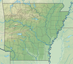
Warm Fork Spring River Tributary to Spring River | |
---|---|
Location | |
Country | United States |
State | Missouri Arkansas |
County | Fulton (AR) Oregon (MO) |
City | Thayer, MO |
Physical characteristics | |
Source | confluence of Howell Creek and Elk Creek |
• location | about 3 miles northeast of Brandsville, Missouri |
• coordinates | 36°40′35.87″N091°38′59.64″W / 36.6766306°N 91.6499000°W [1] |
• elevation | 750 ft (230 m) [2] |
Mouth | Spring River |
• location | Mammoth Spring, Arkansas |
• coordinates | 36°29′40.23″N091°23′9.51″W / 36.4945083°N 91.3859750°W [2] |
• elevation | 492 ft (150 m) [2] |
Length | 19.21 mi (30.92 km) [3] |
Basin size | 238.04 square miles (616.5 km2) [4] |
Discharge | |
• location | Spring River |
• average | 317.46 cu ft/s (8.989 m3/s) at mouth with Spring River [4] |
Basin features | |
Progression | Spring River → Black River → White River → Mississippi River → Gulf of Mexico |
River system | White River |
Tributaries | |
• left | Elk Creek Anthony Branch Cox Creek |
• right | Howell Creek Bay Creek |
Bridges | County Road M, unnamed road (x4), Oregon County 327, unnamed road, MO 19, E Adams Street, Warm Fork Road, US 63, W Walnut Street, US 63, unnamed road |
The Warm Fork Spring River is a stream in Oregon County, Missouri, and northern Fulton County, Arkansas, United States. [2] The stream begins in western Oregon County at the confluence of Howell Creek and Elk Creek and the stream becomes the Spring River at its confluence with the cold springwaters of Mammoth Spring in northern Fulton County.
The stream was named due to the temperature difference between its waters and the cold springwaters entering from Mammoth Spring. [5] This is the only stream of this name in the United States. [1]
According to the Geographic Names Information System, it has also been known historically as: [1]
The Spring River is a 57-mile (92 km) long river which flows through the U.S. states of Missouri and Arkansas. It consists of two branches, the South Fork of the Spring River and the Spring River proper. The South Fork of the Spring River starts in Howell County, Missouri and flows south through Fulton and Sharp counties in Arkansas. The South Fork of the Spring River joins the Spring River proper near the town of Hardy, Arkansas. The South Fork is a quiet stream with gravelly bars that are ideal for camping.
The Grand River is a tributary of the Missouri River in South Dakota in the United States. The length of the combined branch is 110 mi (177 km). With its longest fork, its length is approximately 200 mi (320 km).
The Current River forms in the southeastern portion of the Ozarks of Missouri and becomes a 7th order stream as it flows southeasterly out of the Ozarks into northeastern Arkansas where it becomes a tributary of the Black River, which is a tributary of the White River, a tributary of the Mississippi River. The Current River is roughly 184 miles (296 km) long and drains about 2,641 square miles (6,840 km2) of land mostly in Missouri and a small portion of land in northeastern Arkansas. The headwaters of the Current River are nearly 900 feet (270 m) above sea level, while the mouth of the river lies around 280 feet (85 m) above sea level. The basin drains a rural area that is dominated by karst topography, underlain by dolomite and sandstone bedrock with a small area of igneous rock southeast of Eminence, Missouri. The annual daily mean discharge of the river near Doniphan, Missouri is 2,815 cubic feet (79.7 m3) per second. In 1964, over 134 mi (160 km) of the upper course of the river and its tributaries were federally protected as the Ozark National Scenic Riverways, the first national park in America to protect a river system.
The Eleven Point River is a 138-mile-long (222 km) river in southern Missouri and northern Arkansas, United States.
The South Branch Potomac River has its headwaters in northwestern Highland County, Virginia, near Hightown along the eastern edge of the Allegheny Front. After a river distance of 139 miles (224 km), the mouth lies east of Green Spring, Hampshire County, West Virginia, where it meets the North Branch Potomac River to form the Potomac.
The Black River is a tributary of the White River, about 300 miles (480 km) long, in southeastern Missouri and northeastern Arkansas in the United States. Via the White River, it is part of the Mississippi River watershed. Black River Technical College is named for the river.
The Licking River is a tributary of the Muskingum River, about 40 mi (65 km) long, in central Ohio in the United States. Via the Muskingum and Ohio Rivers, it is part of the watershed of the Mississippi River.
Jacks Fork is one of two rivers in Missouri that are part of the Ozark National Scenic Riverways system.
Bay Creek is a stream in the U.S. states of Arkansas and Missouri. It is a tributary of the South Fork Spring River.
Myatt Creek is a stream in northeastern Fulton County, Arkansas and southeastern Howell County, Missouri.
Anthony Branch is a stream in Oregon County in the Ozarks of southern Missouri. It is a tributary of the Warm Fork Spring River.
Bay Creek is a stream in Oregon County in the Ozarks of southern Missouri. It is a tributary of the Warm Fork Spring River.
Cox Creek is a stream in Oregon County in the Ozarks of southern Missouri. It is a tributary of the Warm Fork Spring River.
English Creek is a stream in Oregon County of southern Missouri and Fulton County of northern Arkansas. It is a tributary of Spring River.
Mill Stone Branch is a stream in Oregon County in the Ozarks of southern Missouri. It is a tributary of Warm Fork Spring River. The stream headwaters are located at 36°37′50″N91°35′46″W and the confluence with the Warm Fork is at 36°37′17″N91°34′02″W.
Orchard Creek is a stream in Oregon County in the Ozarks of southern Missouri. It is a tributary of the Warm Fork Spring River.
Twomile Creek is a stream in Oregon County in the Ozarks of southern Missouri, United States. It is a tributary of the Warm Fork Spring River.
Logan Creek is a stream in western Reynolds County in the Ozarks of southeast Missouri. It is a tributary of the Black River.
Bear Creek is a stream in Bollinger and Wayne counties in the U.S. state of Missouri. It is a tributary of the Castor River.
Howell Creek is a stream in Howell and Oregon counties of southern Missouri. The stream is a tributary to the Warm Fork Spring River.