
Dakota County is the third-most populous county in the U.S. state of Minnesota, located in the east central portion of the state. As of the 2020 census, the population was 439,882. The population of Dakota County was estimated to be 442,038 in 2021. The county seat is Hastings. Dakota County is named for the Dakota Sioux tribal bands who inhabited the area. The name is recorded as "Dahkotah" in the United States Census records until 1851. Dakota County is included in the Minneapolis–St. Paul–Bloomington, MN–WI Metropolitan Statistical Area, the sixteenth largest metropolitan area in the United States with about 3.64 million residents. The largest city in Dakota County is the city of Lakeville, the eleventh-largest city in Minnesota and sixth-largest Twin Cities suburb. The county is bordered by the Minnesota and Mississippi Rivers on the north, and the state of Wisconsin on the east.

The Brazos River, called the Río de los Brazos de Dios by early Spanish explorers, is the 11th-longest river in the United States at 1,280 miles (2,060 km) from its headwater source at the head of Blackwater Draw, Roosevelt County, New Mexico to its mouth at the Gulf of Mexico with a 45,000-square-mile (116,000 km2) drainage basin. Being one of Texas' largest rivers, it is sometimes used to mark the boundary between East Texas and West Texas.

The Trinity River is a 710-mile (1,140 km) river, the longest with a watershed entirely within the U.S. state of Texas. It rises in extreme northern Texas, a few miles south of the Red River. The headwaters are separated by the high bluffs on the southern side of the Red River.

The Feather River is the principal tributary of the Sacramento River, in the Sacramento Valley of Northern California. The river's main stem is about 73 miles (117 km) long. Its length to its most distant headwater tributary is just over 210 miles (340 km). The main stem Feather River begins in Lake Oroville, where its four long tributary forks join—the South Fork, Middle Fork, North Fork, and West Branch Feather Rivers. These and other tributaries drain part of the northern Sierra Nevada, and the extreme southern Cascades, as well as a small portion of the Sacramento Valley. The total drainage basin is about 6,200 square miles (16,000 km2), with approximately 3,604 square miles (9,330 km2) above Lake Oroville.

The Eel River is a major river, about 196 miles (315 km) long, of northwestern California. The river and its tributaries form the third largest watershed entirely in California, draining a rugged area of 3,684 square miles (9,540 km2) in five counties. The river flows generally northward through the Coast Ranges west of the Sacramento Valley, emptying into the Pacific Ocean about 10 miles (16 km) downstream from Fortuna and just south of Humboldt Bay. The river provides groundwater recharge, recreation, and industrial, agricultural and municipal water supply.

The Buffalo River is the longest unimpounded river in Middle Tennessee in the United States. It flows 125 miles (201 km) through the southern and western portions of that region. The Buffalo is the largest tributary of the Duck River. Canoeing is popular, especially in its middle section. The river is named for the Buffalo fish which was abundant when the first European settlers arrived.

The Mokelumne River is a 95-mile (153 km)-long river in northern California in the United States. The river flows west from a rugged portion of the central Sierra Nevada into the Central Valley and ultimately the Sacramento–San Joaquin River Delta, where it empties into the San Joaquin River-Stockton Deepwater Shipping Channel. Together with its main tributary, the Cosumnes River, the Mokelumne drains 2,143 square miles (5,550 km2) in parts of five California counties. Measured to its farthest source at the head of the North Fork, the river stretches for 157 miles (253 km).
The Potomac Highlands of West Virginia centers on five West Virginian counties in the upper Potomac River watershed in the western portion of the state's Eastern Panhandle, bordering Maryland and Virginia. Because of geographical proximity, similar topography and landscapes, and shared culture and history, the Potomac Highlands region also includes Pocahontas, Randolph, and Tucker counties, even though they are in the Monongahela River or New River watersheds and not that of the Potomac River.

The Crow River is a tributary of the Mississippi River in south-central Minnesota in the United States. It drains a watershed of 2,756 square miles (7,140 km2).

Cache Creek is an 87-mile-long (140 km) stream in Lake, Colusa and Yolo counties, California.

The Soque River and its watershed are located entirely within the county boundaries of Habersham County in northeast Georgia. The Soque is a tributary of the Chattahoochee River. Portions of the river run along State Route 197.

The geology of Minnesota comprises the rock, minerals, and soils of the U.S. state of Minnesota, including their formation, development, distribution, and condition.

Rice Creek is a tributary of the Mississippi River in the northern suburbs of the Minneapolis–St. Paul metropolitan area of Minnesota in the United States. It is approximately 28 miles (45 km) long and drains a watershed of 201 square miles (520 km2).

The Long Prairie River is a tributary of the Crow Wing River, 96 miles (154 km) long, in central Minnesota in the United States. Via the Crow Wing River, it is part of the watershed of the Mississippi River, draining an area of 892 square miles (2,310 km2) in a generally rural region.
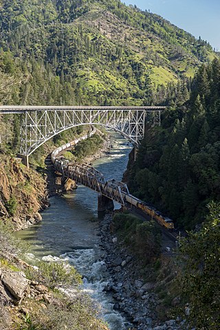
The North Fork Feather River is a watercourse of the northern Sierra Nevada in the U.S. state of California. It flows generally southwards from its headwaters near Lassen Peak to Lake Oroville, a reservoir formed by Oroville Dam in the foothills of the Sierra, where it runs into the Feather River. The river drains about 2,100 square miles (5,400 km2) of the western slope of the Sierras. By discharge, it is the largest tributary of the Feather.

East Fork Russian River is a 15 mi (24 km) long tributary of the Russian River in Mendocino County, California artificially connected to the Eel River via an interbasin diversion at the Potter Valley Project hydroelectric facility. It forms in the north of Potter Valley, flows south through this valley, then southwest through a mountain pass to Lake Mendocino, an artificial reservoir that empties into Russian River. At one time Clear Lake to the east drained through Cold Creek then along the lower part of East Fork Russian River through Coyote Valley to the Russian River proper. A few hundred years ago a massive landslide blocked this channel, and Clear Lake found a new outlet to the Sacramento River.

The geography of Arkansas varies widely. The state is covered by mountains, river valleys, forests, lakes, and bayous in addition to the cities of Arkansas. Hot Springs National Park features bubbling springs of hot water, formerly sought across the country for their healing properties. Crowley's Ridge is a geological anomaly rising above the surrounding lowlands of the Mississippi embayment.

Buffalo Creek is a stream in the U.S. states of Pennsylvania and West Virginia. It rises in East Finley Township, Washington County, Pennsylvania. Its tributaries are Brushy Run, Mill Run, Indian Camp Run, Buck Run, and Dutch Fork. These streams flow through the townships of East Findley, Donegal, Hopewell, and Buffalo, and the creek itself empties into the Ohio River at Wellsburg, West Virginia. The stream was presumably named for a Buffalo trace that once passed through the valley.

Cold Creek is a river of Mendocino County, California, a tributary of East Fork Russian River. In the past it may have connected Clear Lake to the Russian River before this route was blocked by a large landslide and Clear Lake began to drain into the Sacramento River watershed.