Related Research Articles
Clarion Municipal Airport is a city-owned public-use airport located one nautical mile (1.85 km) northwest of the central business district of Clarion, a city in Wright County, Iowa, United States. This airport is included in the FAA's National Plan of Integrated Airport Systems for 2009–2013, which categorized it as a general aviation facility.
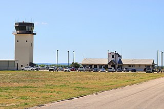
New Braunfels National Airport is a public use airport in Guadalupe County, Texas, United States. It is owned by the city of New Braunfels and located four nautical miles east of its central business district. Formerly known as New Braunfels Regional Airport, it is included in the National Plan of Integrated Airport Systems for 2011–2015, which categorized it as a general aviation facility.
Springdale Municipal Airport is a public use airport in Washington County, Arkansas, United States. It is owned by the City of Springdale and located one nautical mile (2 km) southeast of its central business district. This airport is included in the National Plan of Integrated Airport Systems for 2011–2015, which categorized it as a general aviation facility.
Tri-County Airport is a public use airport located nine nautical miles west of the central business district of Ahoskie, in Hertford County, North Carolina, United States. It is owned by the Tri-County Airport Authority. This airport is included in the National Plan of Integrated Airport Systems for 2011–2015, which categorized it as a general aviation facility.

Billy Mitchell Airport is a public use airport located four nautical miles east of the central business district of Hatteras, in Dare County, North Carolina, United States. The airport is located in the Cape Hatteras National Seashore and is owned by the National Park Service. It is named after United States Army Air Service General Billy Mitchell, and is included in the National Plan of Integrated Airport Systems for 2017–2021, which categorized it as a general aviation facility.

Grant County Regional Airport - GCRA is in Grant County, Oregon, a mile southwest of John Day, Oregon. The National Plan of Integrated Airport Systems for 2011–2015 categorized it as a general aviation facility.

McMinnville Municipal Airport is three miles southeast of McMinnville, in Yamhill County, Oregon. The FAA's National Plan of Integrated Airport Systems for 2009–2013 categorized it as a general aviation facility. It is across Oregon Route 18 from the Evergreen Aviation & Space Museum, home to the Hughes H-4 Hercules Spruce Goose flying boat.

Tillamook Airport is a public use airport located 3 miles (4.8 km) south of the central business district of Tillamook, a city in Tillamook County, Oregon, United States. It is owned by the Port of Tillamook Bay. According to the FAA's National Plan of Integrated Airport Systems for 2009–2013, it is categorized as a general aviation facility.

Pike County Airport, also known as Hatcher Field, is a public-use airport in Pike County, Kentucky, United States. It is owned by the Pike County Regional Airport Board and located six nautical miles (11 km) northwest of the central business district of Pikeville, Kentucky. This airport is included in the FAA's National Plan of Integrated Airport Systems for 2009–2013, which categorized it as a general aviation facility.
Santee Cooper Regional Airport is a public use airport located seven nautical miles (13 km) south of the central business district of Manning, a city in Clarendon County, South Carolina, United States. It is owned by Clarendon County and began service in 1966. According to the FAA's National Plan of Integrated Airport Systems for 2009–2013, it is categorized as a general aviation facility.
Blue Ridge Regional Airport is nine miles southwest of Martinsville, in Henry County, Virginia. It is owned by the Blue Ridge Airport Authority. The FAA's National Plan of Integrated Airport Systems for 2009–2013 categorized it as a general aviation facility.
Russellville Regional Airport is a city-owned public-use airport located two nautical miles (3.7 km) southeast of the central business district of Russellville, a city in Pope County, Arkansas, United States. According to the FAA's National Plan of Integrated Airport Systems for 2009–2013, it is categorized as a general aviation facility. It was formerly known as Russellville Municipal Airport.

Abernathy Field is a public use airport located three nautical miles southwest of the central business district of Pulaski, a city in Giles County, Tennessee, United States. It is owned by the City of Pulaski and Giles County. According to the FAA's National Plan of Integrated Airport Systems for 2009–2013, it is categorized as a general aviation facility.
Madison Municipal Airport is a city-owned public use airport located one nautical mile northeast of the central business district of Madison, a city in Lake County, South Dakota, United States. This airport is included in the FAA's National Plan of Integrated Airport Systems for 2009–2013, which categorized it as a general aviation facility.
Orange City Municipal Airport was a city-owned public-use airport located one nautical mile (1.85 km) south of the central business district of Orange City, a city in Sioux County, Iowa, United States. This airport was included in the FAA's National Plan of Integrated Airport Systems for 2009–2013, which categorized it as a general aviation facility.
Kit Carson County Airport is in Kit Carson County, Colorado, three miles south of Burlington, which owns it. The FAA's National Plan of Integrated Airport Systems for 2009–2013 categorized it as a general aviation facility.
Malone-Dufort Airport is two miles west of Malone, a village in the Town of Malone, Franklin County, New York. The FAA's National Plan of Integrated Airport Systems for 2009–2013 categorized it as a general aviation facility.
Baker Municipal Airport is a public-use airport located one nautical mile southeast of the central business district of Baker, a city in Fallon County, Montana, United States. The airport is owned by Baker City and Fallon County. It is included in the FAA's National Plan of Integrated Airport Systems for 2011–2015, which categorized it as a general aviation facility.
Jesup–Wayne County Airport is a county-owned, public-use airport located three nautical miles (6 km) south of the central business district of Jesup, a city in Wayne County, Georgia, United States. It is also known as William A. Zorn Airport.
Tompkinsville-Monroe County Airport is a public use airport located two nautical miles (4 km) northeast of the central business district of Tompkinsville, a city in Monroe County, Kentucky, United States. It is included in the National Plan of Integrated Airport Systems for 2011–2015, which categorized it as a general aviation facility.
References
- 1 2 3 4 FAA Airport Form 5010 for EKQ PDF . Federal Aviation Administration. Effective 28 December 2023.
- ↑ National Plan of Integrated Airport Systems for 2009–2013: Appendix A: Part 3 (PDF, 1.28 MB) Archived 2011-06-06 at the Wayback Machine . Federal Aviation Administration. Updated 15 October 2008.
- ↑ "Wayne County Airport (ICAO: KEKQ, FAA: EKQ)". Great Circle Mapper. Retrieved 18 June 2010.