Weeki Wachee Gardens, Florida

Last updated
Weeki Wachee Gardens, Florida
NB HCR 597 - Weeki Wachee Gardens.JPG
County Road 597 entering Weeki Wachee Gardens
Hernando County Florida Incorporated and Unincorporated areas Weeki Wachee Gardens Highlighted.svg
Location in Hernando County and the state of Florida
Coordinates: 28°32′1″N82°37′29″W / 28.53361°N 82.62472°W / 28.53361; -82.62472 Coordinates: 28°32′1″N82°37′29″W / 28.53361°N 82.62472°W / 28.53361; -82.62472
Country United States
State Florida
County Hernando
Area
[1]
  Total1.41 sq mi (3.64 km2)
  Land1.25 sq mi (3.25 km2)
  Water0.15 sq mi (0.40 km2)
Elevation
3 ft (1 m)
Population
 (2020)
  Total1,138
  Density907.50/sq mi (350.44/km2)
Time zone UTC-5 (Eastern (EST))
  Summer (DST) UTC-4 (EDT)
ZIP code
34607 [2]
Area code 352
FIPS code 12-75641 [3]
GNIS feature ID1867226 [4]

Weeki Wachee Gardens is a census-designated place (CDP) in Hernando County, Florida, United States. The population was 1,146 at the 2010 census. [5]

Contents

Geography

Weeki Wachee Gardens is located in western Hernando County at 28°32′1″N82°37′29″W / 28.53361°N 82.62472°W / 28.53361; -82.62472 (28.533569, -82.624784), [6] along the Weeki Wachee River east of its mouth in the Gulf of Mexico. Shoal Line Boulevard is the main road through the community, leading northeast 1.5 miles (2.4 km) to Cortez Boulevard and south 4 miles (6 km) to Hernando Beach.

According to the United States Census Bureau, the CDP has a total area of 1.4 square miles (3.6 km2), of which 1.3 square miles (3.3 km2) are land and 0.1 square miles (0.3 km2), or 9.60%, are water. [5]

Demographics

Historical population
CensusPop.Note
2020 1,138
U.S. Decennial Census [7]

As of the census [3] of 2000, there were 1,140 people, 556 households, and 361 families residing in the CDP. The population density was 822.6 inhabitants per square mile (317.6/km2). There were 888 housing units at an average density of 640.8 per square mile (247.4/km2). The racial makeup of the CDP was 97.98% White, 0.18% African American, 0.79% Native American, 0.09% Asian, and 0.96% from two or more races. Hispanic or Latino of any race were 1.14% of the population.

There were 556 households, out of which 13.3% had children under the age of 18 living with them, 56.7% were married couples living together, 5.0% had a female householder with no husband present, and 34.9% were non-families. 27.5% of all households were made up of individuals, and 10.4% had someone living alone who was 65 years of age or older. The average household size was 2.05 and the average family size was 2.39.

In the CDP, the population was spread out, with 12.2% under the age of 18, 3.7% from 18 to 24, 18.0% from 25 to 44, 39.5% from 45 to 64, and 26.7% who were 65 years of age or older. The median age was 54 years. For every 100 females, there were 108.4 males. For every 100 females age 18 and over, there were 106.0 males.

The median income for a household in the CDP was $29,826, and the median income for a family was $33,942. Males had a median income of $36,389 versus $19,583 for females. The per capita income for the CDP was $21,423. About 10.1% of families and 9.0% of the population were below the poverty line, including 25.9% of those under age 18 and 3.9% of those age 65 or over.

Related Research Articles

<span class="mw-page-title-main">Hernando County, Florida</span> County in Florida, United States

Hernando County is a county located on the west central coast of the U.S. state of Florida. As of the 2020 census, the population was 194,515. Its county seat is Brooksville, and its largest community is Spring Hill.

<span class="mw-page-title-main">Hernando, Florida</span> Census-designated place in Florida, US

Hernando is a census-designated place in Citrus County, Florida, United States. The population was 9,054 at the 2010 census. At one time it was a city but it was disincorporated in the 1970s.

<span class="mw-page-title-main">Inverness Highlands North, Florida</span> Census-designated place in Florida, US

Inverness Highlands North is an unincorporated area and census-designated place (CDP) in Citrus County, Florida, United States. The population was 2,401 at the 2010 census, up from 1,470 in 2000.
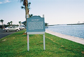
<span class="mw-page-title-main">Bayport, Florida</span> Census-designated place in Florida, United States

Bayport is an unincorporated community and census-designated place (CDP) in Hernando County, Florida, United States. The population was 43 at the 2010 census.

<span class="mw-page-title-main">Brookridge, Florida</span> Census-designated place in Florida, United States

Brookridge is a census-designated place (CDP) in Hernando County, Florida, United States. The population was 4,420 at the 2010 census, up from 3,279 at the 2000 census.

<span class="mw-page-title-main">Hernando Beach, Florida</span> Census-designated area in Hernando County Florida, United States

Hernando Beach is a census-designated place (CDP) in Hernando County, Florida, United States. The population was 2,299 at the 2010 census.

<span class="mw-page-title-main">High Point, Hernando County, Florida</span> Census-designated place in Florida, United States

High Point is an unincorporated area and census-designated place (CDP) in Hernando County, Florida, United States. The population was 3,686 at the 2010 census.

<span class="mw-page-title-main">Hill 'n Dale, Florida</span> Census-designated place in Florida, United States

Hill 'n Dale is a census-designated place (CDP) in Hernando County, Florida, United States. The population was 1,934 at the 2010 census.
<span class="mw-page-title-main">Istachatta, Florida</span> Census-designated place in Florida, United States

Istachatta is an unincorporated community and census-designated place (CDP) in Hernando County, Florida, United States. The population was 116 at the 2010 census, up from 65 at the 2000 census. The name "Istachatta" is derived from a Seminole word meaning "man snake".

<span class="mw-page-title-main">Masaryktown, Florida</span> Census-designated place in Florida, United States

Masaryktown is an unincorporated community and census-designated place (CDP) in Hernando County, Florida, United States. The population was 1,077 at the 2020 census. It is named after the first president of Czechoslovakia, Tomáš Garrigue Masaryk.

<span class="mw-page-title-main">Nobleton, Florida</span> Census-designated place in Florida, United States

Nobleton is an unincorporated community and census-designated place (CDP) in Hernando County, Florida, United States. The population was 282 at the 2010 census, up from 160 at the 2000 census.

<span class="mw-page-title-main">North Brooksville, Florida</span> Census-designated place in Florida, United States

North Brooksville is a census-designated place (CDP) in Hernando County, Florida, United States. The population was 3,544 at the 2010 census. It is a suburb included in the Tampa-St. Petersburg-Clearwater, Florida Metropolitan Statistical Area.

<span class="mw-page-title-main">North Weeki Wachee, Florida</span> Census-designated place in Florida, United States

North Weeki Wachee is a census-designated place (CDP) in Hernando County, Florida, United States. The population was 8,524 at the 2010 census, up from 4,253 at the 2000 census.

<span class="mw-page-title-main">Pine Island, Hernando County, Florida</span> Census-designated place in Florida, United States

Pine Island is an unincorporated community and census-designated place (CDP) in Hernando County, Florida, United States. The population was 64 at the 2010 census, unchanged from the 2000 census.
<span class="mw-page-title-main">Ridge Manor, Florida</span> Census-designated place in Florida, United States

Ridge Manor is a census-designated place (CDP) in Hernando County, Florida, United States. The population was 4,513 at the 2010 census.

<span class="mw-page-title-main">South Brooksville, Florida</span> Census-designated place in Florida, United States

South Brooksville is a census-designated place (CDP) in Hernando County, Florida, United States. The population was 4,007 at the 2010 census. It is a suburb included in the Tampa-St. Petersburg-Clearwater, Florida Metropolitan Statistical Area.

<span class="mw-page-title-main">Spring Hill, Florida</span> Census-designated place in Hernando County Florida, United States

Spring Hill is a census-designated place (CDP) in Hernando County, Florida, United States. The population was 113,568 at the 2020 census, up from 98,621 at the 2010 census. Spring Hill belongs to Florida's Nature Coast region and is in the Tampa-St. Petersburg-Clearwater metro area. It is east of Hernando Beach, southwest of Brooksville, and north of Tampa.

<span class="mw-page-title-main">Timber Pines, Florida</span> Census-designated place in Florida, United States

Timber Pines is a census-designated place (CDP) in Hernando County, Florida, United States. The population was 5,386 at the 2010 census.
<span class="mw-page-title-main">Weeki Wachee, Florida</span> Unincorporated community in Florida, United States

Weeki Wachee is an unincorporated community and former city located in Hernando County, Florida, United States. As of the 2020 census, the community has a total population of 16. The 12,000-acre (4,900 ha) Weeki Wachee Preserve and the Weeki Wachee Springs park are located in the area. The park includes water rides, animal shows, mermaid costume shows, and manatee watching. The communities of Weeki Wachee Gardens and Spring Hill are nearby.

<span class="mw-page-title-main">Pinehurst, Massachusetts</span> Census-designated place in Massachusetts, United States

Pinehurst is an unincorporated village and census-designated place (CDP) in the town of Billerica, Middlesex County, Massachusetts, United States. The population was 7,152 at the 2010 census. It is located in the southeastern part of town along Massachusetts Route 3A between the Shawsheen River and the Burlington town line.

References

  1. "2020 U.S. Gazetteer Files". United States Census Bureau. Retrieved December 2, 2021.
  2. "Weeki Wachee Gardens FL ZIP Code". zipdatamaps.com. 2023. Retrieved February 17, 2023.
  3. 1 2 "U.S. Census website". United States Census Bureau . Retrieved 2008-01-31.
  4. "US Board on Geographic Names". United States Geological Survey. 2007-10-25. Retrieved 2008-01-31.
  5. 1 2 "Geographic Identifiers: 2010 Demographic Profile Data (G001): Weeki Wachee Gardens CDP, Florida". American Factfinder. U.S. Census Bureau. Retrieved April 28, 2017.[ dead link ]
  6. "US Gazetteer files: 2010, 2000, and 1990". United States Census Bureau. 2011-02-12. Retrieved 2011-04-23.
  7. "Census of Population and Housing". Census.gov. Retrieved June 4, 2016.