
The demography of Australia covers basic statistics, most populous cities, ethnicity and religion. The population of Australia is estimated to be 25,987,800 as of 26 April 2022. Australia is the 55th most populous country in the world and the most populous Oceanian country. Its population is concentrated mainly in urban areas and is expected to exceed 28 million by 2030.

Brisbane is the capital and most populous city of the Australian state of Queensland, and the third-most populous city in Australia. Brisbane has a metropolitan population of approximately 2.6 million, and it lies at the centre of the South East Queensland metropolitan region, which encompasses a population of around 3.8 million. The Brisbane central business district is situated within a peninsula of the Brisbane River about 15 km (9 mi) from its mouth at Moreton Bay, a bay of the Coral Sea. Geographically Australia's largest metropolitan area, Brisbane extends in all directions along the hilly floodplain of the Brisbane River Valley between Moreton Bay and the Taylor and D'Aguilar mountain ranges. It sprawls across several of Australia's most populous local government areas, most centrally the City of Brisbane, Australia's most populous local government area. The demonym of Brisbane is "Brisbanite".

Gippsland is a rural region that makes up the southeastern part of Victoria, Australia, mostly comprising the coastal plains to the rainward (southern) side of the Victorian Alps. It covers an elongated area of 41,556 km2 (16,045 sq mi) located further east of the Shire of Cardinia between Dandenong Ranges and Mornington Peninsula, and is bounded to the north by the mountain ranges and plateaus/highlands of the High Country, to the southwest by the Western Port Bay, to the south and east by the Bass Strait and the Tasman Sea, and to the east and northeast by the Black-Allan Line.
Australia legally has no official language. However, English is by far the most commonly spoken and has been entrenched as the de facto national language since European settlement. Australian English is a major variety of the English language with a distinctive pronunciation and lexicon, and differs slightly from other varieties of English in grammar and spelling. General Australian serves as the standard dialect.

The states and territories are federated administrative divisions in Australia, ruled by regional governments that constitute the second level of governance between the federal government and local governments. States are self-governing polities with incomplete sovereignty and have their own constitutions, legislatures, departments, and certain civil authorities that administer and deliver most public policies and programmes. Territories can be autonomous and administer local policies and programmes much like the states in practice, but are still constitutionally and financially subordinate to the federal government and thus have no true sovereignty.

Australia, officially the Commonwealth of Australia, is a sovereign country comprising the mainland of the Australian continent, the island of Tasmania, and numerous smaller islands. With an area of 7,617,930 square kilometres (2,941,300 sq mi), Australia is the largest country by area in Oceania and the world's sixth-largest country. Australia is the oldest, flattest, and driest inhabited continent, with the least fertile soils. It is a megadiverse country, and its size gives it a wide variety of landscapes and climates, with deserts in the centre, tropical rainforests in the north-east, and mountain ranges in the south-east.

The Census in Australia, officially the Census of Population and Housing, is the national census in Australia that occurs every five years. The census collects key demographic, social and economic data from all people in Australia on census night, including overseas visitors and residents of Australian external territories, only excluding foreign diplomats. The census is the largest and most significant statistical event in Australia and is run by the Australian Bureau of Statistics (ABS). Every person must complete the census, although some personal questions are not compulsory. The penalty for failing to complete the census after being directed to by the Australian Statistician is one federal penalty unit, or A$220. The Australian Bureau of Statistics Act 1975 and Census and Statistics Act 1905 authorise the ABS to collect, store, and share anonymised data.

The Australian Bureau of Statistics (ABS) is the independent statutory agency of the Australian Government responsible for statistical collection and analysis, and for giving evidence-based advice to federal, state and territory governments. The ABS collects and analyses statistics on economic, population, environmental and social issues, publishing many on their website. The ABS also operates the national Census of Population and Housing that occurs every five years.
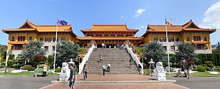
In Australia, Buddhism is a minority religion. According to the 2016 census, 2.4 percent of the total population of Australia identified as Buddhist. It was also the fastest-growing religion by percentage, having increased its number of adherents by 79 percent between the 1996 and 2001 censuses. The highest percentage of Buddhists in Australia is present in Christmas Island, where Buddhists constitute 18.1% of the total population according to the 2016 Census. Buddhism is the third largest religion in the country after Christianity and Islam.

Kempsey Shire is a local government area in the mid north coast region of New South Wales, Australia.
Australians, colloquially known as Aussies, are the citizens, nationals and individuals associated with the country of Australia. This connection may be residential, legal, historical or ethno-cultural. For most Australians, several of these connections exist and are collectively the source of their being Australian. Australian law does not provide for a racial or ethnic component of nationality, instead relying on citizenship as a legal status. Australians are colloquially referred to as Aussies.

Grevillea acanthifolia, commonly known as the Acanthus-leaved grevillea, is a plant in the family Proteaceae and is endemic to New South Wales. It is a shrub with stiff, prickly, divided leaves and pink to purple "toothbrush" flowers.
The history of Jainism in Australia is relatively short when compared to the history of Christianity on the same continent. There are four Jain centres in Australia. The Jain population in Australia was counted in the 2016 census to be 4,047, of whom 38% lived in Greater Sydney, 31% in Greater Melbourne, and 15% in Greater Perth. The states and territories with the highest proportion of Jains are Western Australia (0.025%) and Victoria (0.022%), whereas those with the lowest are Queensland (0.006%) and Tasmania (0.001%).

The Hume is an economic rural region located in the north-eastern part of Victoria, Australia. Comprising an area in excess of 40,000 square kilometres (15,000 sq mi) with a population that ranges from 263,000 to 300,000, the Hume region includes the local government areas of Alpine Shire, Rural City of Benalla, City of Wodonga, City of Greater Shepparton, Shire of Indigo, Shire of Mansfield, Shire of Strathbogie, Shire of Towong and the Rural City of Wangaratta, and also includes five unincorporated areas encompassing the alpine ski resorts in the region.

The Grampians is an economic rural region located in the western part of Victoria, Australia. The 48,646-square-kilometre (18,782 sq mi) region lies to the northwest of the western suburbs of Greater Melbourne, to the state's western border with South Australia and includes the Grampians National Park and significant gold mining heritage assets. The Grampians region has two sub-regions, Grampians Central Highlands and Wimmera Southern Mallee.

Conospermum caeruleum, commonly known as blue brother, is a shrub in the family Proteaceae and is endemic to the south west of Western Australia. It is a prostrate shrub with small, dense heads of blue, rarely pink flowers and usually grows in heavy soils subject to flooding.
The 2016 Australian census was the seventeenth national population census held in Australia. The census was officially conducted with effect on Tuesday, 9 August 2016. The total population of the Commonwealth of Australia was counted as 23,401,892 – an increase of 8.8 per cent or 1,894,175 people since the 2011 census. Norfolk Island joined the census for the first time in 2016, adding 1,748 to the population.
