Related Research Articles

Riley County is a county located in the U.S. state of Kansas. Its county seat and largest city is Manhattan. As of the 2020 census, the population was 71,959. The county was named after Bennet Riley, the 7th governor of California, and a Mexican–American War hero. Riley County is home to Fort Riley and Kansas State University.

Pottawatomie County is a county located in the U.S. state of Kansas. Its county seat is Westmoreland. As of the 2020 census, the county population was 25,348. The county was named for the Potawatomi tribe.

Ottawa County is a county located in the U.S. state of Kansas. Its county seat and largest city is Minneapolis. As of the 2020 census, the county population was 5,735. The county was named after the Odawa tribe.
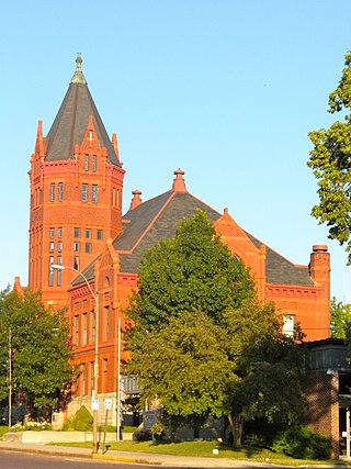
Marshall County is a county located in the U.S. state of Kansas. Its county seat and largest city is Marysville. As of the 2020 census, the county population was 10,038. The county was named after Frank J. Marshall, a state representative who operated the first ferry over the Big Blue River.

Lincoln County is a county located in the U.S. state of Kansas. Its county seat and largest city is Lincoln Center. As of the 2020 census, the county population was 2,939. The county was named after Abraham Lincoln, the 16th president of the United States.

Geary County is a county located in the U.S. state of Kansas. Its county seat and most populous city is Junction City. As of the 2020 census, the county population was 36,739. The county is named in honor of John Geary, the first mayor of San Francisco, a governor of the Kansas Territory, and the 16th governor of Pennsylvania.

Home is an unincorporated community in southern Franklin Township, Marshall County, Kansas, United States. As of the 2020 census, the population of the community and nearby areas was 154. It lies along U.S. Route 36 – the Pony Express Highway – and a Union Pacific rail line, east of the city of Marysville.
KNDY is a commercial AM radio station in Marysville, Kansas that plays classic country music as well as local news, weather, and sports coverage. The station signed on the air July 10, 1956 and celebrated 50 year s of broadcasting in July 2006 by moving into a new broadcast studio with sister-station KNDY-FM 95.5.
KNDY-FM is commercial radio station in Marysville, Kansas that plays country music as well as local news, weather, and sports coverage. The station signed on the air July 23, 1974 and moved into a new broadcast studio with sister-station KNDY 1570 AM in July 2006.

Area code 785 is a telephone area code in the North American Numbering Plan for most of the northern part of the U.S. state Kansas. It was created in a split of the numbering plan area 913 on July 20, 1997. The numbering plan area stretches from the Colorado state line on the west to the Missouri state line on the east, while excluding the Kansas side of the Kansas City metropolitan area, which retained 913. The largest city by population isTopeka, the state capital city.

Liberty Township is one of thirteen townships in Parke County, Indiana, United States. As of the 2020 census, its population was 598 and it contained 296 housing units.
Manhattan Area Technical College is a public technical college in Manhattan, Kansas, United States. It was founded in 1965 and offers Associate of Applied Science degrees in 8 disciplines and technical certificate programs in several others. Manhattan Area Technical College is accredited through the Higher Learning Commission. The college's primary service area includes Geary, Riley, Clay, Marshall, Dickinson, and Pottawatomie Counties.

Lecompton Township is a township in Douglas County, Kansas, USA. As of the 2000 census, its population was 1,761.

Wakarusa Township is a township in Douglas County, Kansas, USA. As of the 2010 census, its population was 2,318. It was named for the Wakarusa River which flows through Douglas County from Wabaunsee County to the Kansas River near Eudora.

Stateline Township is one of the thirteen townships of Sherman County, Kansas, United States. The population was 344 at the 2000 census.
North Central Kansas is a tourism and geographical region of the state of Kansas. It consists of 15 counties, and has a population of over 150,000. The Salina micropolitan area is part of North Central Kansas. The region stretches from the Nebraska border in the north to Russell, Ellsworth, Saline, and Dickinson Counties in the south. Its western border includes Smith, Osborne, and Russell Counties, and its eastern border Dickinson, Clay, Washington, and Marshall Counties.
Grove Township is a township in Shawnee County, Kansas and part of the Topeka metropolitan area. The population was 473 at the 2000 Census.
Red Vermillion is a township in Nemaha County, Kansas, United States.
Neuchatel Township is a township in Nemaha County, Kansas, United States.
Dickerson Township is an inactive township in Lewis County, in the U.S. state of Missouri.
References
- ↑ Foster, Emma Elizabeth Calderhead (1917). History of Marshall County, Kansas: Its People, Industries, and Institutions. B.F. Bowen. p. 207.
Municipalities and communities of Marshall County, Kansas, United States | ||
|---|---|---|
| Cities |  | |
| Unincorporated communities | ||
| Ghost towns | ||
| Townships | ||
| Footnotes | †This community is designated a Census-Designated Place (CDP) by the United States Census Bureau. | |
39°41′47″N96°31′46″W / 39.6964°N 96.5294°W
| | This article about a location in Marshall County, Kansas is a stub. You can help Wikipedia by expanding it. |