Herkimer, Kansas

Last updated

Herkimer, Kansas
CDP
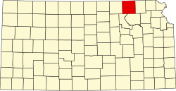
Map of Marshall Co, Ks, USA.png
USA Kansas location map.svg
Red pog.svg
Herkimer
Usa edcp location map.svg
Red pog.svg
Herkimer
Coordinates: 39°53′28″N96°42′40″W / 39.89111°N 96.71111°W / 39.89111; -96.71111 [1]
Country United States
State Kansas
County Marshall
Named for Herkimer, New York
Elevation
[1]
1,250 ft (380 m)
Population
 (2020) [2]
  Total54
Time zone UTC-6 (CST)
  Summer (DST) UTC-5 (CDT)
Area code 785
FIPS code 20-31425
GNIS ID 472670 [1]

Herkimer is a census-designated place (CDP) in Marshall County, Kansas, United States. [1] As of the 2020 census, the population was 54. [2]

Contents

History

Herkimer was named after Herkimer, New York. [3] A post office was opened in Herkimer in 1878, and remained in operation until it was discontinued in 1974. [4]

Demographics

Historical population
CensusPop.Note
2020 54
U.S. Decennial Census

The 2020 United States census counted 54 people, 26 households, and 22 families in Herkimer. [5] [6] The population density was 57.6 per square mile (22.2/km2). There were 26 housing units at an average density of 27.7 per square mile (10.7/km2). [6] [7] The racial makeup was 98.15% (53) white or European American (98.15% non-Hispanic white), 0.0% (0) black or African-American, 0.0% (0) Native American or Alaska Native, 0.0% (0) Asian, 0.0% (0) Pacific Islander or Native Hawaiian, 0.0% (0) from other races, and 1.85% (1) from two or more races. [8] Hispanic or Latino of any race was 0.0% (0) of the population. [9]

Of the 26 households, 15.4% had children under the age of 18; 84.6% were married couples living together; 0.0% had a female householder with no spouse or partner present. 15.4% of households consisted of individuals and 3.8% had someone living alone who was 65 years of age or older. [6] The average household size was 2.4 and the average family size was 3.0. [10] The percent of those with a bachelor’s degree or higher was estimated to be 0.0% of the population, with a 11% margin of error. [11]

14.8% of the population was under the age of 18, 1.9% from 18 to 24, 25.9% from 25 to 44, 11.1% from 45 to 64, and 46.3% who were 65 years of age or older. The median age was 60.3 years. For every 100 females, there were 116.0 males. [6] For every 100 females ages 18 and older, there were 130.0 males. [6]

The 2016-2020 5-year American Community Survey estimates show that the median household income was $76,500 (with a margin of error of +/- $23,596). [12] The median income for those above 16 years old was $31,563 (+/- $31,075). [13] Approximately, 0.0% of families and 13.2% of the population were below the poverty line, including 0.0% of those under the age of 18 and 50.0% of those ages 65 or over. [14] [15]

Education

The community is served by Marysville USD 364 public school district.

Related Research Articles

<span class="mw-page-title-main">Meade, Kansas</span> City in Meade County, Kansas

Meade is a city in and the county seat of Meade County, Kansas, United States. As of the 2020 census, the population of the city was 1,505.

<span class="mw-page-title-main">Ness City, Kansas</span> City in Ness County, Kansas

Ness City is a city in and the county seat of Ness County, Kansas, United States. As of the 2020 census, the population of the city was 1,329. Ness City is famous for its four-story Old Ness County Bank Building located downtown and nicknamed Skyscraper of the Plains.

<span class="mw-page-title-main">Lyndon, Kansas</span> City in Osage County, Kansas

Lyndon is a city in, and the county seat of Osage County, Kansas, United States. As of the 2020 census, the population of the city was 1,037.

<span class="mw-page-title-main">Oaklawn-Sunview, Kansas</span> Unincorporated community in Sedgwick County, Kansas

Oaklawn-Sunview is a census-designated place (CDP) in Sedgwick County, Kansas, United States. As of the 2020 census, the population was 2,880. It is located on the south side of Wichita along the west side of K-15 and 47th Street South intersection.

<span class="mw-page-title-main">Pine Ridge, South Dakota</span> CDP in South Dakota, United States

Pine Ridge is a census-designated place (CDP) and the most populous community in Oglala Lakota County, South Dakota, United States. The population was 3,138 at the 2020 census. It is the tribal headquarters of the Oglala Sioux Tribe on the Pine Ridge Indian Reservation.

<span class="mw-page-title-main">Bendena, Kansas</span> Unincorporated community in Doniphan County, Kansas

Bendena is a census-designated place (CDP) in Doniphan County, Kansas, United States. As of the 2020 census, the population was 117. The community is part of the St. Joseph, MO–KS Metropolitan Statistical Area.

<span class="mw-page-title-main">Home, Kansas</span> Unincorporated community in Marshall County, Kansas

Home is a census-designated place (CDP) in southern Franklin Township, Marshall County, Kansas, United States. As of the 2020 census, the population was 154. It lies along U.S. Route 36 – the Pony Express Highway – and a Union Pacific rail line, east of the city of Marysville.

<span class="mw-page-title-main">Healy, Kansas</span> Unincorporated community in Lane County, Kansas

Healy is a census-designated place (CDP) in Lane County, Kansas, United States. As of the 2020 census, the population was 195.

<span class="mw-page-title-main">Bucyrus, Kansas</span> CDP in Kansas, United States

Bucyrus is a census-designated place (CDP) in Miami County, Kansas, United States. As of the 2020 census, the population was 171. It is located 6 miles (9.7 km) east-southeast of Spring Hill, and named after Bucyrus, Ohio. It is part of the Kansas City metropolitan area.

<span class="mw-page-title-main">Hillsdale, Kansas</span> CDP in Kansas, United States

Hillsdale is a census-designated place (CDP) in Miami County, Kansas, United States. As of the 2020 census, the population was 247. Hillsdale is located near U.S. Route 169 and K-7 6 miles (9.7 km) north-northeast of Paola. It is part of the Kansas City metropolitan area.

<span class="mw-page-title-main">Franklin, Kansas</span> Unincorporated community in Crawford County, Kansas

Franklin is a census-designated place (CDP) in Crawford County, Kansas, United States. As of the 2020 census, the population was 473. Franklin is located along U.S. Route 69, 1 mile (1.6 km) south of Arma, or 5.9 miles (9.5 km) north of Frontenac.

<span class="mw-page-title-main">Milton, Kansas</span> Unincorporated community in Sumner County, Kansas

Milton is a census-designated place (CDP) in Sumner County, Kansas, United States. As of the 2020 census, the population was 155. It is located 4.5 miles (7.2 km) southeast of Norwich at the intersection of N Argonia Rd and W 120th Ave N, next to the railroad.

<span class="mw-page-title-main">Fort Dodge, Kansas</span> Unincorporated community in Ford County, Kansas

Fort Dodge is a census-designated place (CDP) in Grandview Township, Ford County, Kansas, United States. As of the 2020 census, the population was 97. It is located on U.S. Route 400 5 miles (8 km) southeast of Dodge City. Fort Dodge has a post office with ZIP code 67843.

<span class="mw-page-title-main">Hallowell, Kansas</span> Unincorporated community in Cherokee County, Kansas

Hallowell is a census-designated place (CDP) in Cherokee County, Kansas, United States. As of the 2020 census, the population was 101.

<span class="mw-page-title-main">Odin, Kansas</span> Unincorporated community in Barton County, Kansas

Odin a census-designated place (CDP) in Barton County, Kansas, United States. As of the 2020 census, the population was 87. It is located northwest of Claflin at the intersection of NE 140 Rd and NE 90 Ave.

<span class="mw-page-title-main">Kickapoo Site 7, Kansas</span> Unincorporated community in Brown County, Kansas

Kickapoo Site 7 is a census-designated place (CDP) in Brown County, Kansas, United States, on the Kickapoo Indian Reservation. As of the 2020 census, the population was 104.

<span class="mw-page-title-main">Kickapoo Tribal Center, Kansas</span> Unincorporated community in Brown County, Kansas

Kickapoo Tribal Center is a census-designated place (CDP) in Brown County, Kansas, United States, on the Kickapoo Indian Reservation. As of the 2020 census, the population was 177, making it the most populous location within the reservation.

<span class="mw-page-title-main">Lowell, Kansas</span> Unincorporated community in Cherokee County, Kansas

Lowell is a census-designated place (CDP) in Cherokee County, Kansas, United States. As of the 2020 census, the population was 244.

<span class="mw-page-title-main">Radley, Kansas</span> Unincorporated community in Crawford County, Kansas

Radley is a census-designated place (CDP) in Crawford County, Kansas, United States. As of the 2020 census, the population was 105.

<span class="mw-page-title-main">Niles, Kansas</span> Unincorporated community in Ottawa County, Kansas

Niles is a census-designated place (CDP) in Ottawa County, Kansas, United States. As of the 2020 census, the population was 56.

References

  1. 1 2 3 4 "Herkimer, Kansas", Geographic Names Information System , United States Geological Survey, United States Department of the Interior
  2. 1 2 "Profile of Herkimer, Kansas (CDP) in 2020". United States Census Bureau. Archived from the original on May 28, 2022. Retrieved May 28, 2022.
  3. Blackmar, Frank Wilson (1912). Kansas: A Cyclopedia of State History, Embracing Events, Institutions, Industries, Counties, Cities, Towns, Prominent Persons, Etc. Standard Publishing Company. pp.  839.
  4. "Kansas Post Offices, 1828-1961". Kansas Historical Society. Archived from the original on October 9, 2013. Retrieved June 15, 2014.
  5. "US Census Bureau, Table P16: HOUSEHOLD TYPE". data.census.gov. Retrieved January 2, 2024.
  6. 1 2 3 4 5 "US Census Bureau, Table DP1: PROFILE OF GENERAL POPULATION AND HOUSING CHARACTERISTICS". data.census.gov. Retrieved January 2, 2024.
  7. Bureau, US Census. "Gazetteer Files". Census.gov. Retrieved December 30, 2023.{{cite web}}: |last= has generic name (help)
  8. "US Census Bureau, Table P1: RACE". data.census.gov. Retrieved January 2, 2024.
  9. "US Census Bureau, Table P2: HISPANIC OR LATINO, AND NOT HISPANIC OR LATINO BY RACE". data.census.gov. Retrieved January 2, 2024.
  10. "US Census Bureau, Table S1101: HOUSEHOLDS AND FAMILIES". data.census.gov. Retrieved January 2, 2024.
  11. "US Census Bureau, Table S1501: EDUCATIONAL ATTAINMENT". data.census.gov. Retrieved January 2, 2024.
  12. "US Census Bureau, Table S1903: MEDIAN INCOME IN THE PAST 12 MONTHS (IN 2020 INFLATION-ADJUSTED DOLLARS)". data.census.gov. Retrieved January 2, 2024.
  13. "US Census Bureau, Table S2001: EARNINGS IN THE PAST 12 MONTHS (IN 2020 INFLATION-ADJUSTED DOLLARS)". data.census.gov. Retrieved January 2, 2024.
  14. "US Census Bureau, Table S1701: POVERTY STATUS IN THE PAST 12 MONTHS". data.census.gov. Retrieved January 2, 2024.
  15. "US Census Bureau, Table S1702: POVERTY STATUS IN THE PAST 12 MONTHS OF FAMILIES". data.census.gov. Retrieved January 2, 2024.

Further reading