Lillis, Kansas | |
|---|---|
 | |
 Lillis  Lillis | |
| Coordinates: 39°36′35″N96°17′46″W / 39.60972°N 96.29611°W [1] | |
| Country | United States |
| State | Kansas |
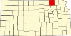
| County | Marshall |
| Named after | T. F. Lillis |
| Elevation | 1,247 ft (380 m) |
| Time zone | UTC-6 (CST) |
| • Summer (DST) | UTC-5 (CDT) |
| Area code | 785 |
| FIPS code | 20-40425 |
| GNIS ID | 473425 [1] |
Lillis is an unincorporated community in Marshall County, Kansas, United States. [1]