The flat plain of the depression is interrupted by geest ridges in places. From Langwedel, as far as the River Lesum, it is separated from the Wümme Depression by a narrow ridge of dunes, on which the town of Achim and the older districts of the city of Bremen lie. At many places, such as south of the mouth of the River Aller or in Bremen-Huchting, the Weser Depression transitions to bog and marsh without any clear boundary. The southern part of the Weser Depression belongs to the state of North Rhine-Westphalia, with its towns of Minden and Petershagen. The borough of Petershagen includes Westphalia's northernmost Weser settlement, Schlüsselburg. North of that, the Weser passes the Low Saxon town of Stolzenau.
Below Hoya, the Weser reaches the Breslau-Magdeburg-Bremen glacial valley, which approaches from the southeast. As the Weser heads off in a northwestern direction, the edge of the Wildeshausen Geest bears away to the west and the Weser Depression broadens to a width of about 20 kilometres (12mi). Here there are also carr landscapes. From Achim to Bremen-Blumenthal, the width of the depression reduces again to about 10 kilometres (6.2mi). In the wide sections of the depression the soil does not just consist of river sediments or bog, but is also sandy in places. These areas of sand at the level of the depression are also known as 'foregeest' (Vorgeest), but are nevertheless separated by a boggy strip from the ascending edge of the geest itself. The largest are the Schwarme Heath (Schwarmer Heide) and the Thedinghausen Foregeest (Thedinghauser Vorgeest). Downstream of Bremen, the marshlands of Stedingen come close to the Weser. The river is separated from the northwestern edge of the geest by a wide, nowadays largely cultivated, strip of moor.
The eastern edge of the Weser Depression lies closer to the river from the confluence of the Aller (near Verden) to Bremen-Rönnebeck. In Bremen, the Bremen Dunes, south of the Lesum, separate the Weser Depression from the Wümme Depression. North of the Lesum, the Osterholz Geest, near Bremen-Vegesack, forms a steep river bank.
In the north, the Weser Depression transitions into the coastal marshes. Northwest of its confluence with the Hunte, there are no natural eminences between the Weser and the Jade Bight. The height of this peninsula, comprising Stadland and Butjadingen, lies between 0.8metres under sea level (NN) and 1.2metres above it (at a place on the 'neck' of the Jade Bight it reaches 2metres). The first ridge of geest does not appear until the far side of the Jade Bight, the Friesische Wehde. On the eastern side of the Lower Weser, the edge of the Osterholz Geest peels away north of Bremen-Blumenthal[1] to a distance of six to ten kilometres from the river. The marshland here is called Osterstade.
Administrative regions
Politically, the Weser Depression is divided between the following administrative units that belong to the state of Lower Saxony, apart from those in the district of Minden-Lübbecke and the city of Bremen:
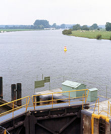
The Weser is a river of Lower Saxony in north-west Germany. It begins at Hannoversch Münden through the confluence of the Werra and Fulda. It passes through the Hanseatic city of Bremen. Its mouth is 50 km (31 mi) further north against the ports of Bremerhaven and Nordenham. The latter is on the Butjadingen Peninsula. It then merges into the North Sea via two highly saline, estuarine mouths.
Wesermarsch is a Kreis (district) in the northwestern part of Lower Saxony, Germany. Neighboring are the districts of Cuxhaven and Osterholz, the city of Bremen in the state Free Hanseatic City of Bremen, the urban district of Delmenhorst, the district of Oldenburg and the urban district of Oldenburg, and the districts of Ammerland and Friesland.
Osterholz is a district (Landkreis) in Lower Saxony, Germany. It is bounded by the districts of Wesermarsch, Cuxhaven, Rotenburg and Verden, and by the city of Bremen.
Rotenburg is a district (Landkreis) in Lower Saxony, Germany. It is landlocked by the districts of Stade, Harburg, Heidekreis, Verden, Osterholz and Cuxhaven.
Verden is a Kreis (district) in the centre of Lower Saxony, Germany. Adjoining it are the districts of Osterholz, Rotenburg, Heidekreis, Nienburg, and Diepholz, as well as the city of Bremen.
The Hamme is a 48 km (30 mi) long river in Germany, Lower Saxony, north-east of Bremen. Its source is north of Osterholz-Scharmbeck. It flows through the moors north-east of Bremen called Teufelsmoor, and meets the river Wümme in Ritterhude. From this junction, the river is called Lesum. The Lesum flows into the river Weser in Bremen-Vegesack.
Hunte is a 189-kilometre (117 mi) long river in north-western Germany, a left tributary of the Weser.
The Stade Geest is a natural region of low, sandy heath (geest) in the North German Plain.
The Linteln Geest, shown on some maps as the Verden Heath, is a geest region in the north German state of Lower Saxony and belongs administratively to the borough of Kirchlinteln.
The region between the Elbe and Weser rivers forms the Elbe–Weser triangle, also rendered Elbe-Weser Triangle, in northern Germany. It is also colloquially referred to as the Nasses Dreieck or "wet triangle".
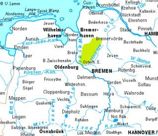
Bremen Switzerland is an undulating geest landscape in the north of Bremen and the adjacent district of Osterholz, and forms the western portion of the Osterholz Geest. In comparison to the rather flat land on which the city of Bremen is built and its surrounding area which is built on marsh and bog, Bremen Switzerland reaches heights of up to about 49 m above sea level (NN). The region of the Bremen Switzerland is framed by the Weser tributary of Lesum to the south, the Weser to the west, the marsh region of Osterstade to the northwest, the forest of Düngel to the north, the former B 6 federal route to Bremerhaven to the east and the adjoining heath of Lange Heide.
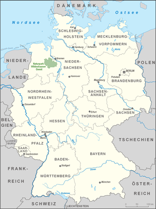
The Wildeshausen Geest is part of the northwest Germany's geest ridge, that begins near Meppen on the river Ems with the Hümmling, is broken by the Weser depression, continues with the Osterholz Geest and reaches the marshes of Kehdingen by the river Elbe with the ridges of the Wingst and Stade Geest. It gives its name to the eponymous nature park.
The Wümme Depression is a bog, geest and forest landscape within the Elbe–Weser triangle in the German state of Lower Saxony. It belongs mainly to the district of Rotenburg and is part of the Stade Geest. To the south it borders on the Achim-Verden Geest. It has no sharply defined boundary with the Lüneburg Heath; as a result many places are seen as belonging to both regions. Typical of the gently undulating terrain are the many small rivers, streams and lakes. These include the rivers Wümme, Wieste, Fintau, Rodau, Wiedau and Vissel, as well as the twin lakes known in German as the Bullenseen. In this ancient landscape Low German is commonly spoken.
The Middle Weser Valley is part of the Weser Depression around the River Weser on the North German Plain, extending from the gap of Porta Westfalica to the town of Hoya. It is not a true valley, because it is only bordered by low hills at two points. It lies in the German federal states of Lower Saxony and North Rhine-Westphalia.
The Osterholz Geest is an undulating, sandy area of ground moraine between the city of Bremen and the towns of Bremerhaven and Bremervörde.
The Middle Weser Region includes, in its fullest sense, the land along the Middle Weser between Minden and Bremen. It lies within the federal states of North Rhine-Westphalia, Lower Saxony and Bremen. However, the term is often used just to refer to the Lower Saxon part, because of the different political development of the three states and the cooperative associations formed in Lower Saxony some years ago. The Lower Saxon part of the Middle Weser Region forms the geographical heart of this state. In the centre of the Middle Weser Region are the towns of Minden, Nienburg/Weser and Verden (Aller). In the extreme north, the city of Bremen, which is not part of Lower Saxony, has a very important influence on that area of Lower Saxony surrounding it.
The Rahden-Diepenau Geest is a natural region in the extreme northeast of North Rhine-Westphalia and in the neighbouring state of Lower Saxony in north Germany. It includes the overwhelmingly gently rolling geest between the Lübbecker Lößland to the south, the Diepholz Moor Depression to the north, the Middle Weser Valley to the east and the western Wiehen Hills and Bersenbrück Land to the west. The Rahden-Diepenau Geest is part of the Dümmer Geest Depression and thus belongs to the North German Plain, although they include foothills of the Central Uplands in the shape of the Stemmer Berge.
Minden Land is a cultural landscape in East Westphalia, the northeastern part of North Rhine-Westphalia in Germany. It covers the four-fifths of the district of Minden-Lübbecke that lie on the North German Plain and is clearly bounded to the south by the Weser Hills and Wiehen Hills, where it adjoins the Ravensberg Land and the Upper Weser Valley. Its other boundaries are delineated by those of the district.
The Wesermünde Geest is the collective name for several geest ridges in the west of Cuxhaven district and Bremen's North Borough in northern Germany. The ridges are separated from one another by wetlands. These terminal moraines were formed during the Saale glaciation, are up to between 10 and 70 m above sea level (NN), and are covered by scattered woods and farmland. The wetland areas, between 0 and 5 m above sea level, are predominantly used for grazing.
The Achim-Verden Geest is part of the Stade Geest. Its main part is in the northeast of the German state of Lower Saxony, a smaller part in the state of Bremen.
This page is based on this Wikipedia article Text is available under the CC BY-SA 4.0 license; additional terms may apply. Images, videos and audio are available under their respective licenses.