
Surrey is a ceremonial county in South East England and one of the home counties. It is bordered by Greater London to the northeast, Kent to the east, East and West Sussex to the south, and Hampshire and Berkshire to the west. The largest settlement is Woking.

Dorking is a market town in Surrey in South East England, about 21 mi (34 km) south of London. It is in Mole Valley District and the council headquarters are to the east of the centre. The High Street runs roughly east–west, parallel to the Pipp Brook and along the northern face of an outcrop of Lower Greensand. The town is surrounded on three sides by the Surrey Hills Area of Outstanding Natural Beauty and is close to Box Hill and Leith Hill.

Ashtead is a large village in the Mole Valley district of Surrey, England, approximately 16 mi (26 km) south of central London. Ashtead is on the single-carriageway A24 between Epsom and Leatherhead. The village is on the northern slopes of the North Downs and is in the catchment area of The Rye, a tributary of the River Mole.

Leatherhead is a town in the Mole Valley district of Surrey, England, about 17 mi (27 km) south of Central London. The settlement grew up beside a ford on the River Mole, from which its name is thought to derive. During the late Anglo-Saxon period, Leatherhead was a royal vill and is first mentioned in the will of Alfred the Great in 880 AD. The first bridge across the Mole may have been constructed in around 1200 and this may have coincided with the expansion of the town and the enlargement of the parish church.

The River Mole is a tributary of the River Thames in southern England. It rises in West Sussex near Gatwick Airport and flows northwest through Surrey for 80 km to the Thames at Hampton Court Palace. The river gives its name to the Surrey district of Mole Valley.
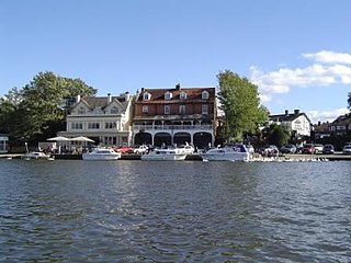
Elmbridge is a local government district with borough status in Surrey, England. Its council is based in Esher, and other notable towns and villages include Cobham, Walton-on-Thames, Weybridge and Molesey. The borough lies just outside the administrative boundary of Greater London, but is mostly within the M25 motorway which encircles London. Many of the borough's urban areas form part of the wider Greater London Built-up Area.

Mole Valley is a local government district in Surrey, England. Its council is based in Dorking, and the district's other town is Leatherhead. The largest villages are Ashtead, Fetcham and Great Bookham, in the northern third of the district.
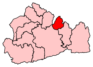
Epsom and Ewell is a constituency in Surrey represented in the House of Commons of the UK Parliament since 2001 by Chris Grayling, a Conservative.
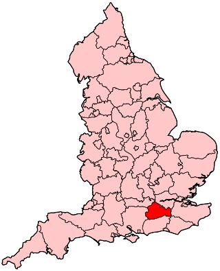
Epsom was a borough constituency represented in the House of Commons of the Parliament of the United Kingdom. It elected one Member of Parliament (MP) by the first past the post system of election. From its creation in 1885 until its abolition in 1974, it was won by eight Conservatives. The winner took less than 50% of the votes in its contested elections once, in 1945, receiving 49.9% of the vote in a three-party contest. Six elections, the last being a by-election in 1912, were uncontested.

Surrey County Council is the county council for the non-metropolitan county of Surrey, England. The council is composed of 81 elected councillors, and in all but one election since 1974 the Conservative Party has held the majority. The leader of the council is Tim Oliver.
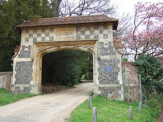
Westhumble is a village in south east England, approximately 2 km (1.2 mi) north of Dorking, Surrey. The village is not part of a civil parish, however the majority of the settlement is in the ecclesiastical Parish of Mickleham.

Leatherhead Football Club is a football club based in Leatherhead, Surrey, England. The club is nicknamed The Tanners and plays home at Fetcham Grove. They play in the Isthmian League South Central Division. The club is affiliated to the Surrey County Football Association and is a FA Charter Standard club.
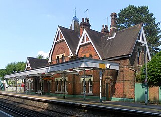
Box Hill & Westhumble is a railway station in the village of Westhumble in Surrey, England, approximately 2 miles (3.2 km) north of Dorking town centre. Box Hill is located approximately 1⁄2 mile (800 m) to the east. It is 21 miles 14 chains (34.1 km) down the line from London Waterloo. Train services are operated by Southern who manage the station, and South Western Railway.
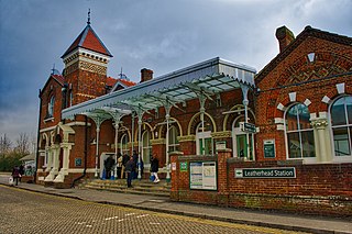
Leatherhead railway station is in Leatherhead, Surrey, England. It is managed by Southern, with services provided by them and South Western Railway. It is 18 miles 2 chains (29 km) from London Waterloo.

Norbury Park is an area of mixed wooded and agricultural land surrounding a privately owned its Georgian manor house near Leatherhead and Dorking, Surrey. On the west bank of the River Mole, it is close to the village of Mickleham.

The Sessions House is a municipal building in Ewell Road, Surbiton, London. It is a Grade II listed building.
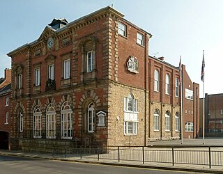
Worksop Town Hall is a municipal building in Potter Street, Worksop, Nottinghamshire, England. The town hall, which was the headquarters of Worksop Borough Council, is a Grade II listed building. It is used for meetings of Bassetlaw District Council, whose main offices are in an adjoining building.

Myrtle Grove, also known since 1926 as Bingley Town Hall, is a municipal building in Myrtle Park, Bingley, West Yorkshire, England. The building, which was the headquarters of Bingley Urban District Council, is a Grade II listed building.

Woking Civic Offices is a municipal building in Gloucester Walk, Woking, Surrey, England. It is in use as the headquarters of Woking Borough Council.


