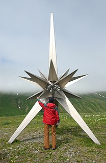
There are 21 mountain peaks named West Peak in the United States according to the US Geological Survey Geographic Names Information System.

The Geographic Names Information System (GNIS) is a database that contains name and locative information about more than two million physical and cultural features located throughout the United States of America and its territories. It is a type of gazetteer. GNIS was developed by the United States Geological Survey in cooperation with the United States Board on Geographic Names (BGN) to promote the standardization of feature names.
- West Peak Valdez–Cordova Census Area, Alaska, 61°09′38″N146°12′51″W / 61.16056°N 146.21417°W , el. 4,875 feet (1,486 m) [1]
- West Peak Aleutians West Census Area, Alaska, 52°55′45″N173°12′24″E / 52.92917°N 173.20667°E [2]
- West Peak Juneau, Alaska, 58°15′10″N134°15′14″W / 58.25278°N 134.25389°W , el. 3,255 feet (992 m) [3]
- West Peak Nome Census Area, Alaska, 65°55′19″N166°14′48″W / 65.92194°N 166.24667°W , el. 2,290 feet (700 m) [4]
- West Peak Graham County, Arizona, 32°44′14″N110°02′18″W / 32.73722°N 110.03833°W , el. 8,645 feet (2,635 m) [5]
- West Peak Tuolumne County, California, 37°58′49″N119°29′53″W / 37.98028°N 119.49806°W , el. 10,522 feet (3,207 m) [6]
- West Peak Marin County, California, 37°55′24″N122°35′48″W / 37.92333°N 122.59667°W , el. 2,546 feet (776 m) [7]
- West Peak Eagle County, Colorado, 39°51′32″N106°32′51″W / 39.85889°N 106.54750°W , el. 11,053 feet (3,369 m) [8]
- West Peak New Haven County, Connecticut, 41°33′44″N072°50′37″W / 41.56222°N 72.84361°W , el. 1,007 feet (307 m) [9]
- West Peak Piscataquis County, Maine, 45°32′42″N069°17′45″W / 45.54500°N 69.29583°W , el. 3,176 feet (968 m) [10]
- West Peak Somerset County, Maine, 45°08′48″N070°17′18″W / 45.14667°N 70.28833°W , el. 4,131 feet (1,259 m) [11]
- West Peak Piscataquis County, Maine, 45°55′29″N069°01′59″W / 45.92472°N 69.03306°W , el. 2,500 feet (760 m) [12]
- West Peak Oxford County, Maine, 44°36′06″N070°54′08″W / 44.60167°N 70.90222°W , el. 3,665 feet (1,117 m) [13]
- West Peak Fergus County, Montana, 46°46′47″N109°32′11″W / 46.77972°N 109.53639°W , el. 8,186 feet (2,495 m) [14]
- West Peak Madison County, Montana, 45°44′01″N112°29′03″W / 45.73361°N 112.48417°W , el. 9,659 feet (2,944 m) [15]
- West Peak Coos County, New Hampshire, 44°45′18″N071°29′48″W / 44.75500°N 71.49667°W , el. 3,520 feet (1,070 m) [16]
- West Peak Grafton County, New Hampshire, 44°00′24″N071°32′50″W / 44.00667°N 71.54722°W , el. 4,094 feet (1,248 m) [17]
- West Peak Elko County, Nevada, 40°54′19″N115°38′30″W / 40.90528°N 115.64167°W , el. 6,608 feet (2,014 m) [18]
- West Peak Jefferson County, Washington, 47°48′04″N123°42′40″W / 47.80111°N 123.71111°W , el. 7,782 feet (2,372 m) [19]
- West Peak Jefferson County, Washington, 47°43′22″N123°20′56″W / 47.72278°N 123.34889°W , el. 7,116 feet (2,169 m) [20]
- West Peak Kittitas County, Washington, 47°19′12″N121°10′51″W / 47.32000°N 121.18083°W , el. 5,535 feet (1,687 m) [21]

Valdez–Cordova Census Area is a census area located in the state of Alaska, United States. As of the 2010 census, the population was 9,636. It is part of the Unorganized Borough and therefore has no borough seat. Its largest communities are Valdez and Cordova.

Aleutians West Census Area is a census area located in the U.S. state of Alaska. As of the 2010 census, the population was 5,561. It is part of the Unorganized Borough and therefore has no borough seat. Its largest city is Unalaska. It contains most of the Aleutian Islands, from Attu Island in the west to Unalaska Island in the east, as well as the Pribilof Islands, which lie north of the Aleutians in the Bering Sea.

The City and Borough of Juneau, commonly known as Juneau, is the capital city of Alaska. It is a unified municipality on Gastineau Channel in the Alaskan panhandle, and it is the second largest city in the United States by area. Juneau has been the capital of Alaska since 1906, when the government of what was the District of Alaska was moved from Sitka as dictated by the U.S. Congress in 1900. The municipality unified on July 1, 1970, when the city of Juneau merged with the city of Douglas and the surrounding Greater Juneau Borough to form the current municipality, which is larger by area than both Rhode Island and Delaware.
