Westfield Common

Last updated

Westfield Common
Right of Way across Westfield Common.jpg
United Kingdom adm location map.svg
Red pog.svg
Location of Westfield Common in the UK
Location Woking, Surrey, England
Coordinates 51°17′31″N0°33′36″W / 51.292°N 0.560°W / 51.292; -0.560 Coordinates: 51°17′31″N0°33′36″W / 51.292°N 0.560°W / 51.292; -0.560
Governing body Woking Borough Council

Westfield Common is an area of land in Westfield, Woking that is registered common land.

Contents

Attributes

Westfield Common has boundaries that have been little reduced since 1719. [1]

The common has been recognised by the local authority with a preliminary assessment by Natural England as a regionally important Site of Nature Conservation (SNCI). [2] as it supports nationally scarce plants in the chamomile family and in aquatic species for example populations of great crested newts in two ponds. It has species-rich areas of: wet woodland, drains and ponds. [3]

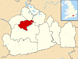
The Common gives its name to a residents association called the Westfield Common Residents Association (WCRA) open to all users of the common in the local authority. [4]

Commons registration

Under the First Wilson ministry's Commons Registration Act 1965 (CRA), a task and duty was given to top level local authorities to log and register all Common Land within England & Wales to ensure continued protection for public benefit and to mitigate the effects of 19th century inclosure resulting in perennial court claims of ownership by the aristocracy and other landowners to pieces of common land, even where used as such by the common people of a parish. The common was registered with registration number is CL 121 at Surrey County Council. Under the CRA section 9, having unclear ownership, most of which was possessed in common by its users, the land became subject to the protection of the local authority (Woking Borough Council). [5] [6] There are no pinpointed common rights such as taking of grass, berries or grazing recorded in the official register. [7]

Management Plan

A comprehensive management plan [8] to improve the ecology and social benefits of the common has been developed by Surrey Wildlife Trust and formally adopted by Woking Borough Council.

Related Research Articles

<span class="mw-page-title-main">Village green</span> Common open area within a settlement

A village green is a common open area within a village or other settlement. Historically, a village green was common grassland with a pond for watering cattle and other stock, often at the edge of a rural settlement, used for gathering cattle to bring them later on to a common land for grazing. Later, planned greens were built into the centres of villages.

<span class="mw-page-title-main">Clapham Park</span> Human settlement in England

Clapham Park is an area in the Borough of Lambeth in London, to the south of central Clapham and west of Brixton.

<span class="mw-page-title-main">Borough of Waverley</span> Non-metropolitan district in England

The Borough of Waverley is a local government district with borough status in Surrey, England. The borough's headquarters are in the town of Godalming; other notable settlements are the towns of Farnham and Haslemere and the large village of Cranleigh. At the 2021 Census, the population of the borough was 128,200.

<span class="mw-page-title-main">Borough of Elmbridge</span> Local government district in Surrey, England

Elmbridge is a local government district with borough status in Surrey, England. Its principal towns and villages are Esher, Cobham, Walton-on-Thames, Weybridge and Molesey. It directly borders the London Borough of Richmond upon Thames and the London Royal Borough of Kingston upon Thames. Some areas of the borough form a continuation of the Greater London Built-up Area, formerly falling into the Metropolitan Police District.

<span class="mw-page-title-main">Common land</span> Land owned collectively

Common land is land owned by a person or collectively by a number of persons, over which other persons have certain common rights, such as to allow their livestock to graze upon it, to collect wood, or to cut turf for fuel.

<span class="mw-page-title-main">Horsell</span> Human settlement in England

Horsell is a village in the borough of Woking in Surrey, England, less than a mile north-west of Woking town centre. In November 2012, its population was 9,384. Horsell is integral to H. G. Wells' classic science fiction novel The War of the Worlds, the sand pits of Horsell Common being the site of the first Martian landing. Horsell Common has since been designated a Site of Special Scientific Interest. Another landmark is the McLaren Technology Centre, built on the northern edge of the common in the early 2000s for the McLaren Group.

<span class="mw-page-title-main">Goldsworth Park</span> Human settlement in England

Goldsworth Park is a large housing estate to the north-west of Woking in Surrey, England. It was named after the nearby Goldsworth area which was a large 'tithing' of Woking Parish. The tithing included most of the north west of Woking, such as Brookwood, Knaphill and St. John's. It is bordered by villages such as St. John's, Knaphill and Horsell.

<span class="mw-page-title-main">Burgh Heath</span> Human settlement in England

Burgh Heath is a residential neighbourhood with a remnant part of the Banstead Commons of the same name. Immediately north of Upper Kingswood on the A217 road, it adjoins part of Banstead to the north. The north of the area is more specifically called Great Burgh, but the terms are largely interchangeable.

<span class="mw-page-title-main">History of Woking</span>

Woking means"(settlement belonging to the) followers of Wocc ". Over time, the name has been written variously as, for example, Wochingas, and Wokynge.

<span class="mw-page-title-main">Surrey County Council</span> English principal local authority

Surrey County Council is the county council administering certain services in the non-metropolitan county of Surrey in England. The council is composed of 81 elected councillors, and in all but one election since 1965 the Conservative Party has held the majority. The leader of the council is Tim Oliver.

<span class="mw-page-title-main">East Pennard</span> Human settlement in England

East Pennard is a village and civil parish 4 miles (6.4 km) north west of Castle Cary, and 5 miles (8.0 km) south of Shepton Mallet, in the Mendip district of Somerset, England. It has a population of 348. The parish includes the hamlets of Stone, Parbrook and Huxham.

<span class="mw-page-title-main">Knaphill</span> Human settlement in England

Knaphill is a village in Surrey, England, between Woking to the east and Aldershot to the west; to the south and north on the A322 – its western border – are Brookwood, and Bisley. Some of the village is on a hill, hence its name.

<span class="mw-page-title-main">St John's, Woking</span> Human settlement in England

St Johns and Hook Heath is a suburban ward in Surrey consisting of two settlements founded in the 19th century in the medieval parish of Woking. The two 'villages' have residents' associations and are centred 2.5 km WSW and SW of Woking's town centre in the northwest of the English county – by including such suburbs, Woking is the largest town in the county. The ward in 2011 contained 1,888 homes across its 3.46 square kilometres (1.34 sq mi).

<span class="mw-page-title-main">Sheerwater</span> Human settlement in England

Sheerwater is a residential neighbourhood or small suburb of Woking, in the Woking district in Surrey, England, occasionally described as a village, between West Byfleet and Horsell. Its border is defined to the north by a gently winding part of the Basingstoke Canal and to the south by the South West Main Line which passes from cutting level to that of an embankment. The neighbourhood has a business park and light industry at its south-western end. The whole area is linear, includes diverse green spaces to north and south, and covers 92 hectares.

<span class="mw-page-title-main">Woking</span> Town in Surrey, south east England

Woking is a town and borough in northwest Surrey, England, around 22 mi (35 km) from central London. It appears in Domesday Book as Wochinges and its name probably derives from that of a Saxon landowner. The earliest evidence of human activity is from the Paleolithic, but the low fertility of the sandy, local soils meant that the area was the least populated part of the county in 1086. Between the mid-17th and mid-19th centuries, new transport links were constructed, including the Wey Navigation, Basingstoke Canal and London to Southampton railway line. The modern town was established in the mid-1860s, as the London Necropolis Company began to sell surplus land surrounding the railway station for development.

<span class="mw-page-title-main">Metropolitan Green Belt</span> Statutory green belt around London, England

The Metropolitan Green Belt is a statutory green belt around London, England. It comprises parts of Greater London, Berkshire, Buckinghamshire, Essex, Hertfordshire, Kent and Surrey, parts of two of the three districts of Bedfordshire and a small area in Copthorne, Sussex. As of 2017/18, Government statistics show the planning designation covered 513,860 hectares of land.

<span class="mw-page-title-main">Woking Park</span>

Woking Park is a large park and leisure complex in Woking, Surrey, operated and maintained by Woking Borough Council. The park is in the Hoe Valley and will be affected by the Hoe Valley Scheme.

<span class="mw-page-title-main">Westfield, Woking, Surrey</span> Human settlement in England

Westfield is an area in Woking borough, Surrey. Westfield marks the southern boundary of Woking altering from English archetypal suburban homes in the north to semi-rural homes, smallholdings, small woodlands and fields in the south, where it abuts areas of London's Metropolitan Green Belt.

<span class="mw-page-title-main">Sutton Green, Surrey</span> Human settlement in England

Sutton Green is a semi-rural suburban settlement and area of Metropolitan Green Belt between Guildford and Woking, Surrey. Sutton Green neighbours Jacobs Well in the Borough of Guildford.

References

  1. A History of Old Woking - external site
  2. "SNCI designation". www.woking.gov.uk. Woking Borough Council. Retrieved 10 February 2015.
  3. SNCI designation - Woking Borough Council
  4. WCRA - local residents' association website
  5. Commons Registration Act Decision Letter dated 18 October 1997 - Association of Commons Registration Authorities
  6. Planning Inspectorate Decision Notice providing evidence of Registration Number - Uk Government website
  7. CL121 Register Entry -from local residents' association website
  8. Girvan, Isobel (September 2014). "Westfield Common Ecological Management Plan" (PDF). Woking Borough Council.