Sutton Green, Surrey

Last updated

Sutton Green
AllSoulsSuttonGreen.jpg
All Souls', Sutton Green
Surrey UK location map.svg
Red pog.svg
Sutton Green
Location within Surrey
Area5.77 km2 (2.23 sq mi)
Population727 (2011 census) [1]
  Density 126/km2 (330/sq mi)
OS grid reference TQ0054
District
Shire county
Region
Country England
Sovereign state United Kingdom
Post town GUILDFORD
Postcode district GU
Dialling code 01483
Police Surrey
Fire Surrey
Ambulance South East Coast
UK Parliament
List of places
UK
England
Surrey
51°16′52″N0°33′29″W / 51.281°N 0.558°W / 51.281; -0.558

Sutton Green is a semi-rural suburban settlement and area of Metropolitan Green Belt between Guildford and Woking, Surrey. Sutton Green neighbours Jacobs Well in the Borough of Guildford.

Contents

Geography

Physical geography and protected land

Sutton Green is a semi-rural suburban or dispersed settlement and area of Metropolitan Green Belt, [2] between Guildford and Woking, Surrey. Sutton Green neighbours Jacobs Well; part of its easternmost fields is in the flood risk area of the River Wey, being a purposeful long flood meadow as a consequence of the river's many channels and improvements such as the Wey Navigation which passes to the west then east (Send, Surrey side) of the main channel here. [3] The south of the parish is a prominent terrace above a long meander of the Wey including Sutton Place itself. [3] A low contour of this terrace and brief section, north, is ancient woodland. [2] The land is mostly Historic Landscape, in shades, the centre-south, Ladymead Farm being red and adjoining Sutton Place, deep green. West of Sutton Green are farm-separated Prey Heath and Whitmoor Common that is a Surrey Wildlife Trust SSSI. [2]

Administrative geography and local plan

As of the last (2004) 8 to 10-year review, the area is in a slightly redrawn Mayford and Sutton Green one-councillor electoral ward of the Borough. It is in the Woking South County division. [2] There is a range of community facilities serving the local area including the Mayford Centre and the village hall; Local Plan policies resist the loss of community facilities unless there is no longer a need for the facility or where adequate alternative provision is made (policy CUS2). [4]

Schools

Two primary (4-11) schools and an infant and junior school (subdivisions in Send) are approximately two miles from the centre in neighbouring areas; the closest later education provider is at approximately three miles, George Abbot School. [2]

Places of interest

Sutton Place Conservation Area

"Built Heritage and Conservation

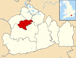
A key feature of the [ward] is Sutton Park and Place. Sutton Place is a Grade 1 Listed Building which was built for Sir Richard Weston in the 16th Century. Additionally, Sutton Park and the area extending to Sutton Green has been designated by the Council as a Conservation Area to protect its character. There are a further nine nationally Listed Buildings in the Conservation Area including Oak House, Lady Grove Farmhouse and the Church of St. Edward the Confessor. In addition, the site of the Old Manor House, west of St. Edwards Roman Catholic Church is nationally recognised as a Scheduled Ancient Monument.

The area contains other buildings which are either nationally Listed or Locally Listed for their architectural and historic interest, together with a number of sites where the County Council considers that there may be archaeological remains. The Local Plan aims to [ensure that development]:

  • preserves the historic character of the Sutton Park Conservation Area (BE9)
  • does not harm the character or setting of the Listed and Locally Listed Buildings in the area (BE10 - BE14)
  • does not harm the site of the Old Manor House Scheduled Ancient Monument (BE15)
  • [includes] archaeological assessments in Areas of High Archaeological Potential as part of a development proposal (BE16)
    Woking Borough Local Plan, 1999, operative as at March 2015 [4]

The original owner and possible architect was Sir Richard Weston a UK politician and courtier with another famous owner being J.Paul Getty, oil magnate and the patriarch of the Getty family who spent the last 25 years of his life at Sutton Place. The current owner is Alisher Usmanov, a Russian businessman.

Anglican church

All Souls' Church remains part of the parish of St Peter, Woking so is historically termed a chapel. The parish has two other centres of collective or individual worship: St Peter's Church, Old Woking, and St Mark's, Westfield. [5]

Catholic church

In addition to the Anglican church, there is also a local Roman Catholic church, Holy Family. This started out holding services in the parish hall of All Saints Church. In 1977, the Catholic church built a hall of its own, where services were first held in August of that year. A new church building was constructed in 1988 and dedicated in March 1989. [6]

Sutton Green Golf Course

Sutton Green has a 71 par golf course co-designed by former world No.1 Laura Davies completed and opened in 1994. The length of the course is 6,480 yards (5,930 m). [7]

Related Research Articles

<span class="mw-page-title-main">Guildford</span> Town in Surrey, England

Guildford is a town in west Surrey, England, around 27 mi (43 km) south-west of central London. As of the 2011 census, the town has a population of about 77,000 and is the seat of the wider Borough of Guildford, which had around 145,673 inhabitants in 2022. The name "Guildford" is thought to derive from a crossing of the River Wey, a tributary of the River Thames that flows through the town centre.

<span class="mw-page-title-main">Godalming</span> Town and civil parish in Surrey, England

Godalming is a market town and civil parish in southwest Surrey, England, around 30 miles (49 km) southwest of central London. It is in the Borough of Waverley, at the confluence of the Rivers Wey and Ock. The civil parish covers 3.74 sq mi (9.7 km2) and includes the settlements of Farncombe, Binscombe and Aaron's Hill. Much of the area lies on the strata of the Lower Greensand Group and Bargate stone was quarried locally until the Second World War.

<span class="mw-page-title-main">Ockham, Surrey</span> Village and parish in Surrey, England

Ockham is a rural and semi-rural village in the borough of Guildford in Surrey, England. The village starts immediately east of the A3 but the lands extend to the River Wey in the west where it has a large mill-house. Ockham is between Cobham and East Horsley.

<span class="mw-page-title-main">Send, Surrey</span> Village in Surrey, England

Send is a village and civil parish in the Guildford borough of the English county of Surrey. The name is thought to mean "sandy place" and sand was extracted at various periods until the 1990s at pits in the outskirts of the parish.

<span class="mw-page-title-main">Pyrford</span> Village and parish in Surrey, England

Pyrford is a village in the borough of Woking in Surrey, England. It is on the left bank of the River Wey, around two miles east of the town of Woking and just south of West Byfleet; the M25 motorway is northeast of the edge of the former parish.

<span class="mw-page-title-main">Brookwood, Surrey</span> Village in Surrey, England

Brookwood is a village in Surrey, England, about 3+12 miles (5.6 km) west of Woking, with a mixture of semi-rural, woodland-set and archetypal suburban residential homes. It lies on the western border of the Woking Borough, with a small part of the village in Guildford Borough. As part of the 2016 boundary review, Brookwood became part of the Heathlands ward which comprises Brookwood, Bridley, Hook Heath, Mayford, Sutton Green and Barnsbury and Wych Hill.

<span class="mw-page-title-main">Goldsworth Park</span> Human settlement in England

Goldsworth Park is a large housing estate to the north-west of Woking in Surrey, England. It was named after the nearby Goldsworth area which was a large 'tithing' of Woking Parish. The tithing included most of the north west of Woking, such as Brookwood, Knaphill and St. John's. It is bordered by villages such as St. John's, Knaphill and Horsell.

<span class="mw-page-title-main">Burpham, Surrey</span> Suburb of Guildford, Surrey, England

Burpham is a suburb of Guildford, a town in Surrey, England with an historic village centre. It includes George Abbot School, a parade of small shops, and the nationally recognised Sutherland Memorial Park.

<span class="mw-page-title-main">History of Woking</span>

Woking means"(settlement belonging to the) followers of Wocc ". Over time, the name has been written variously as, for example, Wochingas, and Wokynge.

<span class="mw-page-title-main">Wonersh</span> Village and civil parish in England

Wonersh is a village and civil parish in the Waverley district of Surrey, England and Surrey Hills Area of Outstanding Natural Beauty. Wonersh contains three Conservation Areas and spans an area three to six miles SSE of Guildford.

<span class="mw-page-title-main">West Byfleet</span> Village and parish in Surrey, England

West Byfleet is a village in Surrey which grew up around its relatively minor stop on the London & South Western Railway: the station, originally Byfleet and Woodham, opened in 1887. More than 1 mile (1.6 km) from the medieval village of Byfleet, the initial concentration of a new development soon established its own economy apart from that of a dependent London commuter village and spread in most directions to its borders including to the border of the old settlement, divided by the shielded M25 motorway today. The first place of worship was dedicated in 1912, the parish of West Byfleet associated with it was established in 1917. The village is bounded to the north by the Basingstoke Canal and to the east by the M25 and the Wey Navigation Canal. Forming part of the contiguous development centred on London and its stockbroker belt just outside the M25 motorway, it is 18 miles from London Heathrow and equidistant between the business parks of Woking and Brooklands. In local government it forms a ward on the same basis as its parish in the Borough of Woking.

<span class="mw-page-title-main">Sutton Place, Surrey</span> Grade I listed tudor manor house

Sutton Place, 3 miles (4.8 km) north-east of Guildford in Surrey, is a large Grade I listed Tudor prodigy house built c. 1525 by Sir Richard Weston, a courtier of Henry VIII.

<span class="mw-page-title-main">Jacobs Well, Surrey</span> Village in Surrey, England

Jacobs Well or Jacobswell is a small village in Surrey, England, of 20th century creation, with a population of 1,171. The village forms a northern outskirt of Guildford, in the civil parish of Worplesdon which can be considered the mother village of medieval date to the west. The Stoke Hill part of Stringers Common, Slyfield Industrial Estate and a Surrey County Council general waste transfer station to the south form the narrowest of its buffer zones to all sides, separating the Slyfield part of Guildford from the village.

<span class="mw-page-title-main">Old Woking</span> Ward in England

Old Woking is a ward and the original settlement of the town and borough of Woking, Surrey, about 1.3 miles (2.1 km) southeast of the modern town centre. It is bounded by the Hoe Stream to the north and the River Wey to the south and between Kingfield to the west and farmland to the east. The village has no dual carriageways or motorways, its main road is the A247, which connects Woking with Clandon Park and provides access to the A3. The village contains parts of Woking's two largest parks and two converted paper mills. The expanded village largely consists of semi-detached houses with gardens and covers an area of 224 hectares

<span class="mw-page-title-main">St John's, Woking</span> Suburb of Woking, Surrey

St Johns and Hook Heath is a suburban ward in Surrey consisting of two settlements founded in the 19th century in the medieval parish of Woking. The two 'villages' have residents' associations and are centred 2.5 km WSW and SW of Woking's town centre in the northwest of the English county – by including such suburbs, Woking is the largest town in the county. The ward in 2011 contained 1,888 homes across its 3.46 square kilometres (1.34 sq mi).

<span class="mw-page-title-main">Woking</span> Town and borough in Surrey, England

Woking is a town and borough in northwest Surrey, England, around 23 mi (36 km) from central London. It appears in Domesday Book as Wochinges, and its name probably derives from that of a Saxon landowner. The earliest evidence of human activity is from the Paleolithic, but the low fertility of the sandy local soils meant that the area was the least populated part of the county in 1086. Between the mid-17th and mid-19th centuries, new transport links were constructed, including the Wey Navigation, Basingstoke Canal and London to Southampton railway line. The modern town was established in the mid-1860s, as the London Necropolis Company began to sell surplus land surrounding the railway station for development.

<span class="mw-page-title-main">Westfield, Woking, Surrey</span> Neighbourhood of Woking, Surrey, England

Westfield is an area in Woking borough, Surrey. Westfield marks the southern boundary of Woking altering from English archetypal suburban homes in the north to semi-rural homes, smallholdings, small woodlands and fields in the south, where it abuts areas of London's Metropolitan Green Belt.

References

  1. Key Statistics: Population. (2011 census Output Area: E00157953 and E00157959) Retrieved 2015-02-27.
  2. 1 2 3 4 5 Interactive Maps Surrey County Council. Accessed 2015-04-15
  3. 1 2 Flood Risk Map Environment Agency. Accessed 2015-04-20
  4. 1 2 The Local Plan of Woking Borough Council: Mayford and Sutton Green section Accessed 2015-20-04
  5. Parish of St Peter Woking website
  6. "Parish History". Holy Family Church. Retrieved 21 August 2019.
  7. Sutton Green Golf Course Official Website