Mayford

Last updated

Mayford
Mayford Village - geograph.org.uk - 1213780.jpg
Mayford village green
Surrey UK location map.svg
Red pog.svg
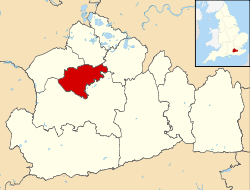
Mayford
Location within Surrey
Population1,776 . [1]
OS grid reference SU999561
District
Shire county
Region
Country England
Sovereign state United Kingdom
Post town Woking
Postcode district GU22
Dialling code 01483
Police Surrey
Fire Surrey
Ambulance South East Coast
UK Parliament
List of places
UK
England
Surrey
51°17′45″N0°34′02″W / 51.2958°N 0.5673°W / 51.2958; -0.5673

Mayford is a village in Woking borough of the county of Surrey, England. It is 3 miles south of Woking on Egley Road, part of the A320 between Woking and Guildford, Surrey. The village is mainly centred on the roundabout in the middle of the village. Mayford lays claim to having been mentioned in the Domesday Book in 1086, as "Maiford". The same spelling was recorded in 1212.

Contents

Etymology

The name Mayford is supposed to be derived from the ford that used to cross the river Hoe. The 'May' part is believed to be short for mayweed, which grows around the River Hoe. Hawthorn trees were only called "May" from the 14th century onwards so this is unlikely to be the origin of the name.

Wildlife

Mayford has a number of hawthorn trees growing in the area. It also has a lot of mayweed growing as well. A lot of the mayweed and hawthorn trees grow on the edge of the River Hoe.

Related Research Articles

<span class="mw-page-title-main">Surrey</span> County of England

Surrey is a ceremonial county in South East England. It is bordered by Greater London to the north east, Kent to the east, East and West Sussex to the south, and Hampshire and Berkshire to the west. The largest settlement is Woking.

<span class="mw-page-title-main">Bisley, Surrey</span> Human settlement in England

Bisley is a village and civil parish in the Borough of Surrey Heath in Surrey, England, approximately 25 miles (40 km) southwest of central London. It is midway between Woking and Camberley. The village had a population of 3,965 in the 2011 Census.

<span class="mw-page-title-main">Pyrford</span> Human settlement in England

Pyrford is a village in the borough of Woking in Surrey, England. It is on the left bank of the River Wey, around two miles east of the town of Woking and just south of West Byfleet; the M25 motorway is northeast of the edge of the former parish.

<span class="mw-page-title-main">Brookwood, Surrey</span> Human settlement in England

Brookwood is a village in Surrey, England, about 3+12 miles (5.6 km) west of Woking, with a mixture of semi-rural, woodland-set and archetypal suburban residential homes. It lies on the western border of the Woking Borough, with a small part of the village in Guildford Borough. As part of the 2016 boundary review, Brookwood became part of the Heathlands ward which comprises Brookwood, Bridley, Hook Heath, Mayford, Sutton Green and Barnsbury and Wych Hill.

<span class="mw-page-title-main">Woking railway station</span> Railway station in Woking, England

Woking railway station is a major stop in Woking, England, on the South West Main Line used by many commuters. It is 24 miles 27 chains (39.2 km) down the line from London Waterloo. The station is managed by South Western Railway, who operate all trains serving it.

<span class="mw-page-title-main">Worplesdon railway station</span> Railway station in Surrey, England

Worplesdon railway station is a railway station in the Woking district of Surrey, England. The station is located between Woking and Guildford stations on the Portsmouth Direct Line, 26 miles 55 chains (42.9 km) down the line from London Waterloo.

<span class="mw-page-title-main">Bishop David Brown School</span> Secondary school in Surrey, England

The Bishop David Brown School is a mixed academy status secondary school located in Sheerwater, (Woking), Surrey, England.

<span class="mw-page-title-main">Jacobs Well, Surrey</span> Village in England

Jacobs Well or Jacobswell is a small village in Surrey, England, of 20th century creation, with a population of 1,171. The village forms a northern outskirt of Guildford, in the civil parish of Worplesdon which can be considered the mother village of medieval date to the west. The Stoke Hill part of Stringers Common, Slyfield Industrial Estate and a Surrey County Council general waste transfer station to the south form the narrowest of its buffer zones to all sides, separating the Slyfield part of Guildford from the village.

<span class="mw-page-title-main">Old Woking</span> Ward in England

Old Woking is a ward and the original settlement of the town and borough of Woking, Surrey, about 1.3 miles (2.1 km) southeast of the modern town centre. It is bounded by the Hoe Stream to the north and the River Wey to the south and between Kingfield to the west and farmland to the east. The village has no dual carriageways or motorways, its main road is the A247, which connects Woking with Clandon Park and provides access to the A3. The village contains parts of Woking's two largest parks and two converted paper mills. The expanded village largely consists of semi-detached houses with gardens and covers an area of 224 hectares

<span class="mw-page-title-main">St John's, Woking</span> Human settlement in England

St Johns and Hook Heath is a suburban ward in Surrey consisting of two settlements founded in the 19th century in the medieval parish of Woking. The two 'villages' have residents' associations and are centred 2.5 km WSW and SW of Woking's town centre in the northwest of the English county – by including such suburbs, Woking is the largest town in the county. The ward in 2011 contained 1,888 homes across its 3.46 square kilometres (1.34 sq mi).

Hoe Bridge School is an independent co-educational, pre-prep and prep school in Woking, England. At its last full inspection in 2014 it was rated excellent by the Independent Schools Inspectorate. The school was established in 1986 following the merger of two former proprietorial boys schools, Allen House and St Michael's School. In 1987 it became a charitable trust administered by a board of governors, and developed to include girls up to Year 6 in 1999. The school is based in a seventeenth century house and is set in its own grounds in Woking, Surrey.

<span class="mw-page-title-main">Woking</span> Town and borough in Surrey, England

Woking is a town and borough in northwest Surrey, England, around 22 mi (35 km) from central London. It appears in Domesday Book as Wochinges and its name probably derives from that of a Saxon landowner. The earliest evidence of human activity is from the Paleolithic, but the low fertility of the sandy, local soils meant that the area was the least populated part of the county in 1086. Between the mid-17th and mid-19th centuries, new transport links were constructed, including the Wey Navigation, Basingstoke Canal and London to Southampton railway line. The modern town was established in the mid-1860s, as the London Necropolis Company began to sell surplus land surrounding the railway station for development.

<span class="mw-page-title-main">Woking Park</span>

Woking Park is a large park and leisure complex in Woking, Surrey, operated and maintained by Woking Borough Council. The park is in the Hoe Valley and will be affected by the Hoe Valley Scheme.

<span class="mw-page-title-main">Westfield, Woking, Surrey</span> Human settlement in England

Westfield is an area in Woking borough, Surrey. Westfield marks the southern boundary of Woking altering from English archetypal suburban homes in the north to semi-rural homes, smallholdings, small woodlands and fields in the south, where it abuts areas of London's Metropolitan Green Belt.

<span class="mw-page-title-main">Sutton Green, Surrey</span> Human settlement in England

Sutton Green is a semi-rural suburban settlement and area of Metropolitan Green Belt between Guildford and Woking, Surrey. Sutton Green neighbours Jacobs Well in the Borough of Guildford.

<span class="mw-page-title-main">Hoe Valley School</span> Free school in Woking, Surrey, England

Hoe Valley School is an outstanding new co-educational, comprehensive, secondary school in Woking, England. The school was established in 2014, and opened to 4 forms of year 7 students for the first time in September 2015. The school was established by local parents, education leaders and business people under the Free Schools programme primarily to serve the south Woking and surrounding area where students have not had access to places at other local schools.

<span class="mw-page-title-main">Mayford Meadows</span>

Mayford Meadows is a 4.9-hectare (12-acre) Local Nature Reserve on the southern outskirts of Woking in Surrey. It is owned and managed by Woking Borough Council.

References

  1. Surrey County Council Census data Archived October 25, 2007, at the Wayback Machine

Bibliography

Commons-logo.svg Media related to Mayford at Wikimedia Commons