Brookwood, Surrey

Last updated

Brookwood
Avenue leading from Brookwood cemetery.jpg
The Avenue leading from Brookwood Cemetery
Surrey UK location map.svg
Red pog.svg
Brookwood
Location within Surrey
Population2,565 (2011. Ward) [1]
OS grid reference SU952570
District
Shire county
Region
Country England
Sovereign state United Kingdom
Post town Woking
Postcode district GU24
Dialling code 01483
Police Surrey
Fire Surrey
Ambulance South East Coast
UK Parliament
List of places
UK
England
Surrey
51°18′14″N0°38′12″W / 51.3038°N 0.6367°W / 51.3038; -0.6367 Coordinates: 51°18′14″N0°38′12″W / 51.3038°N 0.6367°W / 51.3038; -0.6367

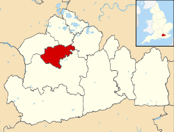
Brookwood is a village in Surrey, England, about 3+12 miles (5.6 km) west of Woking, with a mixture of semi-rural, woodland-set and archetypal suburban residential homes. It lies on the western border of the Woking Borough, with a small part of the village in Guildford Borough. As part of the 2016 boundary review, Brookwood became part of the Heathlands ward which comprises Brookwood, Bridley, Hook Heath, Mayford, Sutton Green and Barnsbury and Wych Hill. [2]

Contents

The village is known for the 500-acre Brookwood Cemetery, also called the London Necropolis. The village also gave its name to the former Victorian Brookwood Hospital, once the leading mental institution in Surrey. Since its closure in 1994, it has been redeveloped as housing.

Geography

The village borders Knaphill, on the other side of the main A322 road, which is home to Brookwood Manor. The village also borders the Basingstoke Canal which has a flight of locks there. Pirbright Camp is a short distance to the west, with the decommissioned Princess Royal Barracks, Deepcut slightly further away to the west. The village is surrounded mainly by heathland such as Sheet's Heath, a Site of Special Scientific Interest, Smarts Heath and Brookwood Heath.

The main road is Connaught Road, a long road containing mixed Victorian terraces, a variety of 1930's semi-detached and larger detached houses. Branching off are smaller cul-de-sacs with more modern houses, some which back onto the canal itself. Along the road, there is a primary school which was established in 1906. [3]

History

Brookwood appears by name (as Brocwud and Brocwude) in the bounds of the Forest of Windsor as set down in 1225, [4] and is depicted within 'Brookewood Walke' on John Norden's 1607 map of the Forest. [5] It was mapped in detail for the first time in 1709, when it was recorded as covering 684 acres (excluding two large internal enclosures) bounded on all but the north-east side by Woking Common. [6] Timber from Brookwood was used for the repair of local bridges in the late sixteenth and early seventeenth centuries, [7] [8] [9] and by 1719 the wood appears to have been stripped of all trees. [10]

The village has grown over the 150 or so years since the vast cemetery and station first set roots in this area. Many of London's dead were buried in Brookwood Cemetery during the Victorian era due to the over-population of the city at that time. The logistics were accomplished using the London Necropolis Railway, consisting of funeral trains running from London Waterloo railway station to Brookwood and subsequently down a small branch line into the cemetery grounds. This branch-line is now disused. The main station and nearby Brookwood Club private members bar are at least 100 years old. [11]

The name, 'Brook wood', refers to the small streams which used to rise within it, and in particular to 'Coresbrook'. [12] The name is unlikely to derive from 'brocc' (meaning 'badger'), although the animal features on the village crest and on the school uniform.

Transport

Brookwood railway station is on the South West Main Line, with four trains per hour each way. The junction with the Alton Line is about 1+14 miles (2 km) further west. There is also a regular bus service to Guildford, Woking and Frimley.

Sports teams and organisations

Brookwood has a football team, Brookwood and District Football Club. Formed in 2007, B & D FC currently play in the Surrey and Hants Border League Division 3. Last season 2009/10 they were winners of the Prince Albert Cup, beating Abbey Rangers 5-4 in the match at Surrey Sports Park.

Youth organisations

Brookwood is home to quite a number of youth organisations and clubs. Most of these meet at either the Memorial Hall, St Saviours Church or are based in the school.

Brookwood Scout Group meets in the Brookwood Memorial Hall every week during term time and offers both boys and girls between the ages of six and fourteen with the opportunity to take part in a wide range of activities and adventure. The group is a member of the Scout Association and covers the youngest three age bands that the Association caters for (Beavers, Cubs and Scouts).

Angling at Brookwood Country Park

Goldsworth Park Angling Club, established 2015, manages angling at Goldsworth Park Lake and Brookwood Ponds, under license with Woking Borough Council.

See also

Related Research Articles

<span class="mw-page-title-main">Surrey</span> County of England

Surrey is a county in South East England which borders Kent to the east, East Sussex to the southeast, West Sussex to the south, Hampshire to the west, Berkshire to the northwest, and Greater London to the northeast. With about 1.2 million people, Surrey is the 12th-most populous English county, the third-most populous home county, after Kent and Essex, and the third-most populous in the Southeast, after Hampshire and Kent.

London Necropolis Company Cemetery operator established in 1852

The London Necropolis Company (LNC), formally the London Necropolis & National Mausoleum Company until 1927, was a cemetery operator established by Act of Parliament in 1852 in reaction to the crisis caused by the closure of London's graveyards in 1851. The LNC intended to establish a single cemetery large enough to accommodate all of London's future burials in perpetuity. The company's founders recognised that the recently invented technology of the railway provided the ability to conduct burials a long distance from populated areas, mitigating concerns over public health risks from living near burial sites. Accordingly, the company bought a very large tract of land in Brookwood, Surrey, around 25 miles (40 km) from London, and converted a portion of it into Brookwood Cemetery. A dedicated railway line, the London Necropolis Railway, linked the new cemetery to the city.

<span class="mw-page-title-main">Brookwood Cemetery</span> Burial ground in Surrey, England

Brookwood Cemetery, also known as the London Necropolis, is a burial ground in Brookwood, Surrey, England. It is the largest cemetery in the United Kingdom and one of the largest in Europe. The cemetery is listed a Grade I site in the Register of Historic Parks and Gardens.

Chobham Human settlement in England

Chobham is a village and civil parish in the Borough of Surrey Heath in Surrey, England.

Bisley, Surrey Human settlement in England

Bisley is a village and civil parish in the Borough of Surrey Heath in Surrey, England, approximately 25 miles (40 km) southwest of central London. It is midway between Woking and Camberley. The village had a population of 3,965 in the 2011 Census.

London Necropolis railway station Former railway station in London

London Necropolis railway station was the terminus at Waterloo, London, of the London Necropolis Railway. The London Necropolis Railway was opened in 1854 as a reaction to severe overcrowding in London's existing graveyards and cemeteries. It aimed to use the recently developed technology of the railway to move as many burials as possible to the newly built Brookwood Cemetery in Brookwood, Surrey. This location was within easy travelling distance of London, but distant enough for the dead not to pose any risk to public hygiene. There were two locations for the station; the first was in operation from 1854 to 1902, the second from 1902 to 1941.

Goldsworth Park Human settlement in England

Goldsworth Park is a large housing estate to the north-west of Woking in Surrey, England. It was named after the nearby Goldsworth area which was a large 'tithing' of Woking Parish. The tithing included most of the north west of Woking, such as Brookwood, Knaphill and St. John's. It is bordered by villages such as St. John's, Knaphill and Horsell.

Ash, Surrey Village in England

Ash is a village and civil parish in the far west of the borough of Guildford, Surrey. Ash is on the eastern side of the River Blackwater, with a station on the Reading-Guildford-Gatwick line, and direct roads to Aldershot, Farnham and Guildford. The 2011 census counted the residents of the main ward of Ash, which excludes Ash Vale, as 6,120. It is within the Aldershot Urban Area and adjoins the riverside in the east of that large town; Ash has a small museum in the local cemetery chapel, a large secondary school and a library.

<span class="mw-page-title-main">History of Woking</span>

Woking means"(settlement belonging to the) followers of Wocc ". Over time, the name has been written variously as, for example, Wochingas, and Wokynge.

Normandy, Surrey Human settlement in England

Normandy is a civil parish of 16.37 square kilometres in the borough of Guildford in Surrey, England and the name of the largest village in that parish. Almost surrounded by its hill ranges, Normandy is in the plain west of Guildford, straddles the A323 'Aldershot Road' and is north of the narrowest part the North Downs known as the Hog's Back which carries a dual carriageway. The parish in 2011 had a population of 2,981 living in 1,310 households, has woods, a public common and four government-operated commons to the north that are an SSSI heath. Normandy has been home to a number of notable residents, including William Cobbett.

West End, Surrey Human settlement in England

West End is a village and civil parish in Surrey Heath, Surrey, England, approximately 25 miles (40 km) southwest of central London. It is midway between the towns of Camberley and Woking, 4 mi (6.4 km) to the west and east respectively. The River Bourne rises from its sources to the immediate west to run through the village. Until the mid 20th century, the West End consisted of a collection of smallholdings surrounded by a substantial area of common land

Knaphill Human settlement in England

Knaphill is a village in Surrey, England, between Woking to the east and Aldershot to the west; to the south and north on the A322 – its western border – are Brookwood, and Bisley. Some of the village is on a hill, hence its name.

Jacobs Well, Surrey Village in England

Jacobs Well or Jacobswell is a small village in Surrey, England, of 20th century creation, with a population of 1,171. The village forms a northern outskirt of Guildford, in the civil parish of Worplesdon which can be considered the mother village of medieval date to the west. The Stoke Hill part of Stringers Common, Slyfield Industrial Estate and a Surrey County Council general waste transfer station to the south form the narrowest of its buffer zones to all sides, separating the Slyfield part of Guildford from the village.

St Johns, Woking Human settlement in England

St Johns and Hook Heath is a suburban ward in Surrey consisting of two settlements founded in the 19th century in the medieval parish of Woking. The two 'villages' have residents' associations and are centred 2.5 km WSW and SW of Woking's town centre in the northwest of the English county – by including such suburbs, Woking is the largest town in the county. The ward in 2011 contained 1,888 homes across its 3.46 square kilometres (1.34 sq mi).

<span class="mw-page-title-main">Sheerwater</span> Human settlement in England

Sheerwater is a residential neighbourhood or small suburb of Woking, in the Woking district in Surrey, England, occasionally described as a village, between West Byfleet and Horsell. Its border is defined to the north by a gently winding part of the Basingstoke Canal and to the south by the South West Main Line which passes from cutting level to that of an embankment. The neighbourhood has a business park and light industry at its south-western end. The whole area is linear, includes diverse green spaces to north and south, and covers 92 hectares.

<span class="mw-page-title-main">Woking</span> Town in south east England

Woking is a town and borough in northwest Surrey, England, around 22 mi (35 km) from central London. It appears in Domesday Book as Wochinges and its name probably derives from that of a Saxon landowner. The earliest evidence of human activity is from the Paleolithic, but the low fertility of the sandy, local soils meant that the area was the least populated part of the county in 1086. Between the mid-17th and mid-19th centuries, new transport links were constructed, including the Wey Navigation, Basingstoke Canal and London to Southampton railway line. The modern town was established in the mid-1860s, as the London Necropolis Company began to sell surplus land surrounding the railway station for development.

Westfield, Woking, Surrey Human settlement in England

Westfield is an area in Woking borough, Surrey. Westfield marks the southern boundary of Woking altering from English archetypal suburban homes in the north to semi-rural homes, smallholdings, small woodlands and fields in the south, where it abuts areas of London's Metropolitan Green Belt.

References

  1. "Woking Ward population 2011". Neighbourhood Statistics. Office for National Statistics. Archived from the original on 21 October 2016. Retrieved 5 October 2016.
  2. "Heathlands". Woking. Retrieved 17 January 2019.
  3. "Our School". Brookwood Primary School. Retrieved 17 January 2019.
  4. Hardy, Thomas Duffus (1844). Rotuli Litterarum Clausarum, 9 Hen III. London. p. 56.
  5. Norden, John (1607). A Description of the Honor of Windesor (Map).
  6. Holmes, John (1709). A Mapp of Brookwood lying in the Parish of Woking in the County of Surrey being Parcell of the Crown Lands (Map).
  7. Fairbrother, E.H. (1913). "Surrey Bridges and Waterways". Surrey Archaeological Collections. 26: 145. Retrieved 2 March 2022.
  8. "Letter from William [Paulet], Marquis of Winchester, and Sir Walter Mildmay to John Tamworth and William More". Surrey History Centre Catalogue. Retrieved 2 March 2022.
  9. "Certificate of Robert Treswell, esq, surveyor general of his Majesty's woods". Surrey History Centre Catalogue. Retrieved 3 March 2022.
  10. "Map of the Manor of Woking, surveyed by John Remnant of Guildford". Surrey History Centre Catalogue. Retrieved 2 March 2022.
  11. "Home". Brookwood Club. Retrieved 17 January 2019.
  12. "Brookwood: Early-attested site in the Parish of Woking". Survey of English Place-Names. English Place-Name Society. Retrieved 2 March 2022.