Whitstone Hundred

Last updated

Gloucestershire Hundreds in 1832 Gloucestershire 1832 Map.png
Gloucestershire Hundreds in 1832

Whitstone was an ancient hundred of Gloucestershire, England. From the 13th century it comprised two adjacent divisions, which included the ancient parishes of:

Gloucestershire County of England

Gloucestershire is a county in South West England. The county comprises part of the Cotswold Hills, part of the flat fertile valley of the River Severn, and the entire Forest of Dean.

Lower Division
Eastington, Stroud a village located in Stroud District, United Kingdom

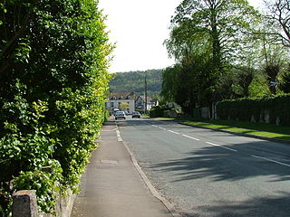
Eastington is a village and civil parish in the English county of Gloucestershire. It lies 4 miles west of Stroud and 9 miles south of Gloucester at the entrance to the Stroud Valley. It is situated west of the town of Stonehouse and is convenient for Junction 13 of the M5 motorway and the A38 and A419 roads. Since the M5 and its access roads were opened, the main road no longer runs through the village.

Frocester a village located in Stroud District, United Kingdom

Frocester is a village and civil parish in Stroud District, Gloucestershire, England. It lies below the Cotswold escarpment, 10 miles south of Gloucester and 4 miles west of Stroud. In the 2001 census the parish had a population of 194, decreasing to 155 at the 2011 Census.

Kings Stanley human settlement in United Kingdom

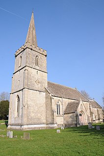
King's Stanley is a village in Gloucestershire, England, situated southwest of the town of Stroud. The village is part of what is known locally as 'The Stanleys', along with its neighbours Leonard Stanley and Stanley Downton. Marling Close, which contains the local playing fields on which the cricket and football teams play, was donated to the village by local magnates The Marlings who also helped found Marling School, and is now in the care of the Marling Trust. The village is overlooked by Selsley common. The village is home to the oldest Baptist Church in Gloucestershire that started meeting in 1640. In the Domesday Book of 1086 it is recorded as held by Turstin FitzRolf.

Upper Division
Fretherne village in United Kingdom

Fretherne is a small village in Gloucestershire, England, situated between the larger villages of Frampton-on-Severn and Arlingham. It forms the civil parish of Fretherne with Saul with the village of Saul. In the Domesday Book of 1086 it is recorded as held by Turstin FitzRolf.

Hardwicke, Stroud human settlement in United Kingdom

Hardwicke is a village on the A38 road some 4 miles / 7 km south of the city of Gloucester, Gloucestershire, England. Despite its proximity to Gloucester, the village comes under Stroud (district) Council. The population of the village taken at the United Kingdom Census 2011 was 3,901.

Haresfield village in the United Kingdom

Haresfield is a village near Gloucester, Gloucestershire, England around one mile from Junction 12 of the M5 motorway and between the villages of Brookthorpe, Harescombe and Hardwicke. The population of the village taken at the 2011 census was 378.

The hundred existed at the time of the Domesday Book in 1086, but covering a smaller area. By 1220 the adjacent Blacklow hundred had been absorbed. Blachelaue in the Domesday Book contained the parishes of Alkerton (now Eastington), Frampton (-on-Severn), Frocester, (Kings) Stanley, (Leonard) Stanley, Stonehouse, Wheatenhurst, and Fretherne. [1]

Domesday Book 11th-century survey of landholding in England as well as the surviving manuscripts of the survey

Domesday Book is a manuscript record of the "Great Survey" of much of England and parts of Wales completed in 1086 by order of King William the Conqueror. The Anglo-Saxon Chronicle states:

Then, at the midwinter [1085], was the king in Gloucester with his council .... After this had the king a large meeting, and very deep consultation with his council, about this land; how it was occupied, and by what sort of men. Then sent he his men over all England into each shire; commissioning them to find out "How many hundreds of hides were in the shire, what land the king himself had, and what stock upon the land; or, what dues he ought to have by the year from the shire."

The ancient meeting place of the hundred was probably at Whitestones Field in the parish of Hardwicke, although meetings were later held at Quedgeley, Stonehouse, Wheatenhurst and Frampton. [2]

Related Research Articles

Whitminster human settlement in United Kingdom

Whitminster is a village and civil parish in Gloucestershire, on the A38 trunk road approximately 6 miles south of Gloucester and 6 miles northwest of Stroud. The parish population at the 2011 census was 881. It was formerly known as Wheatenhurst, the name being changed officially in 1945. Wheatenhurst manor, with Whitminster House and the parish church of St Andrew, lies about a mile to the west of the modern village.

Stonehouse, Gloucestershire town and civil parish in the Stroud District of Gloucestershire, England in the United Kingdom

Stonehouse is a town in the Stroud District of Gloucestershire in southwestern England.

Stroud (UK Parliament constituency) Parliamentary constituency in the United Kingdom, 1955 onwards

Stroud is a constituency represented in the House of Commons of the UK Parliament since 2017 by David Drew of the Labour Co-op party.

River Frome, Stroud river that flows through Stroud in Gloucestershire, United Kingdom

The River Frome, once also known as the Stroudwater, is a small river in Gloucestershire, England. It is to be distinguished from another River Frome in Gloucestershire, the Bristol Frome, and the nearby River Frome, Herefordshire. The river is approximately 25 miles (40 km) long.

Quedgeley human settlement in the United Kingdom

Quedgeley is a suburban town or modern village suburb 3.5 miles (5.6 km) southwest of the city of Gloucester, England. A thin strip of land between the Severn and the Gloucester Ship Canal occupies the west, and the south-eastern part of the town is Kingsway Village, directly to the north of which is Tuffley.

Arlingham village in the United Kingdom

Arlingham is a village and civil parish in the Stroud District of Gloucestershire, England. The 2001 Census recorded a parish population of 410, increasing to 459 at the 2011 census. The parish contains the hamlets of Milton End, Overton and Priding The next parish to the east is Fretherne with Saul.

Stroud and District Football League

The Stroud and District Football League is a football competition based in England. This league was established in 1902. The league is affiliated to the Gloucestershire County FA. It has a total of seven divisions with the highest, Division One, sitting at level 14 of the English football league system. It is a feeder to the Gloucestershire Northern Senior League (GNSL).

Stroud and Thornbury was a county constituency represented in the House of Commons of the Parliament of the United Kingdom. It elected one Member of Parliament (MP) by the first past the post system of election.

Frampton Mansell village in the United Kingdom

Frampton Mansell is a small English village 5 miles ESE of Stroud, in the parish of Sapperton. It is lies off the A419 road between Stroud and Cirencester.

Saul, Gloucestershire village in Gloucestershire, England

Saul is a village in Gloucestershire, England. It is in the parish of Fretherne with Saul in the district of Stroud.

Stonehouse (Bristol Road) railway station

Stonehouse railway station was a station in Stonehouse, England, on the Bristol and Gloucester Railway between Haresfield and Frocester.

Framilode village in the United Kingdom

Framilode is a village on the banks of the River Severn in Gloucestershire, England, in the parish of Fretherne with Saul. It consists of two settlements: the larger, Framilode, is at the mouth of the River Frome. The smaller settlement, Framilode Passage, lies about 0.5 mile downstream.

Leonard Stanley human settlement in United Kingdom

Leonard Stanley is a village located south of the town of Stonehouse in Gloucestershire. Approximately 3 miles (4.8 km) west of Stroud, it is situated 7 miles (11 km) east of the River Severn. The surrounding land use around Leonard Stanley is primarily agricultural, however, Leonard Stanley does contain a small cluster of residential and urban usage.

Richard Capel (1586–1656) was an English nonconforming clergyman of Calvinist views, a member of the Westminster Assembly, and for a period of his life a practicing physician.

Fretherne with Saul is a civil parish in the Stroud district of Gloucestershire, England. It includes the villages of Framilode, Fretherne, Saul and Upper Framilode.

Longney village in Gloucestershire, England

Longney is a village on the river Severn 5 miles south-west of Gloucester, Gloucestershire, England within the parish of Longney and Epney. The parish is long and narrow and the main trades are agricultural with several farms throughout it. Longney is the Saxon name meaning a long island. The population of the Longney and Epney parish is 285 (2011).

Langley and Swinehead Hundred

Langley and Swinehead was an ancient hundred of Gloucestershire, England. Hundreds originated in the late Saxon period as a subdivision of a county and lasted as administrative divisions until the 19th century.

References

  1. Open Domesday Online: Blachelaue (Blacklow) Hundred, accessed June 2017
  2. C R Elrington, N M Herbert, R B Pugh (Editors), Kathleen Morgan, Brian S Smith (1972). "The Hundred of Whitstone". A History of the County of Gloucester: Volume 10: Westbury and Whitstone Hundreds. Institute of Historical Research. Retrieved 9 July 2011.CS1 maint: multiple names: authors list (link)

Coordinates: 51°42′N2°14′W / 51.7°N 2.23°W / 51.7; -2.23