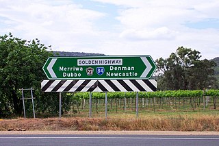
Golden Highway is a 313-kilometre (194 mi) highway, located in the Hunter and Orana regions of New South Wales, Australia. It runs eastwards from Dubbo towards Newcastle on the coast, allowing road transport to avoid travelling over the Blue Mountains to Sydney, and is designated route B84.

Goulburn River, a perennial river of the Hunter River catchment, is located in the Upper Hunter region of New South Wales, Australia.
Taperoo is a suburb in the Australian state of South Australia located on the LeFevre Peninsula in the west of Adelaide about 18 kilometres (11 mi) north-west of the Adelaide city centre.

Bylong Valley Way is a New South Wales regional road linking Golden Highway near Sandy Hollow to Castlereagh Highway near Ilford. It is named after the Bylong Valley, through which the road passes.

The Bylong Valley is a winding but relatively flat valley that crosses the Great Dividing Range between the Goulburn River National Park and Wollemi National Park, west of the upper Hunter Region in New South Wales, Australia.
Bathurst-Ilford Road is a 72.0-kilometre (44.7 mi) New South Wales country road linking Ilford to the regional hub of Bathurst.

Rylstone is a small town in New South Wales, Australia, in the Central Tablelands region within the Mid-Western Regional Council local government area. It is located on the Bylong Valley Way road route. At the 2021 census, Rylstone had a population of 904.

Sandy Hollow is a small rural town in New South Wales, Australia in Muswellbrook Shire. The town is located on the Golden Highway in the far west of the Upper Hunter Valley, about 260 km north of Sydney.

Bylong is a village in New South Wales, Australia, in the Mid-Western Regional Council. It is located on the Bylong Valley Way.

River Heads is a coastal town and locality in the Fraser Coast Region, Queensland, Australia. In the 2021 census, the locality of River Heads had a population of 2,044 people.

Baerami is a locality in the Muswellbrook Shire in the Upper Hunter region of New South Wales, Australia.

The Merriwa railway line is in the Hunter Valley of Northern New South Wales, Australia. The line branches from the Main North line at Muswellbrook and travels southwest to Denman then generally northwest through Sandy Hollow to the town of Merriwa, a distance of approximately 80 kilometres (50 mi). The line was completed to Merriwa on 29 October 1917, however the section north west of Sandy Hollow closed in 1988.
There are 3 mines, Bengalla & Mt Pleasant, just southwest & west of Muswellbrook & Mangoola, 1/2 way to Denman with Ballon Loops of this line & a number of Passing Sidings have been built with the traffic to / from the 3 mines @ Ulan near Gulgong.
The section between Muswellbrook and Sandy Hollow, combined with the Sandy Hollow – Gulgong railway line forms the Australian Rail Track Corporation's Ulan line between Muswellbrook and Gulgong on the Gwabegar railway line.

Ulan is a small village in eastern New South Wales, Australia. Ulan Post Office opened on 1 September 1893.
Bylong River, a perennial river of the Hunter River catchment, is located in the Central Tablelands and Upper Hunter regions of New South Wales, Australia.
Growee River, a perennial river of the Hunter River catchment, is located in the Central Tablelands region of New South Wales, Australia.

Allan is a rural locality in the Southern Downs Region, Queensland, Australia. It was formerly known as Sandy Creek. In the 2016 census, Allan had a population of 87 people.

Josephville is a rural locality in the Scenic Rim Region, Queensland, Australia. In the 2016 census, Josephville had a population of 166 people.
Ten Mile Hollow is a locality split between the northern outskirts of Sydney and the Central Coast region of the state of New South Wales, Australia.
Maryvale is a locality in Dubbo Regional Council, New South Wales, Australia.
Baerami Creek is a locality in the Muswellbrook Shire in the Upper Hunter region of New South Wales, Australia. Part of the locality lies in a part of the valley of the watercourse of the same name, Baerami Creek.
This page is based on this
Wikipedia article Text is available under the
CC BY-SA 4.0 license; additional terms may apply.
Images, videos and audio are available under their respective licenses.
