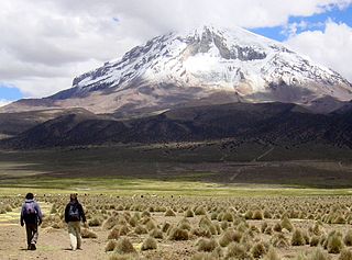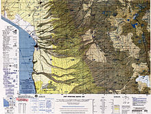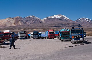
Sajama is a province in the northwestern parts of the Bolivian Oruro Department.

Turco Municipality is the second municipal section of the Sajama Province in the Oruro Department in Bolivia, and was founded on February 15, 1957. Its seat is Turco, situated 154 km west of Oruro at an altitude of 3,860 m. The municipality covers an area of 3,973 km², not taking into account the area of Laca Laca Canton.

Kuntur Ikiña is a 5,044-metre-high (16,549 ft) mountain in the Andes located in the Cordillera Occidental of Bolivia. It is situated in the Oruro Department, Sajama Province, Turco Municipality, north-east of Umurata and south of the Bolivian Route 4 that leads to Tambo Quemado on the border with Chile.

Wila Qullu, also Cerro Laguna, is a 4,948-metre-high (16,234 ft) mountain in the Andes located on the border of Bolivia and Chile in the Cordillera Occidental. Wila Qullu lies between the Salar de Huasco in the Tarapacá Region of Chile and the Salar de Uyuni in Bolivia. On the Bolivian side it is situated in the Potosí Department, Daniel Campos Province, Llica Municipality, Canquella Canton, north of the village of Pampa Anta.

Wila Qullu is a mountain in the Bolivian Andes, about 4,600 metres (15,092 ft) high. It situated in the Cordillera Occidental near the border with Chile. It is located in the Oruro Department, Sabaya Province, Sabaya Municipality, Julo Canton. Wila Qullu lies south-east of the volcano Pukintika and north-west of the mountain Phaq'u Q'awa.

Waylla is a mountain in the Andes located on the border of Bolivia and Chile in the Cordillera Occidental.

Ñuñu Qullu is a 4,723-metre-high (15,495 ft) mountain in the Andes of Bolivia. It is situated in the Oruro Department, Sajama Province, in the north of the Turco Municipality. Ñuñu Qullu lies south-west of the mountain Yaritani, north-east of the volcanic complex of Asu Asuni and south-east of the mountains Chunkarani, Milluni and Pukarani.

Wila Qullu is a mountain in the Oruro Department in the Andes of Bolivia, about 5,140 metres (16,864 ft) high. Wila Qullu is situated in the Sajama Province, in the west of the Curahuara de Carangas Municipality, west of the extinct Sajama volcano and north-east of the Paya Chata mountains. It lies south-west of the mountain Phaq'u Q'awa.

Ari Qullu Phujru is a 4,974-metre-high (16,319 ft) mountain in the Cordillera Occidental in the Andes of Bolivia. It is situated in the Oruro Department, Sajama Province, Turco Municipality, Chachacomani Canton, south-east of the volcanic complex of Kimsa Chata.

Kiswara is a 4,018-metre-high (13,182 ft) mountain in the Andes of Bolivia. It is in the Oruro Department, Sajama Province, in the south of the Turco Municipality. Kiswara lies southeast of the mountain Uyarani. It is on the left bank of the Challwiri River (Chalviri, Challhuiri), a left tributary of the Lauca River.

Chachakumani is a 4,712-metre-high (15,459 ft) mountain in the Cordillera Occidental in the Andes of Bolivia. It is situated in the Oruro Department, Sajama Province, in the west of the Turco Municipality. Chachakumani lies south of Muru Qullu, northeast of Umurata and Kuntur Ikiña and southeast of Uqi Uqini. The Jaruma River flows between Muru Qullu and Chachakumani. It is a tributary of the Sajama River.

Wila Qullu is a mountain in the Andes in Bolivia, about 5,060 metres (16,601 ft) high. It is situated in the Oruro Department, Challapata Province, Challapata Municipality, Challapata Canton. Wila Qullu lies south-east of the mountains Thuru and Wawachani and north-west of Wichhu Qullu. It is situated north of Chunkara Lake.

Wila Qullu is a 4,932-metre-high (16,181 ft) mountain in the Andes of Bolivia. It is situated in the La Paz Department, José Manuel Pando Province, Catacora Municipality. Wila Qullu lies north of the mountain Apachita, north-east of Chuqiwa Qullu (Chuquivakkollu) and south-east of Laram Q'awa.

Chuqil Qamiri is a mountain in the Andes of Bolivia, about 4,820 metres (15,814 ft) high. It lies in the Oruro Department, Sajama Province, Turco Municipality. Chuqil Qamiri is situated south-west of the mountain Qhapaqa and south-east of the mountains Wila Qullu and Wintu Qachi. The rivers Chuqil Amaya and Lupi Tanka originate east and west of the mountain. They flow to the south

Qutallani is a 4,706-metre-high (15,440 ft) mountain in the Andes of Bolivia. It lies in the Oruro Department, Sajama Province, Turco Municipality. Qutallani is situated south-west of the mountains Chuqil Qamiri, Wintu Qachi and Wila Qullu.

Wila Qullu is a mountain in the Andes of Bolivia, about 4,700 metres (15,420 ft) high. It is situated in the Oruro Department, Sajama Province, Turco Municipality. Wila Qullu lies north-east of the mountain Qutallani and south-west of Wintu Qachi.

Yapu Qullu is a dome in the Cordillera Occidental of Bolivia southeast of the summit of the Chullkani volcano. It is located in the Oruro Department, Sajama Province, Turco Municipality, east of the Sajama River and southwest of a plain named Titi Pampa. The peak of Yapu Qullu reaches a height of 4,148 m (13,609 ft).

Jach'a Qullu is a mountain in the Andes of Bolivia which reaches a height of approximately 4,740 m (15,550 ft). It is located in the Oruro Department, Sajama Province, Turco Municipality. Jach'a Qullu lies southwest of Yaritani and Q'ara Qullu and east of Ñuñu Qullu.


