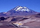
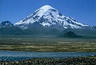
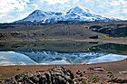
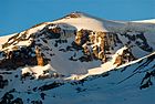
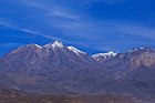
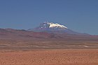
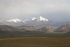
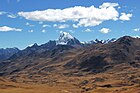
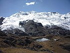
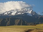
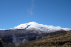
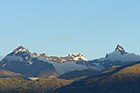
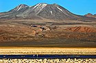
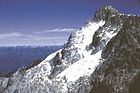
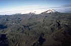
Elevation Name Range Coordinates Image Country 6,961 Aconcagua Principal Cordillera 32°39′S 70°01′W / 32.650°S 70.017°W / -32.650; -70.017 (Aconcagua ) Argentina 6,893 Ojos del Salado Puna de Atacama 27°06′34″S 68°32′29″W / 27.10944°S 68.54139°W / -27.10944; -68.54139 (Ojos del Salado ) Argentina – Chile 6,792 Monte Pissis Puna de Atacama 27°45′S 68°47′W / 27.750°S 68.783°W / -27.750; -68.783 (Monte Pissis ) Argentina 6,768 Huascarán Cordillera Blanca 9°7′S 77°36′W / 9.117°S 77.600°W / -9.117; -77.600 (Huascarán ) Peru 6,759 Bonete Puna de Atacama 28°01′S 68°45′W / 28.017°S 68.750°W / -28.017; -68.750 (Cerro Bonete ) Argentina 6,758 Tres Cruces Puna de Atacama 27°06′S 68°52′W / 27.100°S 68.867°W / -27.100; -68.867 (Nevado Tres Cruces ) Argentina – Chile 6,739 Llullaillaco Puna de Atacama 24°43′10.8″S 68°31′51.9″W / 24.719667°S 68.531083°W / -24.719667; -68.531083 (Llullaillaco ) Argentina – Chile 6,720 Mercedario Cordillera de la Ramada 31°58′S 70°10′W / 31.967°S 70.167°W / -31.967; -70.167 (Cerro Mercedario ) Argentina 6,670 Cazadero (Walther Penck) Puna de Atacama 27°11′S 68°34′W / 27.183°S 68.567°W / -27.183; -68.567 (Cazadero ) Argentina 6,638 Incahuasi Puna de Atacama 27°02′00″S 68°17′48″W / 27.03333°S 68.29667°W / -27.03333; -68.29667 (Incahuasi ) Argentina – Chile 6,634 Yerupajá Cordillera Huayhuash 10°16′S 76°54′W / 10.267°S 76.900°W / -10.267; -76.900 (Yerupajá ) Peru 6,565 Tupungato 33°21′12″S 69°46′17″W / 33.35333°S 69.77139°W / -33.35333; -69.77139 (Tupungato ) Argentina – Chile 6,542 Sajama Cordillera Occidental 18°6′S 68°53′W / 18.100°S 68.883°W / -18.100; -68.883 (Nevado Sajama ) Bolivia 6,500 Ramada Norte Cordillera de la Ramada Argentina 6,488 El Muerto 27°03′26″S 68°29′02″W / 27.05722°S 68.48389°W / -27.05722; -68.48389 (El Muerto ) Argentina – Chile 6,471 Del Veladero 27°55′S 68°55′W / 27.917°S 68.917°W / -27.917; -68.917 (Del Veladero ) Argentina 6,438 Illimani Cordillera Real 16°39′14″S 67°47′05″W / 16.65389°S 67.78472°W / -16.65389; -67.78472 (Illimani ) Bolivia 6,437 Antofalla Puna de Atacama 25°32′S 68°00′W / 25.53°S 68.00°W / -25.53; -68.00 (Antofalla ) Argentina 6,436 Cerro del Nacimiento Cordillera de la Ramada 27°14′S 68°30′W / 27.233°S 68.500°W / -27.233; -68.500 (Cerro del Nacimiento ) Argentina 6,427 Ancohuma Cordillera Real 15°51′12″S 68°32′27″W / 15.85333°S 68.54083°W / -15.85333; -68.54083 (Ancohuma ) Bolivia 6,425 Coropuna Cordillera Ampato 15°31′00″S 72°39′00″W / 15.51667°S 72.65000°W / -15.51667; -72.65000 (Coropuna ) Peru 6,414 El Cóndor Puna de Atacama 26°38′S 68°22′W / 26.633°S 68.367°W / -26.633; -68.367 (El Cóndor ) Argentina 6,395 Huandoy Cordillera Blanca 9°1′41″S 77°39′50″W / 9.02806°S 77.66389°W / -9.02806; -77.66389 (Huandoy ) Peru 6,380 Ausangate Cordillera Vilcanota 13°47′19″S 71°13′52″W / 13.78861°S 71.23111°W / -13.78861; -71.23111 (Ausangate ) Peru 6,380 Cachi 24°55′54.3″S 66°23′27.2″W / 24.931750°S 66.390889°W / -24.931750; -66.390889 (Nevado de Cachi ) Argentina 6,369 Huantsán Cordillera Blanca 09°30′53″S 77°18′37″W / 9.51472°S 77.31028°W / -9.51472; -77.31028 (Huantsan ) Peru 6,368 Illampu Cordillera Real 15°49′S 68°34′W / 15.817°S 68.567°W / -15.817; -68.567 (Illampu ) Bolivia 6,345 Chopicalqui Cordillera Blanca 09°05′12″S 77°34′26″W / 9.08667°S 77.57389°W / -9.08667; -77.57389 (Chopicalqui ) Peru 6,344 Siula Grande Cordillera Huayhuash 10°17′41″S 76°53′28″W / 10.29472°S 76.89111°W / -10.29472; -76.89111 (Siula Grande ) Peru 6,342 Parinacota Cordillera Occidental 18°09′59″S 69°08′35″W / 18.16639°S 69.14306°W / -18.16639; -69.14306 (Parinacota Volcano ) Bolivia – Chile 6,335 Reclus Puna de Atacama Argentina 6,093 Solimana Cordillera Ampato 15°24′36″S 72°53′35″W / 15.41000°S 72.89306°W / -15.41000; -72.89306 (Solimana ) Peru 6,310 Ampato Cordillera Ampato 15°49′18″S 71°52′45″W / 15.82167°S 71.87917°W / -15.82167; -71.87917 (Ampato ) Peru 6,309 Chinchey Cordillera Blanca 09°22′47″S 77°19′33″W / 9.37972°S 77.32583°W / -9.37972; -77.32583 (Chinchey ) Peru 6,282 Pomerape Cordillera Occidental 18°07′41″S 69°07′44″W / 18.12806°S 69.12889°W / -18.12806; -69.12889 (Pomerape ) Bolivia – Chile 6,280 Majadita Argentina – Chile 6,274 Palcaraju Cordillera Blanca 09°22′05″S 77°22′13″W / 9.36806°S 77.37028°W / -9.36806; -77.37028 (Palcaraju ) Peru 6,271 Salcantay Peru 6,267 Chimborazo Cordillera Occidental 01°28′S 78°48′W / 1.467°S 78.800°W / -1.467; -78.800 (Chimborazo ) Ecuador 6,259 Santa Cruz Cordillera Blanca 08°53′39″S 77°42′30″W / 8.89417°S 77.70833°W / -8.89417; -77.70833 (Santa Cruz ) Peru 6,239 Los Patos 27°18′04″S 68°48′31″W / 27.30111°S 68.80861°W / -27.30111; -68.80861 (Los Patos ) Argentina - Chile 6,233 Pular Puna de Atacama 24°11′42″S 68°03′31″W / 24.19500°S 68.05861°W / -24.19500; -68.05861 (Pular ) Chile 6,216 Olivares Principal Cordillera 30°17′54″S 69°54′04″W / 30.29833°S 69.90111°W / -30.29833; -69.90111 (Nevado Olivares ) Argentina – Chile 6,205 Cerro Solo Puna de Atacama 27°06′15″S 68°42′47″W / 27.10417°S 68.71306°W / -27.10417; -68.71306 (Cerro Solo ) Argentina - Chile 6,200 Ramada Cordillera de la Ramada 22°12′S 66°37′W / 22.200°S 66.617°W / -22.200; -66.617 (Cerro Ramada ) Argentina – Chile 6,188 Copa Cordillera Blanca Peru 6,184 Cerro Quemado Puna de Atacama Argentina 6,176 Aucanquilcha 21°13′15″S 68°28′06″W / 21.22083°S 68.46833°W / -21.22083; -68.46833 (Aucanquilcha ) Chile 6,168 El Toro 29°07′46″S 69°07′58″W / 29.12944°S 69.13278°W / -29.12944; -69.13278 (Cerro El Toro ) Argentina – Chile 6,162 Ranrapalca Cordillera Blanca 9°24′40″S 77°25′00″W / 9.41111°S 77.41667°W / -9.41111; -77.41667 (Ranrapalca ) Peru 6,160 Las Tórtolas 29°56′S 69°54′W / 29.933°S 69.900°W / -29.933; -69.900 (Cerro Las Tórtolas ) Argentina – Chile 6,157 Cerro La Mesa Cordillera de la Ramada 32°03′51″S 70°06′52″W / 32.06417°S 70.11444°W / -32.06417; -70.11444 (Cerro La Mesa ) Argentina 6,152 Cumbre del Laudo Argentina 6,148 Alto San Juan 33°28′07″S 69°48′54″W / 33.46861°S 69.81500°W / -33.46861; -69.81500 (Alto San Juan ) Argentina - Chile 6,148 Nevado de Palermo 24°45′57.6″S 66°24′43.7″W / 24.766000°S 66.412139°W / -24.766000; -66.412139 (Nevado de Palermo ) Argentina 6,147 Pucaranra Cordillera Blanca 9°23′30″S 77°21′3″W / 9.39167°S 77.35083°W / -9.39167; -77.35083 (Pucaranra ) Peru 6,146 El Ermitaño 26°47′13″S 68°36′12″W / 26.78694°S 68.60333°W / -26.78694; -68.60333 (El Ermitaño ) Chile 6,145 San Pedro 21°53′27″S 68°23′36″W / 21.89083°S 68.39333°W / -21.89083; -68.39333 (San Pedro ) Chile 6,130 Queva 24°18′29.9″S 66°43′55.6″W / 24.308306°S 66.732111°W / -24.308306; -66.732111 (Nevado Queva ) Argentina 6,127 Chearoco Cordillera Real 15°57′0″S 68°24′56″W / 15.95000°S 68.41556°W / -15.95000; -68.41556 (Ch'iyar Juqhu ) Bolivia 6,127 Sierra Nevada de Lagunas Bravas Puna de Atacama 26°29′37″S 68°35′09″W / 26.49361°S 68.58583°W / -26.49361; -68.58583 (Sierra Nevada de Lagunas Bravas ) Argentina – Chile 6,122 Hualcán Cordillera Blanca 9°12′11″S 77°31′5″W / 9.20306°S 77.51806°W / -9.20306; -77.51806 (Hualcán ) Peru 6,119 Barrancas Blancas 26°59′37″S 68°40′04″W / 26.99361°S 68.66778°W / -26.99361; -68.66778 (Barrancas Blancas ) Chile 6,110 Alma Negra Cordillera de la Ramada Argentina 6,110 Callangate Cordillera Vilcanota 13°43′54″S 71°09′33″W / 13.73167°S 71.15917°W / -13.73167; -71.15917 (Callangate ) Peru 6,110 Juncal Principal Cordillera 33°03′06″S 70°05′41″W / 33.05167°S 70.09472°W / -33.05167; -70.09472 (Cerro Juncal ) Argentina – Chile 6,108 Chacraraju Cordillera Blanca 8°59′36″S 77°36′54″W / 8.99333°S 77.61500°W / -8.99333; -77.61500 (Chacraraju ) Peru 6,108 Marmolejo Principal Cordillera 33°44′03″S 69°52′40″W / 33.73417°S 69.87778°W / -33.73417; -69.87778 (El Marmolejo ) Argentina – Chile 6,106 Chumpe Cordillera Vilcanota 13°43′32″S 71°4′53″W / 13.72556°S 71.08139°W / -13.72556; -71.08139 (Chumpe ) Peru 6,102 Alcamarinayoc Cordillera Vilcanota 13°41′59″S 71°5′41″W / 13.69972°S 71.09472°W / -13.69972; -71.09472 (Alcamarinayoc ) Peru 6,100 Pico Polacos Cordillera de la Ramada Argentina 6,095 Volcán Aracar 24°17′24.4″S 67°46′59.8″W / 24.290111°S 67.783278°W / -24.290111; -67.783278 (Volcán Aracar ) Argentina 6,093 Jatunhuma Cordillera Vilcanota 13°44′50″S 71°8′12″W / 13.74722°S 71.13667°W / -13.74722; -71.13667 (Jatunhuma ) Peru 6,092 San Pablo 21°53′12″S 68°20′41″W / 21.88667°S 68.34472°W / -21.88667; -68.34472 (San Pablo ) Chile 6,088 Huayna Potosí Cordillera Real 16°16′S 68°01′W / 16.267°S 68.017°W / -16.267; -68.017 (Huayna Potosí ) Bolivia 6,080 Cerro Colorados 26°10.4′S 68°22.5′W / 26.1733°S 68.3750°W / -26.1733; -68.3750 (Cerro Colorados ) Chile 6,075 Chachani 16°11′29″S 71°31′47″W / 16.19139°S 71.52972°W / -16.19139; -71.52972 (Chachani ) Peru 6,074 Chachacomani Cordillera Real Bolivia 6,071 Guallatiri 18°25′26″S 69°05′25″W / 18.42389°S 69.09028°W / -18.42389; -69.09028 (Guallatiri ) Chile 6,070 El Plomo 33°06′10″S 70°03′18″W / 33.10278°S 70.05500°W / -33.10278; -70.05500 (Nevado El Plomo ) Argentina - Chile 6,067 Vicuñas 27°01′29″S 68°36′53″W / 27.02472°S 68.61472°W / -27.02472; -68.61472 (Cerro Vicuñas ) Chile 6,052 Acotango 18°23′00″S 69°02′52″W / 18.38333°S 69.04778°W / -18.38333; -69.04778 (Acotango ) Bolivia – Chile 6,052 Copiapó 27°18′30″S 69°07′58″W / 27.30833°S 69.13278°W / -27.30833; -69.13278 (Copiapó ) Chile 6,051 Socompa 24°23′45.7″S 68°14′43.6″W / 24.396028°S 68.245444°W / -24.396028; -68.245444 (Socompa ) Argentina – Chile 6,049 Yayamari Cordillera Vilcanota 13°46′00″S 70°58′54″W / 13.76667°S 70.98167°W / -13.76667; -70.98167 (Yayamari ) Peru 6,046 Acamarachi 23°18′S 67°37′W / 23.300°S 67.617°W / -23.300; -67.617 (Acamarachi ) Chile 6,046 Pucajirca Cordillera Blanca 8°50′59″S 77°35′43″W / 8.84972°S 77.59528°W / -8.84972; -77.59528 (Pucajirca ) Peru 6,040 Chaupi Orco Apolobamba 14°27′S 69°05′W / 14.450°S 69.083°W / -14.450; -69.083 (Chaupi Orco ) Bolivia - Peru 6,040 El Fraile 27°02′55″S 68°22′46″W / 27.04861°S 68.37944°W / -27.04861; -68.37944 (El Fraile ) Chile 6,040 Quitaraju Cordillera Blanca 8°53′41″S 77°39′46″W / 8.89472°S 77.66278°W / -8.89472; -77.66278 (Quitaraju ) Peru 6,034 Tocllaraju Cordillera Blanca 9°20′50″S 77°23′49″W / 9.34722°S 77.39694°W / -9.34722; -77.39694 (Tocllaraju ) Peru 6,030 Ciénaga Grande Argentina 6,030 Peña Blanca Puna de Atacama 26°49′32″S 68°38′58″W / 26.82556°S 68.64944°W / -26.82556; -68.64944 (Peña Blanca ) Chile 6,029 Salín 24°19′41.4″S 68°03′58.7″W / 24.328167°S 68.066306°W / -24.328167; -68.066306 (Salín ) Argentina – Chile 6,028 Calinga Argentina 6,025 Artesonraju Cordillera Blanca 8°57′S 77°38′W / 8.950°S 77.633°W / -8.950; -77.633 (Artesonraju ) Peru 6,025 Caraz Cordillera Blanca 8°58′4″S 77°40′8″W / 8.96778°S 77.66889°W / -8.96778; -77.66889 (Caraz ) Peru 6,025 Hualca Hualca Cordillera Ampato 15°43′14″S 71°51′36″W / 15.72056°S 71.86000°W / -15.72056; -71.86000 (Hualca Hualca ) Peru 6,023 Palpana Chile 6,019 Piquenes 33°30′51″S 69°50′07″W / 33.51417°S 69.83528°W / -33.51417; -69.83528 (Nevado Piquenes ) Chile 6,018 San Francisco 26°55′06″S 68°15′47″W / 26.91833°S 68.26306°W / -26.91833; -68.26306 (Cerro San Francisco ) Argentina – Chile 6,008 Uturunku 22°15′44″S 67°10′38″W / 22.26222°S 67.17722°W / -22.26222; -67.17722 (Uturunku ) Bolivia 5,991 Pumasillo Cordillera Vilcabamba 13°14′57″S 72°49′9″W / 13.24917°S 72.81917°W / -13.24917; -72.81917 (Pumasillo ) Peru 5,990 Capurata 18°24′54″S 69°02′45″W / 18.41500°S 69.04583°W / -18.41500; -69.04583 (Capurata ) Chile - Bolivia 5,988 Tacora 17°43′S 69°46′W / 17.717°S 69.767°W / -17.717; -69.767 (Tacora ) Chile 5,982 Sillajhuay 19°44′32″S 68°41′26″W / 19.74222°S 68.69056°W / -19.74222; -68.69056 (Sillajhuay ) Chile - Bolivia 5,976 Sabancaya Cordillera Ampato 15°47′18″S 71°51′23″W / 15.78833°S 71.85639°W / -15.78833; -71.85639 (Sabancaya ) Peru 5,971 Sairecabur 22°43′0″S 67°53′30″W / 22.71667°S 67.89167°W / -22.71667; -67.89167 (Sairecabur ) Chile 5,954 Contrahierbas Cordillera Blanca 9°6′22″S 77°29′25″W / 9.10611°S 77.49028°W / -9.10611; -77.49028 (Contrahierbas ) Peru 5,947 Alpamayo Cordillera Blanca 8°56′S 77°42′W / 8.933°S 77.700°W / -8.933; -77.700 (Alpamayo ) Peru 5,929 Lípez Cordillera de Lípez 21°53′S 66°52′W / 21.883°S 66.867°W / -21.883; -66.867 (Cerro Lípez ) Bolivia 5,920 Licancabur 22°50′S 67°53′W / 22.833°S 67.883°W / -22.833; -67.883 (Licancabur ) Bolivia – Chile 5,910 Miñiques Chile 5,900 Huila Aje Cordillera Vilcanota 13°47′7″S 70°58′10″W / 13.78528°S 70.96944°W / -13.78528; -70.96944 (Huila Aje ) Peru 5,897 Cotopaxi 00°40′S 78°26′W / 0.667°S 78.433°W / -0.667; -78.433 (Cotopaxi ) Ecuador 5,897 Ticlla 12°15′23″S 75°57′24″W / 12.25639°S 75.95667°W / -12.25639; -75.95667 (Ticlla ) Peru 5,896 Chañi 24°03′46.4″S 65°44′46.2″W / 24.062889°S 65.746167°W / -24.062889; -65.746167 (Nevado de Chañi ) Argentina 5,888 Ocshapalca Cordillera Blanca 9°24′30″S 77°26′05″W / 9.40833°S 77.43472°W / -9.40833; -77.43472 (Ocshapalca ) Peru 5,885 Pirámide Cordillera Blanca 8°58′31″S 77°37′14″W / 8.97528°S 77.62056°W / -8.97528; -77.62056 (Pirámide ) Peru 5,880 Jotabeche Chile 5,874 Calzada Cordillera Real 15°55′57″S 68°26′16″W / 15.93250°S 68.43778°W / -15.93250; -68.43778 (Calzada ) Bolivia 5,870 Rondoy Cordillera Huayhuash 10°13′19″S 76°54′50″W / 10.22194°S 76.91389°W / -10.22194; -76.91389 (Rondoy ) Peru 5,869 Mururata Cordillera Real Bolivia 5,863 Ollagüe Bolivia – Chile 5,856 San José 33°47′08″S 69°53′35″W / 33.78556°S 69.89306°W / -33.78556; -69.89306 (San José ) Argentina – Chile 5,845 Japu Punta Cordillera Vilcanota 13°45′21″S 71°00′17″W / 13.75583°S 71.00472°W / -13.75583; -71.00472 (Japu Punta ) Peru 5,830 Taulliraju Cordillera Blanca 8°53′33″S 77°34′45″W / 8.89250°S 77.57917°W / -8.89250; -77.57917 (Taulliraju ) Peru 5,828 Q'asiri Cordillera Real 15°54′S 68°30′W / 15.900°S 68.500°W / -15.900; -68.500 (Q'asiri ) Bolivia 5,821 Misti 16°17′40″S 71°24′32″W / 16.29444°S 71.40889°W / -16.29444; -71.40889 (El Misti ) Peru 5,818 Sahuasiray Cordillera Urubamba 13°12′50″S 71°59′18″W / 13.21389°S 71.98833°W / -13.21389; -71.98833 (Sahuasiray ) Peru 5,815 Tutupaca 17°1′35″S 70°22′18″W / 17.02639°S 70.37167°W / -17.02639; -70.37167 (Tutupaca ) Peru 5,812 Jatunñaño Punta Cordillera Vilcanota 13°45′7″S 71°2′14″W / 13.75194°S 71.03722°W / -13.75194; -71.03722 (Jatunñaño Punta ) Peru 5,810 Rinrijirca Cordillera Blanca 8°53′40″S 77°36′39″W / 8.89444°S 77.61083°W / -8.89444; -77.61083 (Rinrijirca ) Peru 5,808 Tocorpuri Bolivia – Chile 5,805 Chupiquiña 16°39′56″S 69°47′58″W / 16.66556°S 69.79944°W / -16.66556; -69.79944 (Chupiquiña ) Chile - Peru 5,800 Jachacunocollo Kimsa Cruz 16°58′S 67°20′W / 16.967°S 67.333°W / -16.967; -67.333 (Jach'a Khunu Qullu ) Bolivia 5,796 Huanacuni Apolobamba 14°51′S 69°10′W / 14.850°S 69.167°W / -14.850; -69.167 (Wanakuni ) Bolivia 5,790 Cayambe Cordillera Real Ecuador 5,787 Tullparaju Cordillera Blanca 9°24′S 77°19′W / 9.400°S 77.317°W / -9.400; -77.317 (Tullparaju ) Peru 5,780 Allincapac Cordillera Carabaya 13°54′29″S 70°24′56″W / 13.90806°S 70.41556°W / -13.90806; -70.41556 (Allincapac ) Peru 5,780 Condoriquiña Cordillera Vilcanota 13°49′30″S 70°55′1″W / 13.82500°S 70.91694°W / -13.82500; -70.91694 (Condoriquiña ) Peru 5,780 Llongote 12°19′45″S 75°56′53″W / 12.32917°S 75.94806°W / -12.32917; -75.94806 (Llongote ) Peru 5,771 Padreyoc Cordillera Vilcabamba 13°22′42″S 72°44′23″W / 13.37833°S 72.73972°W / -13.37833; -72.73972 (Padreyoc (Cusco) ) Peru 5,763 Cerro de La Isla Chile 5,762 Kunturiri Cordillera Occidental 18°02′30″S 69°04′28″W / 18.04167°S 69.07444°W / -18.04167; -69.07444 (Kunturiri (Bolivia-Chile) ) Bolivia 5,761 Aguas Blancas Argentina – Chile 5,756 Nevados de Poquis Chile 5,754 Arizaro 24°25′01.6″S 67°59′15.5″W / 24.417111°S 67.987639°W / -24.417111; -67.987639 (Volcán Arizaro ) Argentina 5,752 Pisco Cordillera Blanca Peru 5,750 Acay 24°25′01.7″S 66°09′38.7″W / 24.417139°S 66.160750°W / -24.417139; -66.160750 (Nevado de Acay ) Argentina 5,750 Pariacaca Cordillera Pariacaca 11°59′30″S 75°59′30″W / 11.99167°S 75.99167°W / -11.99167; -75.99167 (Pariacaca ) Peru 5,743 Joyllor Puñuna Cordillera Vilcanota 13°55′44″S 70°49′1″W / 13.92889°S 70.81694°W / -13.92889; -70.81694 (Joyllor Puñuna ) Peru 5,741 Cerro Barroso Peru 5,735 Champara Cordillera Blanca 8°41′14″S 77°46′52″W / 8.68722°S 77.78111°W / -8.68722; -77.78111 (Champara ) Peru 5,730 Tunshu Cordillera Pariacaca 11°53′35″S 75°59′1″W / 11.89306°S 75.98361°W / -11.89306; -75.98361 (Tunshu ) Peru 5,728 Paruma Bolivia – Chile 5,722 Uruashraju Cordillera Blanca 9°34′46″S 77°18′30″W / 9.57944°S 77.30833°W / -9.57944; -77.30833 (Uruashraju ) Peru 5,721 Huaynaccapac Cordillera Carabaya 13°53′50″S 70°24′56″W / 13.89722°S 70.41556°W / -13.89722; -70.41556 (Huaynaccapac (Puno) ) Peru 5,717 Umurata Cordillera Occidental 18°21′20″S 69°2′59″W / 18.35556°S 69.04972°W / -18.35556; -69.04972 (Umurata ) Bolivia - Chile 5,716 Cashán Cordillera Blanca 9°33′26″S 77°21′20″W / 9.55722°S 77.35556°W / -9.55722; -77.35556 (Cashán ) Peru 5,704 Antisana Ecuador 5,703 Shacsha Cordillera Blanca 9°35′8″S 77°22′8″W / 9.58556°S 77.36889°W / -9.58556; -77.36889 (Shacsha ) Peru 5,697 Lastarria o Azufre 25°10′06.1″S 68°30′25.2″W / 25.168361°S 68.507000°W / -25.168361; -68.507000 (Volcán Lastarria o Azufre ) Argentina - Chile 5,690 Doña Ana Chile 5,690 Achacollo 17°33′48″S 69°52′15″W / 17.56333°S 69.87083°W / -17.56333; -69.87083 (Achacollo ) Peru 5,688 Araral Bolivia – Chile 5,688 Mururaju Cordillera Blanca 9°48′27″S 77°14′38″W / 9.80750°S 77.24389°W / -9.80750; -77.24389 (Mururaju ) Peru 5,686 Vallunaraju Cordillera Blanca 9°25′20″S 77°27′23″W / 9.42222°S 77.45639°W / -9.42222; -77.45639 (Vallunaraju ) Peru 5,682 Caullaraju Cordillera Blanca 9°57′45″S 77°15′36″W / 9.96250°S 77.26000°W / -9.96250; -77.26000 (Caullaraju ) Peru 5,682 Veronica Urubamba 13°9′51″S 72°19′33″W / 13.16417°S 72.32583°W / -13.16417; -72.32583 (Veronica ) Peru 5,681 Muruq'u 21°51′55″S 66°36′22″W / 21.86528°S 66.60611°W / -21.86528; -66.60611 (Muruq'u ) Bolivia 5,680 León Jiwata Kimsa Cruz Bolivia 5,679 Machu Such'i Qhuchi Apolobamba 14°45′S 69°12′W / 14.750°S 69.200°W / -14.750; -69.200 (Machu Such'i Qhuchi ) Bolivia 5,676 Nelly Cordillera Occidental 22°41′55″S 67°45′17″W / 22.69861°S 67.75472°W / -22.69861; -67.75472 (Nelly ) Bolivia 5,676 Iñuma 17°27′38″S 69°50′18″W / 17.46056°S 69.83833°W / -17.46056; -69.83833 (Iñuma ) Peru 5,664 Pichu Pichu Peru 5,658 Colquepucro Cordillera Pariacaca 11°58′22″S 76°1′20″W / 11.97278°S 76.02222°W / -11.97278; -76.02222 (Colquepucro ) Peru 5,654 Chila 15°24′23″S 72°9′59″W / 15.40639°S 72.16639°W / -15.40639; -72.16639 (Chila ) Peru 5,650 Pumahuanca Cordillera Urubamba 13°11′17″S 72°8′16″W / 13.18806°S 72.13778°W / -13.18806; -72.13778 (Pumahuanca ) Peru 5,650 Casiri (Tacna) 17°28′00″S 69°48′48″W / 17.46667°S 69.81333°W / -17.46667; -69.81333 (Casiri ) Peru 5,648 Kunturiri Cordillera Real 16°10′S 68°14′W / 16.167°S 68.233°W / -16.167; -68.233 (Kunturiri ) Bolivia 5,648 Zapaleri Cordillera Central 22°48′00″S 67°10′00″W / 22.80000°S 67.16667°W / -22.80000; -67.16667 (Cerro Zapaleri ) Argentina – Bolivia – Chile 5,647 Casiri (Arequipa) 15°27′46″S 72°10′17″W / 15.46278°S 72.17139°W / -15.46278; -72.17139 (Q'asiri (Arequipa) ) Peru 5,644 Huacshash Huayhuash 10°24′50″S 76°58′30″W / 10.41389°S 76.97500°W / -10.41389; -76.97500 (Huacshash ) Peru 5,640 Wayna Khunu Qullu Kimsa Cruz Bolivia 5,626 Inacaliri Bolivia – Chile 5,622 Huacrish Huayhuash 10°17′55″S 76°57′50″W / 10.29861°S 76.96389°W / -10.29861; -76.96389 (Huacrish ) Peru 5,620 Inca 24°35′58.5″S 68°29′36.9″W / 24.599583°S 68.493583°W / -24.599583; -68.493583 (Cerro Inca ) Argentina - Chile 5,617 Ulla Qhaya Apolobamba 14°59′44″S 69°03′32″W / 14.99556°S 69.05889°W / -14.99556; -69.05889 (Ulla Qhaya ) Bolivia 5,614 Chichicapac Cordillera Carabaya 13°56′40″S 70°22′00″W / 13.94444°S 70.36667°W / -13.94444; -70.36667 (Ch'ichi Qhapaq ) Peru 5,610 Linzor Chile 5,604 Warawarani Cordillera Real 16°03′44″S 68°21′12″W / 16.06222°S 68.35333°W / -16.06222; -68.35333 (Warawarani (Bolivia) ) Bolivia 5,600 Jatuncunca Cordillera Blanca 9°24′37″S 77°27′01″W / 9.41028°S 77.45028°W / -9.41028; -77.45028 (Jatuncunca ) Peru 5,600 Hualipayoc Cordillera Vilcanota 13°41′3″S 71°7′33″W / 13.68417°S 71.12583°W / -13.68417; -71.12583 (Hualipayoc ) Peru 5,597 Mismi 15°31′31″S 71°41′27″W / 15.52528°S 71.69083°W / -15.52528; -71.69083 (Mismi ) Peru 5,596 Wila Lluxi Cordillera Real 16°4′29″S 68°20′23″W / 16.07472°S 68.33972°W / -16.07472; -68.33972 (Wila Lluxi ) Bolivia 5,594 Cerro Rincón 24°01′50.3″S 67°19′17.9″W / 24.030639°S 67.321639°W / -24.030639; -67.321639 (Cerro Rincón ) Argentina - Chile 5,590 Archibarca 25°14′16″S 67°51′54″W / 25.23778°S 67.86500°W / -25.23778; -67.86500 (Cerro Archibarca ) Argentina 5,589 Paqu Kiwuta Cordillera Real 16°5′17″S 68°20′44″W / 16.08806°S 68.34556°W / -16.08806; -68.34556 (Paqu Kiwuta ) Bolivia 5,585 Nevado de Castillo , Nevado General Güemes o Piedra Sonada 24°21′49.9″S 65°39′21.3″W / 24.363861°S 65.655917°W / -24.363861; -65.655917 (Nevado de Castillo ) Argentina 5,570 Copap - Perlilla Cordillera Blanca 9°17′S 77°20′W / 9.283°S 77.333°W / -9.283; -77.333 (Copap ) Peru 5,567 Huancune 17°35′43″S 69°47′21″W / 17.59528°S 69.78917°W / -17.59528; -69.78917 (Huancune ) Peru 5,566 Yaypuri Kimsa Cruz Bolivia 5,560 Auxilio Huayhuash 10°18′20″S 76°57′55″W / 10.30556°S 76.96528°W / -10.30556; -76.96528 (Auxilio ) Peru 5,557 Huaytapallana Huaytapallana Peru 5,552 Lirima Chile 5,550 Cóndor Tuco 13°50′57″S 71°8′7″W / 13.84917°S 71.13528°W / -13.84917; -71.13528 (Cóndor Tuco ) Peru 5,550 Cuyoc Huayhuash 10°23′9″S 76°52′31″W / 10.38583°S 76.87528°W / -10.38583; -76.87528 (Cuyoc ) Peru 5,550 Yanajaja Cordillera Vilcanota 13°47′16″S 71°11′02″W / 13.78778°S 71.18389°W / -13.78778; -71.18389 (Yanajaja ) Peru 5,550 Yucamane 17°11′00″S 70°12′00″W / 17.18333°S 70.20000°W / -17.18333; -70.20000 (Yucamane ) Peru 5,546 Sirk'i Qullu Cordillera Real 16°23′S 67°52′W / 16.383°S 67.867°W / -16.383; -67.867 (Sirk'i Qullu ) Bolivia 5,540 Jach'a Waracha Apolobamba Bolivia 5,530 Chicón Urubamba 13°14′12″S 72°3′22″W / 13.23667°S 72.05611°W / -13.23667; -72.05611 (Chicón ) Peru 5,522 Jolljepunco Cordillera Vilcanota 13°31′9″S 71°12′24″W / 13.51917°S 71.20667°W / -13.51917; -71.20667 (Jolljepunco ) Peru 5,520 Choquetacarpo Vilcabamba 13°13′44″S 72°51′11″W / 13.22889°S 72.85306°W / -13.22889; -72.85306 (Choquetacarpo ) Peru 5,512 Janq'u Uyu Cordillera Real 16°3′0″S 68°19′16″W / 16.05000°S 68.32111°W / -16.05000; -68.32111 (Janq'u Uyu ) Bolivia 5,508 Jisk'a Pata Cordillera Real 15°27′38″S 71°52′5″W / 15.46056°S 71.86806°W / -15.46056; -71.86806 (Jisk'a Pata ) Bolivia 5,507 Carhuachuco Paryaqaqa 11°51′8″S 76°3′18″W / 11.85222°S 76.05500°W / -11.85222; -76.05500 (Qarwachuku ) Peru 5,506 Surihuiri 15°27′38″S 71°52′5″W / 15.46056°S 71.86806°W / -15.46056; -71.86806 (Surihuiri ) Peru 5,505 Sara Sara 15°19′46″S 73°26′41″W / 15.32944°S 73.44472°W / -15.32944; -73.44472 (Sara Sara ) Peru 5,500 Macón 24°27′56″S 67°15′17.5″W / 24.46556°S 67.254861°W / -24.46556; -67.254861 (Macón ) Argentina 5,500 Jacabamba Cordillera Blanca 9°19′19″S 77°19′15″W / 9.32194°S 77.32083°W / -9.32194; -77.32083 (Jacabamba ) Peru 5,500 Pajonal Argentina 5,500 Carhuascancha Cordillera Blanca 9°29′10″S 77°19′19″W / 9.48611°S 77.32194°W / -9.48611; -77.32194 (Carhuascancha ) Peru 5,500 Tacune 16°28′4″S 71°8′15″W / 16.46778°S 71.13750°W / -16.46778; -71.13750 (Tacune ) Peru 5,500 Huallacancha Pariacaca 11°52′12″S 76°2′40″W / 11.87000°S 76.04444°W / -11.87000; -76.04444 (Huallacancha ) Peru 5,493 Churup Cordillera Blanca 9°28′5″S 77°24′56″W / 9.46806°S 77.41556°W / -9.46806; -77.41556 (Churup ) Peru 5,490 Uqi Uqini Cordillera Occidental 18°19′S 69°2′W / 18.317°S 69.033°W / -18.317; -69.033 (Uqi Uqini ) Bolivia - Chile 5,489 Chimboya La Raya 14°26′37″S 70°57′44″W / 14.44361°S 70.96222°W / -14.44361; -70.96222 (Chimboya ) Peru 5,487 Challhua Cordillera Blanca 9°55′15″S 77°13′23″W / 9.92083°S 77.22306°W / -9.92083; -77.22306 (Challhua ) Peru 5,480 Mellado 24°41′02.2″S 68°13′52.1″W / 24.683944°S 68.231139°W / -24.683944; -68.231139 (Volcán Mellado ) Argentina 5,479 Tuco Cordillera Blanca 9°55′45″S 77°12′18″W / 9.92917°S 77.20500°W / -9.92917; -77.20500 (Tuco (Peru) ) Peru 5,477 Rajuntay Cordillera La Viuda 11°32′28.59″S 76°14′46.91″W / 11.5412750°S 76.2463639°W / -11.5412750; -76.2463639 (Rajuntay ) Peru 5,471 Cinajara 13°31′42″S 71°14′1″W / 13.52833°S 71.23361°W / -13.52833; -71.23361 (Cinajara ) Peru 4,470 Huallanca Huallanca 9°55′00″S 77°2′20″W / 9.91667°S 77.03889°W / -9.91667; -77.03889 (Wallanka ) Peru 5,465 Pumarinri 10°24′23″S 76°52′40″W / 10.40639°S 76.87778°W / -10.40639; -76.87778 (Pumarinri (Lima) ) Peru 5,465 Qala Phusa Apolobamba 14°53′14″S 69°06′54″W / 14.88722°S 69.11500°W / -14.88722; -69.11500 (Qala Phusa ) Bolivia 5,464 Huayanay Vilcabamba 13°17′54″S 72°23′35″W / 13.29833°S 72.39306°W / -13.29833; -72.39306 (Huayanay ) Peru 5,463 Huayna Cotoni 12°16′2″S 75°59′4″W / 12.26722°S 75.98444°W / -12.26722; -75.98444 (Huayna Cotoni ) Peru 5,460 Janq'u Qullu Kimsa Cruz Bolivia 5,460 Yanapaccha Cordillera Blanca 9°1′35″S 77°34′37″W / 9.02639°S 77.57694°W / -9.02639; -77.57694 (Yanapaccha ) Peru 5,453 Coruña 17°29′15″S 69°51′14″W / 17.48750°S 69.85389°W / -17.48750; -69.85389 (Coruña ) Peru 5,445 Aqupallqa 12°13′27″S 75°59′28″W / 12.22417°S 75.99111°W / -12.22417; -75.99111 (Aqupallqa ) Peru 5,442 Kimsachata 13°39′36″S 71°2′47″W / 13.66000°S 71.04639°W / -13.66000; -71.04639 (Kimsachata (Quispicanchi) ) Peru 5,434 Huamashraju Cordillera Blanca 9°31′30″S 77°23′6″W / 9.52500°S 77.38500°W / -9.52500; -77.38500 (Huamashraju ) Peru 5,427 Rajucollota Huayhuash 10°17′50″S 76°58′50″W / 10.29722°S 76.98056°W / -10.29722; -76.98056 (Rajucollota ) Peru 5,425 Pisacani 17°16′36.5″S 69°56′17″W / 17.276806°S 69.93806°W / -17.276806; -69.93806 (Pisacani ) Peru 5,424 El Plomo 33°13′58″S 70°12′44″W / 33.23278°S 70.21222°W / -33.23278; -70.21222 (Cerro El Plomo ) Chile 5,424 Jach'a Pata Cordillera Real 16°03′26″S 68°20′31″W / 16.05722°S 68.34194°W / -16.05722; -68.34194 (Jach'a Pata ) Bolivia 5,421 Chacaltaya Cordillera Real Bolivia 4,421 Jathi Qullu Cordillera Real 16°25′54″S 67°56′29″W / 16.43167°S 67.94139°W / -16.43167; -67.94139 (Jathi Qullu ) Bolivia 5,420 Cunurana 14°32′56″S 70°49′55″W / 14.54889°S 70.83194°W / -14.54889; -70.83194 (Cunurana (Melgar) ) Peru 5,420 Paño 24°13′48.2″S 65°41′50.3″W / 24.230056°S 65.697306°W / -24.230056; -65.697306 (Cerro Paño ) Argentina 5,419 Waracha Apolobamba 14°52′14″S 69°04′40″W / 14.87056°S 69.07778°W / -14.87056; -69.07778 (Waracha ) Bolivia 5,416 Nasa Q'ara Cordillera Real 16°08′03″S 68°17′33″W / 16.13417°S 68.29250°W / -16.13417; -68.29250 (Nasa Q'ara ) Bolivia 5,412 Chuska 26°08′56″S 66°13′50.6″W / 26.14889°S 66.230722°W / -26.14889; -66.230722 (Cerro Chuscha ) Argentina 5,410 Ritacuba Blanco Cordillera Oriental 06°29′39″N 72°17′51″W Colombia 5,408 Ticsani 16°46′3″S 70°35′59″W / 16.76750°S 70.59972°W / -16.76750; -70.59972 (Ticsani ) Peru 5,407 Ullqa Cordillera Occidental Bolivia – Chile 5,407 Pukintika Cordillera Occidental 18°44′S 68°59′W / 18.733°S 68.983°W / -18.733; -68.983 (Kunturiri ) Bolivia - Chile 5,404 Corihuayrachina Vilcabamba 13°21′06″S 72°49′15″W / 13.35167°S 72.82083°W / -13.35167; -72.82083 (Corihuayrachina (Vilcabamba) ) Peru 5,401 Cerro Bayo 25°25′S 68°35′W / 25.417°S 68.583°W / -25.417; -68.583 (Cerro Bayo ) Chile 5,400 Chapi 13°37′42″S 69°20′51″W / 13.62833°S 69.34750°W / -13.62833; -69.34750 (Chapi (Peru) ) Peru 5,400 Pachanqutu Paryaqaqa 11°54′42″S 76°3′16″W / 11.91167°S 76.05444°W / -11.91167; -76.05444 (Pachanqutu ) Peru 5,400 Pucagaga Punta Cordillera Blanca 9°27′20″S 77°24′14″W / 9.45556°S 77.40389°W / -9.45556; -77.40389 (Pucagaga Punta ) Peru 5,400 Qillqa 14°22′1″S 71°00′42″W / 14.36694°S 71.01167°W / -14.36694; -71.01167 (Qillqa (Cusco) ) Peru 5,400 Q'umirqucha 13°49′6″S 71°7′31″W / 13.81833°S 71.12528°W / -13.81833; -71.12528 (Mount Q'umirqucha (Peru) ) Peru 5,400 Huasacocha Cordillera Vilcanota 13°50′39″S 71°17′55″W / 13.84417°S 71.29861°W / -13.84417; -71.29861 (Huasacocha ) Peru 5,400 Wayllakancha Paryaqaqa 11°53′24″S 76°2′33″W / 11.89000°S 76.04250°W / -11.89000; -76.04250 (Wayllakancha ) Peru 5,399 Sirihuani Urubamba 13°11′57″S 72°2′39″W / 13.19917°S 72.04417°W / -13.19917; -72.04417 (Sirihuani ) Peru 5,380 Phaq'u Q'awa Cordillera Occidental 18°05′30″S 69°04′08″W / 18.09167°S 69.06889°W / -18.09167; -69.06889 (Phaq'u Q'awa (Oruro) ) Bolivia 5,379 Kuntursinqa 10°29′18″S 76°44′32″W / 10.48833°S 76.74222°W / -10.48833; -76.74222 (Kuntursinqa (Lima) ) Peru 5,368 Mullu Apachita Cordillera Real 16°03′52″S 68°17′20″W / 16.06444°S 68.28889°W / -16.06444; -68.28889 (Mullu Apachita ) Bolivia 5,365 Huacaypaca 11°56′10″S 76°8′27″W / 11.93611°S 76.14083°W / -11.93611; -76.14083 (Huacaypaca ) Peru 5,364 Huila Cordillera Central 2°55′36″N 76°1′56″W / 2.92667°N 76.03222°W / 2.92667; -76.03222 (Nevado del Huila ) Colombia 5,358 Jach'a T'uxu Cordillera Real 16°01′08″S 68°25′26″W / 16.01889°S 68.42389°W / -16.01889; -68.42389 (Jach'a T'uxu ) Bolivia 5,350 Ch'amak Qullu Kimsa Cruz Bolivia 5,350 Rit'ipata Apolobamba 14°37′11″S 69°21′34″W / 14.61972°S 69.35944°W / -14.61972; -69.35944 (Rit'ipata ) Peru 5,350 Tukumach'ay Paryaqaqa 11°55′9″S 75°58′33″W / 11.91917°S 75.97583°W / -11.91917; -75.97583 (Tukumach'ay (Jauja) ) Peru 5,350 Wila Kunka 13°53′49″S 70°26′47″W / 13.89694°S 70.44639°W / -13.89694; -70.44639 (Wila Kunka ) Peru 5,342 Mik'aya Cordillera Real 16°21′59″S 67°56′09″W / 16.36639°S 67.93583°W / -16.36639; -67.93583 (Mk'aya ) Bolivia 5,338 Kikash 10°3′16″S 77°6′00″W / 10.05444°S 77.10000°W / -10.05444; -77.10000 (Kikash ) Peru 5,337 Diamante 25°47′32.5″S 66°50′57.4″W / 25.792361°S 66.849278°W / -25.792361; -66.849278 (Cerro Diamante ) Argentina 5,336 Pomabamba Cordillera Blanca 9°17′33″S 77°22′16″W / 9.29250°S 77.37111°W / -9.29250; -77.37111 (Pomabamba ) Peru 5,336 Wallatani Cordillera Real 17°00′39″S 67°21′41″W / 17.01083°S 67.36139°W / -17.01083; -67.36139 (Wallatani (Bolivia) ) Bolivia 5,326 Jach'a Kunturiri Cordillera Occidental 17°59′S 68°59′W / 17.983°S 68.983°W / -17.983; -68.983 (Jach'a Kunturiri (Oruro) ) Bolivia 5,321 Nevado del Ruiz Cordillera Central 04°53′43″N 75°19′21″W Colombia 5,321 Wak'ani Cordillera Real 16°20′59″S 67°56′39″W / 16.34972°S 67.94417°W / -16.34972; -67.94417 (Wak'ani ) Bolivia 5,320 El Altar Cordillera Real 1°40′S 78°25′W / 1.667°S 78.417°W / -1.667; -78.417 (El Altar ) Ecuador 5,320 Pukasaya 16°27′33″S 70°56′10″W / 16.45917°S 70.93611°W / -16.45917; -70.93611 (Pukasaya (Moquegua) ) Peru 5,313 Cerro Bravo Alto Chile 5,312 Quri Ch'uma Kimsa Cruz Bolivia 5,308 Silla 24°47′27.4″S 68°33′58.9″W / 24.790944°S 68.566361°W / -24.790944; -68.566361 (Cerro Silla ) Argentina 5,304 Sitaq 12°48′7″S 75°14′8″W / 12.80194°S 75.23556°W / -12.80194; -75.23556 (Sitaq ) Peru 5,300 Chuquiananta 17°4′53″S 70°26′58″W / 17.08139°S 70.44944°W / -17.08139; -70.44944 (Chuqi Ananta ) Peru 5,300 Chiarjaque 17°6′32″S 70°12′46″W / 17.10889°S 70.21278°W / -17.10889; -70.21278 (Ch'iyar Jaqhi (Tacna) ) Peru 5,300 Aquichua 13°40′32″S 70°59′00″W / 13.67556°S 70.98333°W / -13.67556; -70.98333 (Jaqhichuwa ) Peru 5,300 Millpu 10°27′46″S 76°51′13″W / 10.46278°S 76.85361°W / -10.46278; -76.85361 (Millpu (Cajatambo) ) Peru 5,300 Pumani 17°4′13″S 70°28′18″W / 17.07028°S 70.47167°W / -17.07028; -70.47167 (Pumani ) Peru 5,300 Putka Paryaqaqa 11°49′46″S 76°2′47″W / 11.82944°S 76.04639°W / -11.82944; -76.04639 (Putka (Junín) ) Peru 5,300 Wachwa 11°38′57″S 76°19′21″W / 11.64917°S 76.32250°W / -11.64917; -76.32250 (Wachwa ) Peru 5,300 Wayrakancha 11°41′25″S 76°11′49″W / 11.69028°S 76.19694°W / -11.69028; -76.19694 (Wayrakancha ) Peru 5,298 Jach'a Qullu Cordillera Real 16°02′41″S 68°23′22″W / 16.04472°S 68.38944°W / -16.04472; -68.38944 (Jach'a Qullu (Bolivia) ) Bolivia 5,290 Waqullani 15°56′3″S 71°30′53″W / 15.93417°S 71.51472°W / -15.93417; -71.51472 (Waqullani ) Peru 5,286 Chequiaraju Cordillera Blanca 9°10′19″S 77°33′29″W / 9.17194°S 77.55806°W / -9.17194; -77.55806 (Chiqllarahu ) Peru 5,286 Pilanco Cordillera Blanca 8°47′59″S 77°41′18″W / 8.79972°S 77.68833°W / -8.79972; -77.68833 (Pilanku ) Peru 5,281 Mama Uqllu Kimsa Cruz Bolivia 5,280 K'isi K'isini Cordillera Occidental 18°14′S 69°4′W / 18.233°S 69.067°W / -18.233; -69.067 (K'isi K'isini ) Bolivia 5,264 Tultul 24°11′30.7″S 67°06′25.8″W / 24.191861°S 67.107167°W / -24.191861; -67.107167 (Cerro Tultul ) Argentina 5,263 Iliniza Sur Ecuador 5,260 Churi Laq'a 16°47′23″S 70°21′15″W / 16.78972°S 70.35417°W / -16.78972; -70.35417 (Churi Laq'a ) Peru 5,254 Rima Rima Cordillera Blanca 9°28′S 77°27′W / 9.467°S 77.450°W / -9.467; -77.450 (Rima Rima ) Peru 5,237 Yanamarey Cordillera Blanca 9°39′40″S 77°15′40″W / 9.66111°S 77.26111°W / -9.66111; -77.26111 (Yanamaray ) Peru 5,230 Sangay 2°00′S 78°20′W / 2.0°S 78.33°W / -2.0; -78.33 Ecuador 5,224 Q'asiri Cordillera Real 16°26′40″S 67°56′15″W / 16.44444°S 67.93750°W / -16.44444; -67.93750 (Q'asiri (Murillo) ) Bolivia 5,223 Juqhuri 17°19′28″S 69°41′25″W / 17.32444°S 69.69028°W / -17.32444; -69.69028 (Juqhuri ) Peru 5,220 Tolima Cordillera Central 04°40′N 75°20′W Colombia 5,214 Jatun Wila Qullu 19°24′7″S 66°34′35″W / 19.40194°S 66.57639°W / -19.40194; -66.57639 (Jatun Wila Qullu ) Bolivia 5,200 Chumpi 11°44′00″S 76°2′30″W / 11.73333°S 76.04167°W / -11.73333; -76.04167 (Chumpi (Junín) ) Peru 5,200 Churu Cordillera Real 16°32′40″S 67°50′26″W / 16.54444°S 67.84056°W / -16.54444; -67.84056 (Churu (Bolivia) ) Bolivia 5,200 Cosapilla Chile 5,200 Kunka 14°27′40″S 70°59′00″W / 14.46111°S 70.98333°W / -14.46111; -70.98333 (Kunka ) Peru 5,200 Kunturi 16°12′48″S 71°8′50″W / 16.21333°S 71.14722°W / -16.21333; -71.14722 (Kunturi (Tarucani) ) Peru 5,200 Kunturkhacha 15°15′39″S 72°10′14″W / 15.26083°S 72.17056°W / -15.26083; -72.17056 (Kunturkhacha ) Peru 5,200 Laram Pukara Cordillera Occidental 18°53′59″S 68°49′10″W / 18.89972°S 68.81944°W / -18.89972; -68.81944 (Laram Pukara ) Bolivia 5,200 Llusk'a Rit'i (Cusco-Puno) 13°43′31″S 70°43′55″W / 13.72528°S 70.73194°W / -13.72528; -70.73194 (Llusk'a Rit'i (Cusco-Puno) ) Peru 5,200 Machu Rit'i 13°47′40″S 70°37′14″W / 13.79444°S 70.62056°W / -13.79444; -70.62056 (Machu Rit'i ) Peru 5,200 Muru Muruni 14°1′59″S 70°9′58″W / 14.03306°S 70.16611°W / -14.03306; -70.16611 (Muru Muruni ) Peru 5,200 Pumaqulluni 14°3′40″S 70°12′20″W / 14.06111°S 70.20556°W / -14.06111; -70.20556 (Pumaqulluni ) Peru 5,200 Qillqata 16°29′55″S 71°00′46.5″W / 16.49861°S 71.012917°W / -16.49861; -71.012917 (Qillqata (Arequipa-Moquegua) ) Peru 5,200 Jori Pintay 13°43′53″S 70°43′19″W / 13.73139°S 70.72194°W / -13.73139; -70.72194 (Quri Pintay ) Peru 5,200 Rit'i Urmasqa 14°38′45″S 69°17′15″W / 14.64583°S 69.28750°W / -14.64583; -69.28750 (Rit'i Urmasqa ) Peru 5,200 Taruka Sayana 13°44′51″S 71°41′50″W / 13.74750°S 71.69722°W / -13.74750; -71.69722 (Taruka Sayana ) Peru 5,200 Ukhu Paryaqaqa 11°47′16″S 76°3′47″W / 11.78778°S 76.06306°W / -11.78778; -76.06306 (Ukhu ) Peru 5,200 Warawarani 17°25′19″S 69°39′44″W / 17.42194°S 69.66222°W / -17.42194; -69.66222 (Warawarani ) Peru 5,198 Ancasmarca Cordillera Urubamba 13°15′6″S 71°59′7″W / 13.25167°S 71.98528°W / -13.25167; -71.98528 (Anqasmarka ) Peru 5,192 Jach'a Juqhu Cordillera Real 16°02′18″S 68°22′53″W / 16.03833°S 68.38139°W / -16.03833; -68.38139 (Jach'a Juqhu ) Bolivia 5,182 P'aqu Urqu 21°48′00″S 66°39′33″W / 21.80000°S 66.65917°W / -21.80000; -66.65917 (P'aqu Urqu (Bolivia) ) Bolivia 5,181 Coñocranra Cordillera Negra 8°56′S 77°42′W / 8.933°S 77.700°W / -8.933; -77.700 (Coñocranra ) Peru 5,176 Quysupakana Cordillera Vilcabamba 13°20′00″S 73°3′00″W / 13.33333°S 73.05000°W / -13.33333; -73.05000 (Quysupakana ) Peru 5,167 Chiqllarasu 13°22′33″S 74°38′18″W / 13.37583°S 74.63833°W / -13.37583; -74.63833 (Chiqllarasu ) Peru 5,163 Irruputuncu Cordillera Occidental 20°44′S 68°33′W / 20.733°S 68.550°W / -20.733; -68.550 (Irruputuncu ) Bolivia – Chile 5,162 Yanashallash Wallanka 9°52′25″S 77°3′35″W / 9.87361°S 77.05972°W / -9.87361; -77.05972 (Yanashallash ) Peru 5,156 Huamanchoque Cordillera Urubamba 13°15′25″S 72°00′42″W / 13.25694°S 72.01167°W / -13.25694; -72.01167 (Huamanchoque ) Peru 5,152 Choquesafra Cordillera Vilcabamba 13°13′34″S 73°12′49″W / 13.22611°S 73.21361°W / -13.22611; -73.21361 (Choquesafra ) Peru 5,145 Napa Bolivia – Chile 5,140 Láscar 23°57′S 67°53′W / 23.950°S 67.883°W / -23.950; -67.883 (Láscar ) Chile 5,118 Pacra Cordillera Blanca 8°25′23″S 77°50′33″W / 8.42306°S 77.84250°W / -8.42306; -77.84250 (P'aqra ) Peru 5,116 Carihuairazo Cordillera Real Ecuador 5,112 Ccarhuarazo 14°19′55″S 73°45′25″W / 14.33194°S 73.75694°W / -14.33194; -73.75694 (Ccarhuarazo ) Peru 5,106 Malcante 25°04′29.8″S 65°51′05.8″W / 25.074944°S 65.851611°W / -25.074944; -65.851611 (Cerro Malcante ) Argentina 5,100 Anka Wachana Willkanuta 13°31′06″S 71°07′07″W / 13.51833°S 71.11861°W / -13.51833; -71.11861 (Anka Wachana (Quispicanchi) ) Peru 5,100 Minasniyuq 13°28′54″S 71°15′53″W / 13.48167°S 71.26472°W / -13.48167; -71.26472 (Minasniyuq (Cusco) ) Peru 5,100 Riticocha 14°45′52″S 70°34′25″W / 14.76444°S 70.57361°W / -14.76444; -70.57361 (Rit'iqucha ) Peru 5,100 Urus Cordillera Blanca 9°21′17″S 77°25′33″W / 9.35472°S 77.42583°W / -9.35472; -77.42583 (Yanarahu (Carhuaz-Huaraz) ) Peru 5,084 Uyuni 20°00′S 66°35′W / 20.000°S 66.583°W / -20.000; -66.583 (Uyuni ) Bolivia 5,082 Cerro Ratones 25°14′33.4″S 66°52′47.2″W / 25.242611°S 66.879778°W / -25.242611; -66.879778 (Cerro Ratones ) Argentina 5,076 Chunkarani 18°08′15″S 68°28′15″W / 18.13750°S 68.47083°W / -18.13750; -68.47083 (Chunkarani ) Bolivia 5,076 Qala T'uxu Cordillera Real 16°04′11″S 68°22′19″W / 16.06972°S 68.37194°W / -16.06972; -68.37194 (Qala T'uxu ) Bolivia 5,075 Wanq'uri 17°7′44″S 69°40′53″W / 17.12889°S 69.68139°W / -17.12889; -69.68139 (Wanq'uri ) Peru 5,073 Qarwapunta Cordillera Negra Peru 5,072 Sirk'i 17°21′S 69°24′W / 17.350°S 69.400°W / -17.350; -69.400 (Sirk'i ) Bolivia 5,071 Khunurana Potosí mountain range 19°48′S 65°39′W / 19.800°S 65.650°W / -19.800; -65.650 (Khunurana ) Bolivia 5,070 Doña Inés Chile 5,050 T'illu Waytapallana 11°49′15″S 75°5′27″W / 11.82083°S 75.09083°W / -11.82083; -75.09083 (T'illu ) Peru 5,044 Capacsaya Cordillera Urubamba 13°11′20″S 72°6′42″W / 13.18889°S 72.11167°W / -13.18889; -72.11167 (Capacsaya ) Peru 5,038 Piqa Bolivia – Chile 5,028 Cerro Negro (La Caldera) 24°24′56.5″S 65°36′02.3″W / 24.415694°S 65.600639°W / -24.415694; -65.600639 (Cerro Negro (La Caldera) ) Argentina 5,026 Cerro Negro (Santa Victoria) 22°08′48.3″S 65°11′35.9″W / 22.146750°S 65.193306°W / -22.146750; -65.193306 (Cerro Negro (Santa Victoria) ) Argentina 5,025 Pucaraju Cordillera Blanca 8°55′49″S 77°32′39″W / 8.93028°S 77.54417°W / -8.93028; -77.54417 (Pukaranu (Lucma) ) Peru 5,024 Cerro Tapado Chile 5,023 Jatun Q'asa Khari Khari 19°43′S 65°39′W / 19.717°S 65.650°W / -19.717; -65.650 (Jatun Q'asa ) Bolivia 5,023 Tungurahua Cordillera Real 1°28′S 78°26′W / 1.467°S 78.433°W / -1.467; -78.433 (Tungurahua ) Ecuador 5,020 Pocitos 24°15′25.8″S 66°59′14.1″W / 24.257167°S 66.987250°W / -24.257167; -66.987250 (Volcán Pocitos ) Argentina 5,020 Kimsa Kunturiri Khari Khari 19°35′S 65°40′W / 19.583°S 65.667°W / -19.583; -65.667 (Kimsa Kunturiri ) Bolivia 5,020 Q'umir Qucha Potosí mountain range 19°48′S 65°39′W / 19.800°S 65.650°W / -19.800; -65.650 (Q'umir Qucha ) Bolivia 5,015 Azul Casa 22°30′55.1″S 65°20′27.8″W / 22.515306°S 65.341056°W / -22.515306; -65.341056 (Cerro Azul Casa ) Argentina 5,006 Yaritani 18°08′37″S 68°21′00″W / 18.14361°S 68.35000°W / -18.14361; -68.35000 (Yaritani ) Bolivia 5,000 Chullumpirini 14°00′29″S 70°10′58″W / 14.00806°S 70.18278°W / -14.00806; -70.18278 (Chullumpirini ) Peru 5,000 Chulluncani 21°33′47″S 67°51′20″W / 21.56306°S 67.85556°W / -21.56306; -67.85556 (Chullunkhäni ) Bolivia 5,000 Llallawa 17°3′54″S 69°32′42″W / 17.06500°S 69.54500°W / -17.06500; -69.54500 (Llallawa ) Peru 5,000 Qiwllaqucha 10°30′11″S 76°00′42″W / 10.50306°S 76.01167°W / -10.50306; -76.01167 (Qiwllaqucha (Pasco) ) Peru 5,000 Wisk'achani 13°36′16″S 70°46′29″W / 13.60444°S 70.77472°W / -13.60444; -70.77472 (Wisk'achani (Camanti-Marcapata) ) Peru 4,981 Pico Bolívar Sierra Nevada 8°35′N 71°2′W / 8.583°N 71.033°W / 8.583; -71.033 (Pico Bolívar ) Venezuela 4,968 Asu Asuni Cordillera Occidental 18°13′S 68°31′W / 18.217°S 68.517°W / -18.217; -68.517 (Asu Asuni ) Bolivia 4,965 Santa Isabel Cordillera Central 04°49′N 75°22′W Colombia 4,960 Q'illu Urqu Potosí mountain range 19°39′54″S 65°40′13″W / 19.66500°S 65.67028°W / -19.66500; -65.67028 (Q'illu Urqu (Tomás Frías) ) Bolivia 4,948 Wila Qullu Cordillera Occidental 20°20′S 68°39′W / 20.333°S 68.650°W / -20.333; -68.650 (Wila Qullu ) Bolivia 4,942 Pico Humboldt Sierra Nevada Venezuela 4,923 Waylla Cordillera Occidental 20°22′S 68°44′W / 20.367°S 68.733°W / -20.367; -68.733 (Waylla ) Bolivia - Chile 4,922 Pico La Concha Sierra Nevada Venezuela 4,920 Wila Pukarani 19°19′50″S 68°18′35″W / 19.33056°S 68.30972°W / -19.33056; -68.30972 (Wila Pukarani ) Bolivia 4,916 Qullqi 15°8′20″S 70°29′52″W / 15.13889°S 70.49778°W / -15.13889; -70.49778 (Qullqi (Puno) ) Peru 4,900 Quenuaorco Cordillera Vilcabamba 13°10′39″S 73°00′38″W / 13.17750°S 73.01056°W / -13.17750; -73.01056 (Quenuaorco ) Peru 4,880 Pico Espejo Sierra Nevada Venezuela 4,850 El Palomo 34°36′28″S 70°17′42″W / 34.60778°S 70.29500°W / -34.60778; -70.29500 (Cerro El Palomo ) Chile 4,843 Cerro Pasto Salado 30°00′39″S 070°11′29″W / 30.01083°S 70.19139°W / -30.01083; -70.19139 Chile 4,842 Pachatusan 13°31′10″S 71°46′50″W / 13.51944°S 71.78056°W / -13.51944; -71.78056 (Pachatusan ) Peru 4,809 Qhapiya 16°19′52″S 69°8′32″W / 16.33111°S 69.14222°W / -16.33111; -69.14222 (Qhapiya ) Peru 4,800 Waytapallana 11°51′17″S 74°58′12″W / 11.85472°S 74.97000°W / -11.85472; -74.97000 (Waytapallana (Aychana) ) Peru 4,787 Pichincha Ecuador 4,764 Cumbal Cordillera Occidental 0°56′56″N 77°53′17″W Colombia 4,755 Pico El Toro Cordillera de Mérida Venezuela 4,750 Quindio Cordillera Central 4°42′56″N 75°23′18″W Colombia 4,748 Chiles Cordillera Occidental Colombia – Ecuador 4,740 Pico El León Cordillera de Mérida Venezuela 4,674 El Morado 33°43′33″S 70°03′45″W / 33.72583°S 70.06250°W / -33.72583; -70.06250 (Cerro El Morado ) Chile 4,646 Puracé 2°19′01″N 76°23′53″W Colombia 4,580 Sotará Cordillera Central 2°06′29″N 76°35′31″W Colombia 4,445 Cerro Negro de Mayasquer Cordillera Occidental Colombia – Ecuador 4,380 Cerro Amaculla [ 1] 21°01′S 68°52′W / 21.017°S 68.867°W / -21.017; -68.867 Chile 4,276 Galeras Cordillera Central 1°13′N 77°22′W / 1.217°N 77.367°W / 1.217; -77.367 (Galeras ) Colombia 4,260 Tinguiririca 34°48′S 70°20′W / 34.800°S 70.333°W / -34.800; -70.333 (Tinguiririca ) Chile 4,150 Doña Juana Cordillera Central 01°28′N 76°49′W Colombia 4,100 Farallones de Cali Cordillera Occidental 03°30′29″N 76°41′45″W Colombia 4,070 Azufral Cordillera Occidental 01°05′00″N 77°43′00″W Colombia 4,058 Monte San Valentín 46°35′42″S 73°20′45″W / 46.59500°S 73.34583°W / -46.59500; -73.34583 (Monte San Valentín ) Chile 4,018 Pico El Águila Cordillera de Mérida Venezuela 4,506 Cerro Chilinchilín 20°11′S 68°59′W / 20.183°S 68.983°W / -20.183; -68.983 Chile