Omasuyos or Uma Suyu is a province in the La Paz Department in Bolivia. Its capital is Achacachi.

Turco Municipality is the second municipal section of the Sajama Province in the Oruro Department in Bolivia, and was founded on February 15, 1957. Its seat is Turco, situated 154 km west of Oruro at an altitude of 3,860 m. The municipality covers an area of 3,973 km², not taking into account the area of Laca Laca Canton.
Piqa is a mountain in the Andes on the border of Bolivia and Chile, west of the Salar de Uyuni. It has a height of 5,038 metres (16,529 ft).
Ch'api Qullu is a mountain in the Bolivian Cordillera Occidental situated on the western shore of the Uyuni salt pan. It is approximately 3,917 m high reaching a prominence of about 350 m. The mountain is located near the village of Canquella in the Potosí Department, Daniel Campos Province, Llica Municipality.

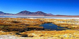
Wila Qullu, also Cerro Laguna, is a 4,948-metre-high (16,234 ft) mountain in the Andes located on the border of Bolivia and Chile in the Cordillera Occidental. Wila Qullu lies between the Salar de Huasco in the Tarapacá Region of Chile and the Salar de Uyuni in Bolivia. On the Bolivian side it is situated in the Potosí Department, Daniel Campos Province, Llica Municipality, Canquella Canton, north of the village of Pampa Anta.
Ch'alla Qullu is a mountain in the Andes located on the border of Bolivia and Chile in the Cordillera Occidental. It is about 4,345 metres (14,255 ft) high. Ch'alla Qullu lies north-east of the Salar de Huasco in the Tarapacá Region of Chile and the mountain Piqa, on the border and west of the Salar de Uyuni and Canquella in Bolivia. On the Bolivian side it is situated in the Potosí Department, Daniel Campos Province, Llica Municipality, Canquella Canton.
Wila Qullu is a mountain in the Bolivian Andes, about 4,600 metres (15,092 ft) high. It situated in the Cordillera Occidental near the border with Chile. It is located in the Oruro Department, Sabaya Province, Sabaya Municipality, Julo Canton. Wila Qullu lies south-east of the volcano Pukintika and north-west of the mountain Phaq'u Q'awa.

Wila Qullu is a mountain in the Andes in Bolivia, about 5,144 metres (16,877 ft) high. It is located in the Oruro Department, Challapata Province, Challapata Municipality. Wila Qullu is situated south of Jach'a River and north of Nacional Route 1. It lies north-west of the mountain Wila Quta which reaches the same height.
Ch'iyar Jaqhi is a 4,937-metre-high (16,198 ft) mountain located in the Andes in Bolivia. It is situated in the Oruro Department, Sebastián Pagador Province, in the south of the Condo "C" Canton. It lies between the mountains Jatun Wila Qullu in the south-west and Wila Qullu in the north-east. One of the nearest mountains is Jach'a Jaqhi (Jachcha Jakke) north-east of it. The river Qullpa Jawira originates near Ch'iyar Jaqhi.
Waylla Q'awa Aymara wayllaStipa obtusa, a kind of feather grass, q'awa little river, ditch, crevice, fissure, gap in the earth, "stipa brook" or "stipa ravine", also spelled Huaylla Khaua) is a mountain in the Andes of Bolivia, west of the Uyuni salt flat. It is situated in the Potosí Department, Daniel Campos Province, Llica Municipality, Canquella Canton.
Jach'a Qullu is a 5,298-metre-high (17,382 ft) mountain in the Cordillera Real in the Andes of Bolivia. It lies in the La Paz Department, Los Andes Province, Batallas Municipality. Jach'a Qullu is situated southwest of Jisk'a Pata and Jach'a Pata, southwest of Jach'a Juqhu and northwest of Wila Lluxi, Warawarani and Qala T'uxu.

Wila Qullu is a mountain in the Oruro Department in the Andes of Bolivia, about 5,140 metres (16,864 ft) high. Wila Qullu is situated in the Sajama Province, in the west of the Curahuara de Carangas Municipality, west of the extinct Sajama volcano and north-east of the Paya Chata mountains. It lies south-west of the mountain Phaq'u Q'awa.
Wila Qullu is a 5,125-metre-high (16,814 ft) mountain in the Andes in Bolivia. It is located in the Oruro Department, Challapata Province, Challapata Municipality, Challapata Canton. Wila Qullu is situated south-east of Chunkara Lake.

Chullpiri is a 5,018-metre-high (16,463 ft) mountain in the Andes of Bolivia east of Poopó Lake. It is located in the Oruro Department, Sebastián Pagador Province, which is identical to the Santiago de Huari Municipality. Chullpiri lies southeast of Wila Sirka and Sirk'i and northeast of Ch'alla Phujru. It is situated south of the Anta Qullu valley.
Wila Qullu is a mountain in the Andes in Bolivia, about 5,060 metres (16,601 ft) high. It is situated in the Oruro Department, Challapata Province, Challapata Municipality, Challapata Canton. Wila Qullu lies south-east of the mountains Thuru and Wawachani and north-west of Wichhu Qullu. It is situated north of Chunkara Lake.
Q'ullq'uni is a 4,570-metre-high (14,993 ft) mountain in the Chilla-Kimsa Chata mountain range in the Andes of Bolivia. It is situated in the La Paz Department, Ingavi Province, Jesús de Machaca Municipality, north-east of Ch'ama (Chama). Q'ullq'uni lies north-west of the mountain Wisk'achani, north-east of the mountain Jisk'a Sallalla and east of the mountains Pukara and Wila Qullu.

Layqa Qullu is a 6,166-metre-high (20,230 ft) peak in the Cordillera Real in the Andes of Bolivia. It is one of the highest peaks in the Illimani massif. It is situated in the La Paz Department, Murillo Province, Palca Municipality, and in the Sud Yungas Province, Irupana Municipality. Layqa Qullu lies south-east of the highest point of the massif, north-west of Link'u Link'u and Silla Pata.
Ch'iyar Jaqhi is a mountain in the Andes of Bolivia, about 4,720 metres (15,486 ft) high. It is situated in the La Paz Department, José Manuel Pando Province, Catacora Municipality. Ch'iyar Jaqhi lies south-east of the mountains Laram Q'awa, Chuqiwa Qullu (Chuquivakkollu), Wila Qullu and Apachita and north-west of the Sirk'i volcano. It is situated at one of the affluents of the Ch'allipiña River (Challipiña).
Wila Qullu is a mountain in the Andes of Bolivia, about 4,700 metres (15,420 ft) high. It is situated in the Oruro Department, Sajama Province, Turco Municipality. Wila Qullu lies north-east of the mountain Qutallani and south-west of Wintu Qachi.
Jach'a Waylla Punta is a 4,743-metre-high (15,561 ft) mountain in the Andes of Bolivia. It is located in the La Paz Department, Larecaja Province, Sorata Municipality. Jach'a Waylla Punta lies in the northern extensions of the Cordillera Real southeast of the mountain Wila Wilani and south of Wankar Quta Qullu. It is situated at the rivers Q'asiri Jawira and Ch'uch'u Jawira.