Tutupaca

Last updated

Tutupaca
Tutupaca2.jpg
Tutupaca viewed from a southern direction.
Highest point
Elevation 5,815 m (19,078 ft)  OOjs UI icon edit-ltr-progressive.svg
Coordinates 17°01′34″S70°22′19″W / 17.026°S 70.372°W / -17.026; -70.372 [1]
Geography
Peru physical map.svg
Red triangle with thick white border.svg
Tutupaca
Location of Tutupaca
Geology
Mountain type Stratovolcanoes
Volcanic arc Andean Volcanic Belt
Last eruption 1802

Tutupaca is a volcano in the region of Tacna in Peru. It is part of the Peruvian segment of the Central Volcanic Zone, one of several volcanic belts in the Andes. Tutupaca consists of three overlapping volcanoes formed by lava flows and lava domes made out of andesite and dacite, which grew on top of older volcanic rocks. The highest of these is usually reported to be 5,815 metres (19,078 ft) tall and was glaciated in the past.

Contents

Several volcanoes in Peru have been active in recent times, including Tutupaca. Their volcanism is caused by the subduction of the Nazca Plate beneath the South America Plate. One of these volcanoes collapsed in historical time, probably in 1802, generating a large debris avalanche with a volume likely exceeding 0.6–0.8 cubic kilometres (0.14–0.19 cu mi) and a pyroclastic flow. The associated eruption was among the largest in Peru for which there are historical records. The volcano became active about 700,000 years ago, and activity continued into the Holocene, but whether there were historical eruptions was initially unclear; some eruptions were instead attributed to the less eroded Yucamane volcano. The Peruvian government plans to monitor the volcano for future activity. Tutupaca features geothermal manifestations with fumaroles and hot springs.

Oral tradition

The people in Candarave considered Tutupaca to be a "bad" mountain, while Yucamane was the "good" one; this may reflect that Tutupaca had recent volcanic eruptions. [2] The Peruvian geographer Mateo Paz Soldán [3] dedicated an ode to Tutupaca. [4]

Geology and geomorphology
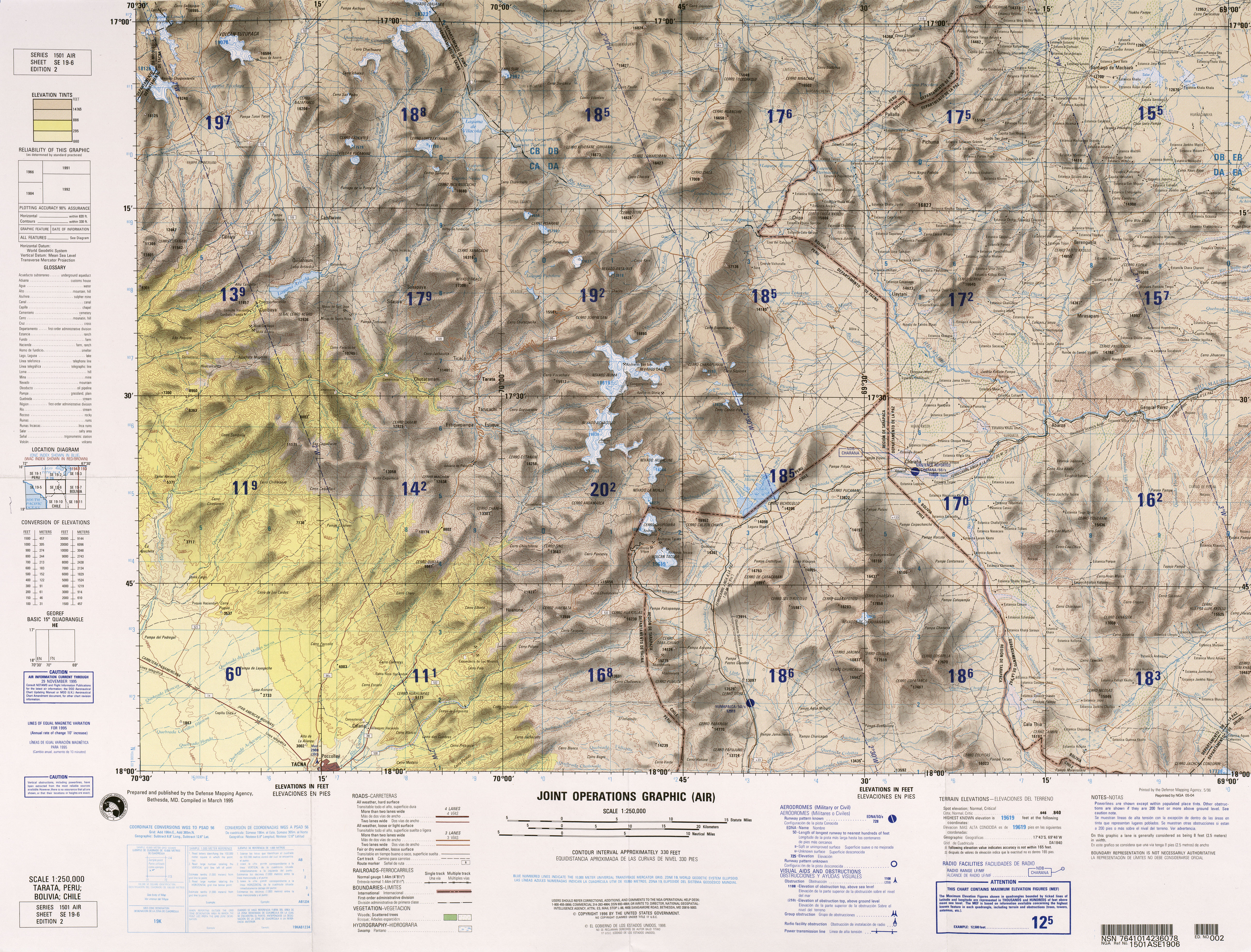
Tutupaca is 25–30 kilometres (16–19 mi) north of the town of Candarave in the region of Tacna in Peru. [5] [6] Lake Suches lies north of the volcano, and two rivers flow nearby: the Callazas River, flowing eastward to the north of the volcano, and then southward past Tutupaca's eastern flank, and the Tacalaya River, which flows south along Tutupaca's western flank. [7] [lower-alpha 1] The local climate is cold, and the terrain is stony, with little vegetation. [8] During the wet season, the mountain is snow-covered, [9] and meltwater from Tutupaca and other regional mountains is an important source of water for the rivers in the region. [10] In contrast, the volcano itself is largely unaffected by human activity. [11]

Tutupaca consists of two volcanic complexes: an older complex that is highly eroded, and two northerly peaks which formed more recently. Of these, the eastern peak ("eastern Tutupaca") consists of seven presumably Holocene lava domes [12] and is 5,790 metres (19,000 ft) high, while the western one ("western Tutupaca") consists of lava domes, lava flows and Plinian eruption deposits of Pleistocene age, and reaches a height of 5,815 metres (19,078 ft). [lower-alpha 2] [5] The Global Volcanism Program gives heights of 5,753 metres (18,875 ft) for the eastern and 5,801 metres (19,032 ft) for the western summit. [1] The western peak is the highest summit of Tutupaca. [14]

The base that Tutupaca rises from lies at elevations ranging from 4,400 metres (14,400 ft) to 4,600 metres (15,100 ft) [6] and the volcano covers a surface area of about 150–170 square kilometres (58–66 sq mi). [15] The older complex is formed mainly by lava flows, which during the Pleistocene were eroded by glaciers forming up to 100 metres (330 ft) thick moraines [6] and U-shaped glacial valleys. [16] Cirques and moraines are also found on the western summit, and tephra layers extend west of the volcano. The older complex, which includes lava domes in the form of small hills on its southern part, [17] was the source of ignimbrite that covers the western and southern parts of the volcano. [6] Postglacial lava flows emanating from a vent located between the two peaks have been identified. [1] Proglacial processes like frost shattering have altered young volcanic products. [18]

Composition

The older complex and western Tutupaca have erupted andesite and dacite, while eastern Tutupaca has only produced dacite. [19] Trachyandesite and trachyte also occur. [20] The volcanic rocks erupted during the Holocene define a potassium-rich calc-alkaline suite. [21] Dacites from eastern Tutupaca contain amphibole, apatite, biotite, clinopyroxene, iron-titanium oxides, orthopyroxene, plagioclase, quartz, and sphene. [22] Mafic [lower-alpha 3] rock fragments are rarely found embedded in Tutupaca rocks. [12] The basal volcanic rocks have suffered hydrothermal alteration, forming clays. [24] Elemental sulfur deposits have been identified at Tutupaca [25] and a 1996 map of the volcano shows a sulfur mine on its southeastern flank. [26]

Sector collapse

A 1 kilometre (0.62 mi) wide amphitheater in eastern Tutupaca, open to the northeast, was formed by a major collapse of the volcano. Lava domes from the younger Tutupaca, as well as highly altered lavas from the older complex, are exposed within the collapse scar, which is the origin of a 6–8-kilometre (3.7–5.0 mi) long debris avalanche deposit. The deposit is mostly found within glacial valleys and is interlaid by the Paipatja pyroclastic flow which divides the debris into two units. [27] The pyroclastic flow reaches both Lake Suches north of the volcano and the Callazas River east of it. [28]

The two units of the debris avalanche are distinguished by their appearance. One features 100–200-metre (330–660 ft) long hummock-like hills, as is typical for volcanic debris avalanches, and the other has ridges which vary in length from 100 to 150 metres (330 to 490 ft). The ridges range from only a few meters to more than 0.5 metres (1 ft 8 in) in height, and from 10 to 30 metres (33 to 98 ft) in height. [29] Such ridges have been observed in other collapse deposits such as at Shiveluch volcano in Russia, and have been explained by sorting processes that take place within granular flows. [30] The differences between the two units appear to be because the first unit was formed from the basal part of Tutupaca, while the second unit was formed by the more recent lava domes of the eastern volcano and formed a granular flow. [31] [32]

The collapse possibly started in the hydrothermal system of the volcano and progressed to affect a growing lava dome, [33] with a total volume probably exceeding 0.6–0.8 cubic kilometres (0.14–0.19 cu mi). [34] The total surface area covered by the collapse is about 12–13 square kilometres (4.6–5.0 sq mi). [13] This collapse was not the first in the history of Tutupaca: collapses on the southeast-east flanks of the volcano [13] occurred 6,0007,500 years ago [35] and delivered debris through glacial valleys on the eastern and southeastern side of the volcano, [12] and on the western side of the volcano [36] a collapse took place before 17,00025,000 years ago. [35] Such large collapses of volcanoes took place in historical time at Mount Bandai in 1888 and Mount St. Helens in 1980; they can produce large avalanches of debris. [37]

Geologic context

Off the coast of Peru, the Nazca Plate subducts at 5–6 centimetres per year (2.0–2.4 in/year) beneath the South America Plate, [38] [14] causing volcanism in three of the four volcanic belts in the Andes, including the Central Volcanic Zone where Tutupaca is located. [38] [lower-alpha 4] Other Peruvian volcanoes include Sara Sara, Solimana, Coropuna, the Andagua volcanic field, Ampato Sabancaya Hualca Hualca, Chachani, El Misti, Ubinas, Huaynaputina, Ticsani, Yucamane, Purupuruni and Casiri. [40] During historical times, major eruptions took place in Peru at El Misti 2,000 years ago and at Huaynaputina in 1600, [38] the latter of which claimed 1,500 fatalities and disrupted the climate of Earth. [41]

The basement of the region consists of folded Mesozoic sediments, and Cenozoic volcanic and sedimentary cover which overlies the Mesozoic rocks. [42] There are many tectonic lineaments and faults which were active in the Tertiary; [43] one of these crosses Tutupaca from north to south, [7] and others influence the positions of geothermal features. [20] The Huaylillas ignimbrite complex [lower-alpha 5] underlies some of the volcanic centres, [43] which include a first set of eroded volcanoes that were active between 8.4–5 and 4–2 million years ago, principally erupting lava flows. These were followed by a second set of volcanoes which were also mainly active with lava flows, such as Casiri, Tutupaca, and Yucamane. A third phase formed dacitic lava domes such as Purupuruni about 100,000 years ago. [45] Other, older stratovolcanoes are found at Tutupaca and are heavily eroded by glaciers. [46]

Tutupaca volcano Tutupaca234.jpg
Tutupaca volcano

Climate and vegetation

Most of the volcanoes in the Central Volcanic Zone are located at over 4,000 metres (13,000 ft) elevation where the climate is cold with frequent freezes. Most precipitation falls between January and March, at Tutupaca it amounts to 200–560 millimetres per year (7.9–22.0 in/year). [47] In the Western Cordillera, altitudes between 3,500–3,900 metres (11,500–12,800 ft) are dominated by vegetation such as cacti, herbs, Peruvian feather grass, and yareta, but also lichens and mosses. Wetlands, called bofedales, display a diverse plant life. Above 4,000 metres (13,000 ft) elevation plant life diminishes and in 20032012 by 5,800 metres (19,000 ft) there was perpetual snow. [48] The volcano is part of the Vilacota Maure Regional Conservation Area  [ es ]. [49]

Eruption history

The oldest volcanic rocks of Tutupaca are 1,135,000 ± 17,000 years old. [24] The older complex was active at first with lava flows and then with a major explosive eruption; [6] a pumice-and-ash flow forms the "Callazas" deposit and may have been produced either by the older complex [50] or by western Tutupaca. [51] A long hiatus separated the activity of the older complex from that of western and eastern Tutupaca. [52] The small lava domes on the older complex have been dated to 260,000 ± 200,000 [17] while more recent domes are 33,000±5,000 years old. [53] Volcanic activity continued into the Holocene, [1] and the volcano is considered to be potentially active. [5] Today, fumaroles occur on the summit of Tutupaca [54] and seismic activity has been recorded. [55]

There are reports of eruptions in 1780, 1787, 1802, 1862 and 1902, [6] supported by dates obtained through radiocarbon dating showing there were eruptions during this period. [37] Some authors believed that Yucamane volcano was a more likely source for these eruptions, [6] but Samaniego 2015 et al. showed that Yucumane last erupted 3,000 years ago, [56] implying that the reported eruptions, especially the 1802 and 1787 events, most likely occurred at Tutupaca. [1]

The sector collapse of eastern Tutupaca was accompanied by an eruption that was among the largest in Peruvian history, reaching a volcanic explosivity index of 3 or 4. Contemporaneous chronicles document ashfall as far as 165 kilometres (103 mi) to the south in Arica. [57] The collapse has been dated to 1731–1802 with high probability [lower-alpha 6] and is thought to be associated with the 1802 eruption. [2] The eruption was probably triggered by the entry of fresh, hot magma into a dacitic magma chamber. [58] Shortly before the collapse, [lower-alpha 7] a pyroclastic flow erupted from the volcano [2] probably as a consequence of the collapse of a lava dome. It formed a deposit on the east flank of Tutupaca, [59] which reaches a thickness of 6 metres (20 ft). [17] The previous eruption may have destabilized the volcano and triggered the main collapse, which also generated the Paipatja pyroclastic flow. The area was thinly inhabited at the time, and thus the impact of the eruption was small. [60]

Hazards

Based on the history of Tutupaca, a future eruption can be envisaged where renewed activity causes another collapse of the volcano. In this case, about 8,000–10,000 people, as well as neighboring geothermal power and mining infrastructure, would be in danger. [60] Several small towns, diversion dams, irrigation canals, and the two roads Ilo Desaguadero and Tacna Tarata Candarave would also be vulnerable. [5] Other dangers are ballistic rocks, pyroclastic flows, scoria avalanches, ash and pumice rains, volcanic gas and lahars. [61] Tutupaca along with Ubinas and Huaynaputina is one of the three volcanoes in Peru to have produced large explosive eruptions. [62]

The Peruvian Instituto Geológico, Minero y Metalúrgico [lower-alpha 8] (INGEMMET) has published a volcano hazard map for Tutupaca. [65] In 2017, Tutupaca was identified as one of the volcanoes to be monitored by the future Peruvian Southern Volcano Observatory. This would entail surveillance of earthquake activity, changes in the composition of fumarole gases and deformation of the volcanoes, and real-time video. This project, budgeted to cost 18,500,000 Peruvian sols (4768041 US dollars) and involves the construction of thirty monitoring stations and the main observatory in the Sachaca District, [66] became active in 2019. [67] Publication of regular activity reports began in May 2019. [55] The volcano is classified as "moderately dangerous". [68]

Geothermal activity

Tutupaca is also the name of a geothermal field in the neighborhood of the volcano, which includes the areas of Azufre Chico, Azufre Grande, Callazas River, Pampa Turun Turun, and Tacalaya River; [8] they are part of the same geothermal system whose temperature at depth is higher than 200 °C (392 °F). [69] [70] The fields feature fumaroles, geysers, [45] mud pots and occurrences of sulfur, both solid and in the form of hydrogen sulfide gas, [8] as well as siliceous sinter and travertine deposits. [71] Hot springs at the foot of the Tutupaca volcano [72] discharge water into the rivers. [8]

Tutupaca has been mentioned as a potential site for geothermal power generation. [73] In 2013, Canada's Alterra Power and the Philippine Energy Development Corporation developed a joint venture to work on a geothermal prospect at Tutupaca, [74] although work at Tutupaca had not begun by October 2014. [75]

Notes

  1. The course of both rivers is influenced by tectonic lineaments. [8]
  2. These heights are from a 2015 source. [13] [5]
  3. A volcanic rock relatively rich in iron and magnesium, relative to silicium. [23]
  4. The Central Volcanic Zone is one of four volcanic belts in the Andes, together with the Northern Volcanic Zone, the Southern Volcanic Zone and the Austral Volcanic Zone. [39]
  5. The Huaylillas ignimbrites were emplaced between 24 and 12 million years ago. [44]
  6. The uncalibrated radiocarbon age of the samples is 218±14 years before present, [32] with 95% confidence; the calibrated age consists of two ranges, with an 85% probability that the date lies between 1731 and 1802. [2]
  7. Stratigraphic relations imply that this pyroclastic flow predates the main collapse, but radiocarbon dating does not have sufficient resolution to separate the two events in time. [2]
  8. A public agency [63] which is among other things responsible for monitoring volcanoes in Peru. [64]

Related Research Articles

<span class="mw-page-title-main">Misti</span> Stratovolcano in Peru

Misti is a dormant volcano located in the Andes mountains in southern Peru, rising above Peru's second-largest city, Arequipa. It is a conical volcano with two nested summit craters, the inner one of which contains a volcanic plug or lava dome with active fumaroles. The summit of the volcano lies on the margin of the outer crater and is 5,822 metres (19,101 ft) above sea level. Snow falls on the summit during the wet season, but does not persist; there are no glaciers. The upper slopes of the volcano are barren, while the lower slopes are covered by bushland.

<span class="mw-page-title-main">Socompa</span> Mountain in Argentina

Socompa is a large stratovolcano at the border of Argentina and Chile with an elevation of 6,051 metres (19,852 ft) metres. Part of the Chilean and Argentine Andean Volcanic Belt (AVB), it is part of the Central Volcanic Zone, one of the various segments of the AVB. This part of the Andean volcanic arc begins in Peru and runs first through Bolivia and Chile, and then through Argentina and Chile, and contains about 44 active volcanoes. Socompa lies close to the pass of the same name, where the Salta-Antofagasta railway crosses the border.

Huaynaputina is a volcano in a volcanic high plateau in southern Peru. Lying in the Central Volcanic Zone of the Andes, it was formed by the subduction of the oceanic Nazca Plate under the continental South American Plate. Huaynaputina is a large volcanic crater, lacking an identifiable mountain profile, with an outer stratovolcano and three younger volcanic vents within an amphitheatre-shaped structure that is either a former caldera or a remnant of glacial erosion. The volcano has erupted dacitic magma.

<span class="mw-page-title-main">Lascar (volcano)</span> A stratovolcano within the Central Volcanic Zone of the Andes

Lascar is a stratovolcano in Chile within the Central Volcanic Zone of the Andes, a volcanic arc that spans Peru, Bolivia, Argentina and Chile. It is the most active volcano in the region, with records of eruptions going back to 1848. It is composed of two separate cones with several summit craters. The westernmost crater of the eastern cone is presently active. Volcanic activity is characterized by constant release of volcanic gas and occasional vulcanian eruptions.

<span class="mw-page-title-main">Nevado de Longaví</span> Volcano in Chile

Nevado de Longaví is a volcano in the Andes of central Chile. The 3,242 m (10,636 ft) high volcano lies in the Linares Province, which is part of the Maule Region. It features a summit crater and several parasitic vents. The volcano is constructed principally from lava flows. Two collapses of the edifice have carved collapse scars into the volcano, one on the eastern slope known as Lomas Limpias and another on the southwestern slope known as Los Bueye. The volcano features a glacier and the Achibueno and Blanco rivers originate on the mountain.

<span class="mw-page-title-main">Ampato</span> Dormant Stratovovlcano in Southern Peru

Ampato is a dormant 6,288-metre (20,630 ft) stratovolcano in the Andes of southern Peru. It lies about 70–75 kilometres (43–47 mi) northwest of Arequipa and is part of a north-south chain that includes the volcanoes Hualca Hualca and Sabancaya, the last of which has been historically active.

<span class="mw-page-title-main">Ollagüe</span> Stratovolcano in Bolivia and Chile

Ollagüe or Ullawi is a massive andesite stratovolcano in the Andes on the border between Bolivia and Chile, within the Antofagasta Region of Chile and the Potosi Department of Bolivia. Part of the Central Volcanic Zone of the Andes, its highest summit is 5,868 metres (19,252 ft) above sea level and features a summit crater that opens to the south. The western rim of the summit crater is formed by a compound of lava domes, the youngest of which features a vigorous fumarole that is visible from afar.

<span class="mw-page-title-main">Taapaca</span> Volcano in Chile

Taapaca is a Holocene volcanic complex in northern Chile's Arica y Parinacota Region. Located in the Chilean Andes, it is part of the Central Volcanic Zone of the Andean Volcanic Belt, one of four distinct volcanic chains in South America. The town of Putre lies at the southwestern foot of the volcano.

<span class="mw-page-title-main">Volcán Putana</span> Mountain in Chile

Volcán Putana, sometimes referred to as Jorqencal or Machuca, is a stratovolcano located In the Central Volcanic Zone (CVZ) of the Andes on the border between Bolivia and Chile and close to the Sairecabur volcanic complex. Its summit is 5,884 metres (19,304 ft) above sea level and contains a summit crater with two smaller craters nested within it. Beneath the summit, the volcano features a number of lava domes and lava flows, some of which originated in flank vents.

<span class="mw-page-title-main">Yucamane</span> Volcano in Peru

Yucamane, Yucamani or Yucumane is an andesitic stratovolcano in the Tacna Region of southern Peru. It is part of the Peruvian segment of the Central Volcanic Zone, one of the three volcanic belts of the Andes generated by the subduction of the Nazca plate beneath the South America plate. Peru's active volcanoes Ubinas, Sabancaya and El Misti are also part of the Central Volcanic Zone.

<span class="mw-page-title-main">Andagua volcanic field</span> Volcanic field in Peru

The Andagua volcanic field is a volcanic field in southern Peru which includes a number of cinder cones, lava domes and lava flows which have filled the Andagua Valley. The volcanic field is part of a larger volcanic province that clusters around the Colca River and is mostly of Pleistocene age, although the Andagua sector also features volcanic cones with historical activity, with the last eruption about 370 years ago. Eruptions were mostly effusive, generating lava flows, cones and small eruption columns. Future eruptions are possible, and there is ongoing fumarolic activity. Volcanic activity in the field has flooded the Andahua valley with lava flows, damming local watersheds in the Laguna de Chachas, Laguna Mamacocha and Laguna Pumajallo lakes and burying the course of the Andagua River. The Andahua valley segment of the larger volcanic province was declared a geopark in 2015.

<span class="mw-page-title-main">Sabancaya</span> Active stratovolcano in Southern Peru

Sabancaya is an active 5,976-metre-high (19,606 ft) stratovolcano in the Andes of southern Peru, about 70 kilometres (43 mi) northwest of Arequipa. It is considered part of the Central Volcanic Zone of the Andes, one of the three distinct volcanic belts of the Andes. The Central Volcanic Zone includes a number of volcanoes, some of which like Huaynaputina have had large eruptions and others such as Sabancaya and Ubinas have been active in historical time. Sabancaya forms a volcanic complex together with Hualca Hualca to the north and Ampato to the south and has erupted andesite and dacite. It is covered by a small ice cap which leads to a risk of lahars during eruptions.

<span class="mw-page-title-main">Apacheta-Aguilucho volcanic complex</span> Pair of volcanoes and lava domes in Chile

Apacheta-Aguilucho volcanic complex is a volcanic complex in Chile. It consists of two volcanoes Cerro Apacheta and Cerro Aguilucho, which are constructed mainly by lava flows and surrounded by outcrops of lava. A sector collapse and its landslide deposit are located on Apacheta's eastern flank. Two lava domes are associated with the volcanic complex, Chac-Inca and Pabellón.

<span class="mw-page-title-main">Tata Sabaya</span> A 5,430-metre (17,810 ft) high volcan in Bolivia

Tata Sabaya is a 5,430-metre (17,810 ft) high volcano in Bolivia. It is part of the Central Volcanic Zone, one of several volcanic belts in the Andes which are separated by gaps without volcanic activity. This section of the Andes was volcanically active since the Jurassic, with an episode of strong ignimbritic volcanism occurring during the Miocene. Tata Sabaya lies in a thinly populated region north of the Salar de Coipasa salt pan.

<span class="mw-page-title-main">Ticsani</span> Volcano in Peru

Ticsani is a volcano in Peru northwest of Moquegua and consists of two volcanoes that form a complex. "Old Ticsani" is a compound volcano that underwent a large collapse in the past and shed 15–30 cubic kilometres (3.6–7.2 cu mi) of mass down the Rio Tambo valley. Today an arcuate ridge remains of this edifice. "Modern Ticsani" is a complex of three lava domes which were emplaced during the Holocene. Two large eruptions took place during the Holocene, producing the so-called "Grey Ticsani" and "Brown Ticsani" deposits; the last eruption occurred after the 1600 eruption of neighbouring Huaynaputina. The volcano is seismically active and features active hot springs and fumaroles; since 2015 the volcano is monitored by the Peruvian government.

<span class="mw-page-title-main">Sara Sara</span> Volcano in Peru

Sara Sara is a 5,505-metre-high (18,061 ft) volcano lying between Lake Parinacochas and the Ocoña River in Peru. It is situated in the Parinacochas Province and the Paucar del Sara Sara Province. The volcano formed during the Pleistocene during four different stages of volcanic activity, which constructed a volcanic edifice with an oval outline consisting of lava flows and lava domes. The volcano was glaciated during the last glacial maximum; it may still feature glaciers. The last eruption was about 14,000 years ago and future eruptions are possible. The volcano was worshipped by the local population, and an Inca mummy of a 15-year old girl was found on the summit by archaeologists.

<span class="mw-page-title-main">Ubinas</span> Volcano in southern Peru

Ubinas is an active stratovolcano in the Moquegua Region of southern Peru, approximately 60 kilometres (37 mi) east of the city of Arequipa. Part of the Central Volcanic Zone of the Andes, it rises 5,672 metres (18,609 ft) above sea level. The volcano's summit is cut by a 1.4-kilometre-wide (0.87 mi) and 150-metre-deep (490 ft) caldera, which itself contains a smaller crater. Below the summit, Ubinas has the shape of an upwards-steepening cone with a prominent notch on the southern side. The gently sloping lower part of the volcano is also known as Ubinas I and the steeper upper part as Ubinas II; they represent different stages in the volcano's geological history.

<span class="mw-page-title-main">Chachani</span> Volcano in Peru

Chachani is a volcanic group in southern Peru, 22 kilometres (14 mi) northwest of the city of Arequipa. Part of the Central Volcanic Zone of the Andes, it is 6,057 metres (19,872 ft) above sea level. It consists of several lava domes and individual volcanoes such as Nocarane, along with lava shields such as the Airport Domes. Underneath Chachani lies a caldera.

Purupuruni is a group of lava domes in southern Peru and a correlative geological formation. They are among the many volcanoes that exist in Peru and whose activity has been associated with the subduction of the Nazca Plate beneath the South America Plate. Purupuruni is associated with a geothermal field and a caldera. Volcanic activity occurred during the Pleistocene 53,000 ± 8,000 years ago but also during the Holocene about 5,300 ± 1,100 years ago; today the volcano is considered to be a low hazard volcano but is being monitored nevertheless.

<span class="mw-page-title-main">Casiri (Tacna)</span> Volcano in Peru

Casiri, also known as Paucarani, is an about 5,650 metres (18,537 ft) high complex volcano in the Barroso mountain range of the Andes, in the Tacna Region of Peru. It consists of four individual volcanic edifices with lava domes; the southeasternmost edifice has been active during the Holocene, producing thick lava flows that have overrun moraines of Pleistocene age. The youngest lava flow has been dated to 2,600 ± 400 years ago. Although no historical eruptions are known, the volcano is considered to be potentially active and is monitored.

References

  1. 1 2 3 4 5 "Tutupaca". Global Volcanism Program . Smithsonian Institution . Retrieved 21 March 2018.
  2. 1 2 3 4 5 Samaniego et al. 2015, p. 13.
  3. "U. Católica de Santa María rinde homenaje a siete científicos arequipeños por sus aportes a la ciencia". La República (in Spanish). 12 January 2012. Retrieved 8 April 2018.
  4. Soldán, Mateo Paz (1863). Géographie du Pérou (in French). Firmin Didot Frères, Fils et Cie. p.  8. OCLC   253927093.
  5. 1 2 3 4 5 "Volcán Tutupaca". INGEMMET (in Spanish). Retrieved 7 March 2018.
  6. 1 2 3 4 5 6 7 Samaniego et al. 2015, p. 3.
  7. 1 2 Samaniego et al. 2015, p. 2.
  8. 1 2 3 4 5 Pauccara & Matsuda 2015, p. 1.
  9. Amstutz, G. C. (1959). "On the Formation of Snow Penitentes". Journal of Glaciology. 3 (24): 309. doi: 10.3189/S0022143000023972 . ISSN   0022-1430.
  10. Begazo, Jesús Gordillo (15 February 2017). "Desarrollo regional tardío y ocupación inca en la pre-cordillera de Tacna". Ciencia & Desarrollo (in Spanish) (3): 73–81. doi: 10.33326/26176033.1996.3.68 . ISSN   2304-8891. S2CID   198573899.
  11. Bernard et al. 2022, p. 4.
  12. 1 2 3 Manrique et al. 2019, p. 2.
  13. 1 2 3 Samaniego et al. 2015, p. 4.
  14. 1 2 Valderrama et al. 2016, p. 3.
  15. Mariño Salazar et al. 2019, p. 12.
  16. Mariño Salazar et al. 2019, p. 26.
  17. 1 2 3 "Geología del volcán Tutupaca". INGEMMET (in Spanish). Retrieved 7 March 2018.
  18. Bernard et al. 2022, p. 5.
  19. Samaniego et al. 2015, pp. 3–4.
  20. 1 2 Pauccara & Matsuda 2015, p. 3.
  21. Samaniego et al. 2015, p. 11.
  22. Samaniego et al. 2015, pp. 11–12.
  23. Pinti, Daniele (2011), "Mafic and Felsic", Encyclopedia of Astrobiology, Springer Berlin Heidelberg, p. 938, doi:10.1007/978-3-642-11274-4_1893, ISBN   9783642112713
  24. 1 2 Mariño et al. 2021, p. 8.
  25. Perales, Oscar J.P. (1994). "General overview and prospects of the mining and metallurgical industry in peru". Resources Processing. 41 (2): 75. doi: 10.4144/rpsj1986.41.72 . ISSN   1883-9150.
  26. Defense Mapping Agency (1996). "Tarata, Peru; Bolivia; Chile" (Map). Latin America, Joint Operations Graphic (2 ed.). 1:250000.
  27. Valderrama et al. 2016, p. 2.
  28. Samaniego et al. 2015, p. 5.
  29. Valderrama et al. 2016, pp. 3, 5.
  30. Valderrama et al. 2016, p. 7.
  31. Valderrama et al. 2016, p. 4.
  32. 1 2 Valderrama et al. 2016, p. 10.
  33. Valderrama et al. 2016, p. 6.
  34. Samaniego et al. 2015, p. 6.
  35. 1 2 Mariño et al. 2021, p. 15.
  36. Mariño et al. 2021, p. 11.
  37. 1 2 Valderrama et al. 2016, p. 1.
  38. 1 2 3 Samaniego et al. 2015, p. 1.
  39. Stern, Charles R. (2004). "Active Andean volcanism: its geologic and tectonic setting" (PDF). Revista Geológica de Chile. 31 (2): 161–206. doi: 10.4067/S0716-02082004000200001 . ISSN   0716-0208.
  40. Mariño et al. 2021, p. 2.
  41. Mariño Salazar et al. 2019, p. 11.
  42. Scandiffio, Verastegui & Portilla 1992, p. 346.
  43. 1 2 Scandiffio, Verastegui & Portilla 1992, p. 347.
  44. Pauccara & Matsuda 2015, p. 2.
  45. 1 2 Scandiffio, Verastegui & Portilla 1992, p. 348.
  46. Mariño Salazar et al. 2019, p. 23.
  47. Mariño Salazar et al. 2019, p. 15.
  48. Gałaś, Andrzej; Panajew, Paweł; Cuber, Piotr (30 November 2015). "Stratovolcanoes in the Western Cordillera – Polish Scientific Expedition to Peru 2003–2012 reconnaissance research". Geotourism/Geoturystyka. 37 (2): 66. doi: 10.7494/geotour.2014.37.61 . ISSN   2353-3641.
  49. Del Carpio Calienes et al. 2022, p. 46.
  50. Centeno Quico & Rivera 2020, p. 26.
  51. Mariño et al. 2021, p. 9.
  52. Mariño et al. 2021, p. 14.
  53. Mariño et al. 2021, p. 10.
  54. Pauccara & Matsuda 2015, p. 9.
  55. 1 2 Centeno Quico & Rivera 2020, p. 27.
  56. "Yucamane". Global Volcanism Program . Smithsonian Institution . Retrieved 21 March 2018.
  57. Samaniego et al. 2015, pp. 14–15.
  58. Manrique et al. 2019, p. 23.
  59. Samaniego et al. 2015, pp. 4–5.
  60. 1 2 Samaniego et al. 2015, p. 16.
  61. Mariño Salazar et al. 2019, pp. 106–107.
  62. Del Carpio Calienes et al. 2022, p. 18.
  63. "Quiénes Somos". INGEMMET (in Spanish). Retrieved 9 April 2018.
  64. "Funciones y Organigrama". INGEMMET (in Spanish). Retrieved 9 April 2018.
  65. Hancco, Nelly (18 April 2017). "Ingemmet elabora el mapa de peligro del volcán Sara Sara" (in Spanish). Diario Correo. Retrieved 7 March 2018.
  66. Hancco, Nelly (31 October 2017). "IGP vigilará los 10 volcanes más peligrosos del Perú". Diario Correo (in Spanish). Retrieved 7 March 2018.
  67. Centeno Quico & Rivera 2020, p. 13.
  68. Del Carpio Calienes et al. 2022, p. 3.
  69. Pauccara & Matsuda 2015, p. 8.
  70. Scandiffio, Verastegui & Portilla 1992, p. 370.
  71. Steinmüller, Klaus (September 2001). "Modern hot springs in the southern volcanic Cordillera of Peru and their relationship to Neogene epithermal precious-metal deposits". Journal of South American Earth Sciences. 14 (4): 381. Bibcode:2001JSAES..14..377S. doi:10.1016/S0895-9811(01)00033-5. ISSN   0895-9811.
  72. Scandiffio, Verastegui & Portilla 1992, p. 355.
  73. Quispe, Juan Luis Silvera (27 May 2013). "Perú tiene reserva geotérmica para generar 3 mil MW de electricidad". La República (in Spanish). Retrieved 7 March 2018.
  74. Flores, Alena Mae S. (19 June 2013). "EDC signs Peru, Chile contracts". Manila Standard Today. Retrieved 8 May 2018.
  75. Poma, Sandy (22 October 2014). "En Tacna hay alto potencial geotérmico". Diario Correo (in Spanish). Retrieved 8 May 2018.

Sources