It is the northern of two lava domes which lie at the southern end of the Sierra de Calalaste[4] and on its eastern flank.[5] A 1.5 kilometres (0.93mi) wide horseshoe-shaped collapse scar dominates the edifice of the lava dome and has generated large debris block.[6] and hummocky debris.[7] A second edifice developed within the collapse scar.[8] The total volume of the volcano is about 5.19 cubic kilometres (1.25cumi).[9]
The volcano is accompanied by ignimbrites[1] and a debris deposit consisting of obsidian lies at the foot of the dome.[4] Two volcanic fallout units are associated with Cueros de Purulla. A lower fallout unit consisting of lapilli and volcanic ash extends several kilometres from the volcano, and remnants occur as far as 180 kilometres (110mi) from it.[10] The upper unit is formed by ignimbrites and pyroclastic density current deposits.[11]
For the past five millennia,[14] the volcano has been used as a source of obsidian, which occurs at 4,380 metres (14,370ft) in the form of blocks and nodules of various colours, and is of high quality.[3] Reportedly, gold and silver can be found at the volcano.[15][16]
Eruption history
The lava dome at Cueros de Purulla is 400,000 ± 100,000 years old[17] and produced volcanic units that resemble the older volcanics of Cerro Blanco; some were originally attributed to that volcano.[5] At first, "coulee" lava flows were erupted and a large lava dome grew. After the collapse, the same processes rebuild part of the volcano. Notably, there is no indication that Cueros de Purulla produced block-and-ash flows.[13] Based on the stratigraphic relations with volcanic rocks from Cerro Blanco, Cueros de Purulla was active during the last 73,000 years.[18] It is considered to be a low-risk volcano.[19]
The "El Paso ash" in the Tafí valley was emplaced between 11802 and 4289 years before present and may originate at Cueros de Purulla volcano.[20] A large eruption occurred during the Holocene, 7820 years before present (i.e. about 5870 BC).[21] Deposits from this eruption form the Cerro Paranilla Ash in the Calchaquí Valleys,[22] while a correlation to the 12,000-4,300 years before present[23] so-called "VO ash" is unlikely.[24] The eruption was highly explosive, forming a buoyant cloud[25] and depositing tephra as far as Cafayate in the Salta Province.[26] However, it is possible that deposits close to Cueros de Purulla might originate from activity at Cerro Blanco instead.[27]Seismic activity was registered in 2020 AD.[28]
↑ Roy, R.; Cassard, D.; Cobbold, P. R.; Rossello, E. A.; Billa, M.; Bailly, L.; Lips, A. L. W. (1 November 2006). "Predictive mapping for copper–gold magmatic-hydrothermal systems in NW Argentina: Use of a regional-scale GIS, application of an expert-guided data-driven approach, and comparison with results from a continental-scale GIS". Ore Geology Reviews. 29 (3): 286. doi:10.1016/j.oregeorev.2005.10.002. hdl:11336/16669. ISSN0169-1368.
↑ Osterrieth, Margarita; Alvarez, María Fernanda; Gallardo, Juan Fernando; Saavedra, Julio; Fernandez-Turiel, Jose-Luis; Rodriguez-Gonzalez, Alejandro; Perez-Torrado, Francisco J.; Rejas, Marta (10 July 2019). "Palaeoenvironmental use of silicophytoliths in soils and palaeosols associated with Holocene volcanic ash deposits in north-western Argentina". Quaternary International. 522: 103. Bibcode:2019QuInt.522..103O. doi:10.1016/j.quaint.2019.07.001. hdl:10261/185417. ISSN1040-6182. S2CID198418382.
↑ Osterrieth, Margarita; Alvarez, María Fernanda; Gallardo, Juan Fernando; Saavedra, Julio; Fernandez-Turiel, Jose-Luis; Rodriguez-Gonzalez, Alejandro; Perez-Torrado, Francisco J.; Rejas, Marta (10 July 2019). "Palaeoenvironmental use of silicophytoliths in soils and palaeosols associated with Holocene volcanic ash deposits in north-western Argentina". Quaternary International. 522: 104. Bibcode:2019QuInt.522..103O. doi:10.1016/j.quaint.2019.07.001. hdl:10261/185417. ISSN1040-6182. S2CID198418382.
Elissondo, M.; Farías, C. (2024). Riesgo Volcánico Relativo en Territorio Argentino (Report). Contribuciones Técnicas Peligrosidad Geológica (in Spanish). Vol.28. Buenos Aires: Instituto de Geología y Recursos Minerales, Servicio Geológico Minero Argentino. p.99.
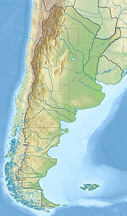
Note: volcanoes are ordered by latitude from north to south
This page is based on this Wikipedia article Text is available under the CC BY-SA 4.0 license; additional terms may apply. Images, videos and audio are available under their respective licenses.