Williamsburg, Missouri

Last updated
MOMap-doton-Williamsburg.png

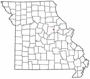
Williamsburg is an unincorporated community in eastern Callaway County, Missouri, United States. [1] It is located on Missouri Supplemental Route D just north of Interstate 70, approximately thirteen miles northeast of Fulton. The Whetstone Creek Conservation Area along Whetstone Creek lies about one mile to the north. [2] The ZIP Code for Williamsburg is 63388. [3]

History

An old variant name was Fruits. [1] A post office called Fruits was established in 1824, and the name was changed to Williamsburg in 1835. [4] The present name is after Harvey Williams, in whose house the post office once was located. [5]

Related Research Articles

<span class="mw-page-title-main">Vichy, Missouri</span> Unincorporated community in the American state of Missouri

Vichy is an unincorporated community in southern Maries County, Missouri, United States. It is located on U.S. Route 63, approximately ten miles north of Rolla. The community was founded in 1880 and is named after Vichy, France. A post office called Vichy has been in operation since 1880. The Rolla National Airport, a former U.S. Army airfield owned and operated by the City of Rolla, with two 5,500 ft (1,700 m) asphalt runways, is located nearby. The ZIP Code for Vichy is 65580.

<span class="mw-page-title-main">Valles Mines, Missouri</span> Unincorporated community in the American state of Missouri

Valles Mines is an unincorporated community in southern Jefferson County, Missouri, United States. It is located approximately seven miles south of De Soto. It is located on Missouri Route V less than one mile west of U.S. Route 67. Joachim Creek flows past the north side of the community. The ZIP Code for Valles Mines is 63087.

Beaufort is an unincorporated community in western Franklin County, Missouri, United States. It is located at the intersection of U.S. Route 50 and Route 185, approximately 11 miles west of Union.

<span class="mw-page-title-main">Maywood, Missouri</span>

Maywood is an unincorporated community in southern Lewis County, Missouri, United States. It is located on Missouri Route V just north of the Lewis-Marion county line, approximately eleven miles northwest of Palmyra and ten miles west of Quincy, Illinois. The community is part of the Quincy, IL–MO Micropolitan Statistical Area. The ZIP Code for Maywood is 63454.

<span class="mw-page-title-main">Loose Creek, Missouri</span>

Loose Creek is an unincorporated community in Osage County, Missouri, United States. It is located north of U.S. Route 50, approximately eight miles east of Missouri's capital of Jefferson City. The ZIP Code for Loose Creek is 65054.

Hams Prairie is an unincorporated community in Callaway County, Missouri, United States. The town is located 5.5 miles south-southeast of Fulton on Missouri Route C. Mokane on the north edge of the Missouri River floodplain is six miles further south along Route C.

Readsville is an unincorporated community in southeastern Callaway County, in the U.S. state of Missouri. The community is located along Missouri Route D approximately six miles north of Portland and the Missouri River and seven miles south of Williamsburg and I-70. The community of Yucatan is three miles north along Route D.

Millersburg is an unincorporated community in Callaway County, in the U.S. state of Missouri. It is located near the Boone-Callaway county line on the Owl Creek tributary of Cedar Creek. The Little Dixie Lake and Little Dixie Wildlife Management Area lie on Owl Creek just north of the community. It is on Missouri Route J about four miles south of I-70.

Bachelor Creek is a stream in northeastern Callaway County, in the U.S. state of Missouri. It is a tributary of the Loutre River.

Bachelor is an unincorporated community in northern Callaway County, in the U.S. state of Missouri. The community is on Missouri Route A, approximately six miles east-southeast of Auxvasse. The headwaters of Bachelor Creek are to the northwest of the community.

Callaway is an unincorporated community in Callaway County, Missouri. The community was located approximately two miles south of Kingdom City and just west of U.S. Route 54. The site was on the Chicago and Alton Railroad and on the north bank of Richland Creek.

Calwood is an unincorporated community in Callaway County, in the U.S. state of Missouri. The community lies at the intersection of Missouri Routes JJ and Z approximately one mile south of I-70. Fulton is about six miles to the southwest on Route Z. Auxvasse Creek flows past approximately one mile to the northeast.

Concord is an unincorporated community in northern Callaway County, in the U.S. state of Missouri. The community is located approximately four miles west-northwest of Auxvasse and about one-half mile north of Missouri Route E.

Dixie is an unincorporated community in southwestern Callaway County, in the U.S. state of Missouri. The community is located at the intersection of Missouri Routes BB and PP. It is on a ridge between Middle River to the east and Hillers Creek to the west. Jefferson City on the Missouri River lies 12 miles to the southwest.

Garrett is an extinct town in eastern Callaway County, in the U.S. state of Missouri. The community and Garrett Cemetery are on Missouri Route K, one-half mile west of the Callaway-Montgomery county line. The community of Readsville is approximately 3.5 miles to the west and Americus is about 4.5 miles to the east on route K.

Guthrie is an unincorporated community in western Callaway County, in the U.S. state of Missouri. The community lies at the intersection of Missouri routes J and Y. New Bloomfield lies two miles south on Route J and the Pine Ridge Recreation Area of the Mark Twain National Forest along Cedar Creek is four miles east on Route Y.

Reform is an unincorporated community in southeastern Callaway County, Missouri, United States. The community is located at the intersection of Routes CC and O approximately six miles north of Steedman and the Missouri River. The Reform Conservation Area lies just to the south. The Callaway Nuclear Generating Station is located at Reform.

Shamrock is an unincorporated community in Shamrock Township in the northeast corner of Callaway County, in the U.S. state of Missouri. The community is on Missouri Route B two miles west of the Loutre River. Auxvasse is ten miles to the west, Montgomery City is about nine miles east and Williamsburg is five miles south.

Stephens is an unincorporated community in northwest Callaway County, in the U.S. state of Missouri. The community is one mile east of Cedar Creek and the Callaway-Boone county line. Lindbergh on I-70 lies 1.5 miles to the south.

Whetstone Creek is a stream in Callaway and Montgomery Counties in the U.S. state of Missouri. It is a tributary of Loutre River.

References

  1. 1 2 U.S. Geological Survey Geographic Names Information System: Williamsburg, Missouri
  2. Missouri Atlas & Gazetteer, DeLorme, 1998, First edition, pp. 38-96, ISBN   0-89933-224-2
  3. "Williamsburg ZIP Code". zipdatamaps.com. 2022. Retrieved November 11, 2022.
  4. "Post Offices". Jim Forte Postal History. Retrieved 7 September 2016.
  5. "Callaway County Place Names, 1928–1945 (archived)". The State Historical Society of Missouri. Archived from the original on 24 June 2016. Retrieved 7 September 2016.

38°55′13″N91°42′06″W / 38.92028°N 91.70167°W / 38.92028; -91.70167