
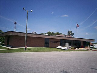
Range Regional Airport is a public use airport located four nautical miles southeast of the central business district of Hibbing, in Saint Louis County, Minnesota, United States. It was formerly known as Chisholm-Hibbing Airport or Chisholm-Hibbing Municipal Airport. The airport is mostly used for general aviation but is also served by one commercial and one charter airline. Scheduled passenger service is subsidized by the Essential Air Service program.

Arnold Palmer Regional Airport is in Westmoreland County, Pennsylvania, United States, two miles (3 km) southwest of Latrobe and about 33 miles (53 km) southeast of Pittsburgh. It was formerly Westmoreland County Airport; it was renamed in September 1999 for Arnold Palmer as part of his 70th birthday celebration. Palmer learned to fly at the airport, and the dedication ceremony included Governor Tom Ridge and a flyover of three A-10s of the Pennsylvania Air National Guard.

Helena Regional Airport is a public airport two miles northeast of Helena, in Lewis and Clark County, Montana, United States. It is owned by the Helena Regional Airport Authority.
Lincolnton–Lincoln County Regional Airport is a public use airport located five nautical miles (9 km) east of the central business district of Lincolnton, a city in Lincoln County, North Carolina, United States. It is owned by the City of Lincolnton & Lincoln County. According to the FAA's National Plan of Integrated Airport Systems for 2009–2013, it is a general aviation airport.
Charlotte–Monroe Executive Airport is a public use airport located five nautical miles (9 km) northwest of the central business district of Monroe, a city in Union County, North Carolina, United States. It is owned by the City of Monroe and was formerly known as Monroe Regional Airport.
Burlington–Alamance Regional Airport is a public use airport in Alamance County, North Carolina, United States. It is located three nautical miles (6 km) southwest of the central business district of Burlington, North Carolina, and is owned by the Burlington–Alamance Airport Authority. This airport is included in the National Plan of Integrated Airport Systems for 2011–2015, which categorized it as a general aviation facility.

South Alabama Regional Airport at Bill Benton Field, formerly known as Andalusia-Opp Airport, is a public use airport in Covington County, Alabama, United States. It is located four nautical miles east of the central business district of Andalusia and about 9 miles (14 km) west of Opp. The airport is governed by the South Alabama Regional Airport Authority, with members appointed by the Andalusia City Council, the Opp Council, and the Covington County Commission.

Stanly County Airport is a county-owned, joint civil-military, public-use airport in Stanly County, North Carolina, United States. It is located four nautical miles northeast of the central business district of Albemarle, North Carolina. This airport is included in the National Plan of Integrated Airport Systems for 2011–2015, which categorized it as a general aviation facility.
Currituck County Regional Airport is a county-owned, public-use airport in Currituck County, North Carolina, United States. It is located four nautical miles south of the central business district of Currituck, North Carolina. This airport is included in the National Plan of Integrated Airport Systems for 2011–2015, which categorized it as a general aviation facility. It was previously known as Currituck County Airport or Currituck Regional Airport.
Northeastern Regional Airport is a public use airport in Chowan County, North Carolina, United States. It is owned by the town of Edenton and located three nautical miles (6 km) southeast of its central business district. This airport is included in the National Plan of Integrated Airport Systems for 2011–2015, which categorized it as a general aviation facility.
Lumberton Municipal Airport is a city-owned, public-use airport located three nautical miles (6 km) west of the central business district of Lumberton, a city in Robeson County, North Carolina, United States. It is included in the National Plan of Integrated Airport Systems for 2011–2015, which categorized it as a general aviation facility.
Elizabeth City Regional Airport is a joint civil-military public and military use airport located three nautical miles (6 km) southeast of the central business district of Elizabeth City, in Pasquotank County, North Carolina, United States. The airport, on the shore of the Pasquotank River, is also known as Elizabeth City-Pasquotank County Regional Airport or ECG Regional Airport. It is included in the National Plan of Integrated Airport Systems for 2011–2015, which categorized it as a general aviation facility.
Baker City Municipal Airport is three miles north of Baker City, in Baker County, Oregon, United States. The National Plan of Integrated Airport Systems for 2011–2015 categorized it as a general aviation facility.

Grant County Regional Airport - GCRA is in Grant County, Oregon, a mile southwest of John Day, Oregon. The National Plan of Integrated Airport Systems for 2011–2015 categorized it as a general aviation facility.
H. L. Sonny Callahan Airport is a public-use airport located three nautical miles southeast of the central business district of Fairhope, a city in Baldwin County, Alabama, United States. It is owned by the Fairhope Airport Authority.
Council Bluffs Municipal Airport is a public use airport located four nautical miles east of the central business district of Council Bluffs, a city in Pottawattamie County, Iowa, United States. It is owned by Council Bluffs Airport Authority. This airport is included in the National Plan of Integrated Airport Systems for 2011–2015, which categorized it as a general aviation facility.

Marion County Regional Airport is a county-owned public-use airport in Marion County, Arkansas, United States. It is located one nautical mile north of the central business district of Flippin, Arkansas.

Batesville Regional Airport is a public-use airport located three nautical miles south of the central business district of Batesville, in Independence County, Arkansas, United States. It is owned by the City of Batesville.

Pocono Mountains Regional Airport is a public airport two miles northwest of Mount Pocono, in Coolbaugh Township, Monroe County, Pennsylvania. It is owned by the Pocono Mountains Regional Airport Authority. The National Plan of Integrated Airport Systems for 2011–2015 categorized it as a general aviation facility.
East Georgia Regional is a city/county-owned public-use airport in Swainsboro, Emanuel County, United States. The airport is located 2 nautical miles (4 km) southeast of the central business district of Swainsboro, Georgia. This airport is included in the National Plan of Integrated Airport Systems for 2011–2015, which categorized it as a general aviation facility.

