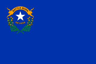
Nevada is a landlocked state in the Western region of the United States. It borders Oregon to the northwest, Idaho to the northeast, California to the west, Arizona to the southeast, and Utah to the east. Nevada is the 7th-most extensive, the 32nd-most populous, and the 9th-least densely populated of the U.S. states. Nearly three-quarters of Nevada's people live in Clark County, which contains the Las Vegas–Paradise metropolitan area, including three of the state's four largest incorporated cities. Nevada's capital is Carson City. Las Vegas is the largest city in the state.
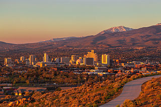
Reno is a city in the northwest section of the U.S. state of Nevada, along the Nevada–California border. It is the county seat and most populous city of Washoe County. Sitting in the High Eastern Sierra foothills, in the Truckee River valley, on the eastern side of the Sierra Nevada, it is about 23 miles (37 km) northeast of Lake Tahoe. Known as "The Biggest Little City in the World", it is the 80th most populous city in the United States, the 3rd most populous city in Nevada, and the most populous in Nevada outside the Las Vegas Valley. The city had a population of 264,165 at the 2020 census.
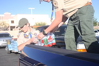
Scouting in Nevada has a long history, from the 1910s to the present day, serving thousands of youth in programs that suit the environment in which they live.

Sparks is a city in Washoe County, Nevada, United States. It was founded in 1904, incorporated on March 15, 1905, and is located just east of Reno. The 2020 U.S. Census counted 108,445 residents in the city. It is the fifth most populous city in Nevada. It is named after John Sparks, Nevada governor (1903–1908), and a member of the Silver Party.
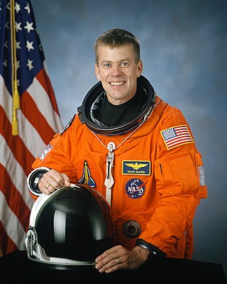
William Cameron "Willie" McCool was an American naval officer and aviator, test pilot, aeronautical engineer, and NASA astronaut, who was the pilot of Space Shuttle Columbia mission STS-107. He and the rest of the crew of STS-107 were killed when Columbia disintegrated during reentry into the atmosphere. McCool was posthumously awarded the Congressional Space Medal of Honor.
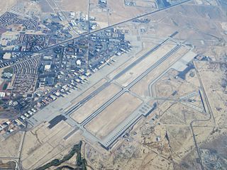
Nellis Air Force Base is a United States Air Force installation in southern Nevada. Nellis hosts air combat exercises such as Exercise Red Flag and close air support exercises such as Green Flag-West flown in "Military Operations Area (MOA) airspace", associated with the nearby Nevada Test and Training Range (NTTR). The base also has the Combined Air and Space Operations Center-Nellis.
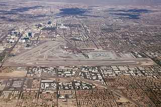
Harry Reid International Airport is an international airport serving the Las Vegas Valley, a metropolitan area in the U.S. state of Nevada. It is located five miles south of downtown Las Vegas in the unincorporated area of Paradise and covers 2,800 acres of land.

The Las Vegas Valley is a major metropolitan area in the southern part of the U.S. state of Nevada, and the second largest in the Southwestern United States. The state's largest urban agglomeration, the Las Vegas Metropolitan Statistical Area is coextensive since 2003 with Clark County, Nevada. The Valley is largely defined by the Las Vegas Valley landform, a 600 sq mi (1,600 km2) basin area surrounded by mountains to the north, south, east and west of the metropolitan area. The Valley is home to the three largest incorporated cities in Nevada: Las Vegas, Henderson and North Las Vegas. Eleven unincorporated towns governed by the Clark County government are part of the Las Vegas Township and constitute the largest community in the state of Nevada.

El Rancho Vegas was a hotel and casino at the north end of the Las Vegas Strip in Winchester, Nevada. It opened in 1941, as the first resort on the Strip, known then as part of Highway 91. It was located at what is now the southwest corner of Las Vegas Boulevard and Sahara Avenue. The El Rancho Vegas was conceived by Thomas Hull, who owned several hotels in California and wanted to expand his operations to Las Vegas. He decided to build his new resort along Highway 91, on desert land located just outside of city limits. Hull intended to target motorists traveling from Los Angeles to Las Vegas, although his remote location was met with skepticism.

Elko Regional Airport, formerly Elko Municipal Airport, is a mile west of downtown Elko, in Elko County, Nevada, United States.
Merced Regional Airport is located two miles (3.2 km) southwest of Merced, in Merced County, California. The National Plan of Integrated Airport Systems for 2021–2025 categorized it as a Commercial Service – Nonprimary airport. Commercial passenger service is subsidized by the Essential Air Service program.

Steven Alexzander Horsford is an American politician and businessman serving as the U.S. representative for Nevada's 4th congressional district since 2019, previously holding the position from 2013 to 2015. A member of the Democratic Party, he served in the Nevada Senate, representing the 4th district, in Clark County, from 2005 to 2013. Horsford was the first African American to serve as Majority Leader (2009–2013) and the first African American to represent Nevada in Congress. He lost to Republican nominee Cresent Hardy in 2014.
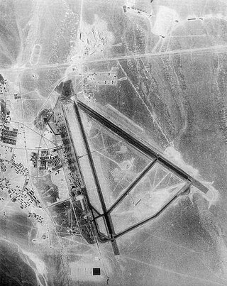
Tonopah Air Force Base is a Formerly Used Defense Site (FUDS) in the USA that was a Tonopah Basin military installation until shortly after it was designated an Air Force Base in 1948. Two of the runways still in use are maintained by Nye County, Nevada; and World War II building foundations and three hangars of the base remain at the municipal Tonopah Airport.

The History of Nevada as a state began when it became the 36th state on October 31, 1864, after telegraphing the Constitution of Nevada to the Congress days before the November 8 presidential election. Statehood was rushed to help ensure three electoral votes for Abraham Lincoln's reelection and add to the Republican congressional majorities.

The Church of Jesus Christ of Latter-day Saints in Nevada refers to the Church of Jesus Christ of Latter-day Saints and its members in Nevada. Nevada has the 7th most church members of any U.S. state, and the fifth-highest percentage of members. The LDS Church is the 2nd largest denomination in Nevada, behind the Roman Catholic Church.
The following is a timeline of the history of the city of Las Vegas, Nevada, United States.
Ice Age Fossils State Park is a 315-acre state park in North Las Vegas, Nevada, United States, on the northernmost fringe of the metropolitan area. It is located adjacent to the Tule Springs Fossil Beds National Monument near Willie McCool Regional Park. The park saw its grand opening on January 20, 2024.
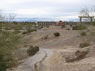
Centennial Hills Park, formerly known as Deer Springs Park, is a 120-acre regional park in Las Vegas, Nevada, United States, located in the neighborhood of Centennial Hills. It is located next to the Centennial Hills Library.

Craig Ranch Regional Park is a 170-acre regional park in North Las Vegas, Nevada, United States, located along State Route 573 and built on a former golf course.


