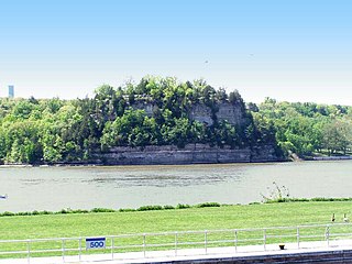
Starved Rock State Park is a state park in the U.S. state of Illinois, characterized by the many canyons within its 2,630 acres (1,064 ha). Located just southeast of the village of Utica, in Deer Park Township, LaSalle County, Illinois, along the south bank of the Illinois River, the park hosts over two million visitors annually, the most for any Illinois state park.

Fort Hawkins was a fort built between 1806 and 1810 in the historic Creek Nation by the United States government under President Thomas Jefferson and used until 1824. Built in what is now Georgia at the Fall Line on the east side of the Ocmulgee River, the fort overlooked the sacred ancient earthwork mounds of the Ocmulgee Old Fields, now known as the Ocmulgee Mounds National Historical Park. The Lower Creek Trading Path passed by just outside the fort's northwestern blockhouse, and continued in a westerly direction until it reached a natural ford on the Ocmulgee River. A trading settlement and later the city of Macon, Georgia, developed in the area prior to the construction of the fort, with British traders being in the area as early as the 1680s. Later, the fort would become important to the Creek Nation, the United States, and the state of Georgia for economic, military, and political reasons.

The Grave Creek Mound in the Ohio River Valley in West Virginia is one of the largest conical-type burial mounds in the United States, now standing 62 feet (19 m) high and 240 feet (73 m) in diameter. The builders of the site, members of the Adena culture, moved more than 60,000 tons of dirt to create it about 250–150 BC.

Manzanar was a town in Inyo County, California, founded by water engineer and land developer George Chaffey.

This is a list of more than 1,100 properties and districts in Nebraska that are on the National Register of Historic Places. Of these, 20 are National Historic Landmarks. There are listings in 90 of the state's 93 counties.

Southampton homestead is a Victorian-Georgian historical homestead located on the banks of the Blackwood River in the south west of Western Australia.

Minisink Archeological Site, also known as Minisink Historic District, is an archeological site of 1320 acres located in both Sussex County, New Jersey and Pike County, Pennsylvania. It was part of a region occupied by Munsee-speaking Lenape that extended from southern New York across northern New Jersey to northeastern Pennsylvania. The Munsee were speakers of one of the three major language dialects of the Lenape Native American tribe. This interstate territory became the most important Munsee community for the majority of the 17th and 18th centuries.

The Rogue River Ranch is a pioneer farm complex in Curry County in southwest Oregon, United States. The ranch is located on the north shore of the Rogue River just outside the Rogue River-Siskiyou National Forest. The original ranch buildings were constructed by George Billings. Later, the ranch was sold to Stanley Anderson, who increased the size of the property and built additional farm buildings. The Bureau of Land Management bought the ranch in 1970. Today, the main ranch house is a museum. The Bureau of Land Management also maintains a campground on the property. The Rogue River Ranch is listed on the National Register of Historic Places.

The Riddle Brothers Ranch is a pioneer ranch complex located in the Steens Mountain Cooperative Management and Protection Area in Harney County in eastern Oregon, United States. It is a rare extant example of the small family ranch. The ranch is located on both sides of the Little Blitzen River on public land and is administered by the Bureau of Land Management.
The Bedford Village Archeological Site (36BD90) is an archaeological site in central Bedford County, Pennsylvania, United States. Located in Bedford Township north of the borough of Bedford, it was once occupied by a Monongahela culture village. Today, the site is the location of Old Bedford Village, an open-air museum.

The James Cant Ranch is a pioneer ranch complex in Grant County in eastern Oregon, United States. The ranch is located on both sides of the John Day River in the John Day Fossil Beds National Monument. The ranch was originally homesteaded by Floyd Officer in 1890. Officer sold the property to James Cant in 1910. Cant increased the size of the property and built a modern ranch complex on the west bank of the river. The National Park Service bought the ranch from the Cant family in 1975, and incorporated the property into the John Day Fossil Beds National Monument. The National Park Service used the main house as a visitor center until 2003. Today, the Cant Ranch complex is preserved as an interpretive site showing visitors an early 20th-century livestock ranch. The James Cant Ranch is listed on the National Register of Historic Places.

The Sod House Ranch is a historic ranch in Harney County in southeastern Oregon, United States. The remaining ranch structures are located south of Malheur Lake in the Malheur National Wildlife Refuge. The ranch was built by Peter French, a well known 19th-century cattle baron. The Sod House Ranch became the headquarters for the northern operating division of the French-Glenn Livestock Company, which eventually covered over 140,000 acres (570 km2). After French was murdered in 1897, the French-Glenn Livestock Company slowly sold off its ranch property. In 1935, the United States Government purchased the Sod House Ranch property to add to an adjacent wildlife refuge. The eight remaining Sod House Ranch buildings are now listed on the National Register of Historic Places.

The David L. Shirk Ranch is a historic ranch located in the Guano Valley of eastern Lake County, Oregon, United States. The ranch was originally homesteaded in 1881. It was purchased by David L. Shirk in 1883. He operated the ranch until 1914. The property was acquired by the United States Government in 1942. The ranch is now administered by the Bureau of Land Management. The remaining historic ranch buildings are listed on the National Register of Historic Places.

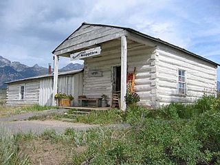
The historical buildings and structures of Grand Teton National Park include a variety of buildings and built remains that pre-date the establishment of Grand Teton National Park, together with facilities built by the National Park Service to serve park visitors. Many of these places and structures have been placed on the National Register of Historic Places. The pre-Park Service structures include homestead cabins from the earliest settlement of Jackson Hole, working ranches that once covered the valley floor, and dude ranches or guest ranches that catered to the tourist trade that grew up in the 1920s and 1930s, before the park was expanded to encompass nearly all of Jackson Hole. Many of these were incorporated into the park to serve as Park Service personnel housing, or were razed to restore the landscape to a natural appearance. Others continued to function as inholdings under a life estate in which their former owners could continue to use and occupy the property until their death. Other buildings, built in the mountains after the initial establishment of the park in 1929, or in the valley after the park was expanded in 1950, were built by the Park Service to serve park visitors, frequently employing the National Park Service Rustic style of design.

The Spikebuck Town Mound and Village Site is a prehistoric and historic archaeological site on Town Creek near its confluence with the Hiwassee River within the boundaries of present-day Hayesville, North Carolina. The site encompasses the former area of the Cherokee village of Quanassee and associated farmsteads. The village was centered on what is known as Spikebuck Mound, an earthwork platform mound, likely built about 1,000 CE by ancestral indigenous peoples during the South Appalachian Mississippian culture period.
The Lower Zuni River Archeological District is an area of approximately 29,500 acres, comprising 89 distinct archeological sites. It is located approximately 24 miles northeast of St. Johns, Arizona, at the Arizona–New Mexico border, along the Zuni River.

Sherwood Ranch Pueblo is an historic pueblo located overlooking the Little Colorado River, near Springerville, Arizona. It has two areas of habitation, consisting of over 800 rooms and was inhabited from approximately 1000-1450 A.D.


