Windmill Hill, Kent

Last updated

Windmill Hill
Kent UK location map.svg
Red pog.svg
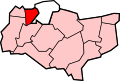
Windmill Hill
Location within Kent
District
Shire county
Region
Country England
Sovereign state United Kingdom
Post town Gravesend
Postcode district DA12
Dialling code 01474
Police Kent
Fire Kent
Ambulance South East Coast
UK Parliament
List of places
UK
England
Kent
51°26′06″N0°22′17″E / 51.434989°N 0.371518°E / 51.434989; 0.371518

Windmill Hill is an area of Gravesend, Kent. It is named for its erstwhile windmills, offers extensive views across the Thames, and was a popular spot for Victorian visitors to the town, because of the Camera obscura installed in the old mill and for its tea gardens and other amusements. The hill was the site of a beacon in 1377, which was instituted by Richard II, and still in use 200 years later at the time of the Spanish Armada, although the hill was then known as "Rouge Hill". A modern beacon was erected and lit, by then-Mayor Peter Hart, during 1988, for the 400th anniversary of the defeat of the Spanish Armada.

During the reign of Elizabeth I the first windmill was placed on top the highest point in Gravesend, 179 ft (55 m) above the high water mark of the river. One mill burnt down in 1763, but was replaced the following year and was demolished, having become derelict, in 1894 - the last surviving windmill on the hill. The adjacent public house was destroyed by fire during Mafeking Night celebrations in 1900. [1]

In August 1606 King James, Anne of Denmark, her brother Christian IV of Denmark, and Prince Henry came to Upnor Castle. They had dinner aboard the Elizabeth Jonas . After dinner they took coaches to Windmill Hill to watch naval cannon salutes. [2]

During World War I a German airship passed over Windmill Hill and dropped bombs on it. Today there are three markers indicating where these bombs struck.

Windmill Hill is one of Gravesham's 24 conservation areas. [3] The 'Windmill Hill Association' [4] [5] , Gravesham Borough Council looks after matters related to the area and holds regular meetings to discuss local issues.

Related Research Articles

<span class="mw-page-title-main">Windmill</span> Machine that makes use of wind energy

A windmill is a structure that converts wind power into rotational energy using vanes called sails or blades, by tradition specifically to mill grain (gristmills), but in some parts of the English-speaking world, the term has also been extended to encompass windpumps, wind turbines, and other applications. The term wind engine is also sometimes used to describe such devices.

<span class="mw-page-title-main">Mitcham</span> Human settlement in England

Mitcham is an area within the London Borough of Merton in Southwest London, England. It is centred 7.2 miles (11.6 km) southwest of Charing Cross. Originally a village in the county of Surrey, today it is mainly a residential suburb, and includes Mitcham Common. It has been a settlement throughout recorded history.

<span class="mw-page-title-main">Gravesend</span> Town in Kent, England

Gravesend is a town in northwest Kent, England, situated 21 miles (35 km) east-southeast of Charing Cross on the south bank of the River Thames and opposite Tilbury in Essex. Located in the diocese of Rochester, it is the administrative centre of the borough of Gravesham. Gravesend marks the eastern limit of the Greater London Built-up Area, as defined by the UK Office for National Statistics. In 2021 it had a population of 58,102.

<span class="mw-page-title-main">Gravesham</span> Borough and non-metropolitan district in England

Gravesham is a local government district with borough status in north-west Kent, England. The council is based in its largest town of Gravesend. The borough is indirectly named after Gravesend, using the form of the town's name as it appeared in the Domesday Book of 1086. The district also contains Northfleet and a number of villages and surrounding rural areas.

<span class="mw-page-title-main">Tilbury</span> Human settlement in England

Tilbury is a port town in the borough of Thurrock, Essex, England. The present town was established as separate settlement in the late 19th century, on land that was mainly part of Chadwell St Mary. It contains a 16th century fort and an ancient cross-river ferry. Tilbury is part of the Port of London with a major deep-water port which contributes to the local economy. Situated 24 miles (38.5 km) east of central London and 23 miles (37 km) southwest of Southend-on-Sea, it is also the southernmost point in Essex.

<span class="mw-page-title-main">Cobham, Kent</span> Village and civil parish in England

Cobham is a village and civil parish in the borough of Gravesham in Kent, England. The village is located 6 miles (10 km) south-east of Gravesend, and just south of Watling Street, the Roman road from Dover to London. The parish, which includes the hamlet of Sole Street, covers an area of 1,240 hectares and had a population of 1,469 at the 2011 census, increasing from 1,328 at the 2001 census.

<span class="mw-page-title-main">Northfleet</span> Human settlement in England

Northfleet is a town in the borough of Gravesham in Kent, England. It is located immediately west of Gravesend, and on the border with the Borough of Dartford. Northfleet has its own railway station on the North Kent Line, just east of Ebbsfleet International railway station on the High Speed 1 line. According to the 2021 census, Northfleet has a population of 29,900.

<span class="mw-page-title-main">Meopham</span> Human settlement in England

Meopham is a large linear village and civil parish in the Borough of Gravesham in north-west Kent, England, lying to the south of Gravesend. The parish covers 6.5 square miles (17 km2), and comprises two villages and two smaller settlements; it had a population of 6,795 at the 2021 census. Meopham village is sometimes described as the longest settlement in England although others such as Brinkworth which is one village make the same claim. Meopham is one of the longest linear settlements in Europe, being 7 miles (11 km) in length.

<span class="mw-page-title-main">Milton-next-Gravesend</span> Ecclesiastical parish in Kent, England

Milton-next-Gravesend is an area and ecclesiastical parish, part of the Gravesend built-up area, in the Gravesham district, north-west of Kent, England.

<span class="mw-page-title-main">Hampton Hill</span> Suburb of south west London

Hampton Hill is a district in the London Borough of Richmond upon Thames to the south of Twickenham. It is bounded by Fulwell and Twickenham Golf Courses to the northwest; a railway line road bridge at the junction of Wellington Road and Clonmel Road; a line southward just east of Wellington Road; Bushy Park to the southeast; and the artificial Longford River to the south and west. Hampton Hill is served by Fulwell railway station and Hampton railway station on the Shepperton to Waterloo line. It is part of what is collectively known as The Hamptons. Much of Hampton Hill High Street, and some neighbouring residential areas are designated as a conservation area.

<span class="mw-page-title-main">West Tilbury</span> Village in England

West Tilbury is a village and former civil parish in the Thurrock district, in the ceremonial county of Essex, England. It is on the top of and on the sides of a 30 metres (98 ft) tall river terrace overlooking the River Thames. Part of the modern town of Tilbury is within the traditional parish of West Tilbury. In 1931 the parish had a population of 444. On 1 April 1936 the parish was abolished to form Thurrock.

<span class="mw-page-title-main">Westwell, Kent</span> Human settlement in England

Westwell is a village and relatively elevated civil parish with a population of 740 (2001), centred 4 miles (6 km) north of Ashford in Kent, England, in the Borough of Ashford.

<span class="mw-page-title-main">Singlewell or Ifield</span> Human settlement in England

Singlewell or Ifield is the name given to the area south of Gravesend in Kent, England.

<span class="mw-page-title-main">Union Mill, Cranbrook</span> Grade I listed smock mill in Cranbrook, Kent, England

Union Mill is a Grade I listed smock mill in Cranbrook, Kent, England, which has been restored to working order. It is the tallest smock mill in the United Kingdom.

<span class="mw-page-title-main">Killick's Mill, Meopham</span> Windmill in Kent, England

Killick's Mill is a Grade II* listed smock mill in Meopham, Kent, England that was built in 1801 and which has been restored.

<span class="mw-page-title-main">The Bat and Ball Ground</span> Sports ground in Gravesend, Kent

The Bat & Ball Ground is a cricket and sports ground in Gravesend in Kent. The ground was used as a first-class cricket venue by Kent County Cricket Club between 1849 and 1971. It remains in use by Gravesend Cricket Club who have used the ground as their home since their formation in 1881. The site also has lawn bowls and tennis facilities and is the home of Gravesend Bowls Club.

<span class="mw-page-title-main">The Mill Field</span> Open space in London, England

The Mill Field is a 3.4-hectare (8.4-acre) Site of Borough Importance for Nature Conservation, Grade II, in Mill Hill in the London Borough of Barnet. It is a public open space which slopes steeply down from the road called The Ridgeway. It may be the site of the windmill which gave the area its name. This was documented as early as 1321 and had disappeared by 1754.

Toltingtrough was a hundred in the Lathe of Aylesford in the county of Kent, England. This hundred is called, in some ancient writings, Toltetern and Tollentr, and in Domesday, Tollentru. In the return made of the several knights fees throughout England, by inquisition into the exchequer, in the 7th year of king Edward I, the archbishop of Canterbury appears to have been then lord of this Hundred.

<span class="mw-page-title-main">George Beeston</span> Member of the Parliament of England

Sir George Beeston or Beston was an English landowner, courtier, soldier and sailor. He was the captain of the Dreadnought in 1588, Member of Parliament for Cheshire in 1589 and Ranger of Delamere Forest.

<span class="mw-page-title-main">Gravesend Town Hall</span> Municipal building in Gravesend, Kent, England

Gravesend Town Hall is a municipal building in the High Street in Gravesend, Kent, England. The town hall, which was the headquarters of Gravesend Municipal Borough Council, is a Grade II* listed building.

References

  1. Coles Finch, William (1933). Watermills and Windmills. London: C W Daniel Company.
  2. John S. Brewer, Court of James the First, vol. 2 (London, 1839), pp. 138-143: Thomas Birch, Court and Times of James the First, vol. 1 (London, 1848), pp. 65-7.
  3. Conservation Areas, Gravesham Borough Council
  4. List of specific and general consultation bodies
  5. Windmill Hill Association Facebook page