Wonokromo Kecamatan Wonokromo | |
|---|---|
 Graha Bumiputera Wonokromo | |
 Map of Wonokromo in Surabaya | |
 Interactive map outlining Wonokromo | |
| Coordinates: 7°18′01″S112°44′15″E / 7.30032°S 112.737509°E | |
| Country | |
| Province | East Java |
| City | Surabaya |
| Area | |
• Total | 8.26 km2 (3.19 sq mi) |
| BPS [1] | |
| Population (mid 2024 estimate) | |
• Total | 153,563 |
| • Density | 19,000/km2 (48,000/sq mi) |
| Time zone | GMT +7 |
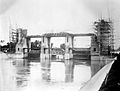
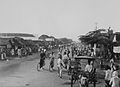
Wonokromo is an administrative district (kecamatan) in the city of Surabaya, Indonesia. The Wonokromo railway station serves the area. The Kalimas River originally turned north and empties into the Tanjung Perak and Kali Jagir, a manmade branch of the river that connects east to the sea and includes a dam built by the Dutch. The area is also home to DTC (Darmo Trade Center) formerly the Wonokromo Market. [2]