Wyodak | |
|---|---|
 Wyodak, as seen from Wyoming Highway 51, December 2017 | |
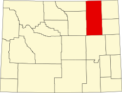
 Wyodak Location within the state of Wyoming  Wyodak Wyodak (the United States) | |
| Coordinates: 44°17′29″N105°22′47″W / 44.29139°N 105.37972°W | |
| Country | United States |
| State | Wyoming |
| County | Campbell |
| Elevation | 4,423 ft (1,348 m) |
| Time zone | UTC-7 (Mountain (MST)) |
| • Summer (DST) | UTC-6 (MDT) |
| ZIP codes | 82718 |
| Area code | 307 |
| GNIS feature ID | 1596649 [1] |
Wyodak is an unincorporated community in east-central Campbell County, Wyoming, United States. [1]