Balakən (also, Balakan, Belokan, and Belokany; Azerbaijani: Balakən; Avar: Билкан is a city and municipality in, and the capital of, the Balakan Rayon of Azerbaijan.

This is a list of the extreme points of Azerbaijan, the points that are farther north, south, east or west than any other location.

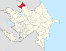
Qarahacılı is a village in the Balakan Rayon of Azerbaijan. The village forms part of the municipality of Kortala.
Nohurdüzü is a village in the Quba Rayon of Azerbaijan. The village forms part of the municipality of Yerfi.
Dzhibir-Kazmalary is a village in the Qusar Rayon of Azerbaijan.
Ağarəhimoba is a village in the Khachmaz Rayon of Azerbaijan. The village forms part of the municipality of Qadaşoba.
Düztahiroba is a village in the Khachmaz Rayon of Azerbaijan. The village forms part of the municipality of Yalama.
Masqarabinə is a village in the Zaqatala Rayon of Azerbaijan. The village forms part of the municipality of Dombabinə.
Qass is a village in the Zaqatala Rayon of Azerbaijan.
Levakend is a village in the Dashkasan Rayon of Azerbaijan. Levakend is approximately 3.2 km away from the capital of Dashkasan Rayon, Yukhary-Dashkesan in a straight line. It is also approximately 325 km west of Azerbaijan's capital, Baku in a straight line.
Barkhalbina is a village in the Zaqatala Rayon of Azerbaijan.
Cillik is a village in the municipality of Qazma in the Balakan Rayon of Azerbaijan.
Yuxarı Fərəcan is a village in the Lachin Rayon of Azerbaijan.
Aşağı Cicimli is a village in the Lachin Rayon of Azerbaijan.
Minaxür is a village and the least populous municipality in the Qusar Rayon of Azerbaijan. It has a population of 242.
Caqarqışlaq is a village and municipality in the Qusar Rayon of Azerbaijan. It has a population of 615.
Urvaoba is a village in the municipality of Urva in the Qusar Rayon of Azerbaijan.
Xanalılar is a village in the Shusha Rayon of Azerbaijan.
Sumaylı is a village in the municipality of Göyəm in the Zaqatala Rayon of Azerbaijan.
Çiçibinə is a village in the municipality of Mazıx in the Zaqatala Rayon of Azerbaijan.