Mink Brook is a 9.5-mile (15.3 km) long stream in western New Hampshire in the United States. It is a tributary of the Connecticut River, which flows to Long Island Sound.

Kadłub is a village in the administrative district of Gmina Miękinia, within Środa Śląska County, Lower Silesian Voivodeship, in south-western Poland. Prior to 1945 it was in Germany.
Lipnica is a village in the administrative district of Gmina Wołów, within Wołów County, Lower Silesian Voivodeship, in south-western Poland. Prior to 1945 it was in Germany.
Drzonowo is a village in the administrative district of Gmina Lisewo, within Chełmno County, Kuyavian-Pomeranian Voivodeship, in north-central Poland. It lies approximately 5 kilometres (3 mi) south of Lisewo, 22 km (14 mi) south-east of Chełmno, and 26 km (16 mi) north of Toruń.

Vardablur is a town in the Aragatsotn Province of Armenia.
Chałupska is a village in the administrative district of Gmina Mogilno, within Mogilno County, Kuyavian-Pomeranian Voivodeship, in north-central Poland.
Budy is a village in the administrative district of Gmina Rajgród, within Grajewo County, Podlaskie Voivodeship, in north-eastern Poland. It lies approximately 4 kilometres (2 mi) south of Rajgród, 18 km (11 mi) east of Grajewo, and 72 km (45 mi) north-west of the regional capital Białystok.
Rybczyzna is a village in the administrative district of Gmina Rajgród, within Grajewo County, Podlaskie Voivodeship, in north-eastern Poland. It lies approximately 4 kilometres (2 mi) south of Rajgród, 18 km (11 mi) east of Grajewo, and 72 km (45 mi) north-west of the regional capital Białystok.

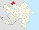
Meshaoba is a village in the Balakan Rayon of Azerbaijan.
Drochów Dolny is a village in the administrative district of Gmina Morawica, within Kielce County, Świętokrzyskie Voivodeship, in south-central Poland. It lies approximately 6 kilometres (4 mi) south-west of Morawica and 21 km (13 mi) south of the regional capital Kielce.
Kobusy is a village in the administrative district of Gmina Sobolew, within Garwolin County, Masovian Voivodeship, in east-central Poland. It lies approximately 5 kilometres (3 mi) south of Sobolew, 23 km (14 mi) south of Garwolin, and 75 km (47 mi) south-east of Warsaw.
Tomczyce is a village in the administrative district of Gmina Mogielnica, within Grójec County, Masovian Voivodeship, in east-central Poland.
Rostki-Piotrowice is a village in the administrative district of Gmina Małkinia Górna, within Ostrów Mazowiecka County, Masovian Voivodeship, in east-central Poland.
Paliszewo is a village in the administrative district of Gmina Czarnków, within Czarnków-Trzcianka County, Greater Poland Voivodeship, in west-central Poland. It lies approximately 10 kilometres (6 mi) east of Czarnków and 61 km (38 mi) north of the regional capital Poznań.
Karolewo is a village in the administrative district of Gmina Wronki, within Szamotuły County, Greater Poland Voivodeship, in west-central Poland.
Dankowice Drugie is a village in the administrative district of Gmina Krzepice, within Kłobuck County, Silesian Voivodeship, in southern Poland. It lies approximately 4 kilometres (2 mi) south-west of Krzepice, 18 km (11 mi) west of Kłobuck, and 81 km (50 mi) north of the regional capital Katowice.
Mnichus is a village in the administrative district of Gmina Ozimek, within Opole County, Opole Voivodeship, in south-western Poland.
Pieniążkowo is a village in the administrative district of Gmina Gniew, within Tczew County, Pomeranian Voivodeship, in northern Poland. It lies approximately 17 kilometres (11 mi) south-west of Gniew, 45 km (28 mi) south of Tczew, and 75 km (47 mi) south of the regional capital Gdańsk.
Kulice is a village in the administrative district of Gmina Pelplin, within Tczew County, Pomeranian Voivodeship, in northern Poland. It lies approximately 5 kilometres (3 mi) south of Pelplin, 25 km (16 mi) south of Tczew, and 54 km (34 mi) south of the regional capital Gdańsk.
Pieńkowo is a village in the administrative district of Gmina Postomino, within Sławno County, West Pomeranian Voivodeship, in north-western Poland. It lies approximately 2 kilometres (1 mi) south-west of Postomino, 14 km (9 mi) north of Sławno, and 183 km (114 mi) north-east of the regional capital Szczecin.