Höytala

Last updated

Coordinates: 41°34′49″N46°29′36″E / 41.58028°N 46.49333°E / 41.58028; 46.49333

Geographic coordinate system Coordinate system

A geographic coordinate system is a coordinate system that enables every location on Earth to be specified by a set of numbers, letters or symbols. The coordinates are often chosen such that one of the numbers represents a vertical position and two or three of the numbers represent a horizontal position; alternatively, a geographic position may be expressed in a combined three-dimensional Cartesian vector. A common choice of coordinates is latitude, longitude and elevation. To specify a location on a plane requires a map projection.

Höytala
Azerbaijan adm location map.svg
Red pog.svg
Höytala
Coordinates: 41°34′49″N46°29′36″E / 41.58028°N 46.49333°E / 41.58028; 46.49333
CountryFlag of Azerbaijan.svg  Azerbaijan
Rayon Zaqatala
Municipality Maqov
Time zone AZT (UTC+4)
  Summer (DST) AZT (UTC+5)

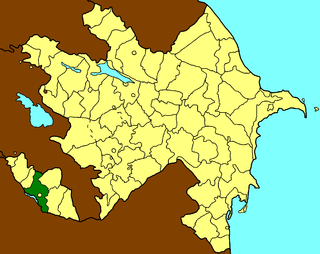
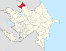
Höytala, [1] old name Oytala (also, Voıtala) is a village in the Zaqatala Rayon of Azerbaijan. The village forms part of the municipality of Maqov. [2]

Azerbaijan Country in the South Caucasus

Azerbaijan, officially the Republic of Azerbaijan, is a country in the South Caucasus region of Eurasia at the crossroads of Eastern Europe and Western Asia. It is bounded by the Caspian Sea to the east, Russia to the north, Georgia to the northwest, Armenia to the west and Iran to the south. The exclave of Nakhchivan is bounded by Armenia to the north and east, Iran to the south and west, and has an 11 km long border with Turkey in the northwest.

Maqov Municipality in Zaqatala, Azerbaijan

Maqov is a village and municipality in the Zaqatala Rayon of Azerbaijan. It has a population of 4,321. The municipality consists of the villages of Maqov, Abalı, Paşan, Yolayrıc, Oytala, and Voytala.

Related Research Articles

Azərbaycan marşı National anthem of Azerbaijan

"Azərbaycan Marşı" or the March of Azerbaijan, is the national anthem of Azerbaijan. The music was composed by Uzeyir Hajibeyov, with lyrics by poet Ahmad Javad. The government officially adopted the anthem in 1920 with the passage of the decree, "On the State Hymn of the Republic of Azerbaijan." In 1992, after the fall of the Soviet Union, Azerbaijan's government officially restored "Azərbaycan Marşı" as the national anthem.

Babek District Rayon in Nakhchivan, Azerbaijan

Babek or Babak is a rayon of Azerbaijan in the Nakhchivan Autonomous Republic. It was formerly known as Nakhchivan District. The district named in honour of Babak Khorramdin, who led a 23-year-long uprising against the Abbasid Caliphate in Iranian Azerbaijan.

Shahbuz District Rayon in Nakhchivan, Azerbaijan

Shahbuz is a rayon of Azerbaijan in the Nakhchivan Autonomous Republic. Shahbuz district was established in August 8, 1930. In the north and east, it is bordered by the Republic of Armenia. The area of the district is 836.58 square kilometres (323.01 sq mi). There are 1 city, 1 settlement and 22 villages within the district. The district capital is Şahbuz.

Lerik, Azerbaijan Place in Lerik, Azerbaijan

Lerik is the capital city of Lerik Rayon in the southern area of Azerbaijan not far from the Iranian border.

Kilvar Place in Davachi, Azerbaijan

Kilvar is a village in the Davachi Rayon of Azerbaijan. The village forms part of the municipality of Pirəbədil.

Qızılkənd Municipality in Imishli, Azerbaijan

Qızılkənd is a village and municipality in the Imishli Rayon of Azerbaijan. It has a population of 3,337.

İyirmi Altı Bakı Komissarı Place in Neftchala, Azerbaijan

İyirmi Altı Bakı Komissarı was town in the Neftchala Rayon of Azerbaijan until 1993.

Kamo, Azerbaijan Place in Goygol, Azerbaijan

Kamo is a former village in the Goygol Rayon of Azerbaijan. The ethnic Armenians that populated the village and the neighbouring village of Azad left in the course of the Nagorno-Karabakh War. In 1989, both villages became home to ethnic Azeri refugees from Zod, Armenia. Azad became the new municipal seat known as Yeni Zod. Kamo was incorporated into Yeni Zod and lost its status as a village in 1999.

Moruxlu Place in Gadabay, Azerbaijan

Moruxlu is a village in the Gadabay Rayon of Azerbaijan. The village forms part of the municipality of Samanlıq.

Hacıxanlı Place in Lachin, Azerbaijan

Hacıxanlı is a village in the Lachin Rayon of Azerbaijan.

Zuxuloba, Qusar Place in Qusar, Azerbaijan

Zuxuloba is a village in the Qusar Rayon of Azerbaijan. The village forms part of the municipality of Şirvanovka.

Kurkend is a village and municipality in the Neftchala Rayon of Azerbaijan. It has a population of 1,749.

Şirvanlı, Neftchala Place in Neftchala, Azerbaijan

Şirvanlı is a village and municipality in the Neftchala Rayon of Azerbaijan. It has a population of 478.

Dalğalı, Neftchala Place in Neftchala, Azerbaijan

Dalğalı is a village in the municipality of Mikayıllı in the Neftchala District of Azerbaijan.

Tatoba is a village in the municipality of Osakücə in the Lankaran Rayon of Azerbaijan.

Eçara Place in Jalilabad, Azerbaijan

Eçara is a village in the Jalilabad Rayon of Azerbaijan. It forms part of the municipality of Ləzran

Yenikənd, Ismayilli Place in Ismailli, Azerbaijan

Yenikənd is a village in the Ismayilli Rayon of Azerbaijan. The village forms part of the municipality of Kəlbənd.

Künövşə Place in Siazan, Azerbaijan

Künövşə is a village in the Siazan Rayon of Azerbaijan. The village forms part of the municipality of Yuxarı Ələz.

Məzəm Place in Qazakh, Azerbaijan

Məzəm is a village in the Qazakh Rayon of Azerbaijan.

References