
Mugu District, a part of Karnali Province, is one of the seventy-seven districts of Nepal. The district, with Gamgadhi as its district headquarters, covers an area of 3,535 km2 (1,365 sq mi) and had a population (2011) of 55,286. Mugu is known for being both the most remote district in Nepal, as well as the least developed.

Panchthar district is one of 14 districts of Province No. 1 of eastern hilly region of Nepal. It is a Hill district of eastern Nepal. The district covers 1,241 km2 (479 sq mi) of area. The 2011 census counted 191,817 population. Phidim is the district headquarters.

Ranishwara is a village development committee in Gorkha District in Gandaki Province of northern-central Nepal. At the time of the 1991 Nepal census it had a population of 2,993 and had 580 houses in the town.
Jarayotar is a Village Development Committee in Bhojpur District in the Kosi Zone of eastern Nepal. At the time of the 2011 Nepal census it had a population of 4031 persons residing in 721 individual households. According to ancestors, this place had a large forest with many animals among which antelope were abundant and the land was dug by them to form a plain land. So, the name of the village was kept Jarayotar.
Syamsila is a village development committee in Bhojpur District in the Kosi Zone of eastern Nepal. At the time of the 1991 Nepal census it had a population of 2767 persons living in 517 individual households.
Thulo Dumba is a village development committee in the Bhojpur District and the Kosi Zone of eastern Nepal. According to the 1991 Nepal census, it had a population of 2604 people living in 537 individual households.
Laxmipur is a town and former Village Development Committee in Ilam District in the Province No. 1 of eastern Nepal.
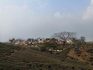
Soyak is a town and Village Development Committee in Ilam District in the Province No. 1 of eastern Nepal. At the time of the 1991 Nepal census, it had a population of 2,758 living in 494 individual households.
Madanpur, Nepal is a Village Development Committee in Nuwakot District in the Bagmati Zone of central Nepal. At the time of the 1991 Nepal census it had a population of 7995 people residing in 1334 individual households.
Chhimkeshwari is a village development committee in Tanahu District in the Gandaki Zone of central Nepal. At the time of the 2011 Nepal census it had a population of 1887 people living in 356 individual households.
Lakhanpur is a Village Development Committee in Ramechhap District in the Janakpur Zone of north-eastern Nepal. At the time of the 1991 Nepal census it had a population of 6,058 people residing in 1,100 individual households.
Dandagaun is a small village located northern part of Mahalaxmi Municipality at Dhankuta district in the Province no. 1 of eastern Nepal. At the time of the 1991 Nepal census it had a population of 1838 people living in 924 individual households. But latest survey which hold by village it has more than 2500 population.
Udayapur Dhurmi is a village development committee in Parsa District in the Narayani Zone of southern Nepal. At the time of the 2011 Nepal census it had a population of 7,163 people living in 1,085 individual households.
Bhairabsthan is a village development committee in the Palpa District of the Lumbini Zone in southern Nepal. According to the 1991 Nepal census, it had a population of 2937 people living in 544 individual households.
Gejha is a town in the Rampur Municipality of the Palpa District in the Lumbini Zone of southern Nepal. This municipality was established on 18 May 2014 by merging the existing Gadakot, Gejha, Khaliban, and Darchha village development committee. At the time of the 1991 Nepal census, it had a population of 4804 people, living in 851 individual households.
Kusumkhola is a village development committee in Palpa District in the Lumbini Zone of southern Nepal. At the time of the 1991 Nepal census it had a population of 1809 people living in 349 individual households.
Palung Mainadi is a village development committee in Palpa District in the Lumbini Zone of southern Nepal. At the time of the 1991 Nepal census it had a population of 2675 people living in 445 individual households.
Bharpa is a village development committee in Panchthar District in the Province No. 1 of eastern Nepal. At the time of the 1991 Nepal census it had a population of 6180 people living in 1089 individual households.
Sinhadevi Sombare is a village development committee in Morang District in the Kosi Zone of south-eastern Nepal. At the time of the 1991 Nepal census it had a population of 2554 people living in 477 individual households.
Parsauni is a village development committee in Nawalparasi District in the Lumbini Zone of southern Nepal. At the time of the 2001 Nepal census it had a population of 6000 people living in 850 individual households.
