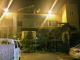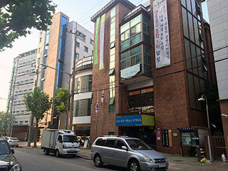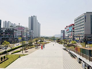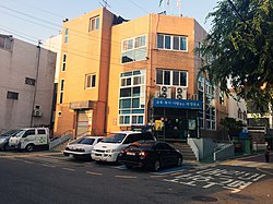
Gwangmyeong is a city in Gyeonggi Province, South Korea. It borders Seoul to the east, north and northeast, Anyang to the southeast, Siheung to the southwest, and Bucheon to the northeast.

Namyangju is a city in Gyeonggi Province, South Korea. To the east is Gapyeong County, to the west is Guri City, and to the north is Pocheon City. Namyangju-si was originally a southern part of Yangju-gun, but was separated into Namyangju-gun in April 1980. In 1995, Migeum-si and Namyangju-gun were merged to form an urban and rural complex. The city hall is located in Geumgok-dong and Dasan-dong, and the administrative districts are 6-eup, 3-myeon, and 7-dong.

Uiwang is a city in Gyeonggi Province, South Korea. It is one of many satellite cities that ring Seoul, making up the Seoul Capital Area. Its largest immediate urban neighbor is Anyang. The low peaks of the Gwangju Mountains shape the local landscape.

Yeongdeungpo District is an administrative district in southwest Seoul, South Korea. Although the origin of the name is uncertain, the first two syllables are thought to be from "yeongdeung" (靈登) or "divine ascent", a shamanic rite. The third syllable is "po", representing the bank of a river (浦), referring to the district's position on the Han River. The 2006 population was 408,819.
Yeonhui-dong (Korean: 연희동) is a dong (neighbourhood) at the center of Seodaemun-gu in Seoul, South Korea. It is an area in Seoul near Yonsei university, and actually the name Yonsei comes from the combination of Yeonhui and Severance.

Geumcheon District is one of the 25 gu (districts) of Seoul, South Korea. It was created from southern parts of Guro District and tiny sections from Gwangmyeong in 1995. Its district office is located in front of Siheung Station, now Geumcheon District Office Station, in Siheung-dong.

Bangbae-dong is a dong, or neighbourhood of the greater Gangnam area Seocho District district of the South Korean city of Seoul. Bangbae-dong is divided into 5 different dongs which are Bangbaebon-dong, Bangbae 1-dong, 2-dong, 3-dong and 4-dong. The origin of Bangbae-dong is derived from the name Bangbae, meaning "dong-ri with my back to Mt. Myeon-ri," which rises on the border between Gwanak District and Seocho District. Bangbae-dong was Bangbae-ri, Sangbuk-myeon, Gwacheon-gun, Gyeonggi-do until the end of the Joseon Dynasty, but became Bangbae-ri, Sindong-myeon, Siheung-gun, Gyeonggi-do in 1914 when the area was confirmed during the Japanese colonial period. It was incorporated into the Seoul Metropolitan Government following the expansion of the Seoul Metropolitan Government's zone in 1963, and became Bangbae-dong to this day. The location is Dong at the western end of Seocho District, and it is an area from the intersection of the road from Seoul to Gwacheon City and the southern circulation road to Umyeon Mountain.

Bupyeong District is one of the 10 administrative divisions that comprise Incheon, South Korea. Bupyeong District comprises an area of 12.35 square miles, and has a population of 508,587. It is located north of Namdong District, east of Seo District, and south of Gyeyang District. The city of Bucheon, in neighboring Gyeonggi Province, comprises its eastern limit.

Samseong-Dong is an affluent neighborhood or ward of Gangnam-gu in Seoul, South Korea.

Bangi-dong (Korean: 방이동) is a neighborhood, dong of Songpa District, Seoul, South Korea.

Dangsan-dong is a dong (neighborhood) of Yeongdeungpo District, Seoul, South Korea.

Daerim-dong is a dong (neighborhood) of Yeongdeungpo District, Seoul, South Korea.

Dorim-dong is a dong (neighborhood) of Yeongdeungpo District, Seoul, South Korea.
Yanghwa-dong is a dong, neighbourhood of Yeongdeungpo-gu in Seoul, South Korea. It is a legal dong managed by its administrative dong, Yangpyeong 2-dong

Bogwang-dong is a dong (neighborhood) of Yongsan District in Seoul, South Korea.
Jugyo-dong is a legal dong, or neighbourhood of the Jung-gu district in Seoul, South Korea. It is governed by its administrative dong, Euljiro 3, 4, 5ga-dong.

Ipbuk-dong is an administrative neighbourhood in Gwonseon-gu, Suwon, Gyeonggi Province, South Korea. Ipbuk-dong is divided into two different legal-status neighbourhoods, namely Ipbuk-dong and Dangsu-dong, which are separated by the Hwanggujicheon—a stream which flows south from Wangsong Reservoir on their northern boundary with the city of Uiwang, through Suwon, eventually to Asan Bay. Dangsu-dong has Suwon's sole boundary with Ansan, and meets Hwaseong further south. The neighbourhood is 96% green belt.
Siheung County, alternatively Shihŭng County was a county (gun) in Gyeonggi Province, South Korea. This county was abolished in 1989 as its one town(읍) of Sorae and two townships(면) of Gunja and Suam became Siheung City at the same time. Today's Siheung City area did not belong to Siheung County before 1914. The area rather was part of old Incheon or Ansan.
Wa-dong is neighbourhood of Danwon-gu, Ansan, Gyeonggi Province, South Korea. It is located in Gwangdeoksan Mountain, a famous tourist attraction in Ansan, a sports park and a driver's license test site, a public cemetery, exclusive soccer, badminton, and basketball courts, so sports facilities and parks are in good harmony. Hwajeongcheon Stream flows outside the east, but an undeveloped mountain blocks the center, dividing the living area. It consists of a housing type in which single-family households such as multi-family and multi-family households are more than 90%, and low-income families with 80% of tenants mainly live. It is an area in urgent need of redevelopment as nine distribution stores, the largest commercial site in the jurisdiction, are stagnating due to their small size.

Hosu-dong is dong (neighborhood) of Danwon District, Ansan, Gyeonggi Province, South Korea. It is located in the center of the new city according to the second stage development plan of the new city in Ansan. It is a residential city where large-scale apartment and general housing are combined, and has various urban structures where education, culture, commerce, and business facilities are concentrated.


