Yesnaby

Last updated

Yesnaby
Ruin alongside standing stone - geograph.org.uk - 5397762.jpg
Orkney Islands UK location map.svg
Red pog.svg
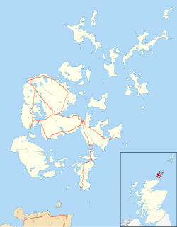
Yesnaby
Location within Orkney
Civil parish
Council area
Country Scotland
Sovereign state United Kingdom
Police Scotland
Fire Scottish
Ambulance Scottish
List of places
UK
Scotland
59°01′23″N3°21′07″W / 59.023°N 3.352°W / 59.023; -3.352
Yesnaby Castle sea stack Sea stack near Yesnaby on Orkney mainland - geograph.org.uk - 35405.jpg
Yesnaby Castle sea stack
Yesnaby Cliffs with a westerly wind blowing Yesnaby Cliffs Orkney Mainland.jpg
Yesnaby Cliffs with a westerly wind blowing

Yesnaby (historic: Yeskenaby, Yestnaby) is a historic township [1] [2] in Sandwick, on the west coast of Orkney Mainland, Scotland, south of Skara Brae. It is renowned for its spectacular Old Red Sandstone coastal cliff scenery which includes sea stacks, blowholes, geos and frequently boiling seas. A car park, coastal trail and interpretive panels serve visitors. The area is popular with climbers because of Yesnaby Castle, a two-legged sea stack just south of the Brough of Bigging. The stack is sometimes described as a smaller version of the Old Man of Hoy.[ citation needed ] Yesnaby is also one of the very few places where Primula scotica grows.

Contents

Geology

The coastal cliffs are formed from the Lower Devonian sandstones ascribed to the Yesnaby Sandstone Group - a set of geological formations restricted to the Yesnaby area, and to the overlying beds of the Lower Stromness Flagstones. Fossil stromatolites from 390 to 400 million years ago can be found in the cliffs in the latter. They are locally known as Horse Tooth Stones from a supposed resemblance.[ citation needed ]

Culture

Orkney folklore has it that a woman known as the "Yesnaby Healer" had the ability to stop bleeding in any person, even over a distance. The Orkney composer Peter Maxwell Davies has immortalised Yesnaby through "Yesnaby Ground", an Interlude for solo piano.

The Archaeology Institute of the University of the Highlands and Islands initiated the Yesnaby Art & Archaeology Research Project [3]

History

During the Second World War an anti-aircraft battery was built on the cliff top at Yesnaby as part of the defences of the Royal Navy base at Scapa Flow. The battery was manned by the Royal Navy and some traces of the wartime buildings remain. [4]

Related Research Articles

<span class="mw-page-title-main">Orkney</span> Archipelago, county and council area in northern Scotland

Orkney, also known as the Orkney Islands, is an archipelago in the Northern Isles off the north coast of Scotland. Orkney is 10 miles (16 km) north of Caithness and has about 70 islands, of which 20 are inhabited. The largest island, the Mainland, has an area of 523 square kilometres (202 sq mi), making it the sixth-largest Scottish island and the tenth-largest island in the British Isles. Orkney's largest settlement, and also its administrative centre, is Kirkwall.

<span class="mw-page-title-main">Hoy, Orkney</span> Island in the Orkney Islands group

Hoy is an island in Orkney, Scotland, measuring 143 square kilometres (55 sq mi) – the second largest in the archipelago, after Mainland. A natural causeway, the Ayre, links the island to the smaller South Walls; the two islands are treated as one entity by the UK census. Hoy is also the name of a hamlet in the northwest of the island.

<span class="mw-page-title-main">Scapa Flow</span> Body of water in the Orkney Islands, Scotland

Scapa Flow is a body of water in the Orkney Islands, Scotland, sheltered by the islands of Mainland, Graemsay, Burray, South Ronaldsay and Hoy. Its sheltered waters have played an important role in travel, trade and conflict throughout the centuries. Vikings anchored their longships in Scapa Flow more than a thousand years ago. It was the United Kingdom's chief naval base during the First and Second World wars, but the facility was closed in 1956.

<span class="mw-page-title-main">Mainland, Orkney</span> Main island of the Orkney Islands, Scotland

The Mainland, also known as Hrossey and Pomona, is the main island of Orkney, Scotland. Both of Orkney's burghs, Kirkwall and Stromness, lie on the island, which is also the heart of Orkney's ferry and air connections.

<span class="mw-page-title-main">Eday</span> Island in the Orkney Islands, Scotland

Eday is one of the islands of Orkney, which are located to the north of the Scottish mainland. One of the North Isles, Eday is about 24 kilometres from the Orkney Mainland. With an area of 27 km2 (10 sq mi), it is the ninth-largest island of the archipelago. The bedrock of the island is Old Red Sandstone, which is exposed along the sea-cliffs.

<span class="mw-page-title-main">Westray</span> Island of Orkney, Scotland

Westray is one of the Orkney Islands in Scotland, with a usual resident population of just under 600 people. Its main village is Pierowall, with a heritage centre, the 15th-century Lady Kirk church and pedestrian ferry service to nearby Papa Westray island. Westray has a number of archeological sites dating from 3500 BC, and remains of several Norse-Viking settlements. The spectacular sea cliffs around Noup Head are home to thousands of seabirds.

<span class="mw-page-title-main">Graemsay</span> Island in western Orkney, Scotland, UK

Graemsay is an island in the western approaches to Scapa Flow, in the Orkney Islands of Scotland. The island has two lighthouses. Graemsay lies within the parish of Stromness.

<span class="mw-page-title-main">Old Man of Hoy</span> Sea stack in Orkney, Scotland

The Old Man of Hoy is a 449-foot (137-metre) sea stack on Hoy, part of the Orkney archipelago off the north coast of Scotland. Formed from Old Red Sandstone, it is one of the tallest stacks in the United Kingdom. The Old Man is popular with climbers, and was first climbed in 1966. Created by the erosion of a cliff through hydraulic action some time after 1750, the stack is not more than a few hundred years old, but may soon collapse into the sea.

Humans have inhabited Orkney, an archipelago in the north of Scotland, for about 8,800 years: Archeological evidence dates from Mesolithic times. Scandinavian clans dominated the area from the 8th century CE, using the islands as a base for further incursions. In the late 14th century the archipelago became part of Scotland.

<span class="mw-page-title-main">Old Man of Stoer</span> Stack in Highland, Scotland, UK

The Old Man of Stoer is a 60-metre-high (200 ft) sea stack of Torridonian sandstone in Sutherland, Scotland, close to the villages of Culkein and Stoer and the nearby Stoer Head Lighthouse. It is a popular climbing route.

<span class="mw-page-title-main">St Bees Head</span> Headland in cumbria

St Bees Head is a headland on the North West coast of the English county of Cumbria and is named after the nearby village of St Bees.

<span class="mw-page-title-main">Fowlsheugh</span>

Fowlsheugh is a coastal nature reserve in Kincardineshire, northeast Scotland, known for its 70-metre-high (230 ft) cliff formations and habitat supporting prolific seabird nesting colonies. Designated as a Site of Special Scientific Interest (SSSI) by Scottish Natural Heritage, the property is owned by the Royal Society for the Protection of Birds. Fowlsheugh can be accessed by a public clifftop trail, or by boats which usually emanate from the nearby harbour at the town of Stonehaven. Tens of thousands of pelagic birds return to the site every spring to breed, after wintering at sea or in more southern climates, principal species being puffins, razorbills, kittiwakes, fulmars and guillemots.

<span class="mw-page-title-main">South Walls</span> Island of the Orkney Islands, Scotland, UK

South Walls is a tidal island or peninsula at the southern end of Hoy in Orkney, Scotland. It is connected to the main body of Hoy, and to the district of North Walls, by a thin neck of land known as the Ayre. Its largest settlement is Longhope, which lies on a long natural harbour of the same name. Both North and South Walls belong to the civil parish of Walls and Flotta.

<span class="mw-page-title-main">Geology of Orkney</span>

The geology of the Orkney islands in northern Scotland is dominated by the Devonian Old Red Sandstone (ORS). In the southwestern part of Mainland, this sequence can be seen to rest unconformably on a Moinian type metamorphic basement.

<span class="mw-page-title-main">Brough, Caithness</span> Village in Caithness, Scotland

Brough /brɒx/ is a small village in Caithness on the far north coast of mainland Scotland. It is the most northerly village of mainland Great Britain. It is 10 miles east of Thurso, 20 miles north-west of Wick, 200 miles north of Edinburgh, and 500 miles north of London. It is on the southern shore of the Pentland Firth, the sea channel between Caithness and the Orkney Islands, notorious for strong tidal currents and exceptionally violent sea conditions. Brough is located on the B855 single-track road, 2.5 miles south east of Dunnet Head Lighthouse, the most northerly lighthouse and point on mainland Britain. The neighbouring village of Dunnet and the wide sandy beaches of Dunnet Bay lie 1.6 miles to the south. Brough is within the civil parish of Dunnet. John o' Groats, the north-easterly point of the mainland, lies 10 miles to the east.

<span class="mw-page-title-main">Eday Group</span> Group in Orkney Islands, Scotland, UK

The Eday Group is a Devonian lithostratigraphic group in Orkney, northern Scotland. The name is derived from the island of Eday where the strata are exposed in coastal cliffs.

<span class="mw-page-title-main">Yesnaby Sandstone Group</span>

The Yesnaby Sandstone Group is a Devonian lithostratigraphic group in west Mainland Orkney, Scotland. The name is derived from the locality of Yesnaby where the strata are exposed in coastal cliffs.

<span class="mw-page-title-main">St Magnus Bay</span> Bay in Northwest of Mainland, Shetland

St Magnus Bay is a large coastal feature in the north-west of Mainland Shetland, Scotland. Roughly circular in shape with a diameter of about 19 kilometres (12 mi), it is open to the North Atlantic Ocean to the west. The indented coastline to the north, south and east between Esha Ness in the north and the Ness of Melby in the south contains numerous bays, firths and voes and there are several islands around the perimeter. The waters of the bay are up to 165 metres (541 ft) deep and may have been the site of a substantial meteor impact.

<span class="mw-page-title-main">Hoy and West Mainland National Scenic Area</span>

Hoy and West Mainland is a national scenic area (NSA) covering parts of the islands of Hoy and Mainland in the Orkney Islands of Scotland, as well as parts of the surrounding sea. It is one of 40 such areas in Scotland, which are defined so as to identify areas of exceptional scenery and to ensure its protection by restricting certain forms of development. The Hoy and West Mainland NSA covers 24,407 ha in total, consisting of 16,479 ha of land with a further 7928 ha being marine.

References

  1. Samuel Lewis (1846). A Topographical Dictionary of Scotland: From Abbey to Jura, Vol I. p. 646.
  2. Samuel Lewis (1846). A Topographical Dictionary of Scotland, Vol II. p. 452.
  3. "Facebook". Facebook.
  4. Miller, James (2001). Scapa, Britain's Famous Wartime Naval Base. Birlinn. pp. 99–101. ISBN   1843410052.