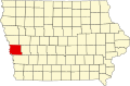
Yorkshire, Iowa

Last updated

Yorkshire, Iowa
USA Iowa location map.svg
Red pog.svg
Yorkshire, Iowa
Coordinates: 41°31′14″N95°34′48″W / 41.52056°N 95.58000°W / 41.52056; -95.58000
Country United States
State Iowa
County Harrison
Elevation
1,175 ft (358 m)
Time zone UTC-6 (Central (CST))
  Summer (DST) UTC-5 (CDT)
GNIS feature ID463247 [1]

Yorkshire is an unincorporated community in Harrison County, in the U.S. state of Iowa. [1]

History

Yorkshire was founded with the arrival of the Chicago, Milwaukee and St. Paul Railroad. Yorkshire was platted in June 1872 by the railroad company and a store was built soon thereafter. [2] Yorkshire was the stop between Persia, Iowa, and Neola, Iowa. [3] The Yorkshire Post Office opened on November 3, 1885, [4] and a number of businesses soon followed.

Yorkshire's population was 25 in 1887, [5] 30 in 1902, [6] and 34 in 1925. [7]

On June 3, 1925, a pair of tornadoes, estimated at F4 (possibly F5) intensity on the Fujita scale, struck Yorkshire and nearby Persia. The damage was widespread in both communities, and in Yorkshire, the community "lost a depot, local store, church, schoolhouse and a number of residential homes." An infant was killed near Persia. [2] [8]

The Yorkshire Post Office closed on October 30, 1943. [4]

Related Research Articles

Gifford is an unincorporated community in southeastern Hardin County, Iowa, United States.

Sperry is an unincorporated community in central Des Moines County, Iowa, United States. It lies along local roads north of the city of Burlington, the county seat of Des Moines County. Its elevation is 751 feet (229 m). Although Sperry is unincorporated, it has a post office with the ZIP code of 52650, which opened on 5 February 1870.

<span class="mw-page-title-main">California Junction, Iowa</span> Census-designated place in Iowa, United States

California Junction is an unincorporated community and census-designated place (CDP) in Harrison County, Iowa, United States. It lies just east of the junction between the east–west and north–south lines of the former Sioux City and Pacific Railroad. In the 2010 census it had a population of 85 inhabitants and a population density of 184.38 people per square mile.

Adaza is an unincorporated community in Greene County, Iowa, United States. It is located on County Road E13, three miles northwest of Churdan, at 42.194705N, -94.4969273W.

Dunbar is an unincorporated community and former railroad depot village in Green Castle Township, Marshall County, Iowa, United States.

Carnforth is an unincorporated community in Poweshiek County, in the U.S. state of Iowa.

Malone is an unincorporated community in Clinton County, in the U.S. state of Iowa.

Carnes is an unincorporated rural small hamlet in Sioux County, in the U.S. state of Iowa. Presently, the hamlet consists of a pizza restaurant.

James is an unincorporated community in Plymouth County, in the U.S. state of Iowa.

Thorpe is an unincorporated community in Honey Creek Township, Delaware County, Iowa, United States.

Chequest was an unincorporated community in Davis County, Iowa, United States. Its elevation is 722 feet (287 m). It was on County Road V42 near Chequest Creek.

Clarkson was an unincorporated community in Warren County, Iowa, United States. It was located two miles east of Carlisle, near the Des Moines River. Its elevation was 935 feet.

Vincennes is an unincorporated community in the southern part of Lee County, Iowa, United States. It lies near the junction of 320th Street and Iowa Highway 27, 2.5 miles south of Argyle. Its elevation is 554 feet.

Newburg is an unincorporated community in Jasper County, in the U.S. state of Iowa.

Galesburg is an unincorporated community in Jasper County, in the U.S. state of Iowa.

Ehler is an unincorporated community in Adams Township, Delaware County, Iowa, United States. The community lies three miles southwest of Ryan.

Bremer is an unincorporated community in Warren Township in Bremer County, Iowa, United States.

Horton is an unincorporated community in Polk Township in Bremer County, Iowa, United States.

Bailey was a community in Wayne Township, Mitchell County, Iowa, United States. Founded in 1886 as a whistle stop, it was briefly known as Wapsie. The community lay north of the Wapsipinicon River.

Astor was an unincorporated community in Crawford County, in the U.S. state of Iowa.

References

  1. 1 2 U.S. Geological Survey Geographic Names Information System: Yorkshire, Iowa
  2. 1 2 "Persia and Yorkshire, Harrison County, Iowa" . Retrieved June 23, 2021.
  3. "Chicago, Milwaukee and St. Paul Railway Passenger Train Schedules" (PDF). 1910.
  4. 1 2 "GNIS Detail - Yorkshire Post Office (historical)". geonames.usgs.gov. Retrieved June 23, 2021.
  5. Cram, George Franklin (1887). Cram's Universal Atlas: Geographical, Astronomical and Historical, Containing a Complete Series of Maps of Modern Geography, Illustrated by Numerous Views and Charts ; the Whole Supplemented with Valuable Statistics, Diagrams, and a Complete Gazetteer of the United States. G.F. Cram. pp. 367–369.
  6. Cram's Modern Atlas: The New Unrivaled New Census Edition. J. R. Gray & Company. 1902. pp. 203–207.
  7. Premier Atlas of the World: Containing Maps of All Countries of the World, with the Most Recent Boundary Decisions, and Maps of All the States, Territories, and Possessions of the United States with Population Figures from the Latest Official Census Reports, Also Data of Interest Concerning International and Domestic Political Questions. Rand McNally & Company. 1925. p. 190.
  8. Grazulis, Thomas P. (1993). Significant tornadoes, 1680-1991: A Chronology and Analysis of Events. St. Johnsbury, Vermont: Environmental Films. p. 799. ISBN   1-879362-03-1.