River Sioux, Iowa | |
|---|---|
 River Sioux  River Sioux | |
| Coordinates: 41°48′09″N96°02′53″W / 41.80250°N 96.04806°W | |
| Country | USA |
| State | Iowa |
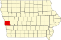
| County | Harrison |
| Township | Little Sioux |
| Area | |
• Total | 0.38 sq mi (0.99 km2) |
| • Land | 0.38 sq mi (0.99 km2) |
| • Water | 0.00 sq mi (0.00 km2) |
| Elevation | 1,037 ft (316 m) |
| Population (2020) | |
• Total | 42 |
| • Density | 110.24/sq mi (42.61/km2) |
| Time zone | UTC-6 (Central (CST)) |
| • Summer (DST) | UTC-5 (CDT) |
| ZIP code | 51545 [3] |
| Area code | 712 |
| FIPS code | 19-67530 |
| GNIS feature ID | 2583493 [2] |
River Sioux is an unincorporated community and census-designated place in Harrison County, Iowa, United States. As of the 2020 Census the population was 42.