
A seamount is a large geologic landform that rises from the ocean floor but that does not reach to the water's surface, and thus is not an island, islet or cliff-rock. Seamounts are typically formed from extinct volcanoes that rise abruptly and are usually found rising from the seafloor to 1,000–4,000 m (3,300–13,100 ft) in height. They are defined by oceanographers as independent features that rise to at least 1,000 m (3,281 ft) above the seafloor, characteristically of conical form. The peaks are often found hundreds to thousands of meters below the surface, and are therefore considered to be within the deep sea. During their evolution over geologic time, the largest seamounts may reach the sea surface where wave action erodes the summit to form a flat surface. After they have subsided and sunk below the sea surface such flat-top seamounts are called "guyots" or "tablemounts".

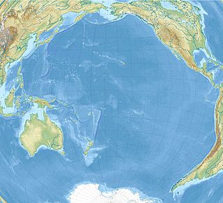
The Hawaiian–Emperor seamount chain is a mostly undersea mountain range in the Pacific Ocean that reaches above sea level in Hawaii. It is composed of the Hawaiian ridge, consisting of the islands of the Hawaiian chain northwest to Kure Atoll, and the Emperor Seamounts: together they form a vast underwater mountain region of islands and intervening seamounts, atolls, shallows, banks and reefs along a line trending southeast to northwest beneath the northern Pacific Ocean. The seamount chain, containing over 80 identified undersea volcanoes, stretches about 6,200 km (3,900 mi) from the Aleutian Trench in the far northwest Pacific to the Lōʻihi Seamount, the youngest volcano in the chain, which lies about 35 kilometres (22 mi) southeast of the Island of Hawaiʻi.

The fifteen volcanoes that make up the eight principal islands of Hawaii are the youngest in a chain of more than 129 volcanoes that stretch 5,800 kilometres (3,600 mi) across the North Pacific Ocean, called the Hawaiian–Emperor seamount chain. Hawaiʻi's volcanoes rise an average of 4,600 metres (15,000 ft) to reach sea level from their base. The largest, Mauna Loa, is 4,169 metres (13,678 ft) high. As shield volcanoes, they are built by accumulated lava flows, growing a few meters or feet at a time to form a broad and gently sloping shape.

Several types of volcanic eruptions—during which lava, tephra, and assorted gases are expelled from a volcanic vent or fissure—have been distinguished by volcanologists. These are often named after famous volcanoes where that type of behavior has been observed. Some volcanoes may exhibit only one characteristic type of eruption during a period of activity, while others may display an entire sequence of types all in one eruptive series.

Meiji Seamount, named after Emperor Meiji, the 122nd Emperor of Japan, is the oldest seamount in the Hawaiian-Emperor seamount chain, with an estimated age of 82 million years. It lies at the northernmost end of the chain, and is perched at the outer slope of the Kuril–Kamchatka Trench. Like the rest of the Emperor seamounts, it was formed by the Hawaii hotspot volcanism, grew to become an island, and has since subsided to below sea level, all while being carried first north and now northwest by the motion of the Pacific Plate. Meiji Seamount is thus an example of a particular type of seamount known as a guyot, and some publications refer to it as Meiji Guyot.

The Hawai’i hotspot is a volcanic hotspot located near the namesake Hawaiian Islands, in the northern Pacific Ocean. One of the best known and intensively studied hotspots in the world, the Hawaii plume is responsible for the creation of the Hawaiian–Emperor seamount chain, a 6,200-kilometer (3,900 mi) mostly undersea volcanic mountain range. Four of these volcanoes are active, two are dormant; more than 123 are extinct, most now preserved as atolls or seamounts. The chain extends from south of the island of Hawaiʻi to the edge of the Aleutian Trench, near the eastern coast of Russia.

The Fogo Seamounts, also called the Fogo Seamount Chain, are a group of undersea mountains southeast of the Grand Banks of Newfoundland in the North Atlantic Ocean. This seamount chain, lying approximately 500 km (310 mi) offshore from the island of Newfoundland, consists of several submarine volcanoes that have been extinct for millions of years. They are one of the few seamount chains located in Canadian waters off the coast of Atlantic Canada.
Daikakuji Seamount is a seamount and the southwesternmost volcanic feature in the Hawaiian Emperor chain bend area.
Koko Guyot is a 48.1-million-year-old guyot, a type of underwater volcano with a flat top, which lies near the southern end of the Emperor seamounts, about 200 km (124 mi) north of the "bend" in the volcanic Hawaiian-Emperor seamount chain. Pillow lava has been sampled on the north west flank of Koko Seamount, and the oldest dated lava is 40 million years old. Seismic studies indicate that it is built on a 9 km (6 mi) thick portion of the Pacific Plate. The oldest rock from the north side of Koko Seamount is dated at 52.6 and the south side of Koko at 50.4 million years ago. To the southeast of the bend is Kimmei Seamount at 47.9 million years ago and southeast of it, Daikakuji at 46.7.
Ōjin Seamount, also called Ōjin Guyot, named after Emperor Ōjin, 15th Emperor of Japan, is a guyot of the Hawaiian-Emperor seamount chain in the Pacific Ocean. It erupted 55 million years ago.
Nintoku Seamount or Nintoku Guyot is a seamount and guyot in the Hawaiian-Emperor seamount chain. It is a large, irregularly shaped volcano that last erupted 66 million years ago. Three lava flows have been sampled at Nintoku Seamount; the flows are almost all alkalic (subaerial) lava. It is 56.2 million years old.

The Macdonald hotspot is a volcanic hotspot in the southern Pacific Ocean. The hotspot was responsible for the formation of the Macdonald Seamount, and possibly the Austral-Cook Islands chain. It probably did not generate all of the volcanism in the Austral and Cook Islands as age data imply that several additional hotspots were needed to generate some volcanoes.

Jasper Seamount is a seamount located in the Fieberling-Guadalupe seamount track, west of Baja California, Mexico. Jasper is the site of detailed geophysical geological and geochemical studies which suggest that many seamounts, big and small, follow the same pattern of growth and death that was originally used to describe the Hawaiian - Emperor seamount chain.

Arago hotspot is a hotspot in the Pacific Ocean, presently located below the Arago seamount close to the island of Rurutu, French Polynesia.

Wōdejebato is a Cretaceous guyot or tablemount in the northern Marshall Islands, Pacific Ocean. Wōdejebato is probably a shield volcano and is connected through a submarine ridge to the smaller Pikinni Atoll 74 kilometres (46 mi) southeast of the guyot; unlike Wōdejebato, Pikinni rises above sea level. The seamount rises for 4,420 metres (14,500 ft) to 1,335 metres (4,380 ft) depth and is formed by basaltic rocks. The name Wōdejebato refers to a sea god of Pikinni.

Limalok is a Cretaceous-Paleocene guyot/tablemount in the southeastern Marshall Islands, one of a number of seamounts in the Pacific Ocean. It was probably formed by a volcanic hotspot in present-day French Polynesia. Limalok lies southeast of Mili Atoll and Knox Atoll, which rise above sea level, and is joined to each of them through a volcanic ridge. It is located at a depth of 1,255 metres (4,117 ft) and has a summit platform with an area of 636 square kilometres (246 sq mi).

Lo-En or Hess is an Albian–Campanian guyot in the Marshall Islands. One among a number of seamounts in the Pacific Ocean, it was probably formed by a hotspot in what is present-day French Polynesia. Lo-En lies southeast of Eniwetok which rises above sea level, and Lo-En is almost connected to it through a ridge.
South Arch volcanic field is an underwater volcanic field south of Hawaiʻi Island. It was active during the last 10,000 years, and covers an area of 35 by 50 kilometres at a depth of 4,950 metres (16,240 ft).

North Arch volcanic field is an underwater volcanic field north of Oahu, Hawaii. It covers an area of about 25,000 square kilometres (9,700 sq mi) and consists of large expanses of alkali basalt, basanite and nephelinite that form extensive lava flows and volcanic cones. Some lava flows are longer than 100 kilometres (62 mi).

