Related Research Articles

Hawaii is the largest island in the United States, located in the eponymous state of Hawaii. It is the southeasternmost of the Hawaiian Islands, a chain of volcanic islands in the North Pacific Ocean. With an area of 4,028 square miles (10,430 km2), it has 63% of the Hawaiian archipelago's combined landmass. However, it has only 13% of the archipelago's population. The island of Hawaiʻi is the third largest island in Polynesia, behind the north and south islands of New Zealand.

Mauna Loa is one of five volcanoes that form the Island of Hawaii in the U.S. state of Hawaii in the Pacific Ocean. Mauna Loa is Earth's largest active volcano by both mass and volume. It was historically considered to be the largest volcano on Earth until Tamu Massif was discovered to be larger. Mauna Loa is a shield volcano with relatively gentle slopes, and a volume estimated at 18,000 cubic miles (75,000 km3), although its peak is about 125 feet (38 m) lower than that of its neighbor, Mauna Kea. Lava eruptions from Mauna Loa are silica-poor and very fluid, and tend to be non-explosive.

Mauna Kea is a dormant shield volcano on the island of Hawaiʻi. Its peak is 4,207.3 m (13,803 ft) above sea level, making it the highest point in Hawaii and the island with the second highest high point, behind New Guinea, the world's largest tropical island with multiple peaks that are higher. The peak is about 38 m (125 ft) higher than Mauna Loa, its more massive neighbor. Mauna Kea is unusually topographically prominent for its height: its prominence from sea level is fifteenth in the world among mountains, at 4,207.3 m (13,803 ft); its prominence from under the ocean is 9,330 m (30,610 ft), rivaled only by Mount Everest. This dry prominence is greater than Everest's height above sea level of 8,848.86 m (29,032 ft), and some authorities have labeled Mauna Kea the tallest mountain in the world, from its underwater base. Mauna Kea is ranked 8th by topographic isolation.

Haleakalā, or the East Maui Volcano, is a massive, active shield volcano that forms more than 75% of the Hawaiian Island of Maui. The western 25% of the island is formed by another volcano, Mauna Kahalawai, also referred to as the West Maui Mountains.

A shield volcano is a type of volcano named for its low profile, resembling a shield lying on the ground. It is formed by the eruption of highly fluid lava, which travels farther and forms thinner flows than the more viscous lava erupted from a stratovolcano. Repeated eruptions result in the steady accumulation of broad sheets of lava, building up the shield volcano's distinctive form.

Kīlauea is an active shield volcano in the Hawaiian Islands. It is located along the southeastern shore of Hawaii Island. The volcano is between 210,000 and 280,000 years old and grew above sea level about 100,000 years ago. Since the islands were settled, it has been the most active of the five volcanoes that together form the island and among the most active volcanoes on Earth. The most recent eruption began in December 2024.

Hualālai is an active volcano on the island of Hawaiʻi in the Hawaiian Islands. It is the westernmost, third-youngest and the third-most active of the five volcanoes that form the island of Hawaiʻi, following Kīlauea and the much larger Mauna Loa. Its peak stands 8,271 feet (2,521 m) above sea level. Hualālai is estimated to have risen above sea level about 300,000 years ago. Despite maintaining a very low level of activity since its last eruption in 1801, and being unusually inactive for the last 2,000 years, Hualālai is still considered active, and is expected to erupt again sometime in the next 100 years. The relative unpreparedness of the residents in the area caused by the lull in activity would worsen an eruption's consequences.

Hawaiʻi Volcanoes National Park is a national park of the United States located in Hawaii on the island of Hawaii. The park encompasses two active volcanoes: Kīlauea, one of the world's most active volcanoes, and Mauna Loa, the world's largest shield volcano. The park provides scientists with insight into the development of the Hawaiian Islands and access for studies of volcanism. For visitors, the park offers dramatic volcanic landscapes, glimpses of rare flora and fauna, and a view into the traditional Hawaiian culture connected to these landscapes.
Kamaʻehuakanaloa Seamount is an active submarine volcano about 22 mi (35 km) off the southeast coast of the island of Hawaii. The top of the seamount is about 3,200 ft (975 m) below sea level. This seamount is on the flank of Mauna Loa, the largest active subaerial shield volcano on Earth. Kamaʻehuakanaloa is the newest volcano in the Hawaiian–Emperor seamount chain, a string of volcanoes that stretches about 3,900 mi (6,200 km) northwest of Kamaʻehuakanaloa. Unlike most active volcanoes in the Pacific Ocean that make up the active plate margins on the Pacific Ring of Fire, Kamaʻehuakanaloa and the other volcanoes of the Hawaiian–Emperor seamount chain are hotspot volcanoes and formed well away from the nearest plate boundary. Volcanoes in the Hawaiian Islands arise from the Hawaii hotspot, and as the youngest volcano in the chain, Kamaʻehuakanaloa is the only Hawaiian volcano in the deep submarine preshield stage of development.

The evolution of Hawaiian volcanoes occurs in several stages of growth and decline. The fifteen volcanoes that make up the eight principal islands of Hawaii are the youngest in a chain of more than 129 volcanoes that stretch 5,800 kilometers (3,600 mi) across the North Pacific Ocean, called the Hawaiian–Emperor seamount chain. Hawaiʻi's volcanoes rise an average of 4,600 meters (15,000 ft) to reach sea level from their base. The largest, Mauna Loa, is 4,169 meters (13,678 ft) high. As shield volcanoes, they are built by accumulated lava flows, growing a few meters or feet at a time to form a broad and gently sloping shape.

An active volcano is a volcano that has erupted during the Holocene, is currently erupting, or has the potential to erupt in the future. A volcano that is not currently erupting but could erupt in the future is known as a dormant volcano. Volcanoes that will not erupt again are known as extinct volcanoes.
The Decade Volcanoes are 16 volcanoes identified by the International Association of Volcanology and Chemistry of the Earth's Interior (IAVCEI) as being worthy of particular study in light of their history of large, destructive eruptions and proximity to densely populated areas. The Decade Volcanoes project encourages studies and public-awareness activities at these volcanoes, with the aim of achieving a better understanding of the volcanoes and the dangers they present, and thus being able to reduce the severity of natural disasters.

The Mauna Loa Observatory (MLO) is an atmospheric baseline station on Mauna Loa, on the island of Hawaii, located in the U.S. state of Hawaii.
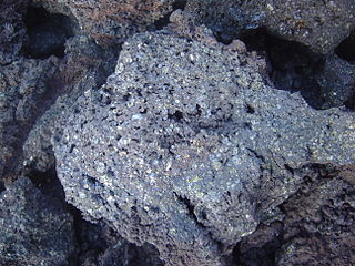
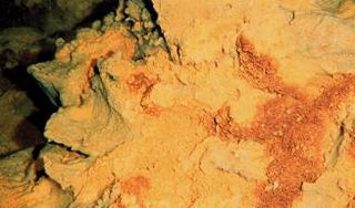
Picrite basalt or picrobasalt is a variety of high-magnesium olivine basalt that is very rich in the mineral olivine. It is dark with yellow-green olivine phenocrysts (20-50%) and black to dark brown pyroxene, mostly augite.

The Hawaiʻi hotspot is a volcanic hotspot located near the namesake Hawaiian Islands, in the northern Pacific Ocean. One of the best known and intensively studied hotspots in the world, the Hawaii plume is responsible for the creation of the Hawaiian–Emperor seamount chain, a 6,200-kilometer (3,900 mi) mostly undersea volcanic mountain range. Four of these volcanoes are active, two are dormant; more than 123 are extinct, most now preserved as atolls or seamounts. The chain extends from south of the island of Hawaiʻi to the edge of the Aleutian Trench, near the eastern coast of Russia.

The 1984 eruption of Mauna Loa was a Hawaiian eruption in the U.S. state of Hawaii that lasted from March 25 to April 15, 1984. It ended a 9-year period of quiescence at the volcano and continued for 22 days, during which time lava flows and lava fountains issued from the summit caldera and fissures along the northeast and southwest rift zones. Although the lava threatened Hilo, the flow stopped before reaching the outskirts of town.

The 1975 eruption of Mauna Loa was a short-lived Hawaiian eruption that followed 25 years of quiescence at the Hawaiian volcano Mauna Loa. The eruption began just before midnight on July 5 and involved fissures extending across the length of Moku‘āweoweo, Mauna Loa's summit caldera, and into the upper ends of the volcano's northeast and southwest rift zones. After only 6 hours, activity in Moku‘āweoweo and on the southwest rift zone ended, but lava fountaining continued along the northeast rift zone until 7:30 p.m. on July 6, when all activity ceased.

The 2022 eruption of Mauna Loa was an episode of eruptive volcanic activity at Mauna Loa, the world's largest active volcano, located on Hawaiʻi island, Hawaiʻi. Mauna Loa began to erupt shortly before midnight HST on November 27, 2022, when lava flows emerged from fissure vents in Moku‘āweoweo. It marked the first eruption at the volcano in 38 years. The eruption ended on December 13, 2022, after more than two weeks.

Kenneth Hon, usually known professionally as Ken Hon, is a geologist and the 21st Scientist-in-Charge (SIC) of the Hawaiian Volcano Observatory (HVO), serving since 2021; succeeding Tina Neal (SIC) and David Phillips. Hon has often been a contact from the Observatory to the news media, and as such is often quoted as an authority figure in the field of Hawaiian volcanology.
References
- 1 2 3 "Mauna Loa". Global Volcanism Program . Smithsonian Institution . Retrieved February 2, 2020.
