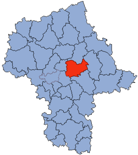
Ossów is a village in the administrative district of Gmina Wołomin, within Wołomin County, Masovian Voivodeship, in east-central Poland. It lies approximately 6 kilometres (4 mi) south of Wołomin and 18 km (11 mi) north-east of Warsaw.

Dąbrówka is a village in Wołomin County, Masovian Voivodeship, in east-central Poland. It is the seat of the gmina called Gmina Dąbrówka. It lies approximately 16 kilometres (10 mi) north of Wołomin and 36 km (22 mi) north-east of Warsaw.
Dręszew is a village in the administrative district of Gmina Dąbrówka, within Wołomin County, Masovian Voivodeship, in east-central Poland. It lies approximately 20 km (12 mi) north of Wołomin, and 40 km (25 mi) north-east of Warsaw.
Trojany is a village in the administrative district of Gmina Dąbrówka, within Wołomin County, Masovian Voivodeship, in east-central Poland. It lies approximately 15 km (9 mi) north-east of Wołomin and 36 km (22 mi) north-east of Warsaw.
Wszebory is a village in the administrative district of Gmina Dąbrówka, within Wołomin County, Masovian Voivodeship, in east-central Poland. It lies approximately 5 kilometres (3 mi) east of Dąbrówka, 18 km (11 mi) north-east of Wołomin, and 39 km (24 mi) north-east of Warsaw.
Adampol is a village in the administrative district of Gmina Jadów, within Wołomin County, Masovian Voivodeship, in east-central Poland. It lies approximately 7 kilometres (4 mi) north-west of Jadów, 31 km (19 mi) north-east of Wołomin, and 53 km (33 mi) north-east of Warsaw.
Myszadła is a village in the administrative district of Gmina Jadów, within Wołomin County, Masovian Voivodeship, in east-central Poland. It lies approximately 6 kilometres (4 mi) east of Jadów, 36 km (22 mi) north-east of Wołomin, and 58 km (36 mi) north-east of Warsaw.
Podbale is a village in the administrative district of Gmina Jadów, within Wołomin County, Masovian Voivodeship, in east-central Poland. It lies approximately 36 kilometres (22 mi) east of Wołomin and 57 km (35 mi) north-east of Warsaw.
Wójty is a village in the administrative district of Gmina Jadów, within Wołomin County, Masovian Voivodeship, in east-central Poland. It lies approximately 32 kilometres (20 mi) north-east of Wołomin and 54 km (34 mi) north-east of Warsaw.
Wola Rasztowska is a village in the administrative district of Gmina Klembów, within Wołomin County, Masovian Voivodeship, in east-central Poland. It lies approximately 6 kilometres (4 mi) north-west of Klembów, 12 km (7 mi) north of Wołomin, and 33 km (21 mi) north-east of Warsaw.
Nowy Cygów is a village in the administrative district of Gmina Poświętne, within Wołomin County, Masovian Voivodeship, in east-central Poland. It lies approximately 13 kilometres (8 mi) east of Wołomin and 32 km (20 mi) north-east of Warsaw.
Ręczaje Polskie is a village in the administrative district of Gmina Poświętne, within Wołomin County, Masovian Voivodeship, in east-central Poland. It lies approximately 9 kilometres (6 mi) east of Wołomin and 28 km (17 mi) north-east of Warsaw.
Trzcinka is a village in the administrative district of Gmina Poświętne, within Wołomin County, Masovian Voivodeship, in east-central Poland. It lies approximately 10 kilometres (6 mi) south-east of Wołomin and 26 km (16 mi) east of Warsaw.
Cegielnia is a village in the administrative district of Gmina Radzymin, within Wołomin County, Masovian Voivodeship, in east-central Poland. It lies approximately 3 kilometres (2 mi) south-west of Radzymin, 8 km (5 mi) north-west of Wołomin, and 24 km (15 mi) north-east of Warsaw.
Dybów-Kolonia is a village in the administrative district of Gmina Radzymin, within Wołomin County, Masovian Voivodeship, in east-central Poland. It lies approximately 3 kilometres (2 mi) south-east of Radzymin, 7 km (4 mi) north of Wołomin, and 26 km (16 mi) north-east of Warsaw.
Mokre is a village in the administrative district of Gmina Radzymin, within Wołomin County, Masovian Voivodeship, in east-central Poland. It lies approximately 4 kilometres (2 mi) north of Radzymin, 11 km (7 mi) north of Wołomin, and 29 km (18 mi) north-east of Warsaw.
Grabów is a village in the administrative district of Gmina Tłuszcz, within Wołomin County, Masovian Voivodeship, in east-central Poland. It lies approximately 4 kilometres (2 mi) south-east of Tłuszcz, 20 km (12 mi) east of Wołomin, and 41 km (25 mi) north-east of Warsaw.
Jaźwie is a village in the administrative district of Gmina Tłuszcz, within Wołomin County, Masovian Voivodeship, in east-central Poland. It lies approximately 5 kilometres (3 mi) south-east of Tłuszcz, 18 km (11 mi) east of Wołomin, and 39 km (24 mi) north-east of Warsaw.
Łysobyki is a village in the administrative district of Gmina Tłuszcz, within Wołomin County, Masovian Voivodeship, in east-central Poland. It lies approximately 2 kilometres (1 mi) south of Tłuszcz, 17 km (11 mi) north-east of Wołomin, and 38 km (24 mi) north-east of Warsaw.