
The Gulf of Finland is the easternmost arm of the Baltic Sea. It extends between Finland to the north and Estonia to the south, to Saint Petersburg in Russia to the east, where the river Neva drains into it. Other major cities around the gulf include Helsinki and Tallinn. The eastern parts of the Gulf of Finland belong to Russia, and some of Russia's most important oil harbors are located farthest in, near Saint Petersburg. As the seaway to Saint Petersburg, the Gulf of Finland has been and continues to be of considerable strategic importance to Russia. Some of the environmental problems affecting the Baltic Sea are at their most pronounced in the shallow gulf. Proposals for a tunnel through the gulf have been made.
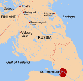
The Karelian Isthmus is the approximately 45–110-kilometre-wide (30–70 mi) stretch of land situated between the Gulf of Finland and Lake Ladoga in northwestern Russia, to the north of the River Neva. Its northwestern boundary is a line from the Bay of Vyborg to the westernmost point of Lake Ladoga, Pekonlahti. If the Karelian Isthmus is defined as the entire territory of present-day Saint Petersburg and Leningrad Oblast to the north of the Neva and also a tiny part of the Republic of Karelia, the area of the isthmus is about 15,000 km2 (5,800 sq mi).

Sestroretsk is a municipal town in Kurortny District of the federal city of St. Petersburg, Russia, located on the shores of the Gulf of Finland, the Sestra River and the Sestroretskiy Lake 34 kilometers (21 mi) northwest of St. Petersburg. Population: 37,248 (2010 Census); 40,287 (2002 Census); 35,498 (1989 Soviet census); 30,500 (1975).
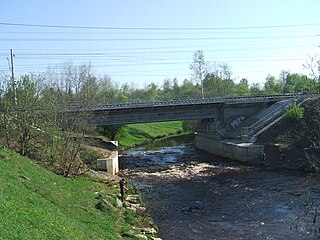
The Sestra is a river in Vsevolozhsky and Vyborgsky Districts of Leningrad Oblast and Kurortny District of Saint Petersburg, Russia. The length of the Sestra is 74 kilometres (46 mi), and the area of its basin is 399 square kilometres (154 sq mi).

Vyborgsky District is an administrative and municipal district (raion), one of the seventeen in Leningrad Oblast, Russia. It is located in the northwest of the oblast on the Karelian Isthmus and borders with Priozersky District in the northeast, Vsevolozhsky District in the east, Kurortny District of the federal city of St. Petersburg in the south, Kymenlaakso and South Karelia regions of Finland in the northwest, and Lakhdenpokhsky District of the Republic of Karelia in the north. From the southwest, the district is limited by the Gulf of Finland. The area of the district is 7,475.472 square kilometers (2,886.296 sq mi). Its administrative center is the town of Vyborg. Population : 120,446 (2010 Census); 113,748 ; 108,571 (1989 Soviet census).
Beloostrov, from 1922 to World War II Krasnoostrov, is a municipal settlement in Kurortny District of the federal city of St. Petersburg, Russia, located on the Sestra River, Karelian Isthmus. Population: 2,080 (2010 Census); 1,690 (2002 Census); 1,405 (1989 Soviet census). The settlement has a railway station Beloostrov.

The Riihimäki–Saint Petersburg railway is a 385-kilometre (239 mi) long segment of the Helsinki–Saint Petersburg connection, which is divided between Saint Petersburg and Leningrad Oblast in Russia and the province of Southern Finland in Finland.
The history of rail transport in Finland began on January 31, 1862, with the opening of the railway line between Helsinki and Hämeenlinna. By 1900 most of the future main lines had been constructed, including the line to St. Petersburg. By the time of the birth of the new Finnish Republic in 1917 lines connected all major cities, major ports, and reached as far as the Swedish border, and inner Finland as far north as Kontiomäki in Paltamo region, as well as eastwards into Karelia.

Lanskaya railway station is a railway station in St. Petersburg, Russia located between Serdobolskaya street and Bolshoi Sampsonievsky street. It was named after the historical district of Saint Petersburg.

Beloostrov railway station is a railway station of the Riihimäki–Saint Petersburg railway in Beloostrov located at the border between St. Petersburg and Leningrad Oblast in Russia. The station is also a rail junction of the bypass route with a same direction to Finland Station through Sestroretsk.

Flugov post also known as Flugov shunting loop, is a goods station in Saint Petersburg, built for delivering cargo from tram stations on the Flugov lane to Sestroretsk.
Primorskaya railway was located near Saint Petersburg and it lay on the route Saint Petersburg, Sestroretsk, Beloostrov. The railway was served by steam locomotives from the moment of opening and before joining to Oktyabrskaya railway in 1925.
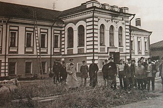
Sestroretsk railway station was a railway station in Sestroretsk, Russia handling transportation to northern destinations including Beloostrov and Sestroretsk.
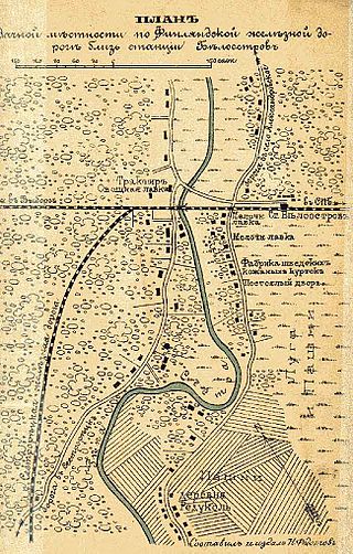
The Sestroretsk spur line was laid by request of the Russian Ministry of Defence for communication of the Sestroretsk armory with the strategic Riihimäki-Saint Petersburg railway in 1871. The line was opened on 2 November 1871, when the first train proceeded on the route from Beloostrov to Sestroretsk.

Miller's pier, is a railway station at the quay in Sestroretsk Kurort, Russia. The 50-metre (160 ft) pier was constructed from boulders dumped into the Gulf of Finland. In time, the harbour acquired the name "Miller's Harbour".
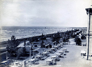
Miller's line was a passenger railway line in Russia from 1873 to 1886, run by the Finnish State Railways. The line ran from Beloostrov to Sestroretsk, and was the site of the world's first functional electric railway.
The Dubki horse-iron road was built to serve the armory at Sestroretsk, Russia. The production of the Sestroretsk armory was originally transported to Saint Petersburg along the coast, by road. But the road to the capital existing at that time was inconvenient, since it lay along the coast on quicksands and lowlands, which were periodically submerged by the waters of the Gulf of Finland. Therefore, seagoing scows (barges) later began to be used. In 1847, a horse-drawn tramroad was built from the plant to the Dubkovsky pier on the Gulf of Finland. In the diagram this tramroad is not shown, but it passed along the axis of the street to the centre of the map. The opening and the location of the pier are designated on the map.

Primorsky station is a former railway terminal in St. Petersburg, Russia. It was constructed by the JSC Primorskaya Saint Peterburg–Sestroretsk railway and was opened on July, 23rd 1893 as part of the Ozerki Line.
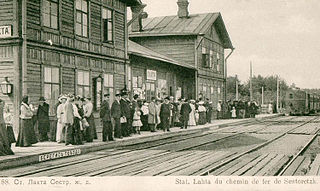
The Primorskaya line was the second line constructed by the Primorskaya railway, near St. Petersburg, Russia. It is now part of the Oktyabrskaya Railway and was electrified in 1952.

Gorskaya, is a railway station in Saint Petersburg, Russia located between Lisiy Nos in Primorsky District and the Sestroretsk in Kurortny District. The station was opened on November 26, 1894, as part of the Primorskaya Line opening section between Razdelnaya and Sestroretsk.


