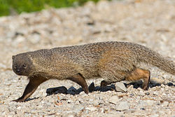
Zeralda Forest | |
---|---|
Geography | |
Location | Zéralda, Algiers Province, ![]() |
Coordinates | 36°42′38″N2°52′09″E / 36.71056°N 2.86917°E |
Elevation | 50 meters (160 ft) |
Area | 1,078 hectares |
Zeralda Forest is a forest located in Zeralda, in the Mitidja region of Algiers Province. It is managed by the Forest Conservation Authority of Algiers (CFA), which operates under the supervision of the General Directorate of Forests (DGF). [1]
The forest is subject to the provisions outlined in Decree 84-45 of February 18, 1984, [2] as amended by Decree 07-09 of January 11, 2007. [3]
On February 17, 2011, [4] Decree 11-02 was issued regarding protected areas, which provided a new impetus to the protection of the forest. Previously classified as a Game reserve, the forest was now designated as a protected area along with the Oggaz reserve [5] in the Mascara Province, Ain Ghoraba [6] in the Tlemcen Province, Ain Maabed [7] in the Djelfa Province, [8] and the Biosphere Reserve in the municipality of Reghaia. [9]
Zeralda Forest is situated at a distance of 30 km to the west of Algiers, 50 km to the east of Tipaza, and 2 km from the Mediterranean Sea. [10] It is located between the municipalities of Zeralda, Mahelma, Souidania, Staoueli, and Rahmania in Mitidja. [11]