Zijderveld | |
|---|---|
Village | |
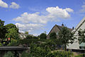
 Street view | |
 Zijderveld Location in the Netherlands  Zijderveld Zijderveld (Netherlands) | |
| Coordinates: 51°56′31″N5°8′22″E / 51.94194°N 5.13944°E | |
| Country | Netherlands |
| Province | Utrecht |
| Municipality | Vijfheerenlanden |
| Area | |
• Total | 4.96 km2 (1.92 sq mi) |
| Elevation | 1 m (3 ft) |
| Population (2021) [1] | |
• Total | 870 |
| • Density | 180/km2 (450/sq mi) |
| Time zone | UTC+1 (CET) |
| • Summer (DST) | UTC+2 (CEST) |
| Postal code | 4122 [1] |
| Dialing code | 0345 |
| Major roads | A2, N484 |
Zijderveld is a village in the Dutch province of Utrecht (province). It is located approximately 6 km northeast of Leerdam within the municipality of Vijfheerenlanden.
The village, initially referenced as Zijtwendervelt in 1282, derives its name from the Dutch expression for "field at a sideways dike". [3] The Dutch Reformed Church, dating back to the 15th century, was rebuilt in 1830. In 1840, the village had a population of 532. [4]